Dolomitic Limestone around Kettlewell
The pages below are under development and will be updated on a regular basis.
Outcrops of brown or buff-coloured dolomitic limestone or dolomite that occur in several locations differ from the grey limestone because they are of a calcium-magnesium carbonate rather than the very pure calcium carbonate of the Great Scar limestones.
The grey, white-weathering, sparry limestones of these carboniferous rocks of the Dales usually comprise something in the order of 99% calcium carbonate with few impurities. In the higher beds, the Yoredale sequence, the thinner limestone beds often contain carbonaceous material giving them a darker or black colour and they are interspersed with sandstones and shales in a cyclical sequence.
The dolomitic limestones may be a consequence of the mineralisation process which put into place the mineral veins, usually along line of weakness, faults or major joints.
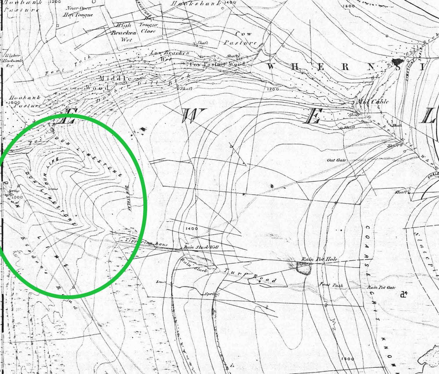
In some areas they follow the bedding of the limestones but elsewhere they occur in large masses. The latter form occurs most prominently around the valley sides of the lower southern slopes of Dowber Gill and also along the north side of Park Gill a short distance from the road at Park Rash; some of these locations are shown below. In other instances dolomitisation may be a consequence of a 'regressive phase' (shallower water) of the ancient sea floors on which they were originally laid down, particularly with respect to the Yoredale sequence higher up in the sequence.
In this area the dolomitic limestones appear to have little effect on cave formation or on the presence of caves. (see note below re Black Keld).
Click on images and maps for larger view: use backarrow for return.
All images are from the author's collection unless otherwise indicated.

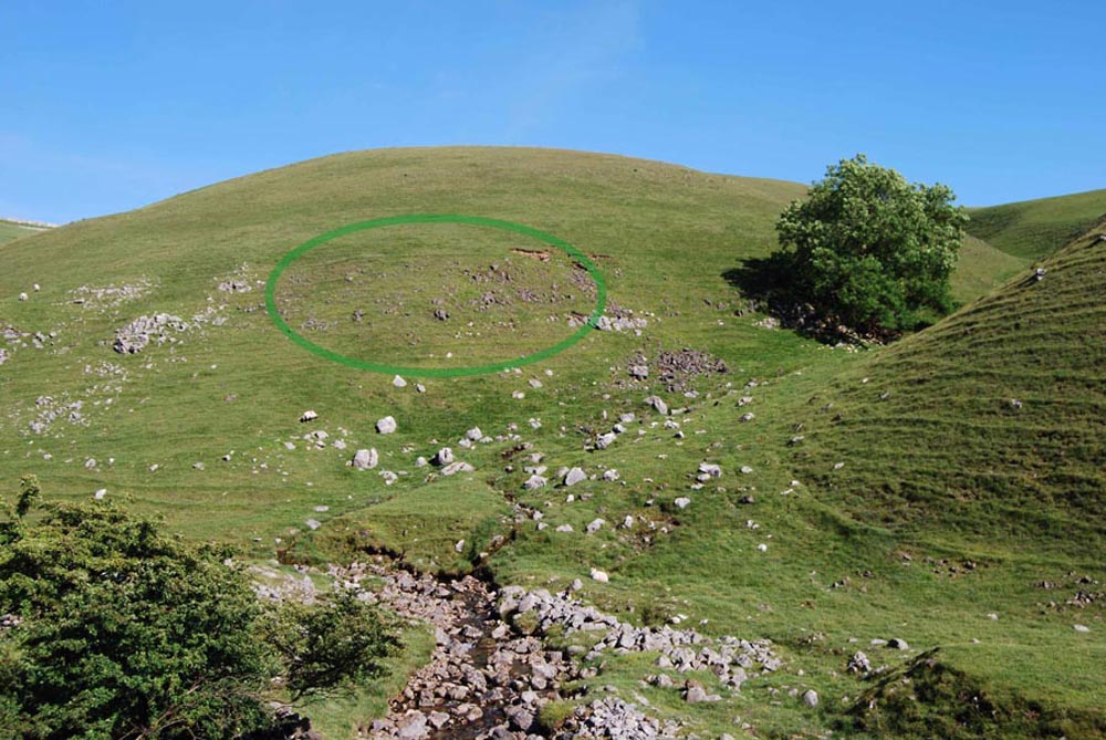
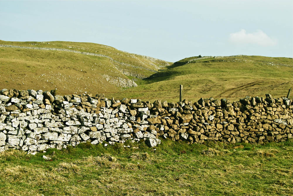
The most obvious indication of the presence of dolomitic limestone can be seen in the dry stone walls as shown here at 9797 7235 near Rain Slack. March 2, 2012.
Dolomitic limestone outcrops extensively on the south bank of the lower parts of Dowber Gill. This is clearly shown on the 6 inch geological sheet 116 of 1852 as "Dun limestone".
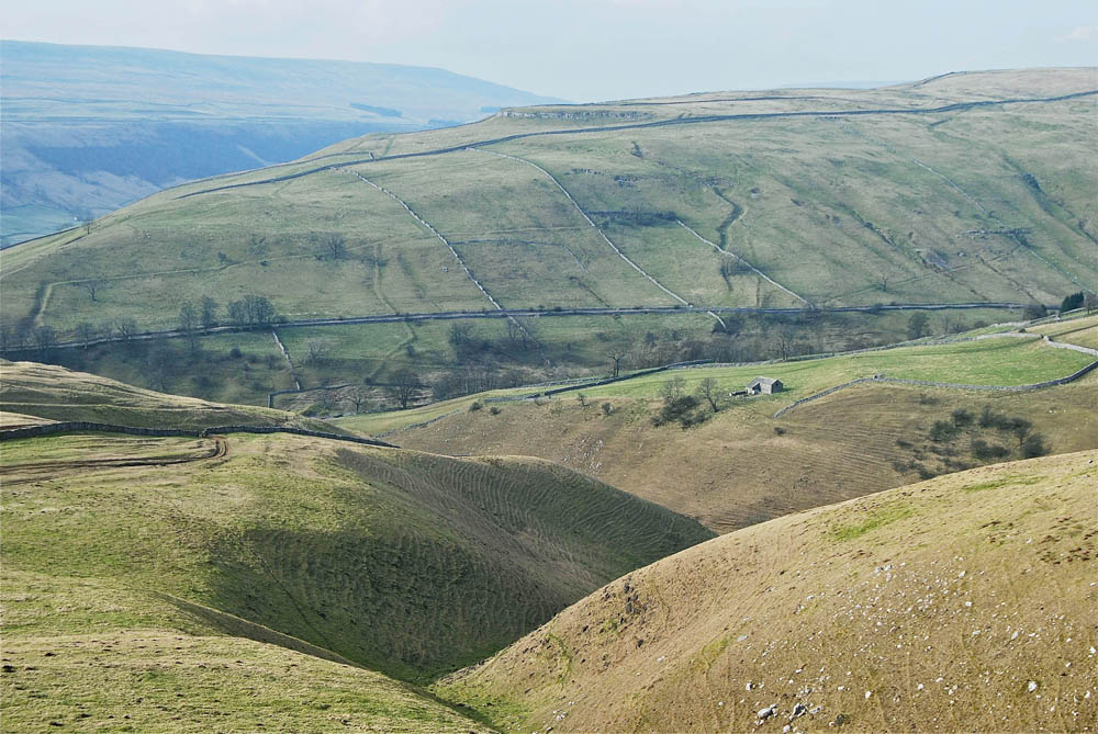
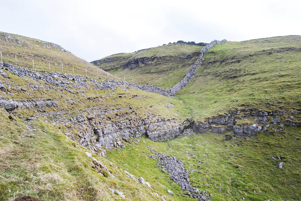
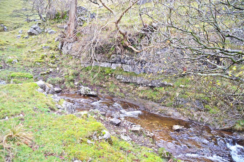
The areas of less competent strata of the Dowber Gill "Dun limestone" have given rise to the prominent well-rounded meltwater channels of lower Dowber Gill (left). March 2, 2012.
These contrast quite strongly to the craggy meltwater channels in the grey limestones of the area (right). March 2 2012.

Large masses of dolomitic limestone are clearly visible on the south bank of Dowber Gill at 97949 72719 (left) and 98012 72719 (right). March 2, 2012.

Left: another large mass of dolomitic limestone is largely concealed under vegetation but the occurence shown in the drystone wall (left) extends to the right for a distance in excess of 350m. March 2, 2012
Right: outcrops of dolomitic limestone occur somewhat randomly across the area as by the path from Park Rash to Dow Cave where it extends over a large part of the hillside. April 5 2012.
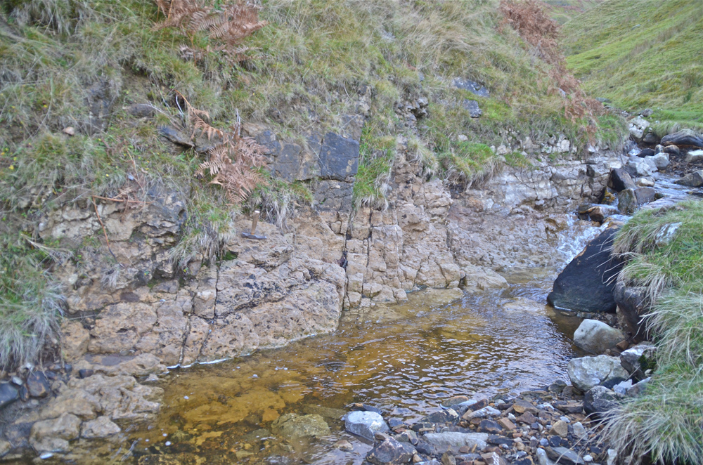
Left: a bed of dolomitic limestone can be seen to underly a scar a little way up Dowber Gill at 98006 72750 Alt. 273m. November 27 2014
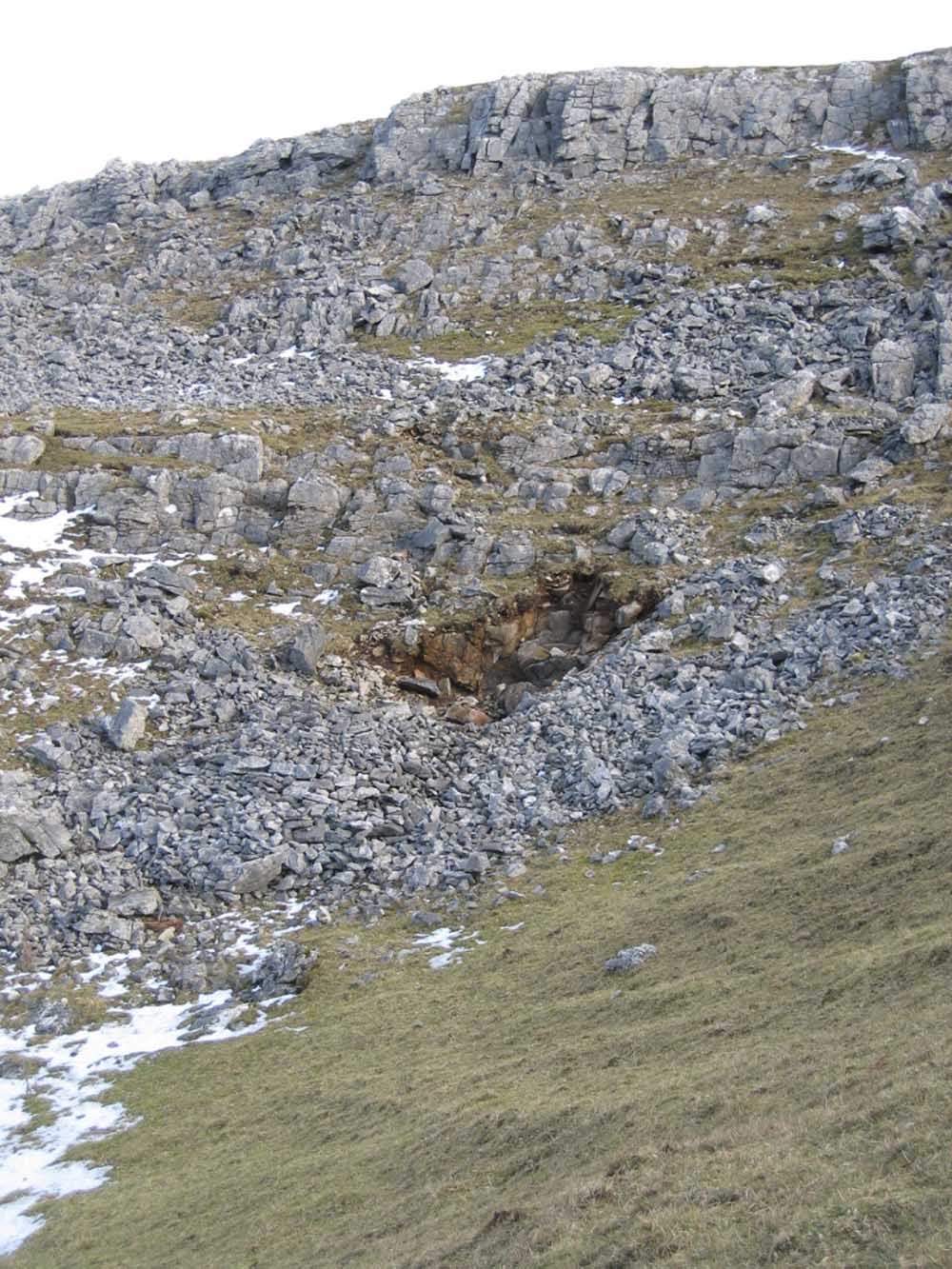
Right: a significant exposure of dolomitic limestone was revealed by floodwaters from the cloudburst of July 20, 2014 in the upper reaches of Dowber Gill at 99162 72900 Alt. 389. November 19, 2014.

Left: a bed of dolomitic limestone was revealed at 98991 72946 Alt. 373m after stream bed deposits were washed away by the flood waters. November 19 2014
A bed of dolomitic limestone was unearthed by C Camm, R Bendall, P Ryder and S E Warrren whilst examining a spring on the limestone terrace above Kettlewell in 1998 at 98333 70322. The bed was some 0.8m thick and composed largely of a coarsely crystalline deposit when first examined. Three years later, in 2001, it appeared that the crystalline nature had changed to a much finer brown sandy deposit. It is assumed that exposure to the atmosphere had affected the deposit in some way. This is still under investigation. Other exposures of dolomite limestone occur in the immediate area.
A good place to see dolomite on a grand scale is in Threshfield Quarry recently opened to public access since quarrying operations ceased in 2000. There is a new public footpath through the quarry from Threshfield giving access to the views below.
The quarry was originally opened up by local entrepreneur John Delaney in 1902 for the extraction of 'brown limestone', i.e. dolomite, much valued in many branches of industry of the day.
This type of deposit is not at all unusual in geological terms as it occurs in many parts of the world. Dolomite is in great demand and has had a particular application in the production of float glass. Dolomite was named after the French mineralogist Deodat de Dolomieu in the 18th century after he first recognised the particular properties of the rock.
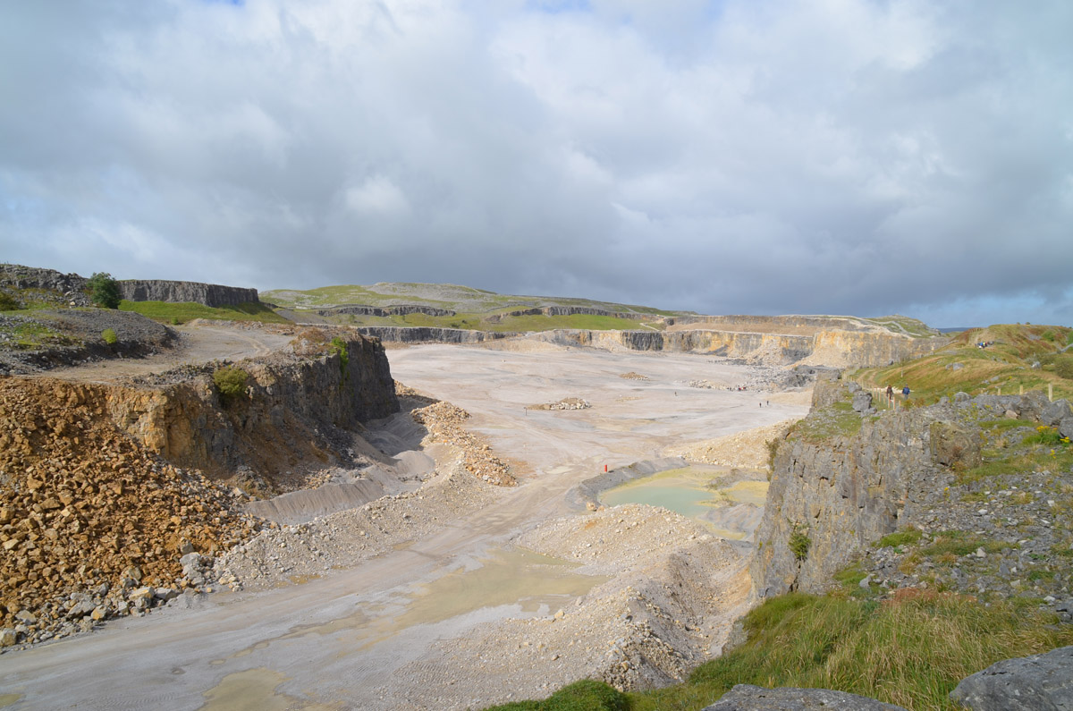
Left: great heaps of brown dolomite occur around the nearer reaches of the quarry although in more recent times the operators concentrated on the vast resources of grey limestone seen in the higher parts of the site. October 29, 2012.
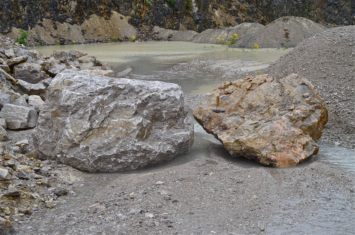
Right: these contrasting boulders illustrate the difference between the grey limestone and the brown dolomite found at Threshfield.
July 29, 2013.
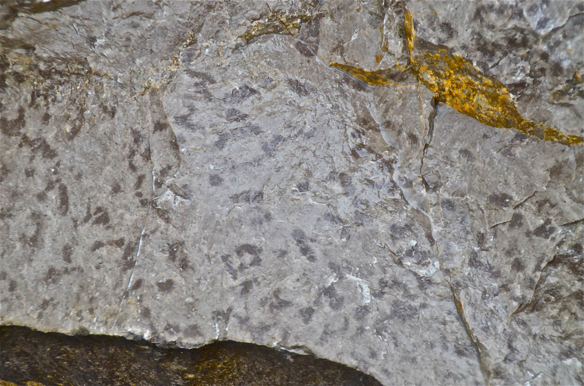
Left: a closer look at the grey limestone shows this particular specimen to be a very fine grained grey limestone, almost a porcellanous limestone, with darker blotches giving the impression of a brecciated limestone. July 29, 2013.
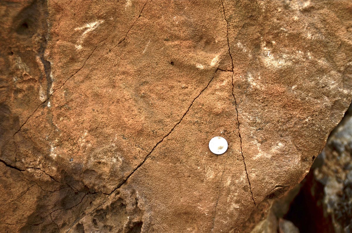
Right: a well weathered specimen of dolomite. July 29, 2013
In 1998 a bed of limestone seen in the river bed close to where the Scargill Fault crosses the River Wharfe was originally identified as dolomitic limestone. On October 1, 2014, during a period of very low river levels, it was found that his appearance was due to an unusual weathering effect on several outcrops of grey limestone along the river bed in the vicinity of NGR 972712.
A bed of "sandy limestone" was recorded by divers in Black Keld which subsequently was identified as dolomitic limestone (Murphy 2003).
Another outcrop of dolomitic limestone can be seen along Tippering Lane near Rain Slack Well.
References:
Warren S E, 2001. Conistone Moor. White Rose Pothole Club Journal 2001, p7, and, Conistone Moor sketch map p9.
Murphy P J, Dolomitization of the Great Scar Limestone Group in the Black Keld catchment, North Yorkshire, UK. Cave and Karst Science Vol. 30, No. 1 2003
There is a range of websites giving further detailed information about dolomite, its occurences and its uses.
Any
shortcomings in the text are entirely my own.
If you would like to get in touch or add information, there is an email
address:
mudinmyhair@btinternet.com
Steve Warren
Website created by WarrenAssociates 2012
Website hosted by Tsohost
Copyright © Steve Warren 2012