DOW CAVE
Kettlewell
Dow Cave has a wide variety of features that are helpful in understanding how this cave and others in the vicinity have been formed and developed on the geological time scale. It is a wonderful cave with many outstanding features, well worth a visit by the connoisseur of the unusual.
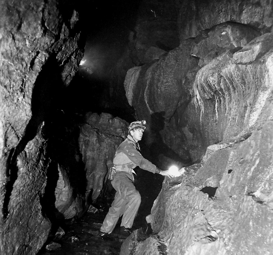
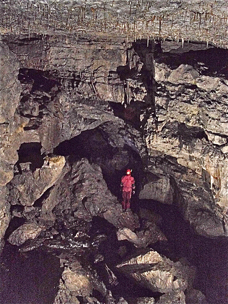
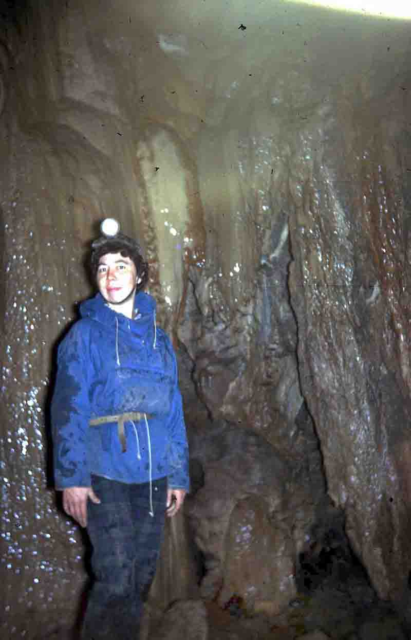
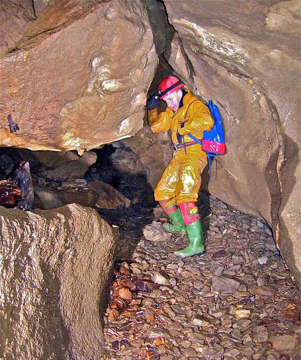
1. Left: the author in Dow Cave c1984.
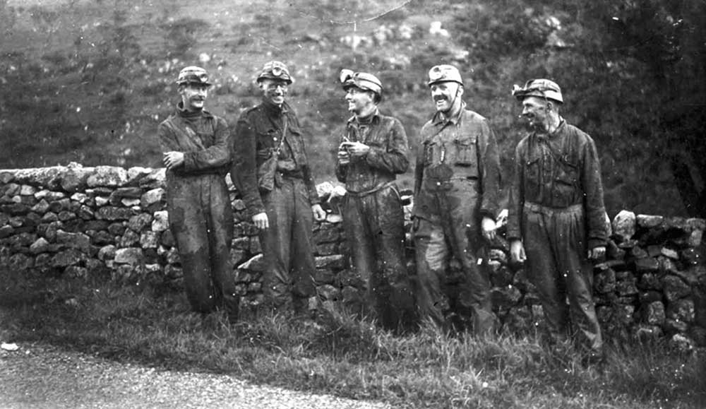
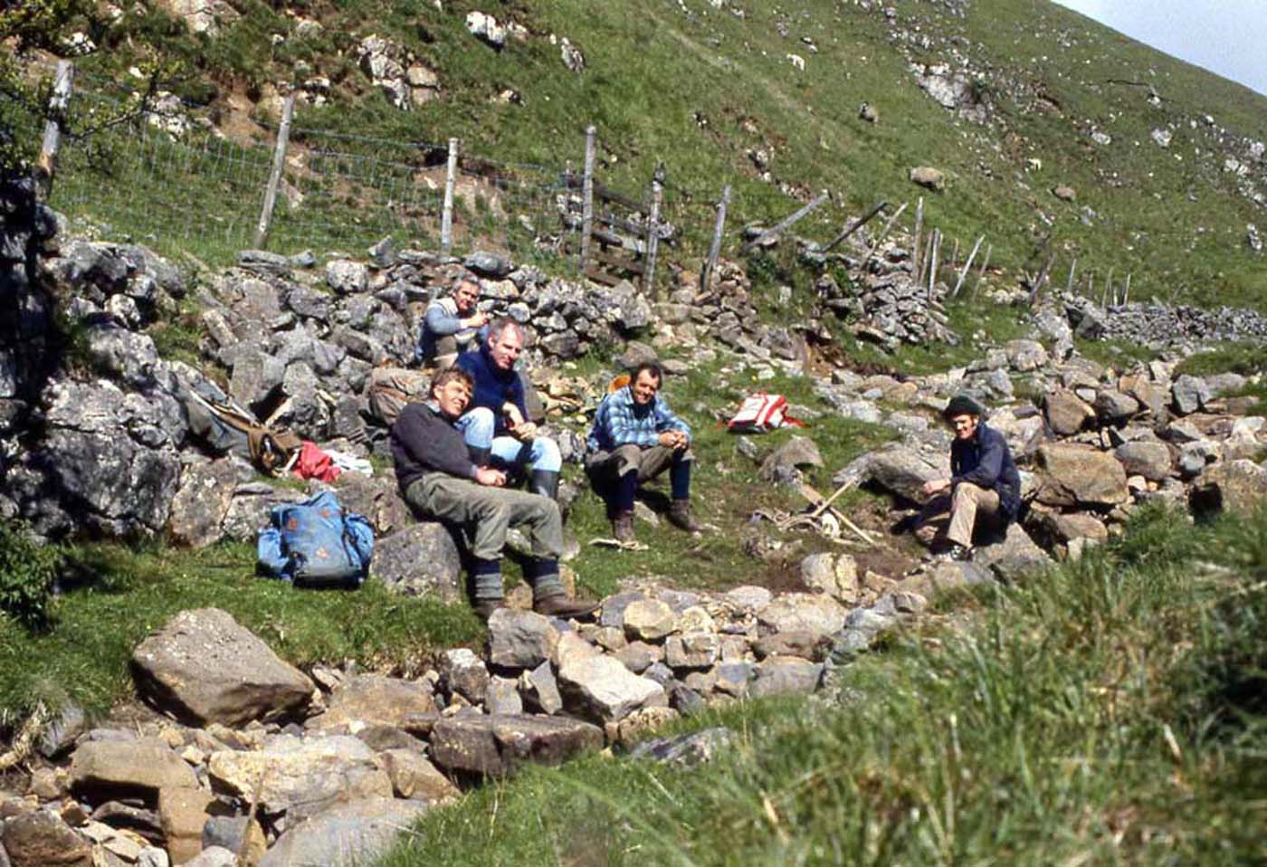
2. Right: some of the Craven Pothole Club members who introduced me to Dow Cave in May 1954. l-r Stan Peckover, Hugh Bottomley, Dennis Brindle (?), Bob Crunden, Alf Birkett. Photo A Mitchell
3. It is important to appreciate that Dow Cave has a number of hazards, not the least of which is severe and unexpected flooding after rainfall on the moorland around the cave. Left: Peter Rose swims for the entrance when a flood pulse came along. January 19, 1986
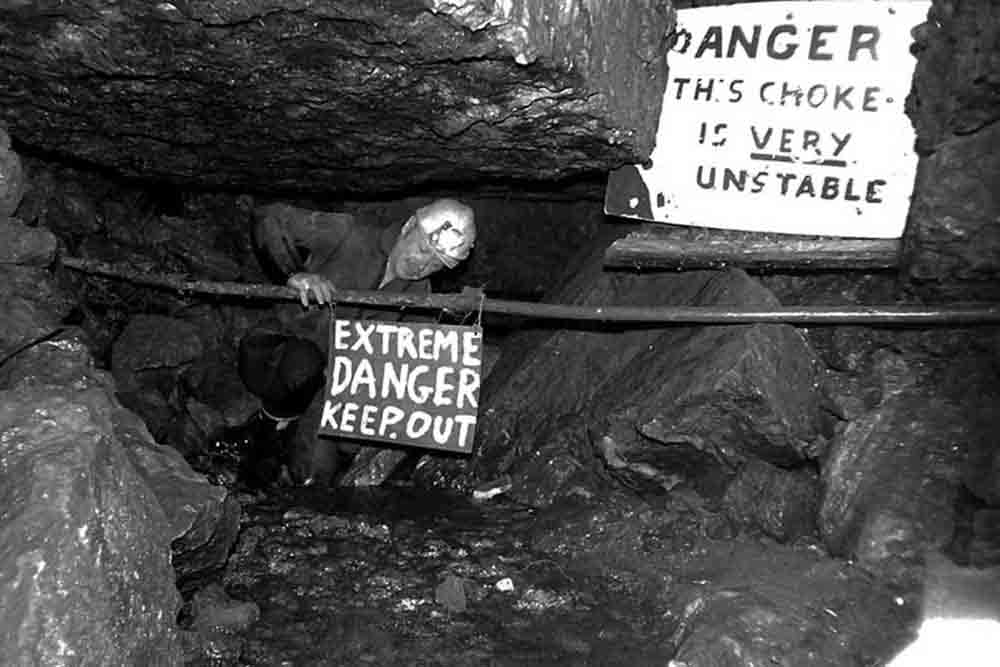
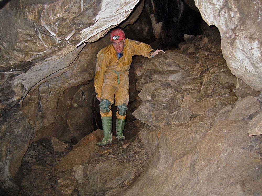
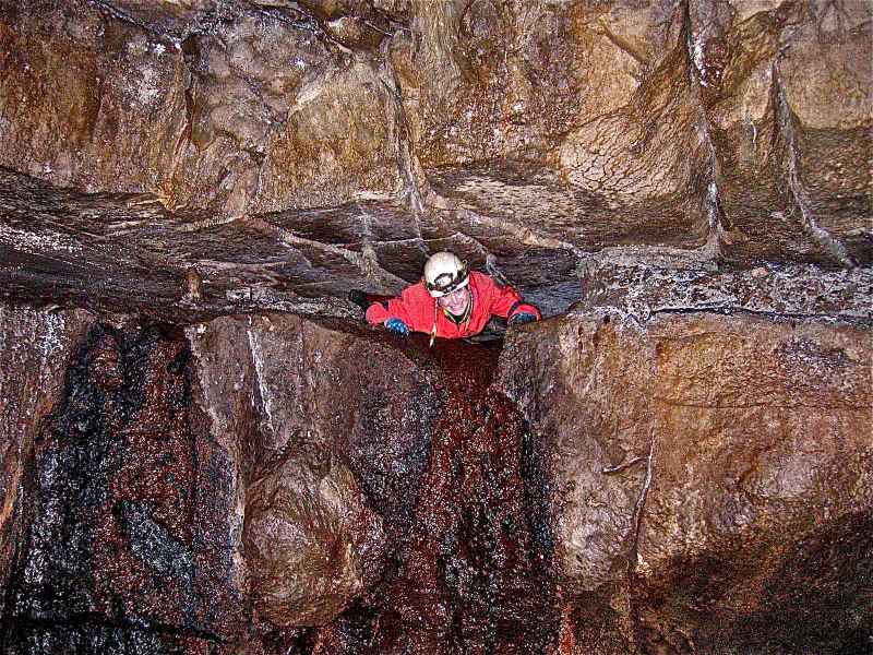
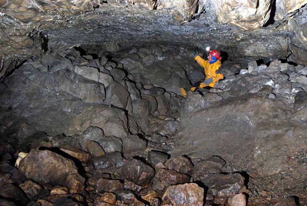
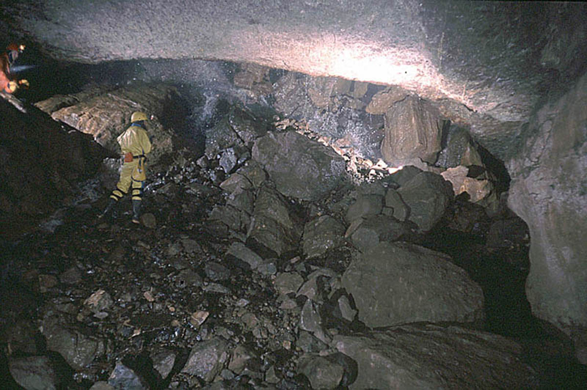
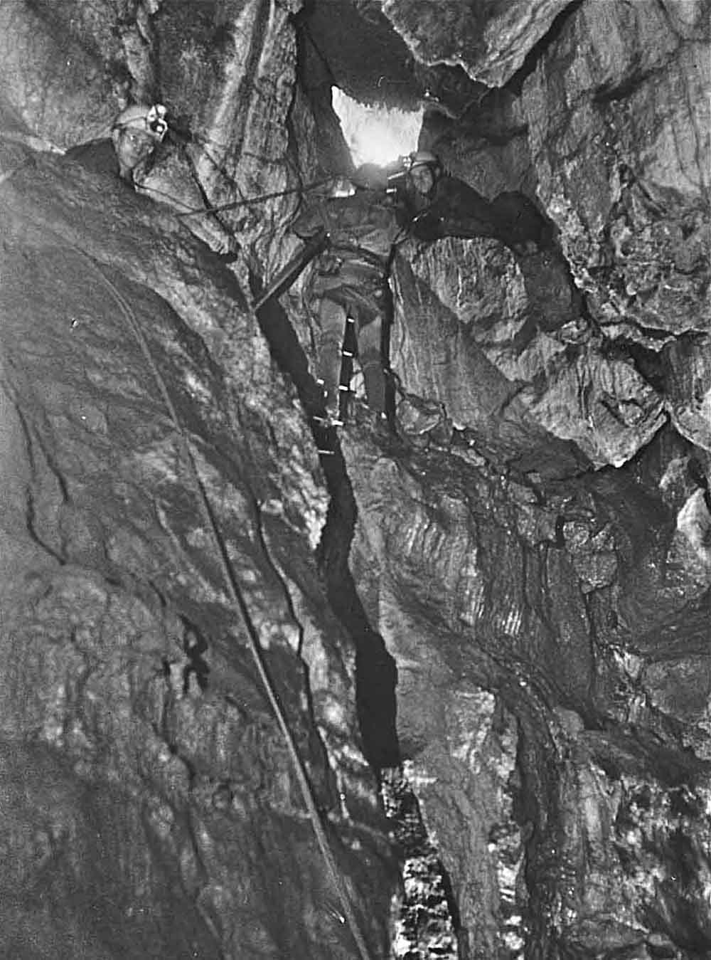
4. At several points faulted rock may collapse at any time. Particularly hazardous points occur at 'Hobson's', at the 'Moving Staircase', and within the 'Second Choke'. With proper procedures, training and suitable equipment such hazards may be minimised. Peter Rose pictured during attempts to reopen the route through "Hobson's' c1982
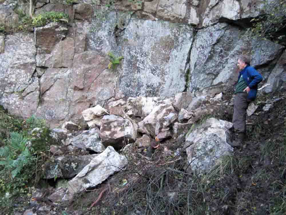
5. Left: In October 2005 several tons of rock fell from the entrance arch. Fortunately there was no-one nearby at the time. November 1 2005
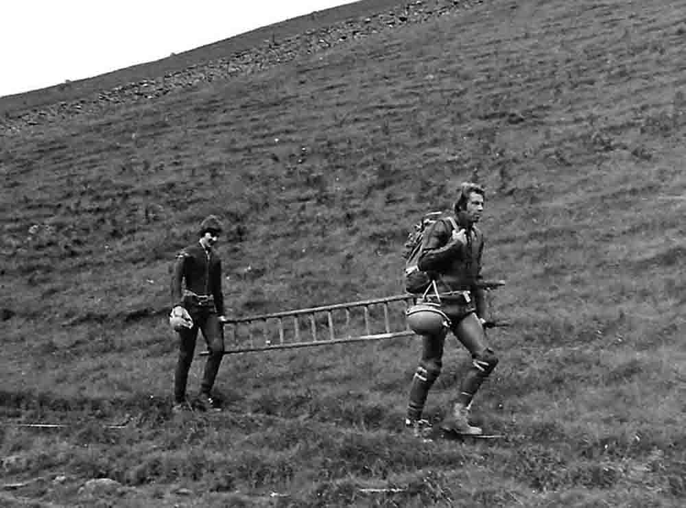
6. Right: Unconventional techniques may be used to circumvent difficult situations. Denis Round and Patrick Warren take a ladder to the First Aven. The ladder was then taken to the Buddhist's Temple to complete some survey work in that area. September 29 1982
The entrance
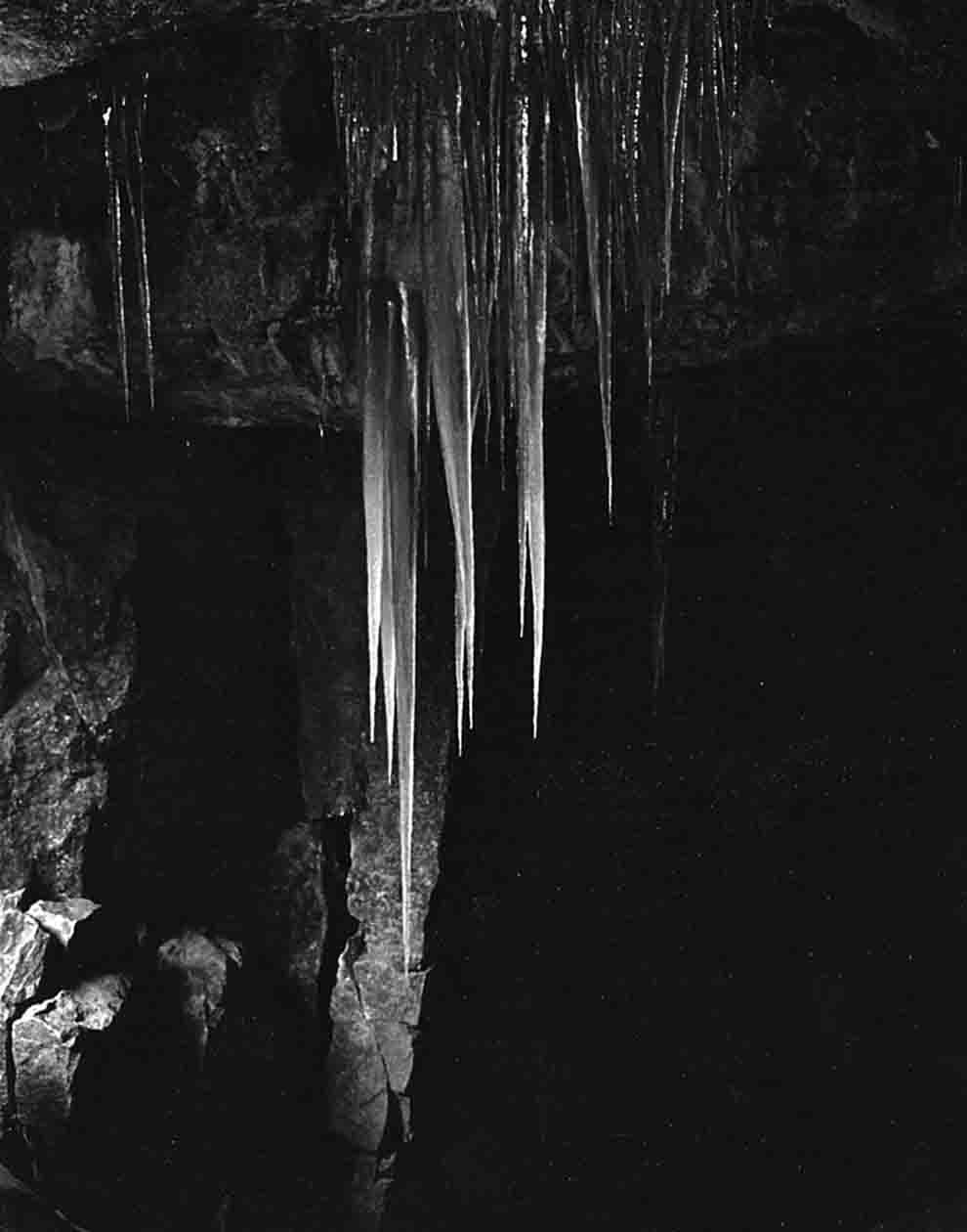
7. Left: The entrance to Dow Cave is a great place for giant icicles in the winter time. January 17,1987
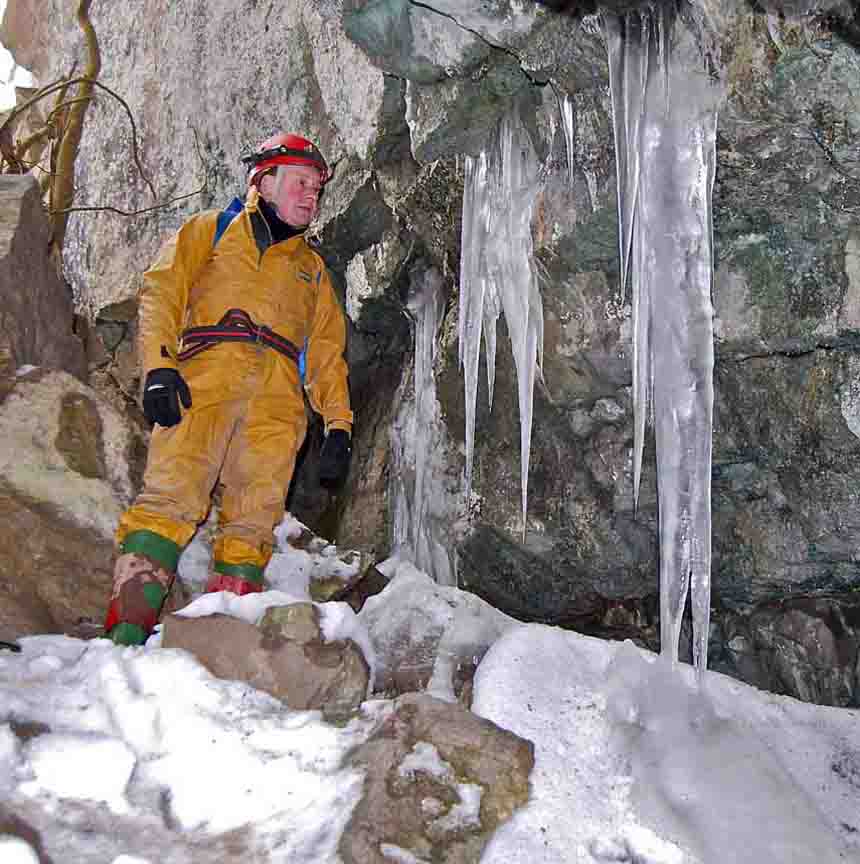
8. Right: February 14, 2009
Dow Cave is located in Caseker Gill, a tributary to Park Gill, itself a tributary to Cam Gill which flows into the River Wharfe at the "limestone village" of Kettlewell, right in the heart of the Yorkshire Dales. Although the entrance and the first 300m or so of Dow Cave are in the upper beds of the Great Scar limestone, the Gordale limestone in modern terminology, the further reaches rise up into the thinner ad darker beds of the Yoredale series.
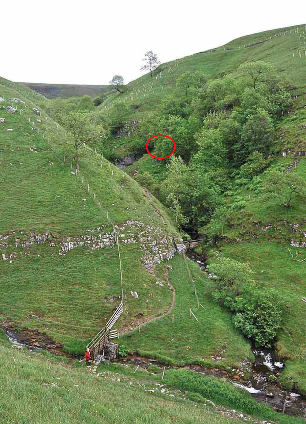
9. Left: The lower reaches of Caseker Gill showing the junction with Park Gill and the approach over the Park Gill footbridge. Dow Cave entrance is hidden to the right of the limestone cliff upper centre of picture. There is a public footpath from the road at Park Rash to the footbridge, and from there up the left hand side of the fence to East Scale Park and back to the tarmac road. There appears to be an unchallenged right of way from the footbridge to the cave entrance. Rightfully belonging to the Trust Lords of Kettlewell, apparently, Dow Cave has always enjoyed freedom of access. June 18 2011. Recent changes in land ownership have altered this situation and the new arrangements may be found on the CNCC website (March 30, 2015).
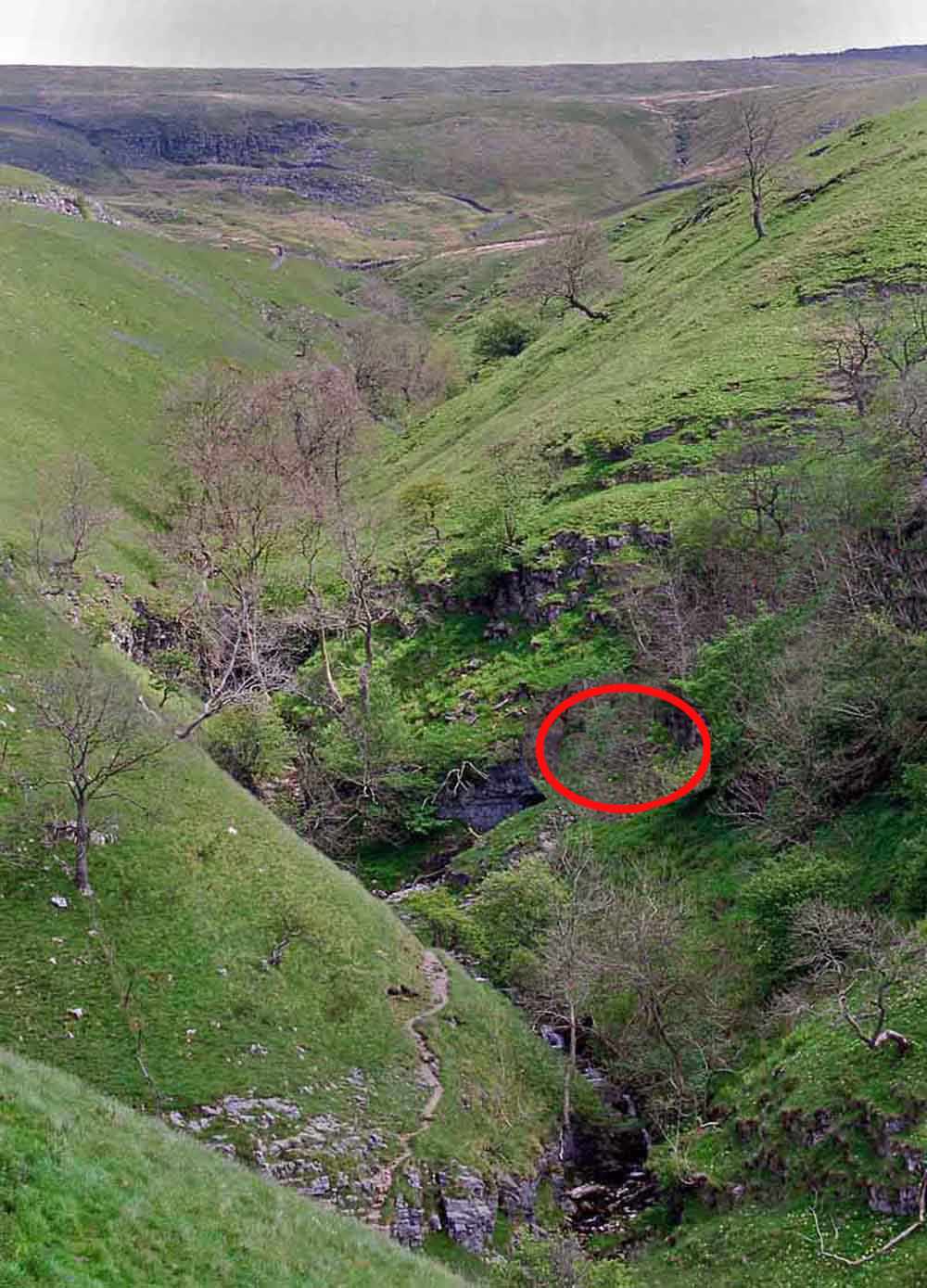
10. Left: the upper reaches of Caseker Gill, the "Hidden Valley". Dow Cave entrance is still hidden away to the right centre of the scar. To the left of the limestone scar is a 4m dry (usually) cascade and gorge leading into the upper gill. The cave generally trends under the right hand side of the gill before changing direction near the upper part of the visible gill. Higher up is Caseker Scar where a mass of millstone grit has slipped away. The summit of Great Whernside forms the skyline. May 25 2009
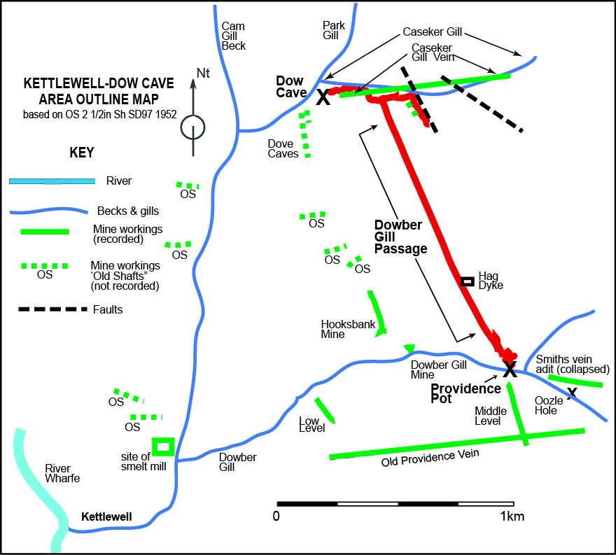
11. Right: sketch map showing the location of Dow Cave in relation to surface features and mine workings.
Brief description of Dow Cave
Essentially, Dow Cave appears to be a post-glacial stream cave incised into or from pre-glacial phreatic cavities. The Main Stream Passage has a length of around 800 metres from the entrance to Stream End, the farthest point of the streamway, the straight line distance from entrance to the end is 554 metres. The trend of the main cave passages are easterly but there is an abrupt change of direction to the south-east at a point some two thirds into the cave. The key to understanding this phenomenon concerns the nature of the passage in the vicinity of The Waterfall, which is in a narrow high rift passage, and that around the Second Miners Chamber, the Triple Oxbow, and Third Miners' Chamber, which is quite clearly a phreatic development. There are also some 200 metres of subsidiary passages as well as 450 metres of mined passages. In addition there is the tributary Dowber Gill Passage, a fault/joint guided streamway of some 1500 metres, fed from a stream sink at Providence Pot in the adjacent Dowber Gill.
Current thinking has prompted the speculation that sections of the Dow Cave system are of hypogenic origin. Some parts are clearly "epigenic" such as the canyon streamway near the entrance, and the that around the Waterfall and succeeding upstream canyon streamway as far as the Second Choke. "Their origin depends on aggressiveness derived from surface or near-surface processes" (A Palmer, Cave Geology p209). This would include glacial meltwaters of the past and more recent flood pulses of highly acidic waters from the peat moorlands of the fells above. However other parts "owe their origin to processes beneath the surface" (Palmer A. p209). These "hypogenic" areas would incude the arched passages of the main streamway, and obviously phreatic sections of the Second Miners' Chamber and below The Waterfall.
Providence
Pot (including Upstream Sump
passages), with a total passage length of some 500m also shows several
distinctive features - phreatic sections and breakdown zones as well as
abandoned vadose passages.
The
transition from Great Scar Limestone up
into the Yoredale Series occurs in a striking manner at the end of the
'Old Cave' where a major breakdown has to be passed at the First Choke,
generally referred to as Hobson's. At
this point the accessible passage rises up
through a prominent 'marker' bed, the Girvanella Bed, and into the thin
often darker beds of the Yoredales. One of the consequences is instability in
these thinner beds along faults and mineralised zones.
The main streamway of Dow Cave is fed from a number of sources: sinks in the bed of Caseker Gill drain into the cave at First Miners' Chamber, Black Inlet and Stemple Rift Inlet principally. Nearer the entrance are smaller feeders at First Inlet and Dribble Mine. A substantial feeder is Dowber Gill Passage carrying water from Dowber Gill and from the Providence Mine fault/vein system. Notably, in flood conditions, a very large amount of water enters the cave in the area of the Second Choke. This will be discussed in the relevant section but a powerful flood pulse has been experienced, some seven to eight hours or so after heavy rain on the fells above, on many occasions. There seemed to be no major sinks in the vicinity that could account for this phenomenon.
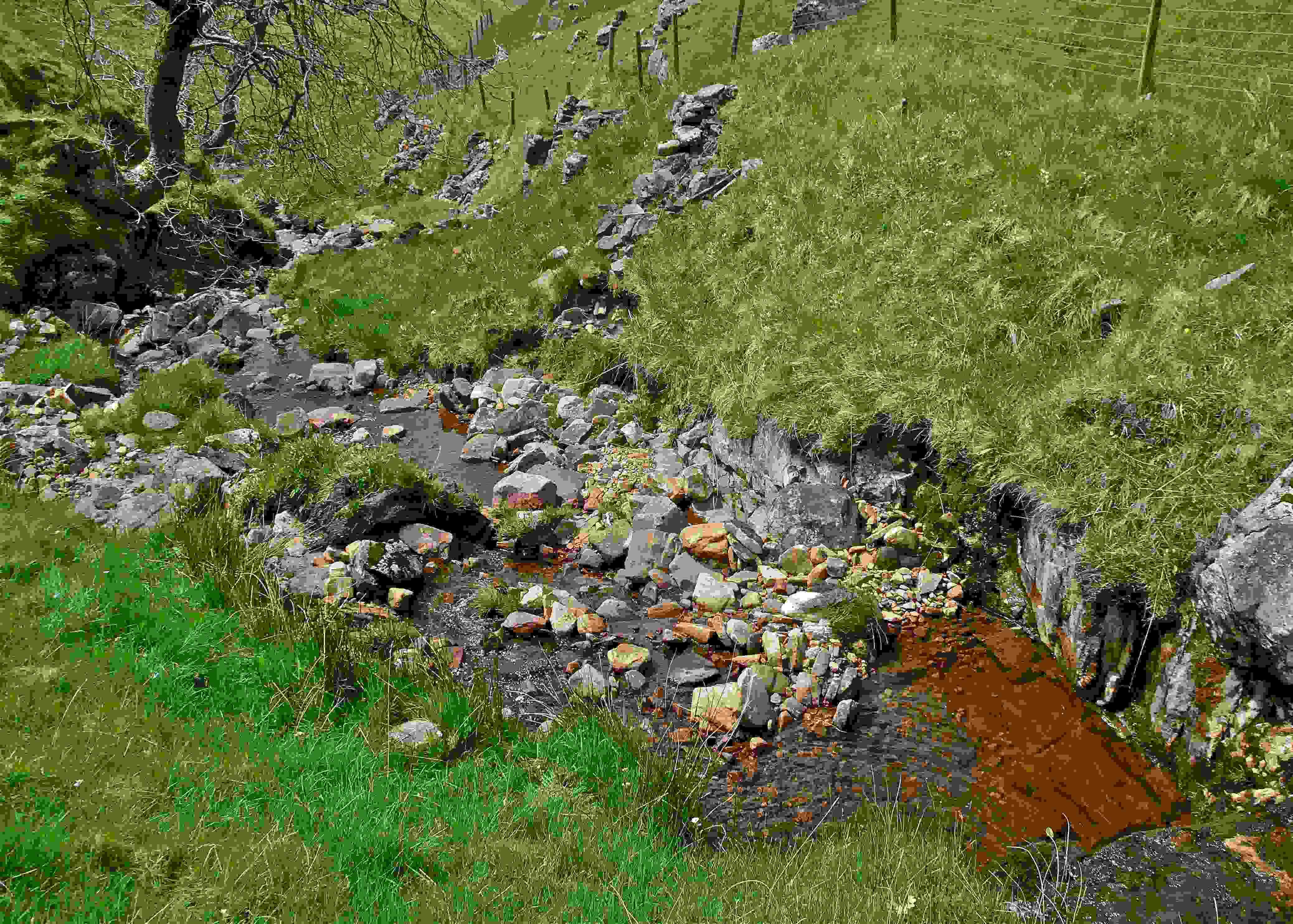
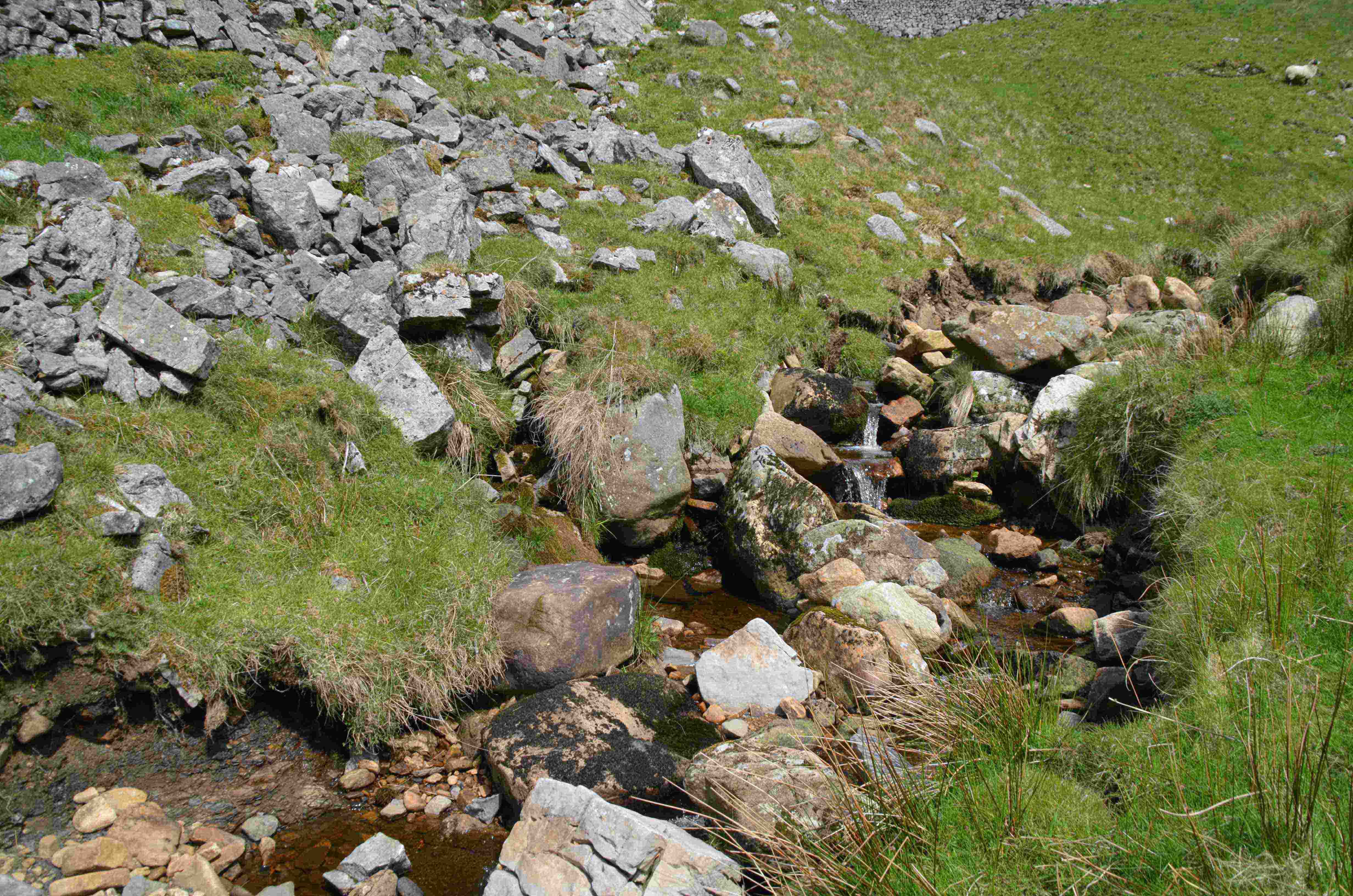
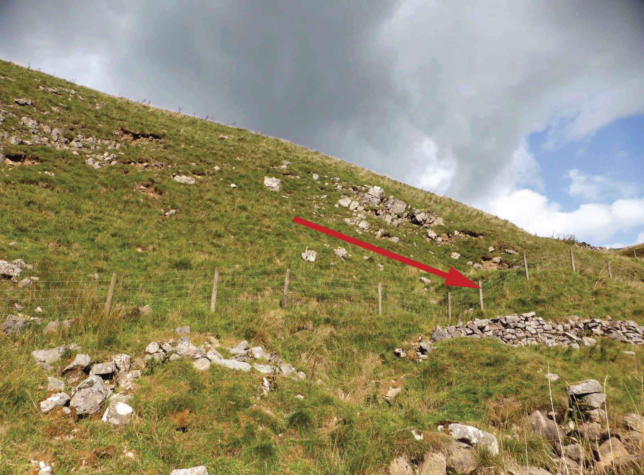
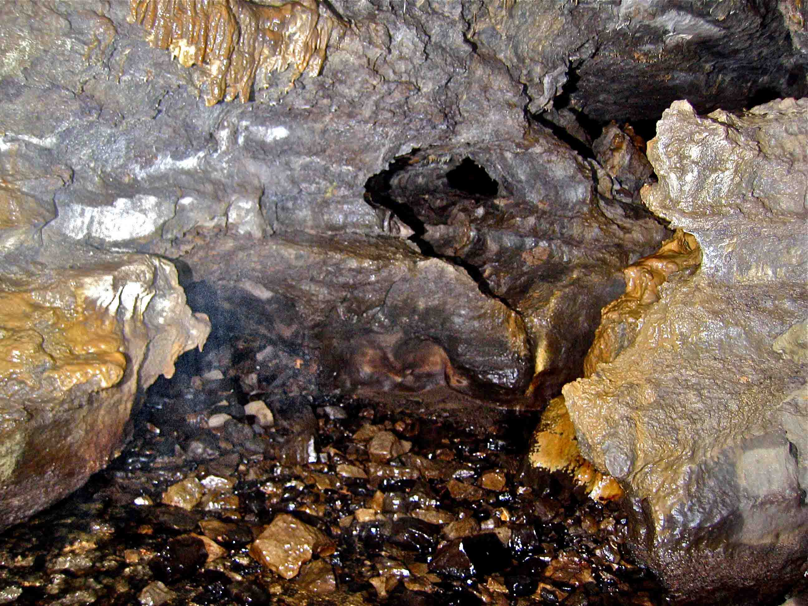
However, in June 2016, Dave Milner and I observed at 98762 74328 Alt 379m:
i) the amount of water sinking in this faulted area in the upper part of Caseker Gill would clearly match that entering Dow Cave at the Second Choke, in normal weather conditions, see pictures below.
ii) the observed surface fault area, where the junction of Simonstone Limestone and Dirt Pot Grit is seen dipping to the East at some 20º, was very similar to a that seen in the Roof Chambers in the Second Choke area of Dow Cave. This fault line may be projected across the moor to the same area of Dow Cave, although totally concealed on the surface due to a great thickness of glacial drift.
iii) these features combined with large area of peat bog on this western flank of Great Whernside could adequately account for both the normal flow rates and the flood pulses sometimes seen at Dow Cave.
Guide to Dow Cave by Patrick Warren
Dow Cave NGR SD 9837 7430 alt. 334 m ODN
Access from Kettlewell
Dow Cave is about 30-35 min walk from Kettlewell: or, park at Park Rash (10-15 min walk). From Kettlewell take the unclassified road that goes over to Coverdale, to the layby at the bottom of the first steep ascent where the road crosses Park Foot Bridge (Park Rash). Cross the stile on the right hand side of the road part way up the hill and follow the path as it contours around the hillside. After the path crosses Park Gill on a footbridge the right of way continues up the steep bank along the left hand side of the fence line. Dow Cave is reached by a short ascent to the right hand side of the fence line followed by a traverse on a well-worn path above the gorge section of Caseker Gill.
The entrance is at the top of the slope on the other side of the beck, to the right of the (usually) dry waterfall, above the rising "Caseker Gill Spring Cave". Dow Cave provides an hour or so of fairly easy caving with varied passages and many interesting features. A trip into the Caseker Gill extension involves passing the Hobson's Choice boulder choke, which is possibly not for people with a nervous disposition.
Entrance to Old Final chamber
Descend the boulder slope and head upstream – initial boulder blocks can be passed by short scrambles. The streamway develops into a magnificent walking canyon until an inlet is met falling from a bedding plane on the left hand side – this can be either a trickle or a waterfall depending on the water level in Caseker Gill. The main passage then becomes lower and wider – wading can be avoided by judicious choices of which side to follow. A particularly deep section is circumvented by a ledge on the right, past a old dig site (Dennis’ dig). The passage then becomes cobble-floored before ending at a collapse. An obviously engineered walled section enters a small chamber – the Treacle Mine. Climb up through this chamber under a drippy inlet and drop back into the large passage through a window at the top of a slope, to reach the main stream again.
On the left at the bottom of the slope an awkward step up gains an oxbow but this side passage is more easily entered from a few feet further on – this is the start of Gloop-de-Loop – an esoteric alternative which degenerates into wet crawling before emerging on an obscure ledge overlooking the old final chamber, after crossing over the main passage.
The main passage continues large, over blocks and past the keyhole entry to Dowbergill Passage on the right, to enter the Old Final Chamber, with a massive collapse straight ahead. The stream emerges from the base of the collapse.
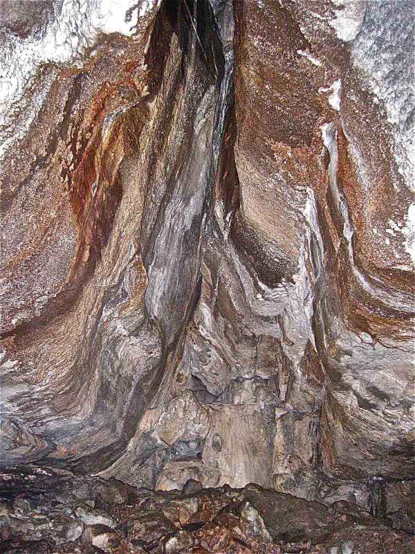
Dowbergill Passage can be followed sensibly for some 150m as a side-trip – it starts a little low but soon becomes stooping / walking, in a gothic canal, with some fine white helictites and straws in the roof. This ends where the roof lowers to apparently meet the water, but this is easily passed on the right to emerge in a wide rift – the lowered roof is now seen to be the foot of a magnificent flowstone cascade – the Buddhist’s Temple. For the adventurous, more wading and climbing past the occasional blockage leads to another wide rift section where a knotted rope signals the climb up into Gypsum Traverse. The continuation at water level is blocked by a fallen slab which creates a 0.5m duck into the ongoing watery passage...
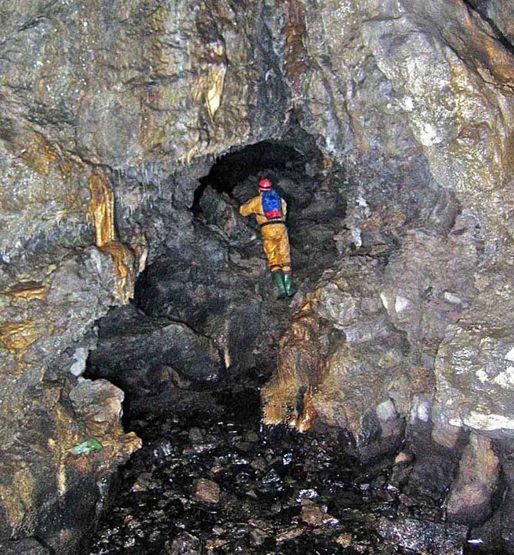
Caseker Gill Extension - Hobson's Choice (boulder choke)
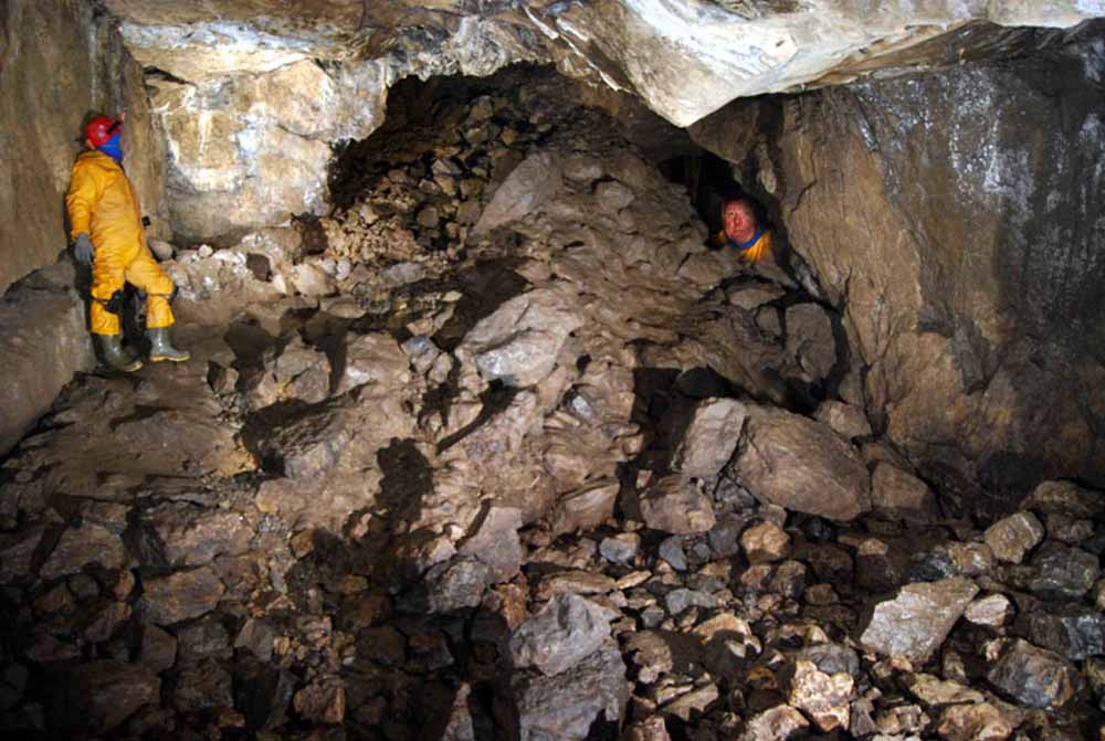
Since it was re-opened in the 1990s, this choke has apparently stabilised, but nonetheless great care is demanded to avoid going off-route. From the Old Final Chamber, go up and across to the right to enter a smaller chamber where the stream may be re-encountered. The water emerges from a hands-and-knees crawl – this point is usually signalled by a ‘danger – loose choke’ sign. At the end of the short crawl, a 1m climb up through a small triangular hole leads (on the right) to a body length of body-sized crawling past boulders. This emerges into a small chamber completely contained within the choke, with hanging death on three sides. Cross this without touching anything, and carefully ascend a 4m climb in the far left corner, using only the large boulders as hand and footholds. This enters Depot Chamber on the far side of the choke.
Note: when passing through Hobson's (in either direction) it's probably sensible that only one person at a time moves through the chamber between the end of the body-sized crawl and the 4m climb up into Depot Chamber.
Hobson's Choice to the Second Choke
From the far end of Depot Chamber, a 3m climb up next to an inlet (entering from the left) leads to a hole and a climb down again into a smaller chamber – Dripstone Chamber. Holes above here lead into mined passages. A brief crawl at floor level on the far side of Dripstone Chamber opens out where the stream is encountered again. From here, the cave resumes larger proportions. Turning a corner past a deep pool leads on to the Second Miners' Chamber with a flooded miners' trial up a slope to the right "The Swimming Pool". Then comes the notable Triple Oxbow, followed by the Third Miners' Chamber with an obvious miners' platform up to the left. A further series of mined passages can be accessed from here and a small inlet enters on the far left. The way on follows the main stream into a rift ending in a 4m waterfall which easily climbed on the right hand side. Two further waterfalls lead to the second choke, marked by a large block and breakdown. Traversing back over the waterfalls gains the Roof Gardens, with some fine formations.
Dig 'A' on the right and Dig 'B' on the left penetrate the choke. With a significant effort, Dig 'A' was pushed up through scaffold chimneys eventually to a further chamber, Albert Hall, but route finding past the end of the scaffolded section is traumatic and the crawl through choke remains desperately loose, with at least one dangling block literally swinging above one's head.
Return through Hobson's
Returning back through Dripstone Chamber, the climb up and back down into Depot Chamber is straightforward. From the base of this climb, keep on the right hand side (as heading back toward the entrance) to reach the top of the 3m climb down into the chamber in the choke. Again take care to use only large boulders as footholds. Cross this small chamber gingerly, and re-enter the body-size crawl on the far left hand side.
After a body length this leads once again to the small triangular hole back down into the stream. This hole looks improbably constricted from above, but one can slide one's legs forward whilst dropping feet-first through it. Finally, proceed down the hands and knees crawl past the warning sign, and breathe a sigh of relief.
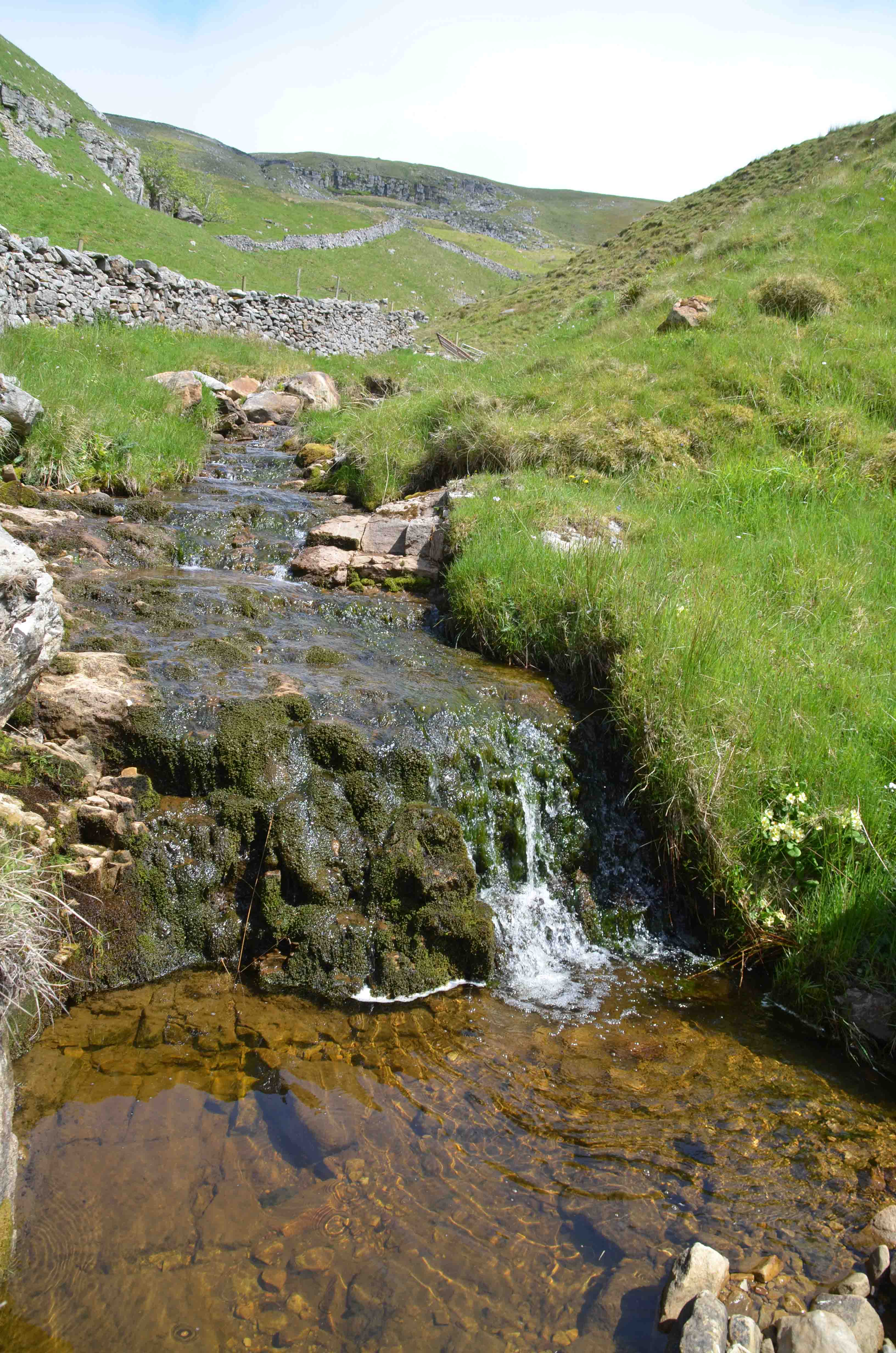
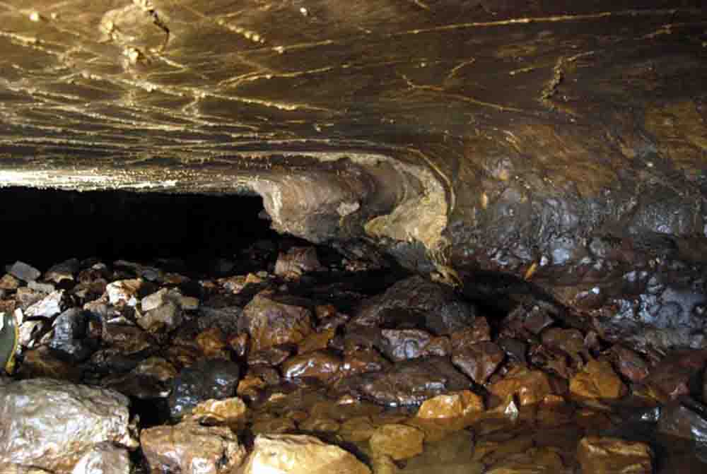
12. Cascade in Caseker Gill at beginning of sink area.
NGR 98762 74328 Alt. 379m. June 2016.
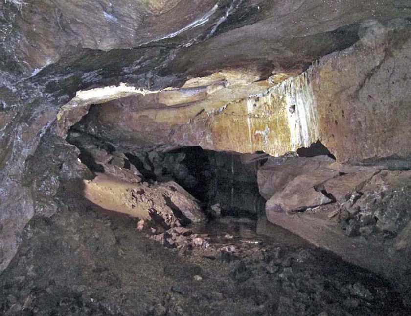
13. Cascade of above is in the bottom right of this scene. June 2016
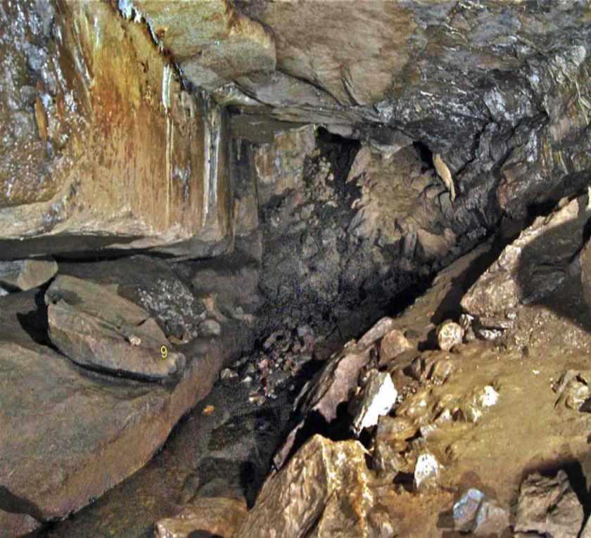
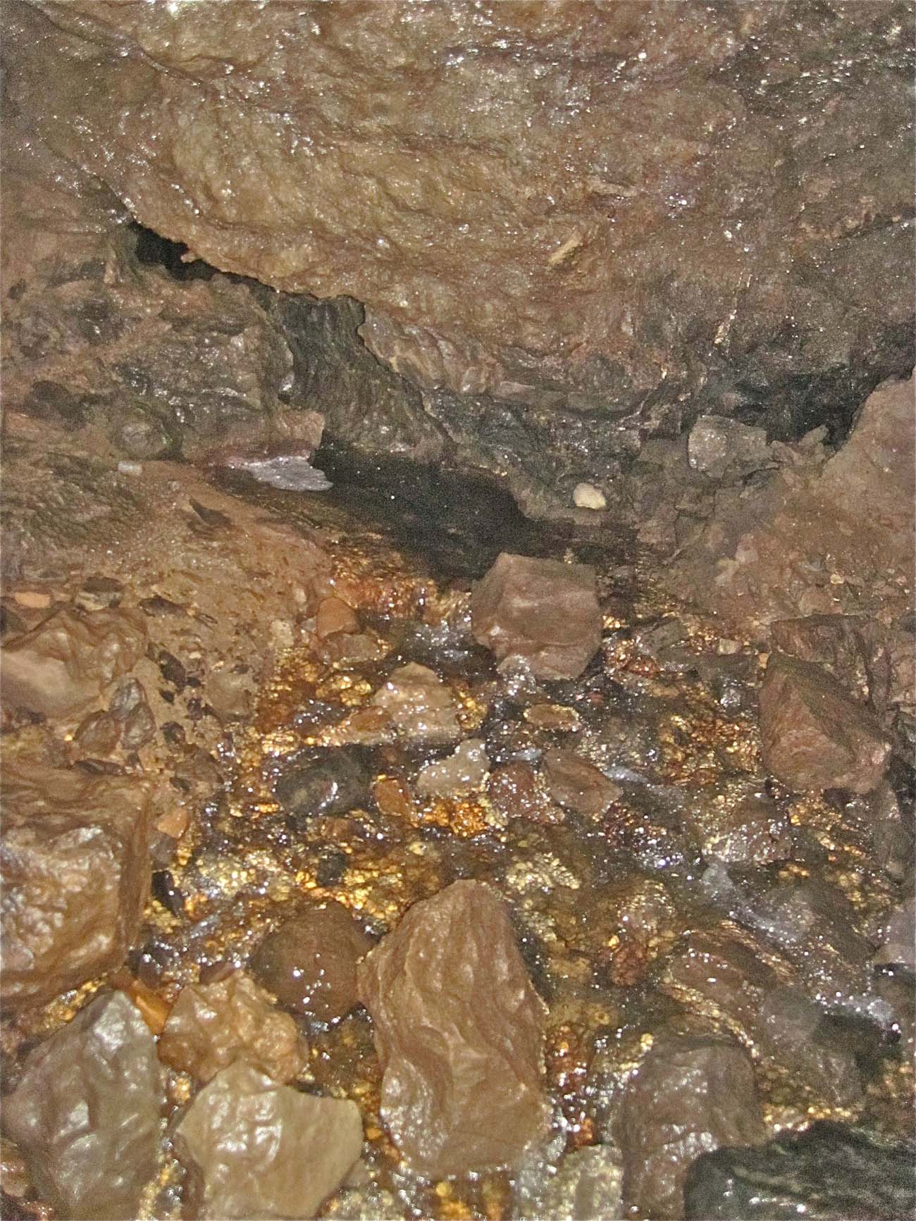
14. Lower part of sink in faulted area. June 2016
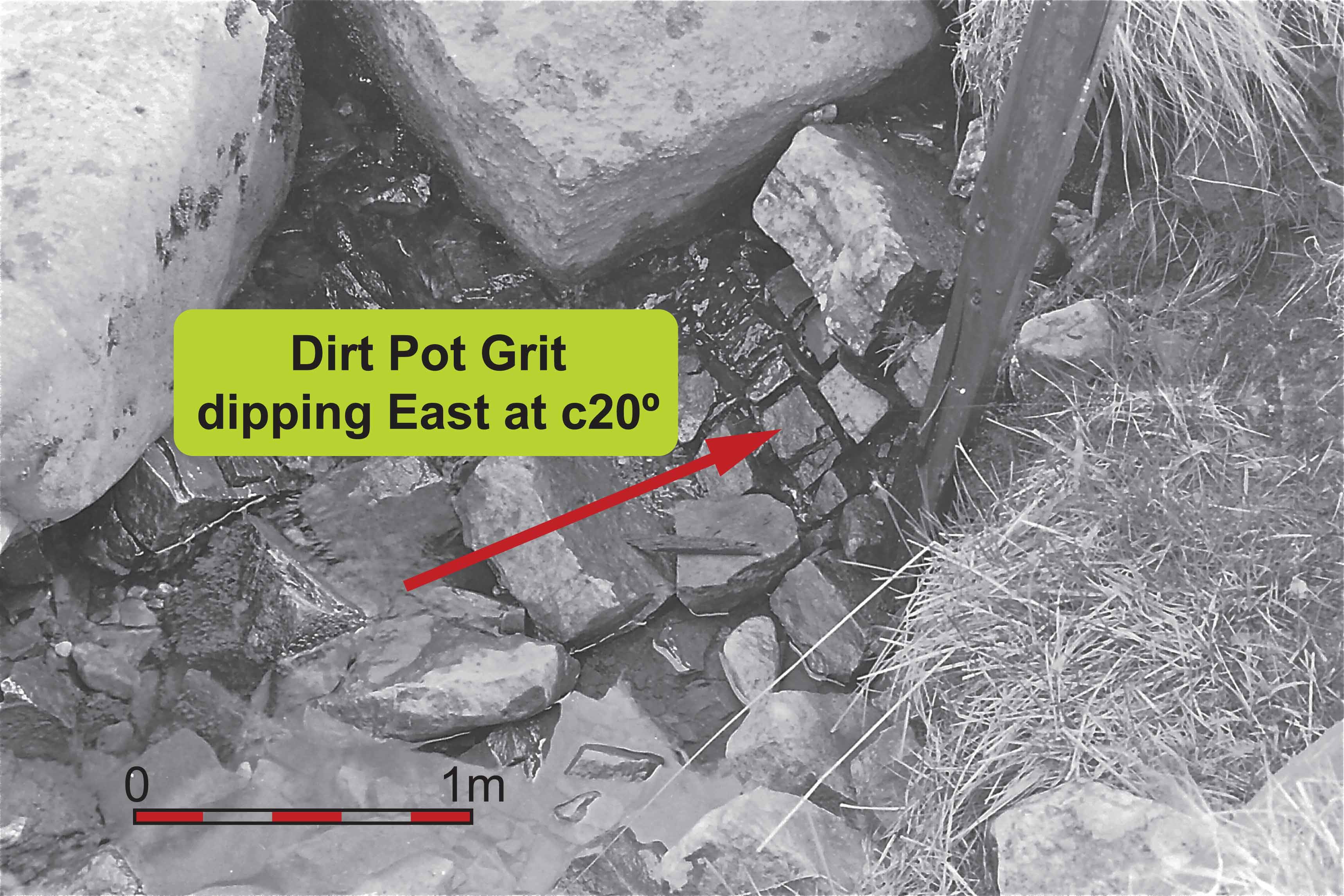
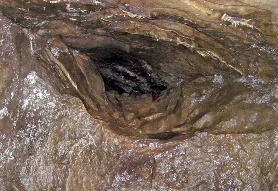
15. Exposure of Dirt Pot Grit dipping East at c20º: September 1988.
This exposure is no longer visible due to overlay of floodwash.
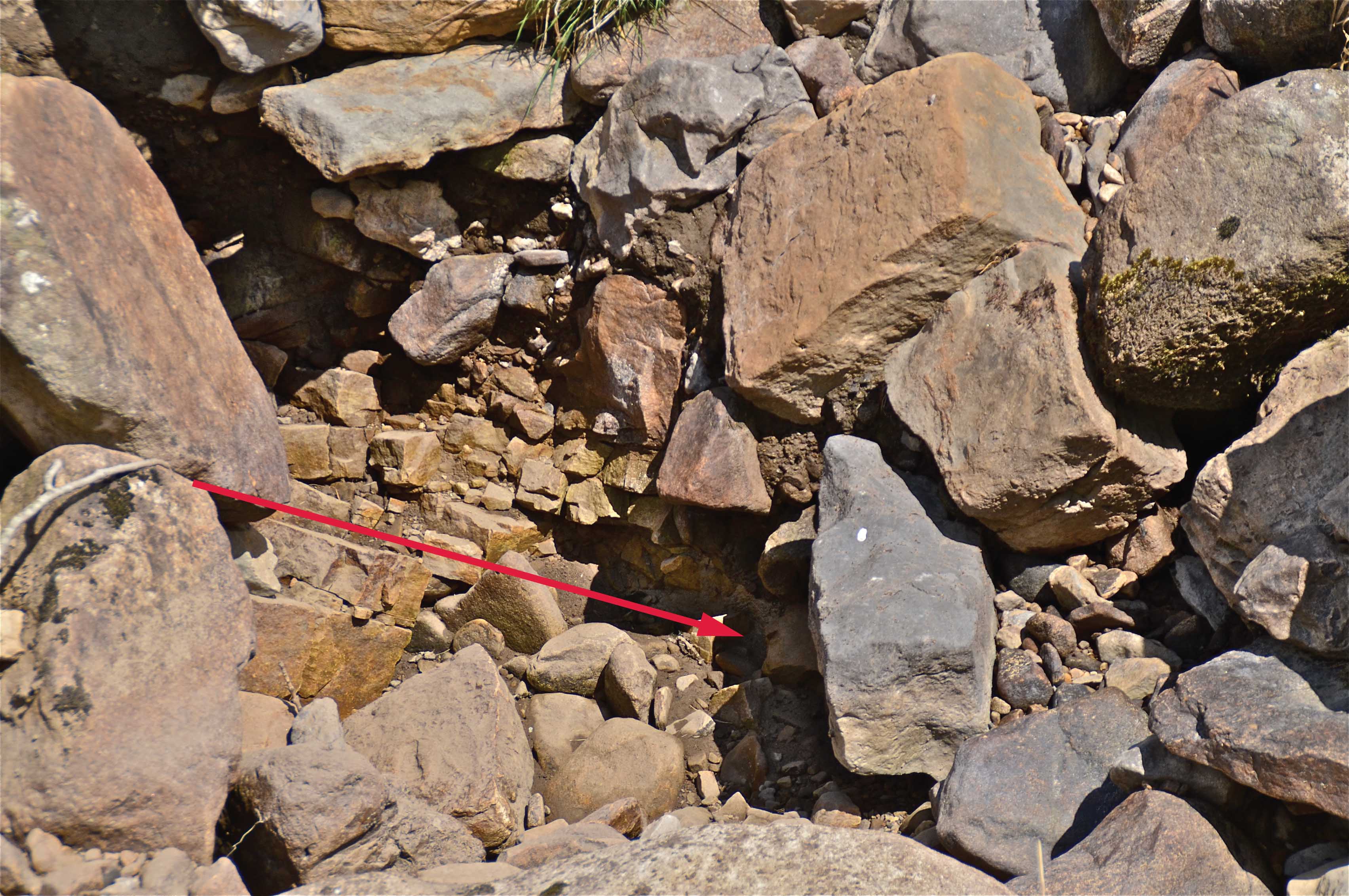
16. Exposure of Dirt Pot Grit dipping East at c20º: September 2018.
17. Junction of Simonstone Limestone and Dirt Pot Grit dipping East at c20º: September 2018.
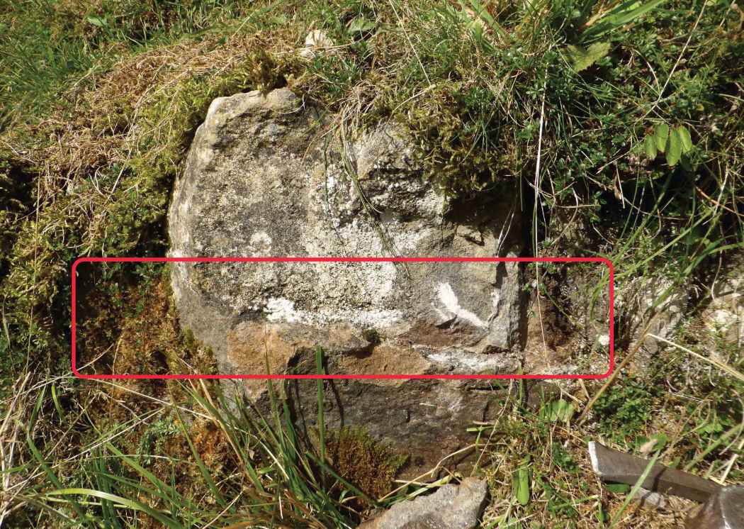
18. Close-up of mergence of Dirt Pot Grit below and Simonstone Limestone above. September 2018
The Miners
(see 'Mine workings around Kettlewell' pages of this website)
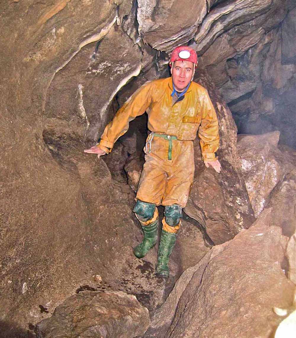
19. Left: Patrick
Warren standing by the Miners'
Platform high in the roof above the Waterfall. Immediately to the left of the figure there is a miners' trial level.
February 14
2009
20. Right: Looking into the 3m long trial level with numerous pickmarks and drill holes on the walls and roof.
February 14
2009
The mined areas in Dow Cave generally follow a vein aligned along 80 degrees although occasional diggings away from this trend can be found. The miners were probably active in the late 18thC. and up to the mid 19thC. When the mined areas in the Caseker Gill Extension were discovered in 1953 extensive enquiries found no record of the mining activities. The only mineral sought by the miners was the lead ore, galena. On the surface above the cave and into Caseker Gill there is a line of old mineshafts, aligned along the 80 degree trend seen underground. In early June 2012 a 'radio-location' excercise showed that a collapsed shaft, 'Shaft A', by the side of Caseker Gill Beck was directly above a choked riser in the Rattle and Sploosh area of Dow Cave. The vertical separation is estimated to be no more than 8 - 10 metres. Further afield there are two small levels known as Dove Caves Upper 180m and Lower (40m) and a small shaft nearby.
These workings did break into small natural cavities but they bear no relation to Dow Cave. Several mine workings in Dowber Gill have been recorded and these have been surveyed as part of this study. From time to time galena specimens have been found, notably a very fine 2kg specimen in Hooksbank Level. Further information on this subject can be found in Mike Dickinson's "Mines and t'Miners" "A history of lead mining in Airedale, Wharfedale and Nidderdale" 1972.
Quite recently Adele Ward found a reference to the Victoria Mine from from which the miners worked the diggings along the Caseker Gill Vein, in Dow Cave, and from the surface. The Victoria Mine also worked the diggings at Dove Caves along a quite separate vein.
Ref: British Mining No. 49: "The Wharfedale Mines" by M C Gill page 51.
Locations in Dow Cave:
Main Streamway:
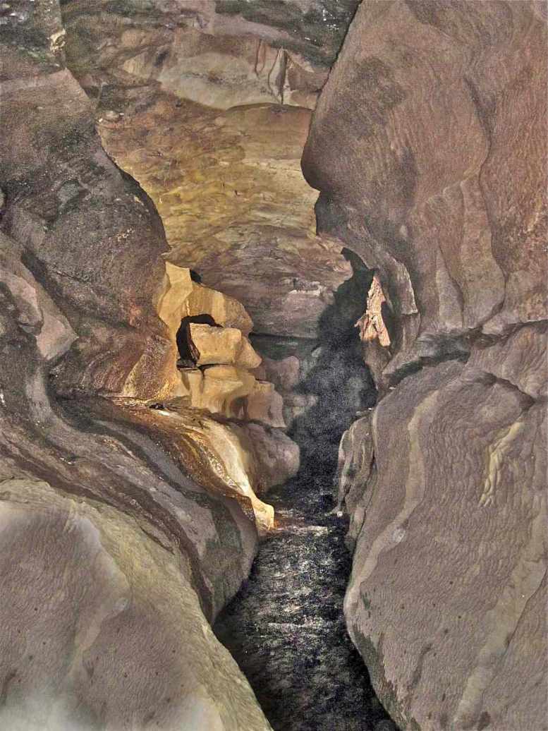
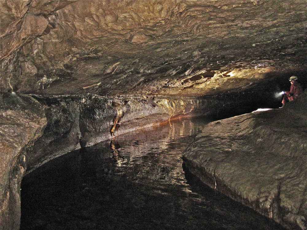
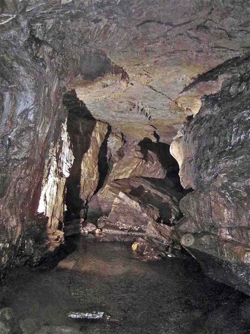
21. Left: Canyon streamway near entrance. October 2010.
22. Right: Arched roof streamway near First Aven. Notice straws and small stalactites in the ceiling along the lines of the limestone jointing. October 2019.
First Inlet:
23. Adele Ward in the short bedding plane inlet at roof level 100m from the entrance that brings in peaty water colouring the calcite deposits. July 2019
First Aven:
24. An 8m blind aven a short distance after the First Inlet. July 2019
The Canal
25. Deep water here is often a repository for lost items. Old carbide lamps used to be a favourite. Notice scallops in ceiling. July 2019
Dennis's Dig:
small dig into mud filled meander on south side of main streamway
The Treacle Mine:
A section of roof breakdown due to intersection of the main passage with a mineralised fault line. Stacks of miners' deads, a short level into a stoped area, and a 10m riser were left by the miners. The riser probably connected with one shaft (Treacle Shaft) of a line of shafts on a 80 degree trend on the surface immediately above. "Treacle Shaft" was descended to a choke at a depth of some 10m in 1954.
26. Left: Phil Ryder at the approach to the Treacle Mine from the Main Streamway. April 5 2009
27. Right: The Treacle Mine area viewed from upstream side showing the nature of the breakdown along a fault - Phil has his back to the fault line. April 5 2009
27a. Left: Miners' walling at the approach to the Treacle Mine, March 2009, now largely washed away by recent flood pulses.
28. Right: A rarely seen part of Dow Cave where the stream has carved a new route under the breakdown zone of the Treacle Mine, March 2009.
I29. Left: mmediately after the Treacle Mine collapse the mineralised fault line is prominent in the roof. Whilst the passage side to the left (north) has a conventional stream passage form, breakdown from the roof to the right (south) has infilled any canyon that may have pre-existed. To the left of the picture, the mud slope leads up into Gloop-de-Loop. September 26 2010
29a. Right: Alternative view off adjacent.
Gloop-de-Loop
A short but well developed abandoned canyon rises to a breakdown area close to a 10 aven. A low wet crawl out of the aven ends at a 5m climb down into the Old Final Chamber. It is the nature of this crawl which gives rise to the name Gloop-de-Loop.
30. Left: Gloop-de-Loop Oxbow, an 8m abandoned roof-level oxbow between the main streamway and Gloop-de-Loop. September 26 2010
31. Right: A little further into the cave just before the Dowber Gill Passage entry there is a scramble over massive blocks that have collapsed from the passage sides.. September 26 2010
Dribble Mine:
A mined passage some 5m above the main streamway, aligned along a 80 degrees, with risers up to 13m above stream level. Passes from grey Great Scar Limestone up into dark or black shaly limestones of the Yoredale Series: see Dow Cave surveys section.
Dowber Gill Passage:

32. The Dow Cave entrance to Dowber Gill Passage, c 1984, a major fault/joint guided stream passage bringing water from Dowber Gill and also from the mineralised fault zone of Providence Vein a little further to the east. See Dowber Gill Passage pages.
Old Final Chamber: Hobson's (Hobson's Choice)
The original end of Dow Cave until extended into Caseker Gill Extension in 1953 by John Hobson as described below.
In early June 1953 whilst trying to follow the stream at the end of the then known extremity of Dow Cave, John Hobson noted a draught through an inaccessible boulder ruckle. He returned on June 23 armed with "a friend, a bar and the adage 'Where's there's a wind there's a way". After an hour or so of moving rocks he was able to squeeze up into a small chamber. John and his friend climbed some fifty feet to enter a lofty chamber with a waterfall descending from the highest point in the roof. "There were one or two old mine passages around the base of the aven": this became known as the First Miners' Chamber. A week later John was joined by Alf Birkett, Dennis Brindle, Arnold Waterfall, and Bob Crunden and after a look at the new chamber they discovered a lower route forward.
This took them into a fabulous series of caverns and streamways. "a narrow chimney with a cascade thundering down; a mass of eccentric formations; an enormous stalactite; another fine pendant; a large Beehive formation; a curious rock doorway; and then "we stood gazing into the 'Roof Garden'. Here was a delightful setting of stalactites and stalagmites, curtains, pillars and straws, most of them serving as host, as it were, to accompanying erratics". "On subsequent visits the cave still had more surprises for us".
The full story can be found in CPC Journal Vol. 1, No. 5, 1953.
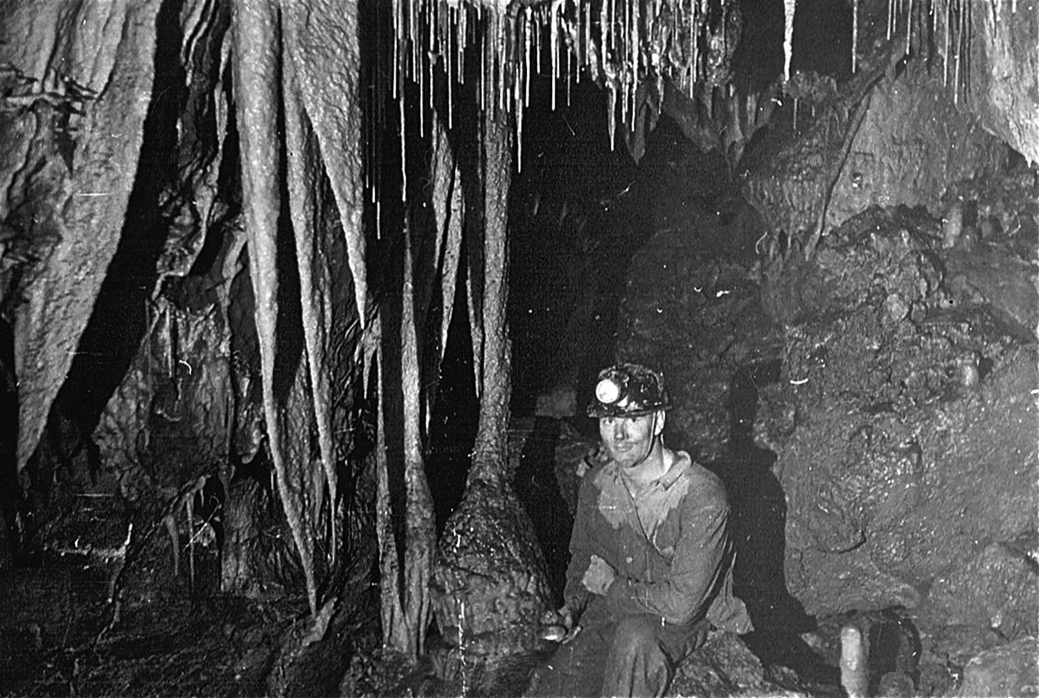
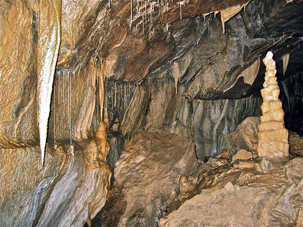
33. Left: Alf Birkett in the Roof Gardens, and,
34. right: "The Nest - a delightful setting of stalactites and stalagmites." Photos R L Crunden October 1953.
The Old Final Chamber is a significant enlargement in the general trend of Dow Cave and partly formed by roof collapse into what may have been an much larger cavern. The route through the breakdown zone or First Choke into the Caseker Gill Extension is popularly known as Hobson's.
The scramble up through Hobson's passes from grey Great Scar Limestone up into the darker Yoredale Beds.
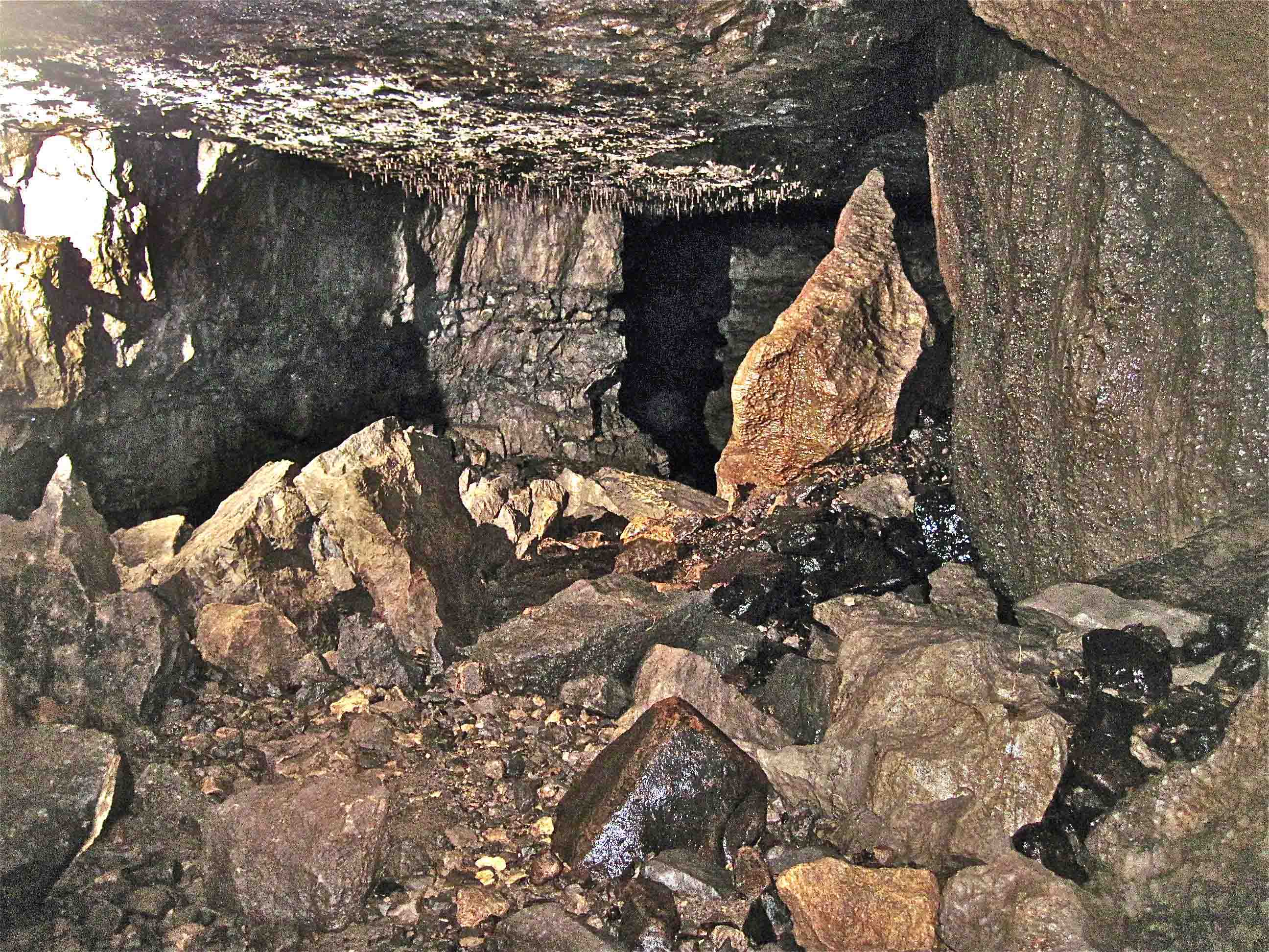
35. Left: Entry to the Old Final Chamber. October 2010.
36. Right: General view of Old Final Chamber. Photo C Dudman November 2013.
37. Left: Nigel Easton and Jan Brownson in The Old Final Chamber. December 28 2004.
38. Right: a chaotic jumble of collapsed blocks through which John Hobson first found a route in 1953. September 26 2009.
The Moving Staircase:
A more obvious choice of route after the first climb up Hobson's involves a scramble up over highly unstable poised blocks, The Moving Staircase, into the First Miners' Chamber. This feature, John Hobson's first exploration, should be avoided by taking a short climb forward at the top of Hobson's towards Depot Chamber.
First Miner's Chamber:
Large cavern situated immediately above Hobson's and formed by collapse of First Choke. Contains 10m waterfall inlet from Caseker Gill above, also contains large heap of miners' spoil from workings around the sides of the chamber.
Depot Chamber:
smaller cavern formed in cavity above collapse region continuing from Hobson's. There is series of mine workings accessed from a climb in the roof of the chamber - Depot Chamber Mine Series. 'Depot' refers to heap of miners' spoil in the chamber.
Dripstone Chamber:
a further smaller cavern with flowstone inlet at south side and narrow ascending fissure to north side, Black Inlet, that brings water in from Caseker Gill.
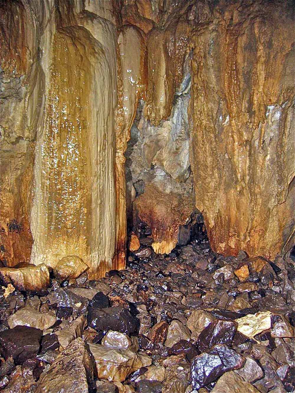
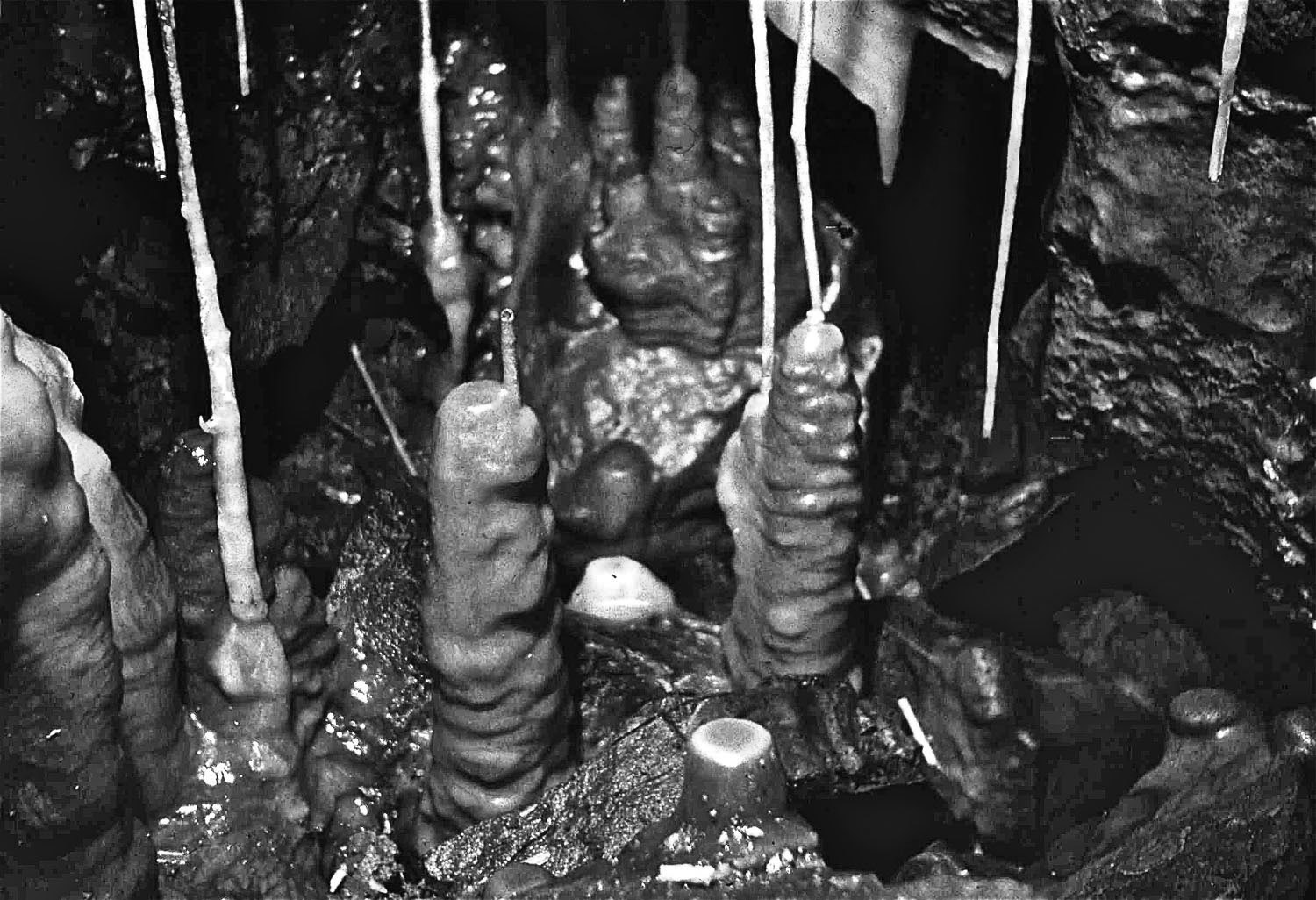
39. Left: Colourful dripstone in Dripstone Chamber. The triangular shape opening right of centre is the start of the crawl back to Depot Chamber. February 14 2009
40. Right: Dripstone Chamber has changed little over the years since this photograph of Maud was taken on August 23, 1964
Second Miners' Chamber:
a large cavern formed on faulted area, boulders and boulder clay seen in walls and roof, extensively worked by miners.
The Swimming Pool:
mine trial to a blind sump off Second Miners' Chamber
Triple Oxbow:
The main stream from the Third Miners' Chamber passes through a complex of oxbows to emerge in the Second Miners' Chamber
41. Left: the bypass to the Triple Oxbow, a section of Dow Cave which appears to have been formed under sump conditions. February 14 2009
42. Right:
another view of the Triple Oxbow
area.
February 14 2009
Third Miners' Chamber:
A large cavern formed in faulted area at a point where main streamway takes a distinct change of direction from a north-westerly trend to a westerly trend. The chamber contains: several mine trials; the Miners Platform built up of mined and natural boulders; the low Stemple Rift Inlet, and a vertical rift up to Stemple Rift Mine Series. In addition a passage leads off to the north into a complex of part natural and part mined rifts and crawls which lead to: Sploosh, a sumped mine trial, and, Rattle, a 7m drop back into the Second Miners' Chamber. Further in there is a mined riser which is located directly under a collapsed mine shaft in Caseker Gill - see section 'Mine Workings around Kettlewell'
Rattle and Sploosh:
see above
Stemple Rift;
difficult climb up a narrow rift over old miner's stemples to higher level leading to:
Stemple Rift Mine Series:
mined passage some 20m above main streamway, aligned along a 80 degree trend, with several risers up to 6m. Total length is some 90m, see Dow Cave surveys section.
Stemple Rift Inlet:
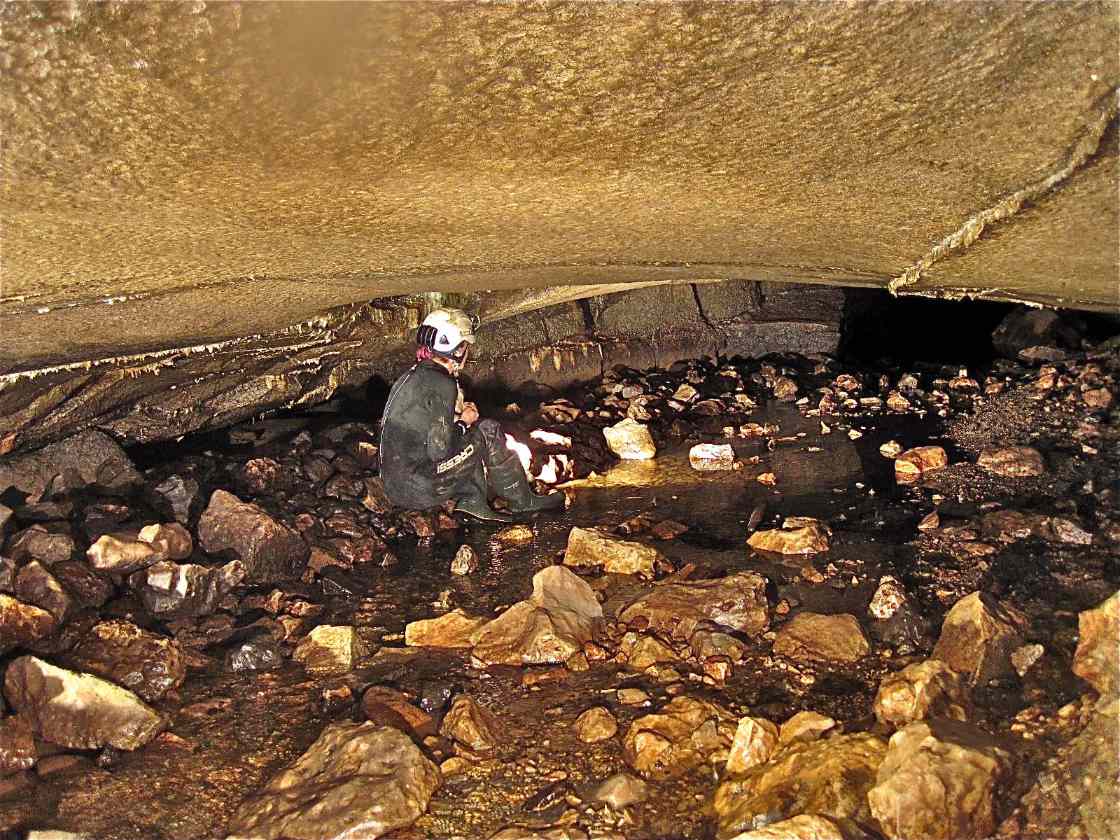
43. Left: Stemple Rift Inlet. June 6, 2013. At the point where the main streamway changes from an easterly trend to a south-easterly trend (looking in),
and almost directly under the Stemple Rift climb up, a substantial inlet emerges from a low passage. Initially tube-like along several sharp bends for some 20m it flattens to a low crawl and a sump. The sump was investigated by Dave Morris (February 5, 1986) to a distance of 4m and to a depth of 3m to where the sump was choked with sand and boulders. The visibility was lost immediately and he concluded that digging would be "futile". There seemed to be a substantial amount of ground to investigate between any likely surface sink and the sump.
44. Right above: In May 1986, Patsy Mellor discovered a likely sink in Caseker Gill taking all the stream. On May 23 Don Mellor, Steve Warren, Trevor Smith, Steve Barwick and Ted Wood, accompanied Patsy to "Patsy's Pot". Several large blocks were hauled out of a highly unstable faulted zone before digging was abandoned when Trevor Smith nearly became entombed. Photo Patsy Mellor, May 23, 1986
The Waterfall:
Goliath
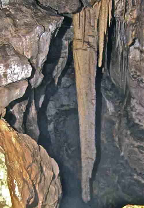
45. On leaving the Third Miners'Chamber a 15m high blind aven is passed and the streamway narrows to meet the 8m waterfall which is easily climbed. Looking back from the top of the Waterfall, the great 5m stalactite 'Goliath" is seen hanging high above the streamway. The smaller stalactite to the right became known as 'David', hence 'David and Goliath'. This view is from south end of the high level oxbow accessed from the natural stairway behind the Bridge. February 14 2009
The Bridge
Clog's Way
46. Clog's
Way was first entered (or nearly the
first) by John Holmes and Edward Whitaker in April 1991. The
well-decorated 20m length of passage contains indications that the
miners had been there previously. It is high in the roof some 11m above
the main streamway between the Third Miners' Chamber and the Waterfall
and the presence of breakdown slabs and flakes suggested a further
cavity may exist above. This led to the discovery of the Hole in the
Roof.
July 7 1991
The Hole in the Roof
47. The
Hole in the Roof or "Dick's Chamber":
this beautiful little chamber high in the roof some 20m above stream
level has probably been seen by no more than a handful of people since
it was previously visited by a miner perhaps 150 years ago. The name
'Dick' is scratched on the wall and immediately opposite the imprint of
corduroy trousers can be seen on the mud.
Photo Patrick Warren, February 14 2009
48. Scaling pole and ladder techniques were used to gain entry to the Hole in the Roof by Edward Whitaker and the writer on July 14, 1991. (Right) Mal Goodwin, Edward Whitaker and Andy Roberts on the second ascent, September 28, 1991
Note: SInce the above was written a long forgotton diary entry has been found. This clearly shows that in fact the 'Hole in the Roof' was explored by Shawn McMinn and David Bradley during survey work around the high level Miners' Platform by the author and Steve Barwick along with Shawn and David on February 9, 1986.
"SM and DB passed through into new chamber 5' x 9' x 5' high".
49. The
obscure high level route out of Dick's
Chamber leads to the high level Miners Platform. This is the route used by Shawn and David to gain access to Dick's Chamber some six years earlier. Although less than 3m the route involves a tight squeeze and dog leg corner not immediately visible from the far side
Photo Patrick Warren, February 14 2009
Dry Cascade
Second Cascade
Third Cascade
Roof Gardens
Greasy Slab
Second Choke
Roof Chambers
The Crawl
Dig A
Dig B
Wet Way
Albert Hall
Curtain Chamber
Stream End
Dow Cave can be seen as a number of sections:
1. Starting from the entrance collapse zone, a large meandering canyon of some 8m in height decreasing to about 2.2m when the first roof breakdown is encountered at The Treacle Mine. This term refers to an area of small scale lead mining where a small vein has been explored for a few metres.
MSW Section here
2. After this first breakdown the passage assumes rectangular proportions but this is mainly due to roof collapse along the line of a mineral vein on 80-260 degrees with collapsed material having filled and concealed the lower part of a pre-existing canyon. The vein has been mined for galena at a higher level (Dribble Mine Series) in earlier times.
Two side passages are apparent in the left hand wall, the first at roof height is a low wide abandoned oxbow which curves round over a distance of 20m to join the second side passage usually referred to as Gloop-de-loop. The reason for the name becomes apparent to anyone following it some 75m to where it drops back down to the main cave. There is a well-developed lesser abandoned stream canyon section in this area.
Returning to the main route, the roof lowers to a low arch, The Creeps, for a few metres before abruptly rising to 5m.
Sections here
As will be explained in due course, there is evidence to support the theory that part of Dow Cave was open to the surface at one time and it is now choked with glacial deposits...........
Here are a few more pictures.
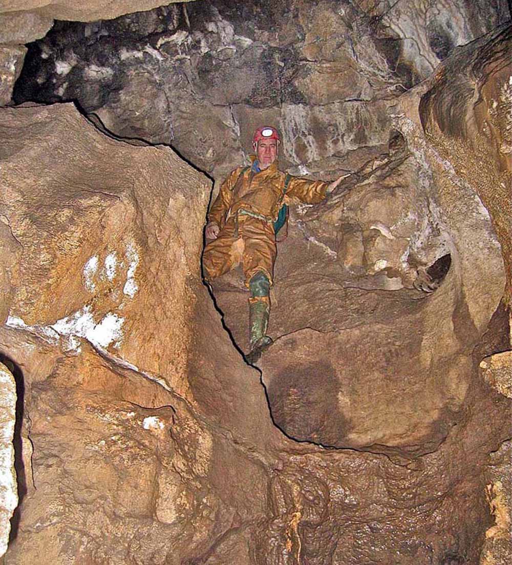
50. Left: Patrick in the high oxbow where it can be seen that the original form of the passage is clearly a vadose feature. February 14 2009
51. Right: Patrick stationed at the top of the natural stairway which ascends from the stream near The Waterfall up to the oxbow. This appears to be an abandoned waterfall which pre-dates the present waterfall by some considerable period of time. February 14 2009
52. Edward Whitaker in the long abandoned oxbow high above the main streamway. February 14 2009
References:
A
B
C
D
Any
shortcomings in the text are entirely my
own.
If you would like to get in touch or add information, there is an email
address:
mudinmyhair@btinternet.com
Steve Warren
Website
created by WarrenAssociates 2012
Website hosted by TSOHost
Copyright © Steve Warren 2012