Low Dow Cave and Dow Fissures, East and West
Click on images and maps for larger view: use backarrow for return.
All images are from the author's collection unless otherwise indicated.
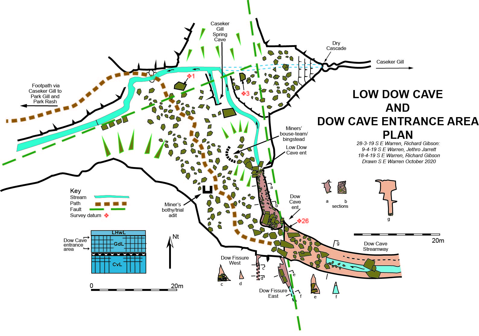
Low Dow Cave
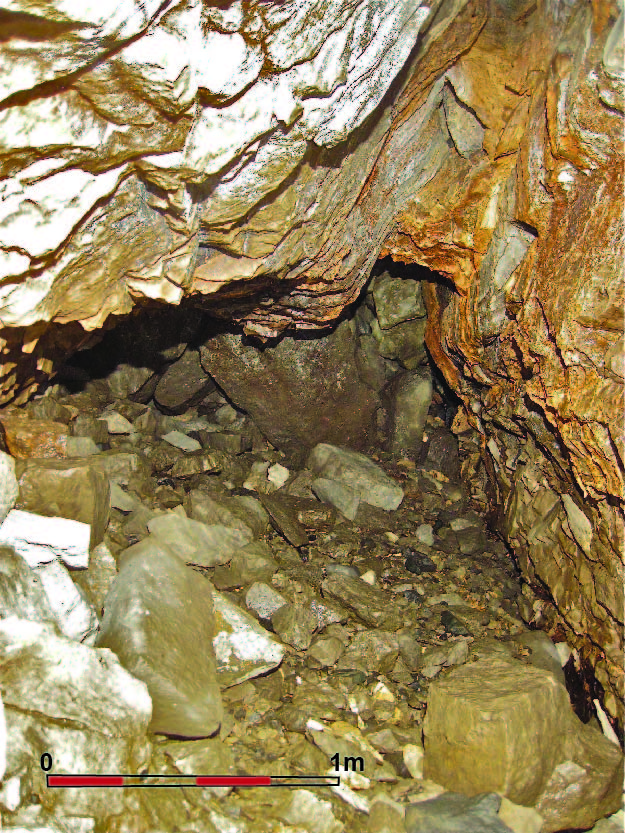
Low Dow Cave is a small but very intriguing cave that lies under the rockfall at the entrance to Dow Cave. Only some thirteen metres in length overall it is quite roomy: see images below. Superficially it appears to be no more than a continuation of the lower section of the Dow Cave canyon. However, although that is no more than seventeen metres away and at the same level within a metre or so, there appears to be little similarity between the two caves.
From the images below it can be seen the roof area of Low Dow Cave tends to follow a joint or fault controlled fissure that closes down at this point. The cave continues a metre or so into breakdown to the left of the figure from where the Dow Cave stream, or part of it, can be seen. This does look like a cave that is entirely separate to the Dow Cave streamway. This raises the question whether or not this cave has formed as a seperate entity to Dow Cave?
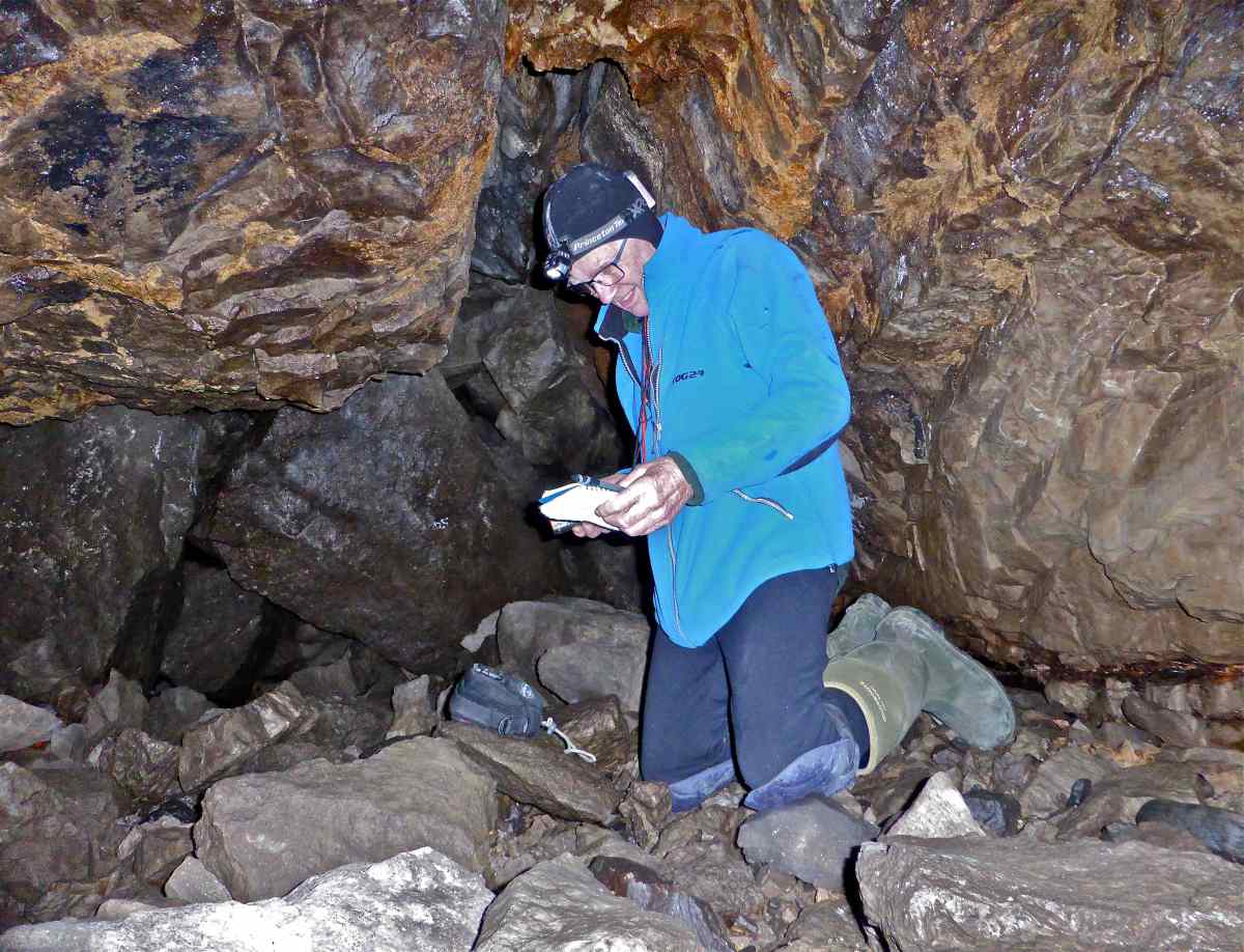
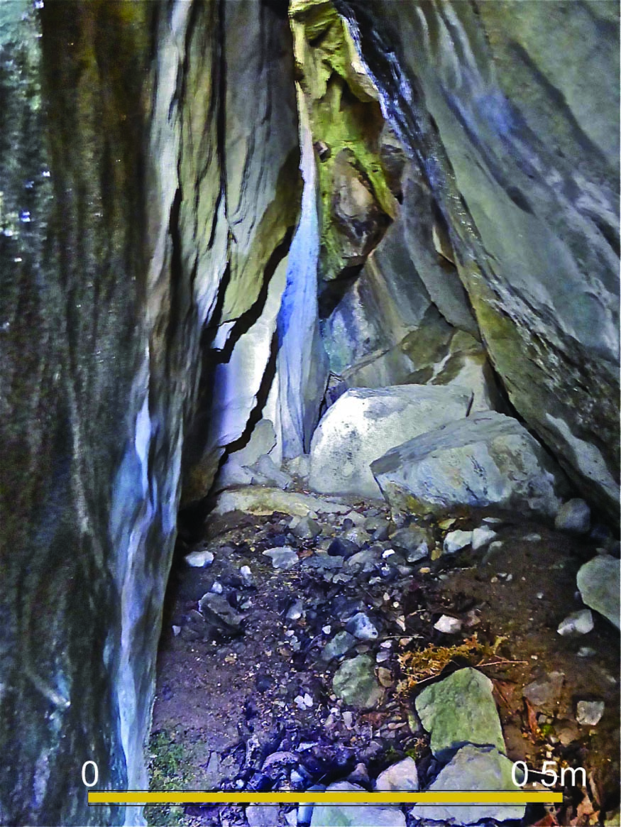
Left: Image 741.The author at the inner extent of Low Dow Cave. The roof is of solid bedrock with layers of iron stained dripstone. Photo: Richard Gibson
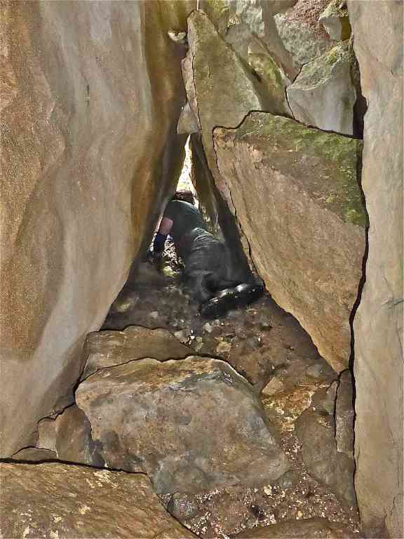
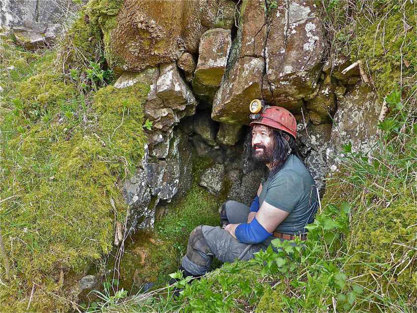
Right:: Image 106. Richard Gibson near the entrance area of the cave. A glint of daylight can be seen at the lower right of the image.
Left: Image 101. This is a view looking into the breakdown area to the left and behind the figure of Image 741 above, From this aspect it may appear that the collapse region around the entrance to Dow Cave has cut right across Low Dow Cave.
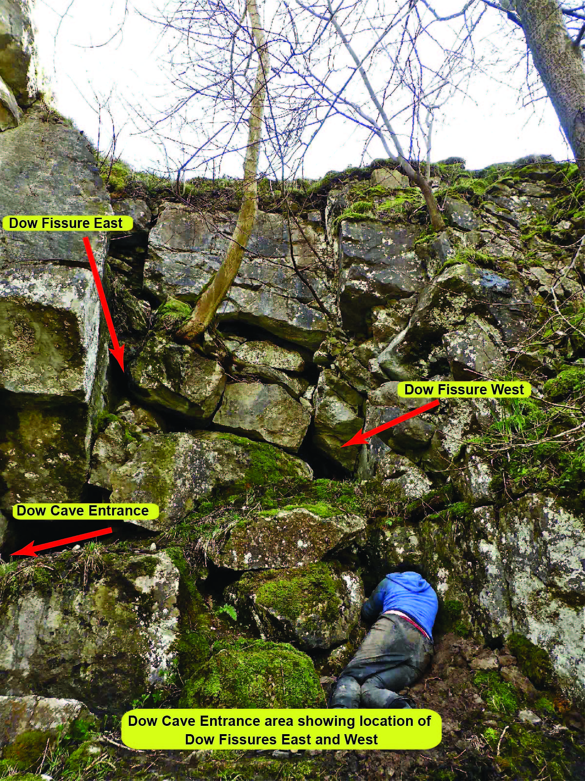
The Dow Fissures: East and West
The Dow Fissures are a pair of fascinating rifts near the head of the rock fall that terminates the main streamway of Dow Cave. Many attempts have been made in digging at both of these sites with the hope of attaining imagined passages along the line of a geological fault or joint parallel to the Dowber Gill Passage.
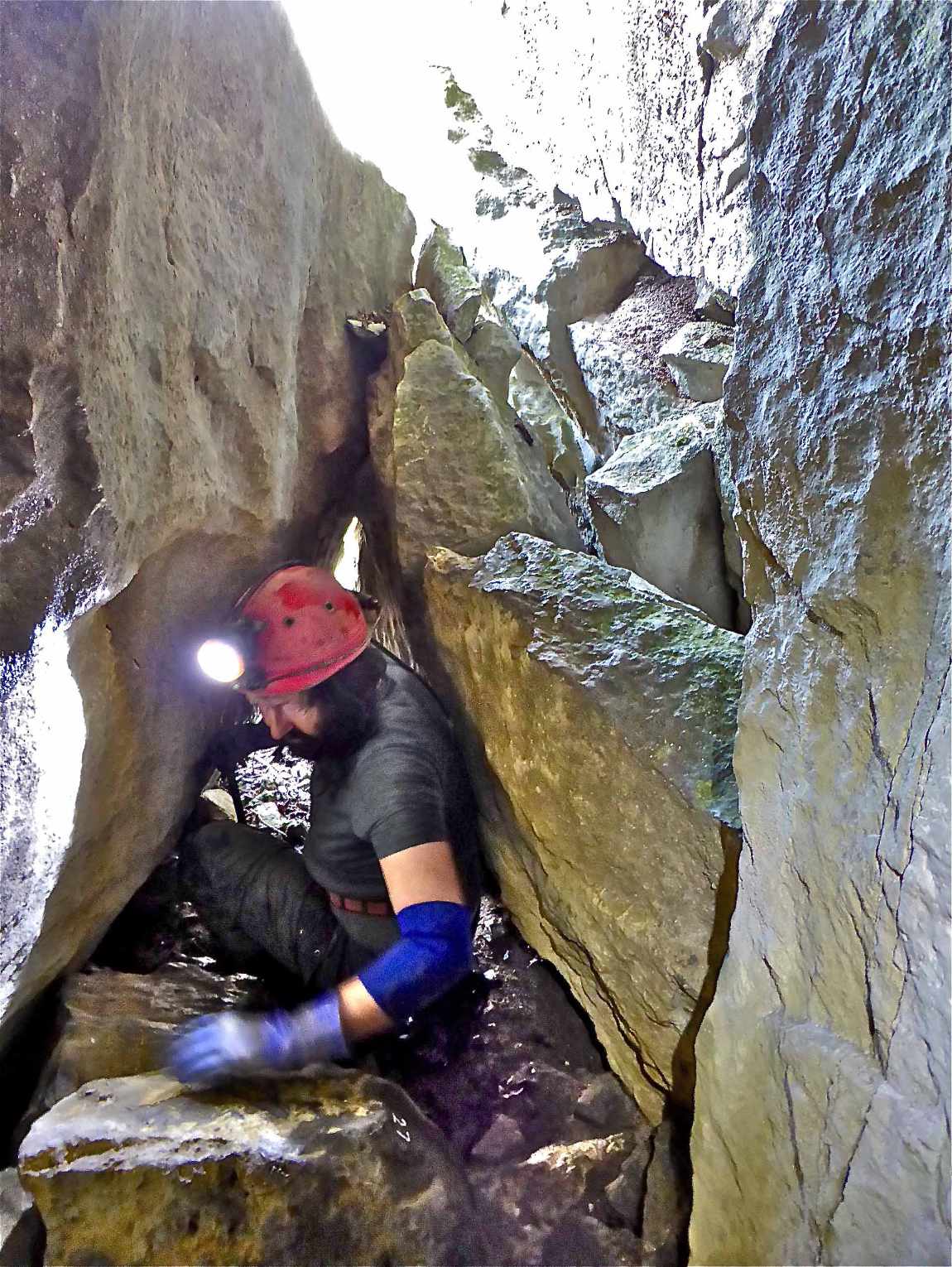
Left: Image 761. This is a view of Dow Fissure East looking towards the entrance .
Right:: Image 759. Dow Fissure East again looking towards the entrance showing the higher level opening.
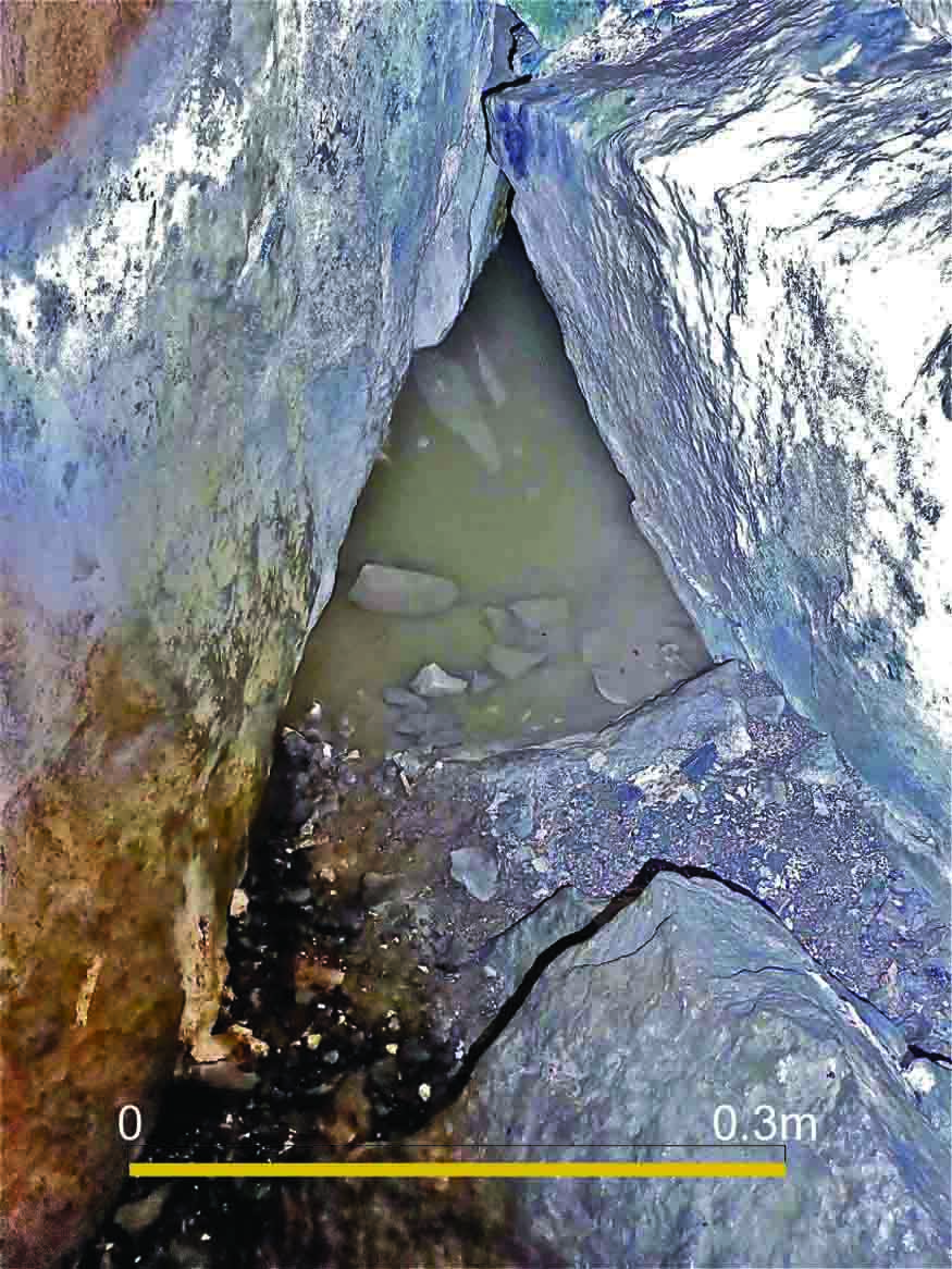
Left: Image 764: Dow Fissure East looking at the fissure closing down to a small pool.
Right:: Image 669. Dow Fissure West closes down at five metres.
Caseker Gill Spring Cave
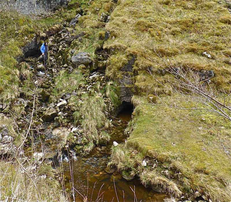
Left: Image 618. Caseker Gill Spring Cave.
This has long been thought to be the main outlet for Dow Cave although some hold the view that it may feed from other sources.
Excavated and explored by Richard Gibson originally to a sump after two metres. From this point John Cordingley dived an underwater bedding on the left hand side to a boulder choking the route.
In 1984 (1-4-84) the writer placed 90 grams of fluorescein in the main streamway of Dow Cave. In less than an hour all the springs in Caseker Gill below the dry fall were showing colour. This persisted down the gill as far as the junction with Park Gill and beyond.
In April 2019 (18-4-19) water temperatures in Dow Cave and in this spring both stood at 6.4C.
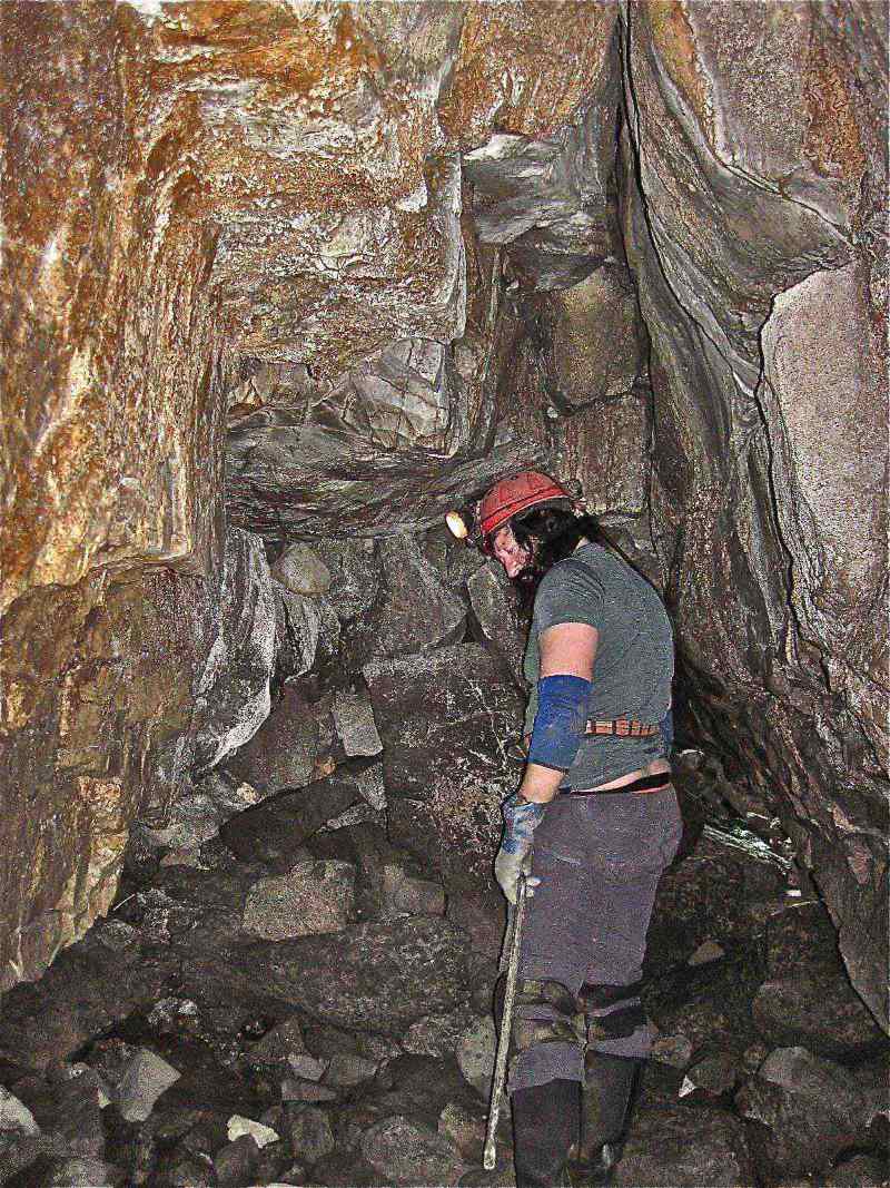
The Miners' bingstead
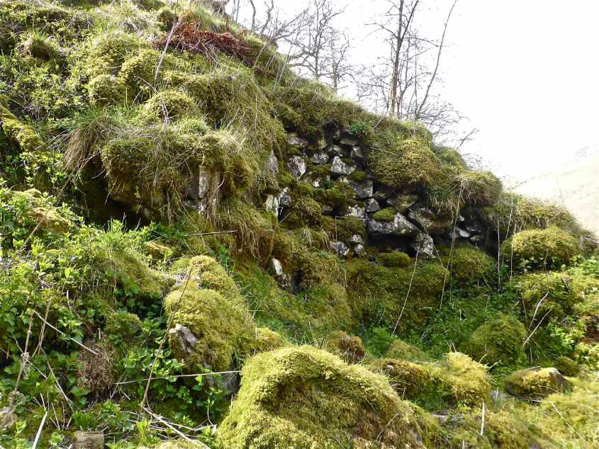
Left: Image 745. The miners' "bouse team" where the miners tipped, stored, the bouse, unsorted ore material, when it was brought out of the cave.
Right:: Image 730. Another view of the bouse team
The Miners' adit trial
Left: Right: Image 771. The miners' digging: either a trial adit to test the ground for possible ore material , or a small "bothy" where the bouse team workers could shelter.
Any
shortcomings in the text are entirely my own.
If you would like to get in touch or add information, there is an email
address:
mudinmyhair@btinternet.com
Steve Warren
Website created by WarrenAssociates 2012
Website hosted by tsohost
Copyright © Steve Warren 2012