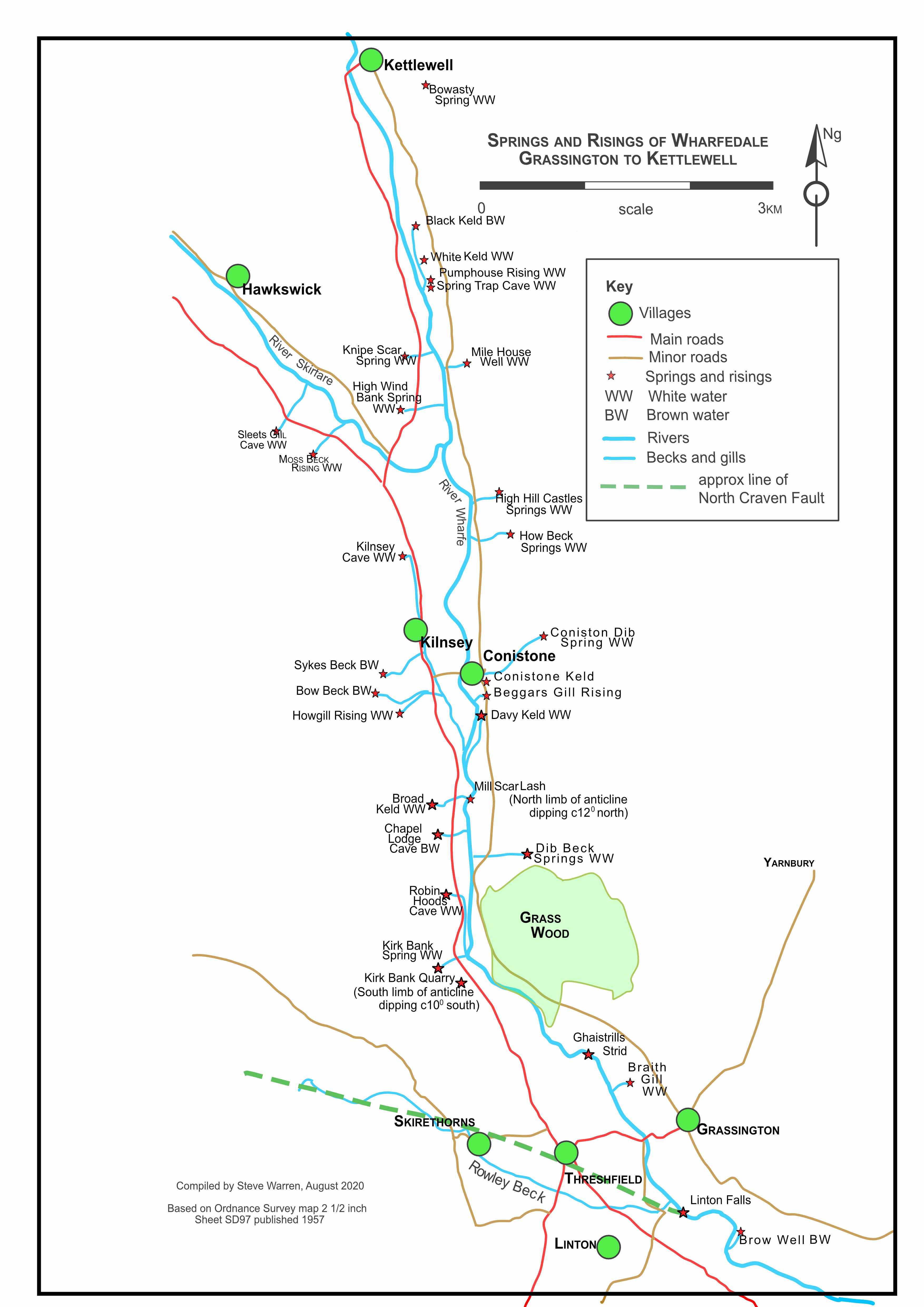
Springs and risings in Upper Wharfedale
Part 1: Grassington to Kettlewell
The
pages below are under development and will be updated on a regular
basis.
All images are from the author's collection unless otherwise indicated
Springs, wells, kelds and risings of Upper Wharfedale: see map below
In early 2020 Adele Ward was asking about springs and wells in Wharfedale and these notes are intended to throw some light on those issues. However, there is no easy way to define any outpouring of water from the limestones of Wharfedale, or any of the other of our Yorkshire Dales for that matter but, essentially, there are two concepts:
a: in our limestone dales there are very few surface streams, because of the highly permeable nature of the limestone terrain, therefore any surface streams that may develop on the higher ground of impermeable strata will almost inevitably sink underground when the flow reaches the limestone by simply entering an existing cave, or by disappearing down faults or joints in the limestone.
b: water falling as precipation will only very rarely collect as a surface stream in limestone country because of this permeability.
These underground waters will usually reappear by:
a: resurging from a cave entrance, as at Robin Hoods Cave, Black Keld and White Keld, (the term "keld" being from a dialectical expression for "spring" or "fountain"), or:
b: appearing as a spring from an otherwise featureless limestone valley side, typical of these are Davy Keld and Braith Gill, or,
c: draining down through the limestones into the alluvium flooring the valleys and consequently joining the general river flow. Such occurences are usually undetectable although there such an event known as "Butter Hole" in the river further up the dale at Arncliffe where it is supected the water from Boreham Cave emerges into the river bed. (This came to light during a conversation with Mr. Jimmy Metcalfe of Old Cotes in the mid 1960s).
These underground waters may be guided as a complete stream in their underground course by the above-mentioned geological faults or joints which are very common in limestone strata. Typical of this is the Mossdale and Langcliffe streams reappearing as "resurgences" or "kelds" such as Black Keld. This is a "brown-water" rising, the colour coming from the peaty collection grounds typically on the gritstones and shales of the uplands.
Another such feature is the brown water rising at Brow Well near Linton Falls. The origins of this water has yet to be determined.
Otherwise underground waters may reach an impermeable bed in the limestone sequence and be forced to "spring" out to surface. Such a bed may typically be shale band, or as is often the case in our local Dales, a band of relatively impervious fine-grained limestone known as the Porcellaneous Band. The effect is the appearance of intriguing ''white water'' springs, kelds or risings on the east side of Wharfedale at Braith Gill, Davy Keld, Dib Scar, How Beck, High Hills Springs, Mile House Well and elsewhere. Due to overlying glacial drift it is often not obvious in the field to determine just which geological feature is bringing water to the surface. It is often the case that a shale band, or the Porcellaneous Band for that matter, is hidden by scree at the base of a limestone scar. The one site where the Porcelleaneous Band was exposed was at Bowasty but that became completely obscured when the location was rebuilt as a storage tank.
On the west side of the valley, due to the underlying dip to the north-east of the limestone strata, there are several risings such as Robin Hoods Cave, Broad Keld, and the Kilnsey risings amongst many others. These locations are all very close to the underlying lower, often impervious, limestones
The Kilnsey Cave white water risings are known to come out at the junction between the higher "Kilnsey Limestone" and the lower "Kilnsey Limestones with Mudstones". This lower limestone bedrock is an exceedingly tough impervious bed of limestone mudstone that drilling activities of 1994 and later coiuld not penetrate whilst attempting to lower the floor of the cave to access the low flooded bedding cave beyond. The question here is of whether or not this same junction is a controlling factor in the risings on the west side of Wharfedale. What has been recorded is that the first section of Chapel Lodge Cave "The Old Cave" is formed along a mudstone bed in the lower part of the Kilnsey Limestone (Cave Surveys from the Yorkshire Dales" page 12).
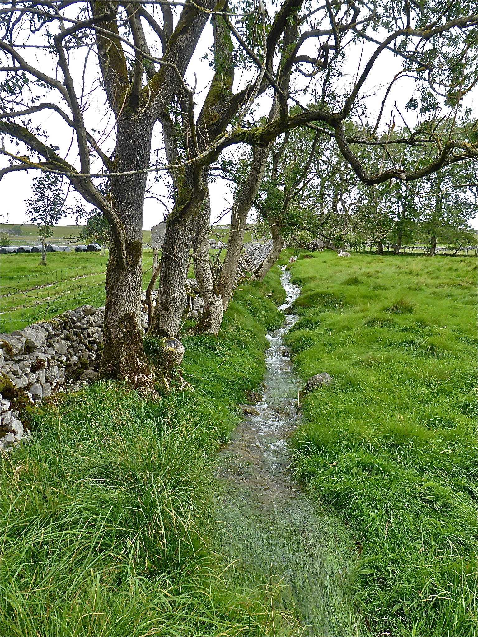
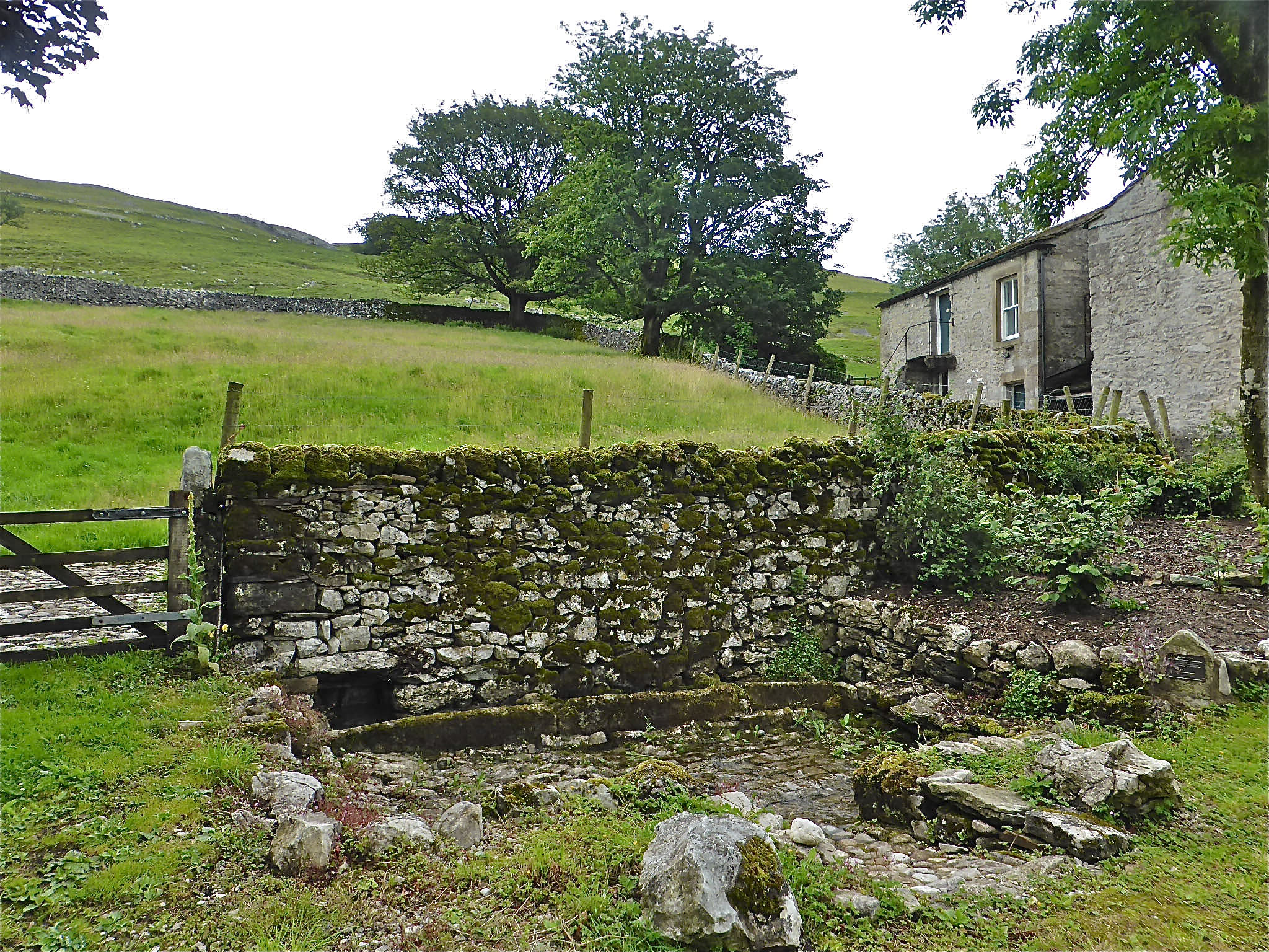
All of these risings are of great importance to the farming community and one of the great features of Wharfedale is the number of field barns, one in nearly every field. These could only be used for housing livestock if there was was a water supply nearby. A field barn nearer to the river may have been accessed by a drive or ‘drove’ from barn to river often crossing the highway by means of a gate each side of the road. Otherwise a field barn more often than not will be sited close to a spring and, if this location is suitable, it will be built up into a trough, often designated as “Well” on the OS map.
What is known, often from the activities of the cave diving fraternity, is that there may be extensive cave passages hidden behind otherwise impenetrable springs and risings. These include ‘Black Keld’, a brown water rising extending for more than 2km, and White Keld extending for some 1.5km. Robin Hood's Cave extends for some 400m, Chapel Lodge Cave some 730m and Sleets Gill Cave 2.4km. Thus Black Keld and Brow Well are shown on the map as “BW” risings and the majority of the others as “WW” risings.
There have been a number of attempts to determine the original source of the waters emanating from such springs or risings but few have been definitive. The classic was that made by Jack Myers and his colleagues of the Northern Pennine Club in 1949. They carried out a series of observations to determine water flow quantities and the likely underground courses of these streams. This culminated in a masterly fluorescein dye test that quite convincingly showed that the Mossdale Beck waters reappeared at Black Keld.
“The test clearly shows that the whole of the Mossdale stream flows to Black Keld”. (The Mossdale Problem” Myers J. O. CRG Trans 1950)
In the 1980s several attempts were made to understand something of the hydrology of the area by the writer, accompanied by Patrick Warren and Peter Atkinson. All the white water springs, with the exception of White Keld, were examined (White Keld was not known about at that time). Water temperatures were recorded and flows estimated but no conclusive information was obtained.
In February 1998, headed by Andy Cole, members of the White Rose Pothole Club made an attempt to determine the source of waters emerging at White Keld amongst elsewhere. This resulted in establishing a connection between Pig Pot Puddle SInk and White Keld. (WRPCJ 2001 p41. Pig Pot Puddle Sink, Richard Bendall)
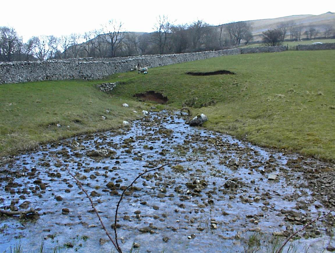
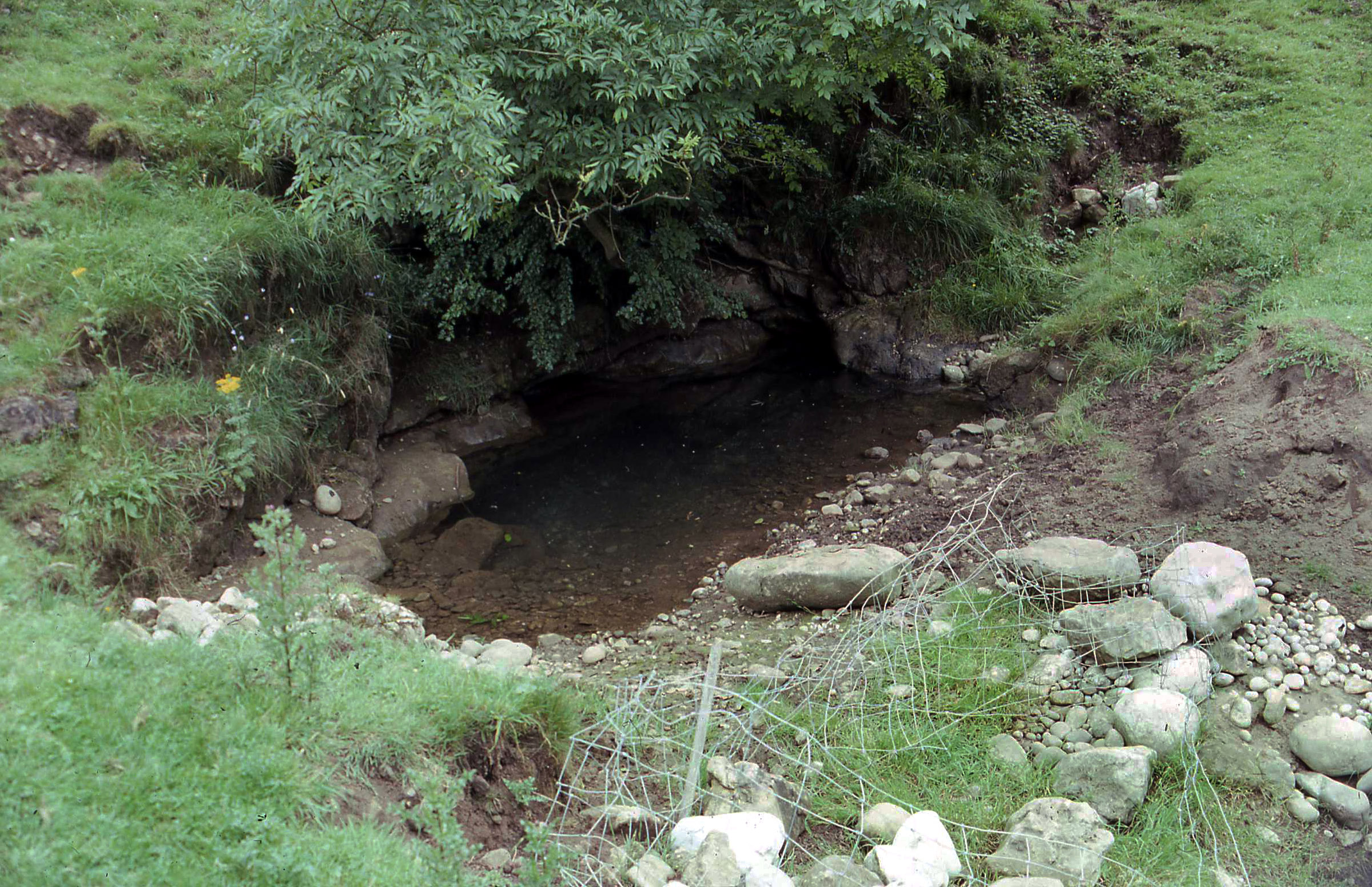
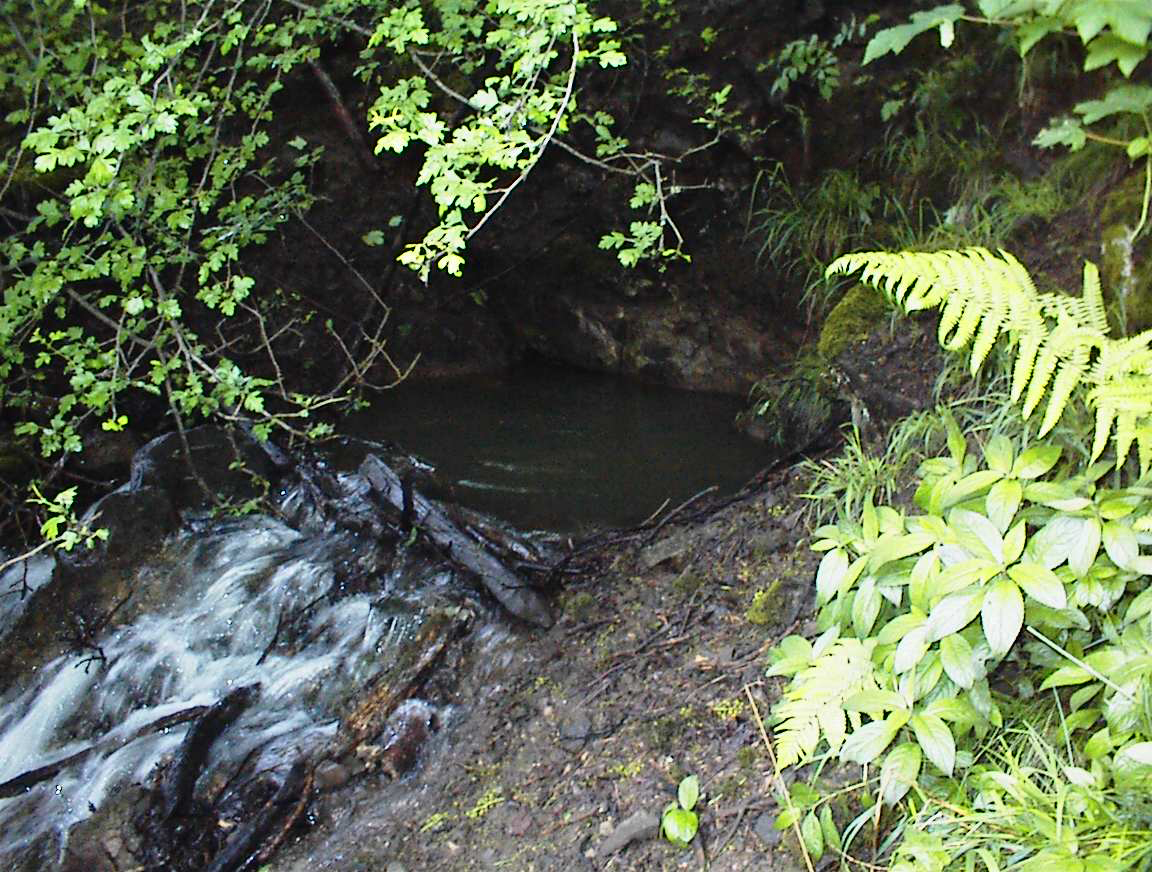
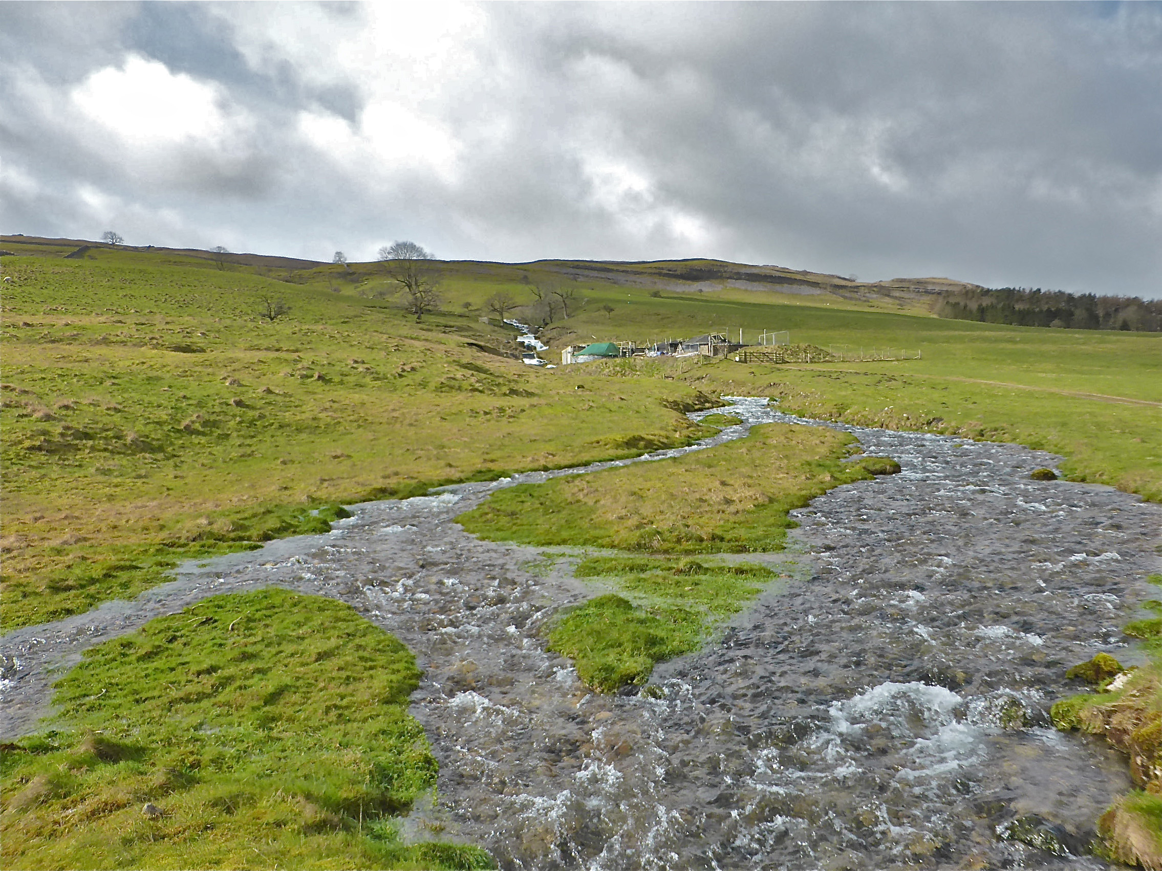
The enigmatic rising at Davy Keld: the mysteries of which are beginning to unfold.
July 2020
NGR: 981670
Alt: 192m
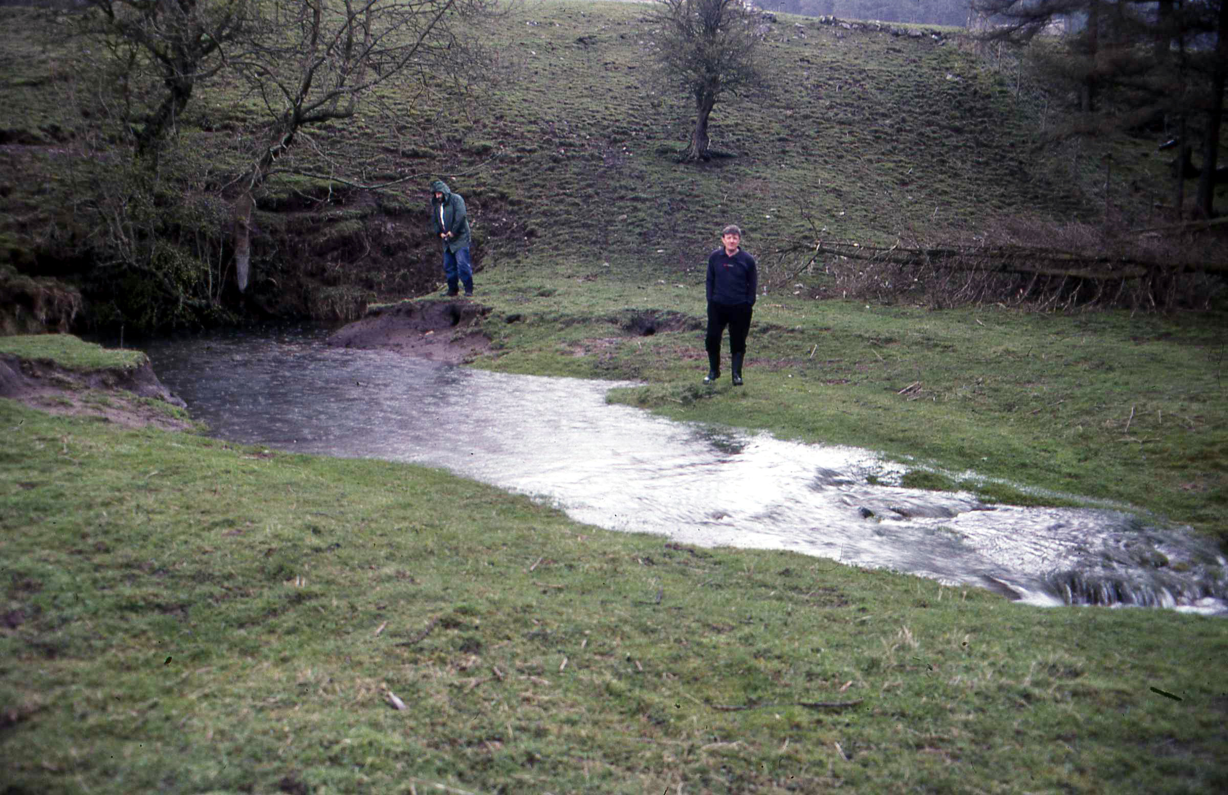
Black Keld in normal flow.
NGR 974709
Alt: 198m
March 9, 1997
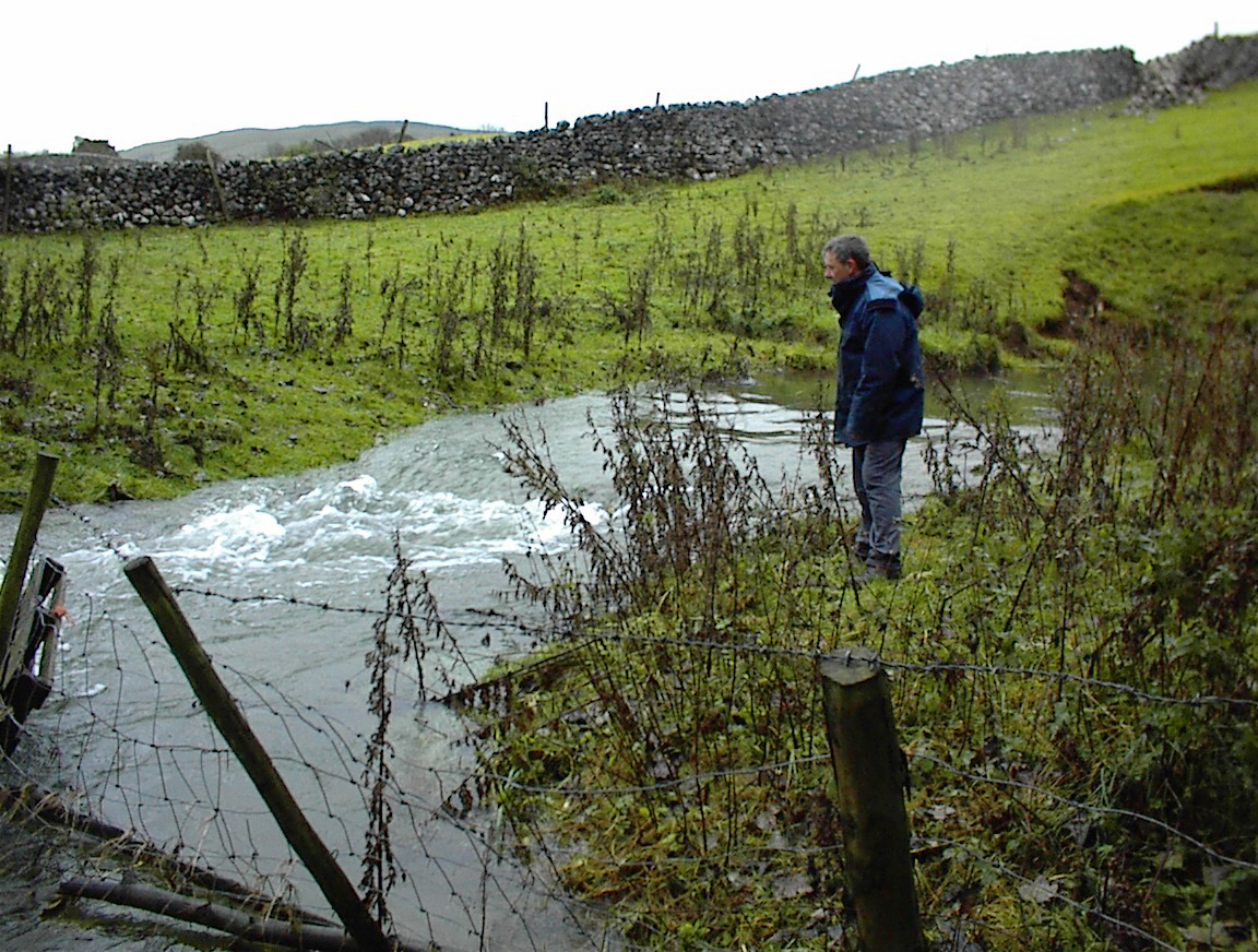
Black Keld in high flood.
June 2000
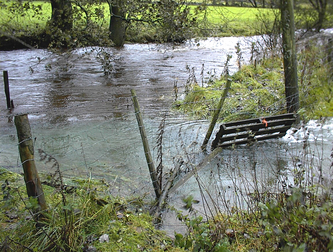
White Keld in normal conditions.
March 9 1997
NGR: 975707
Alt: 198m
White Keld in high flood.
December 22, 1997
White Keld in high flood.
December 1997
White Keld meets Black Keld.
December 1997

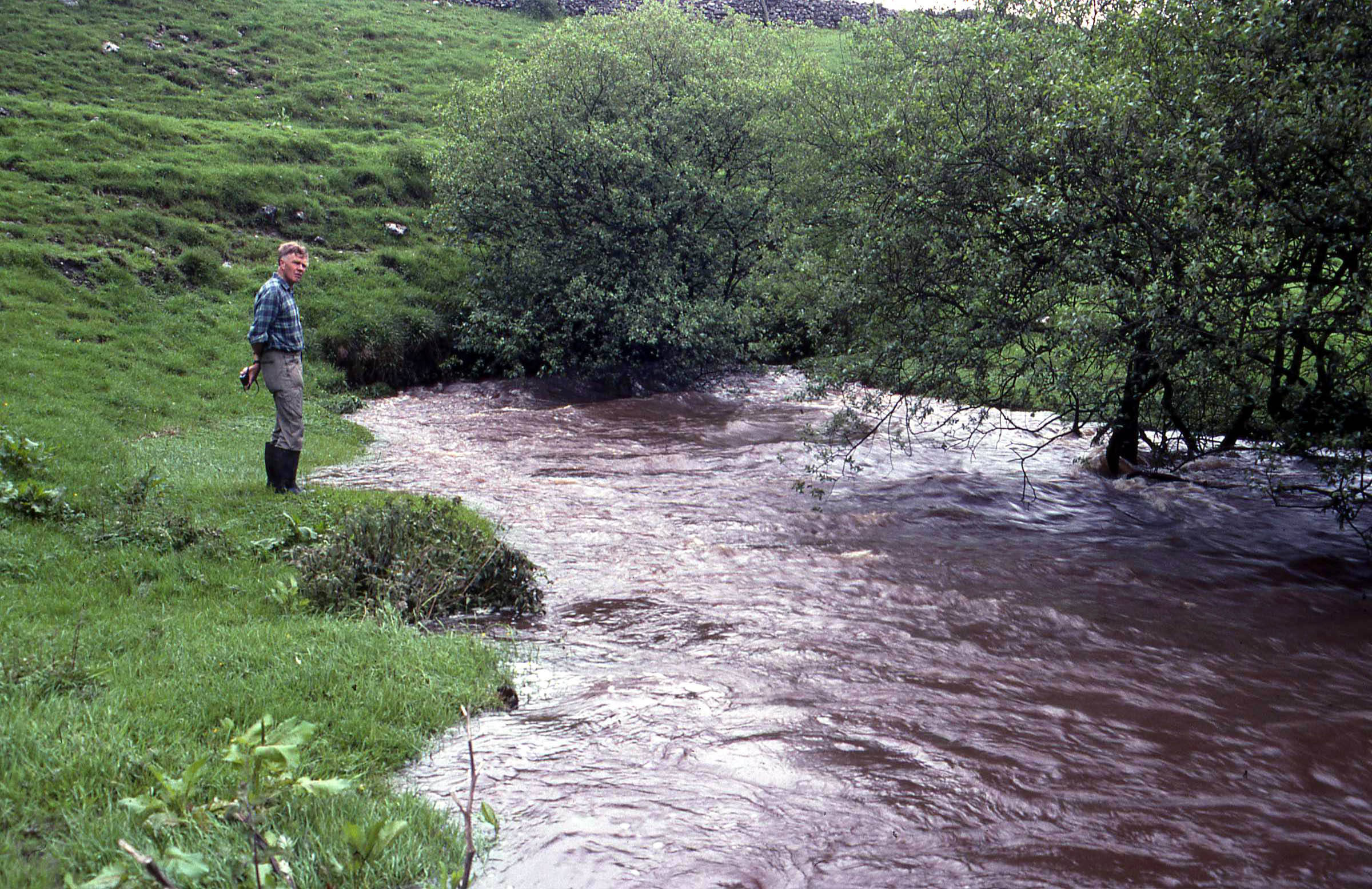
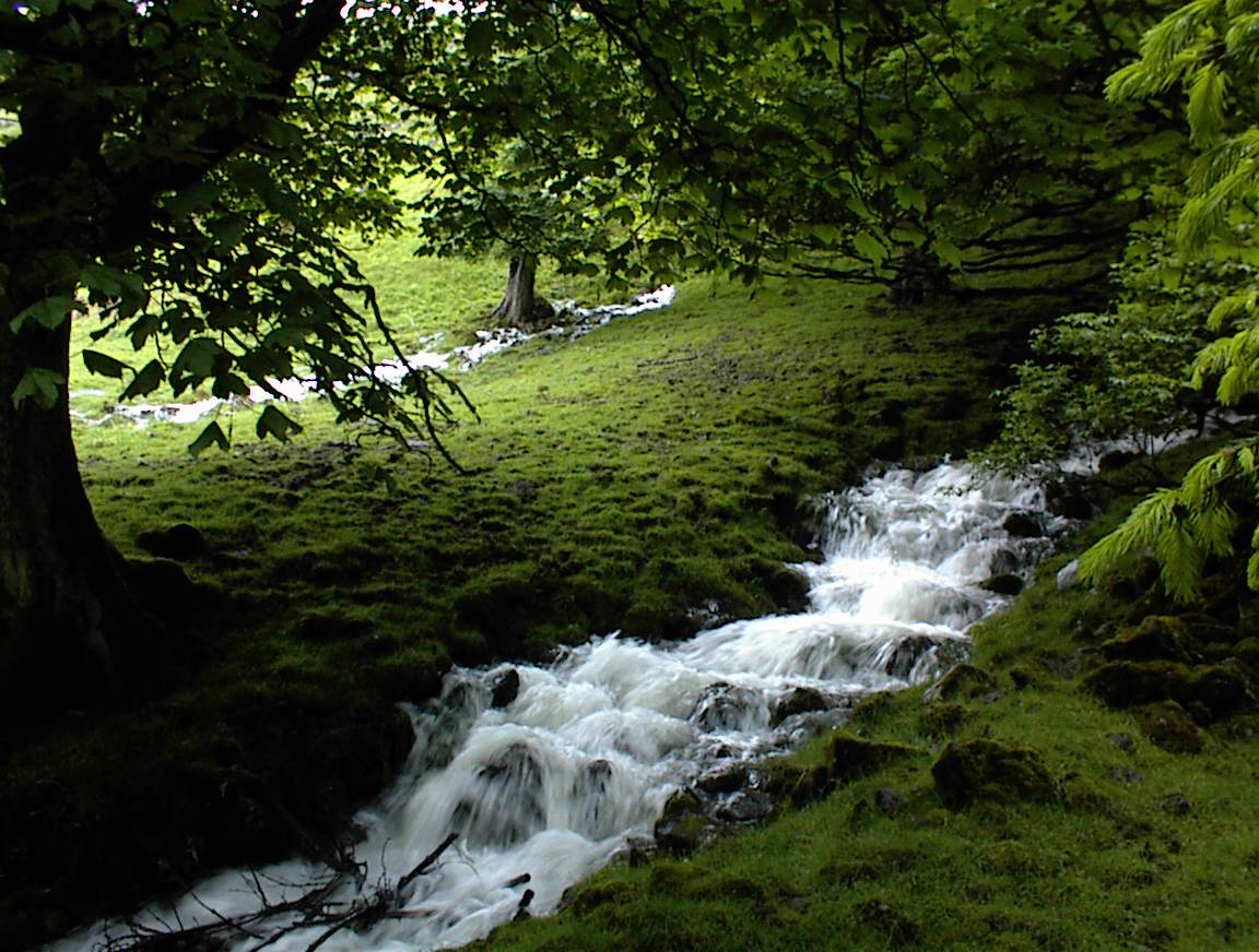
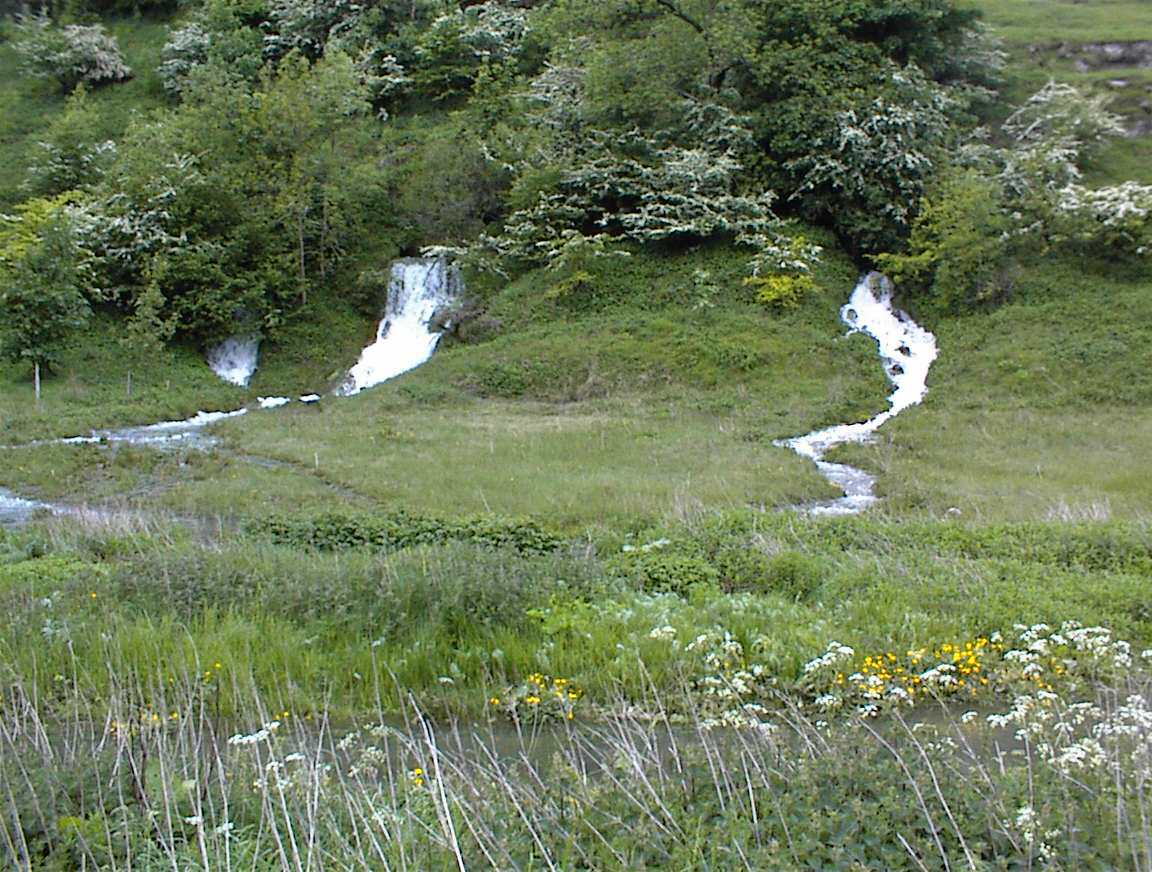
Braith Gill in normal flow
NGR 996643
Alt. 170m
April 2000
Braith Gill in high flood.
June 2000
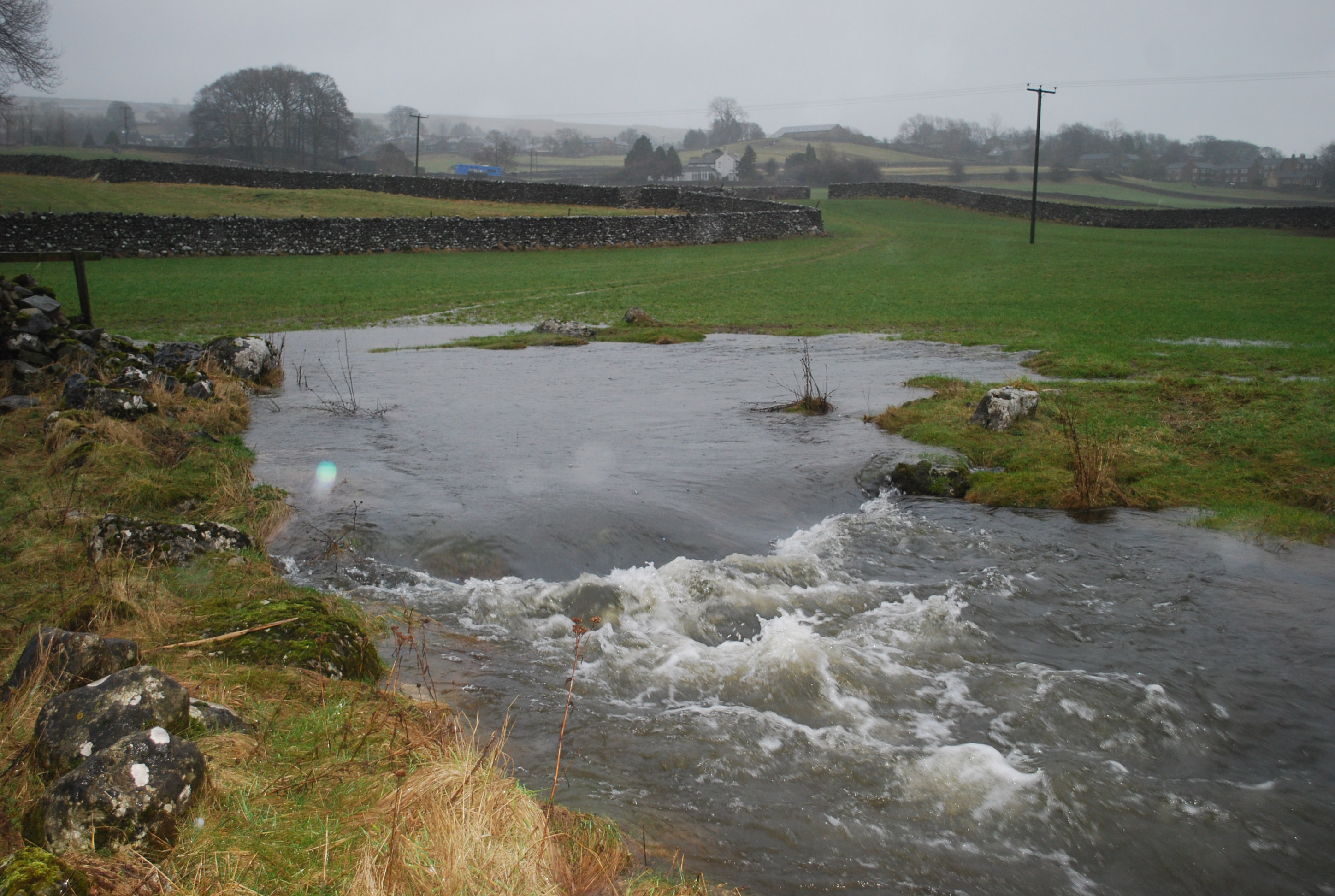
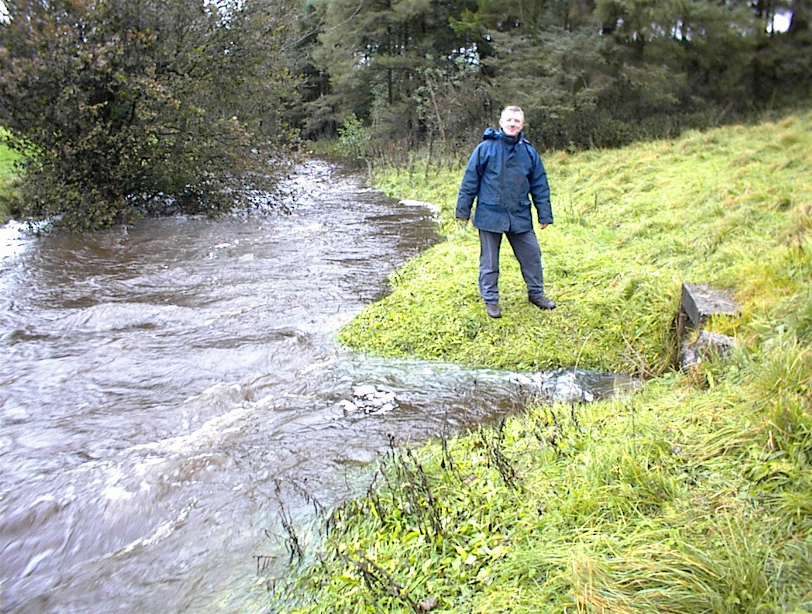
Brow Well in high flood.
NGR 007633
Alt. 160m
April 2000
Chapel Lodge Cave entrance in high flood.
NGR 976662
Alt. 235m
April 2000
Chapel Lodge beck in high flood.
April 2000
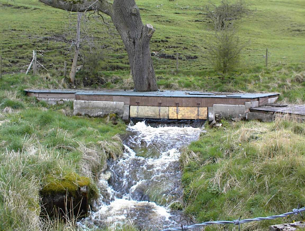
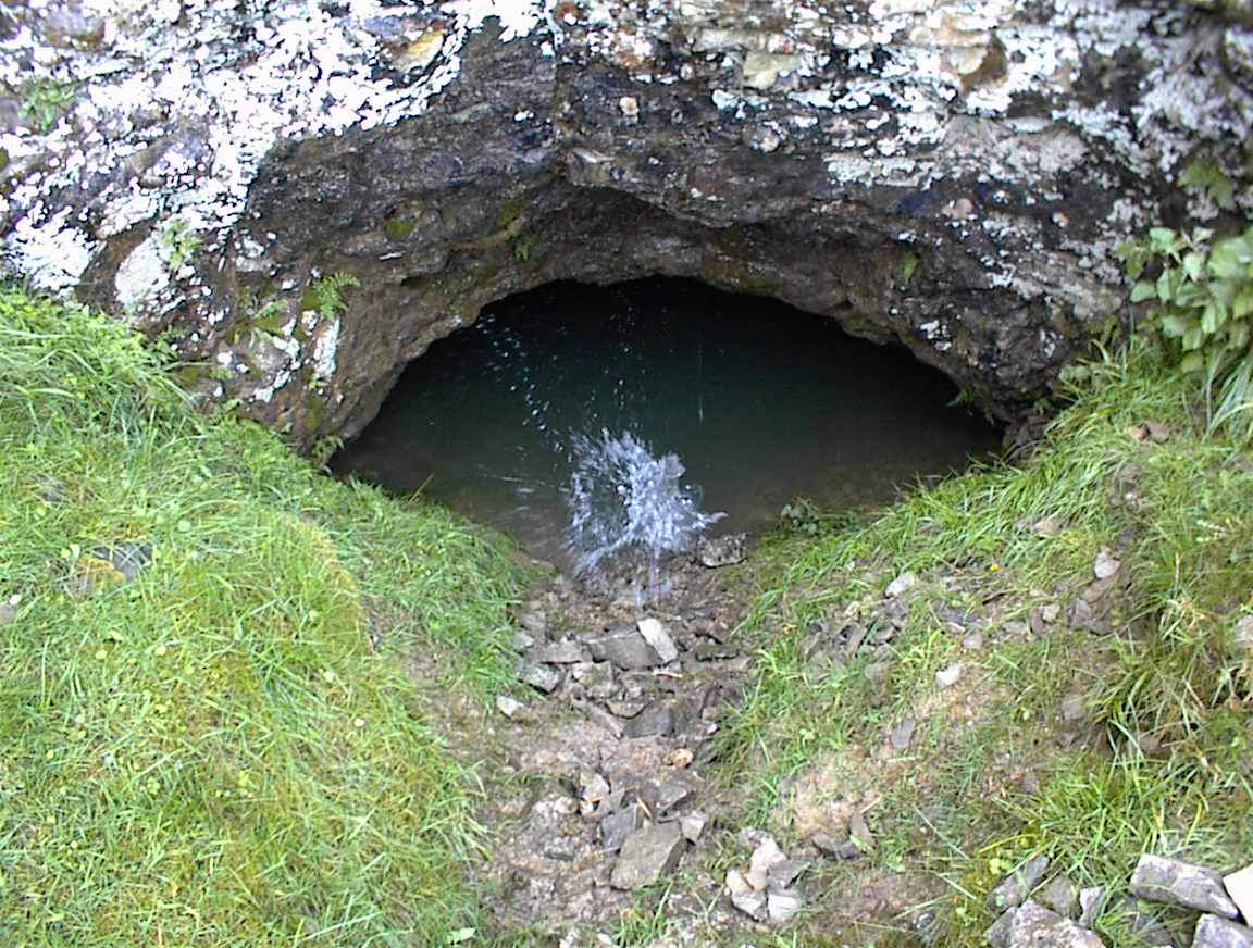
Robin Hood's Cave entrance in high flood.
NGR 978657
Alt. 180m
April 2000
Robin Hood's Cave outflow in high flood.
April 2000
Kirk Bank Spring in flood.
NGR 976652
Alt. 220m
April 2000
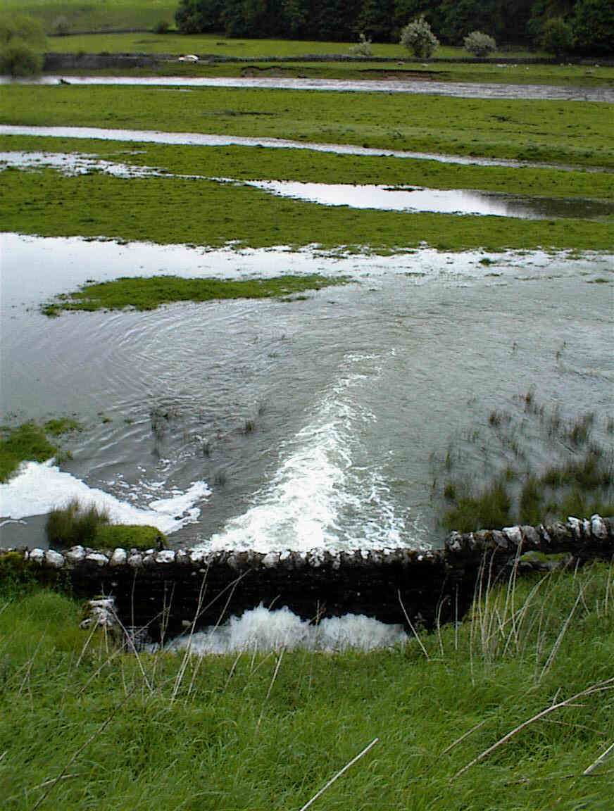
Kilnsey Risings in flood.
NGR 973684
Alt. 190m
April 2000
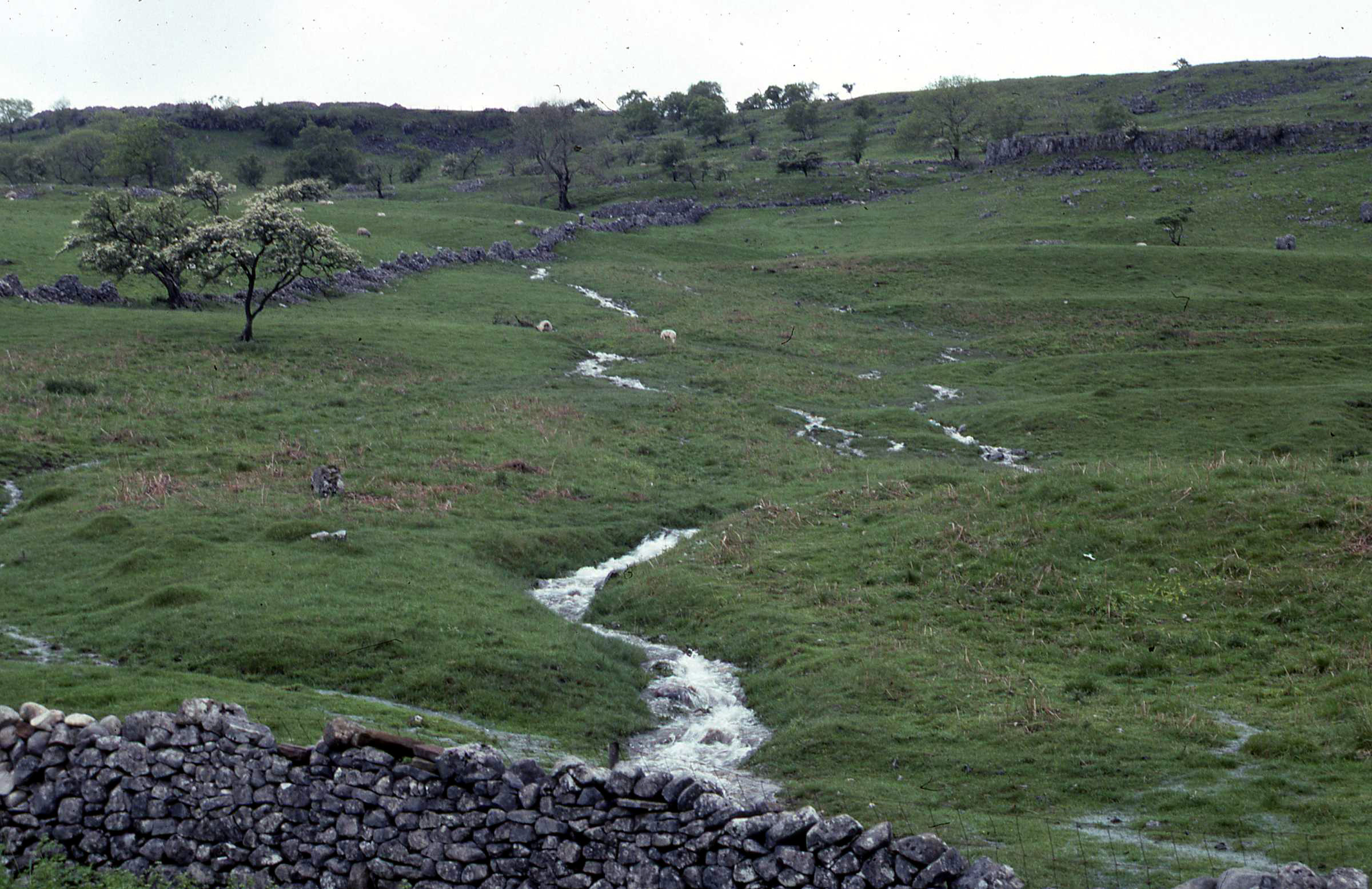
Moss Beck in high flow.
NGR 964692
Alt. 240
March 2019
How Beck in flood, often dry at this point.
NRG 980685
Alt. 198m
August 2020
High Hill Castles Spring.
NGR 983690
Alt. 230m
July 2020
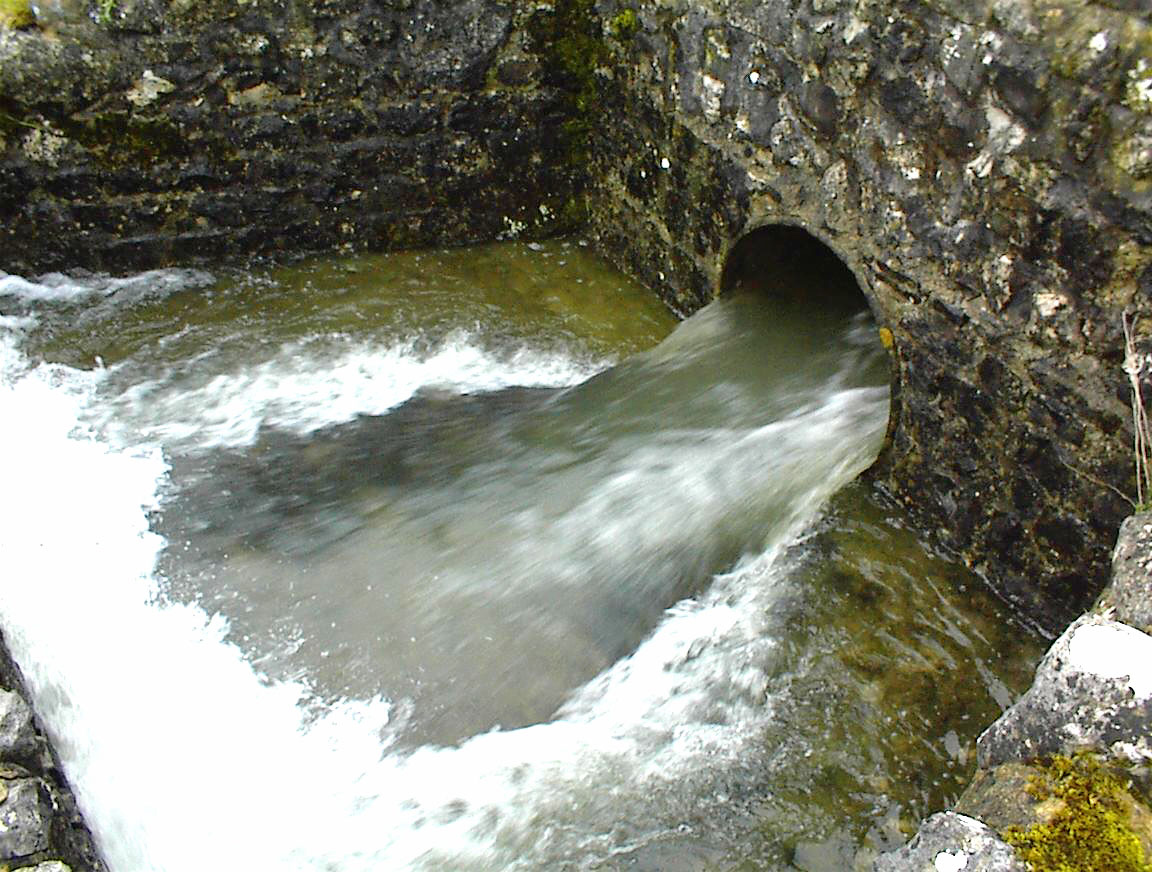
Pumphouse Rising.
NGR 975706
Alt. 210m
April 1997
Pumphouse Rising with powerful stream emerging into Black Keld streamway
October 2002
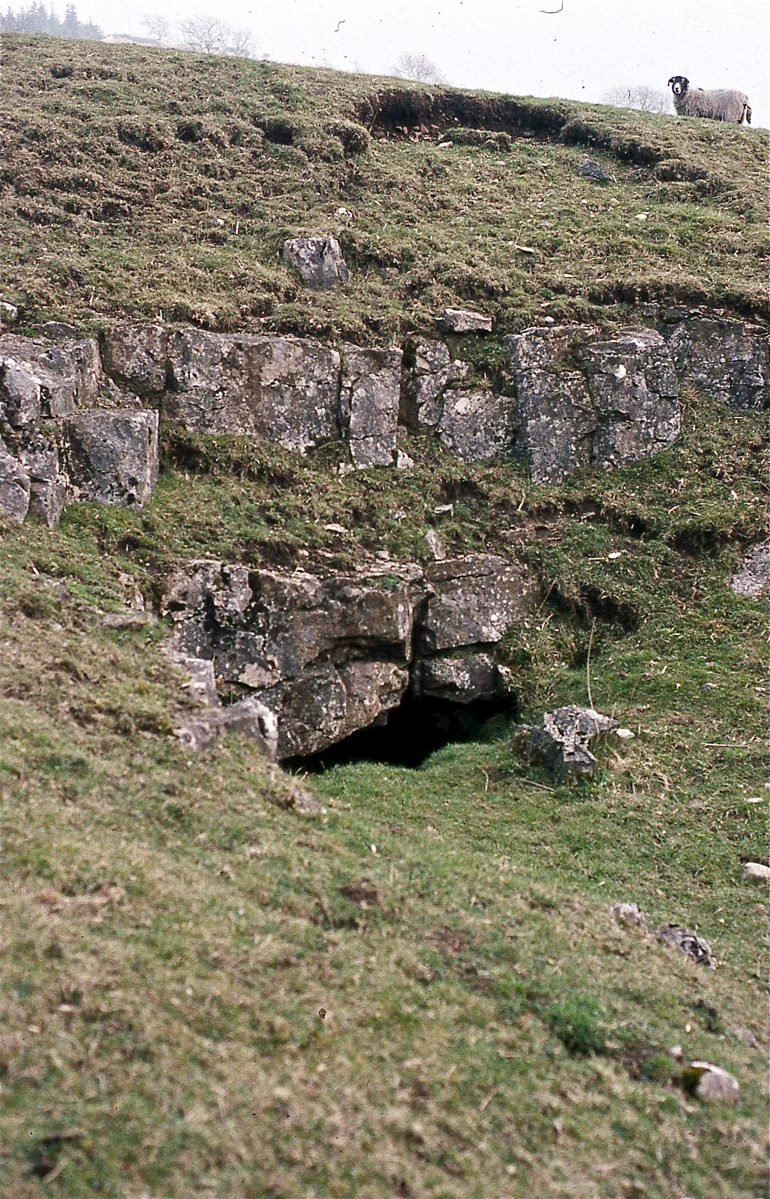
Spring Trap Cave entrance.
NRG 975705
Alt. 198m
April 1997
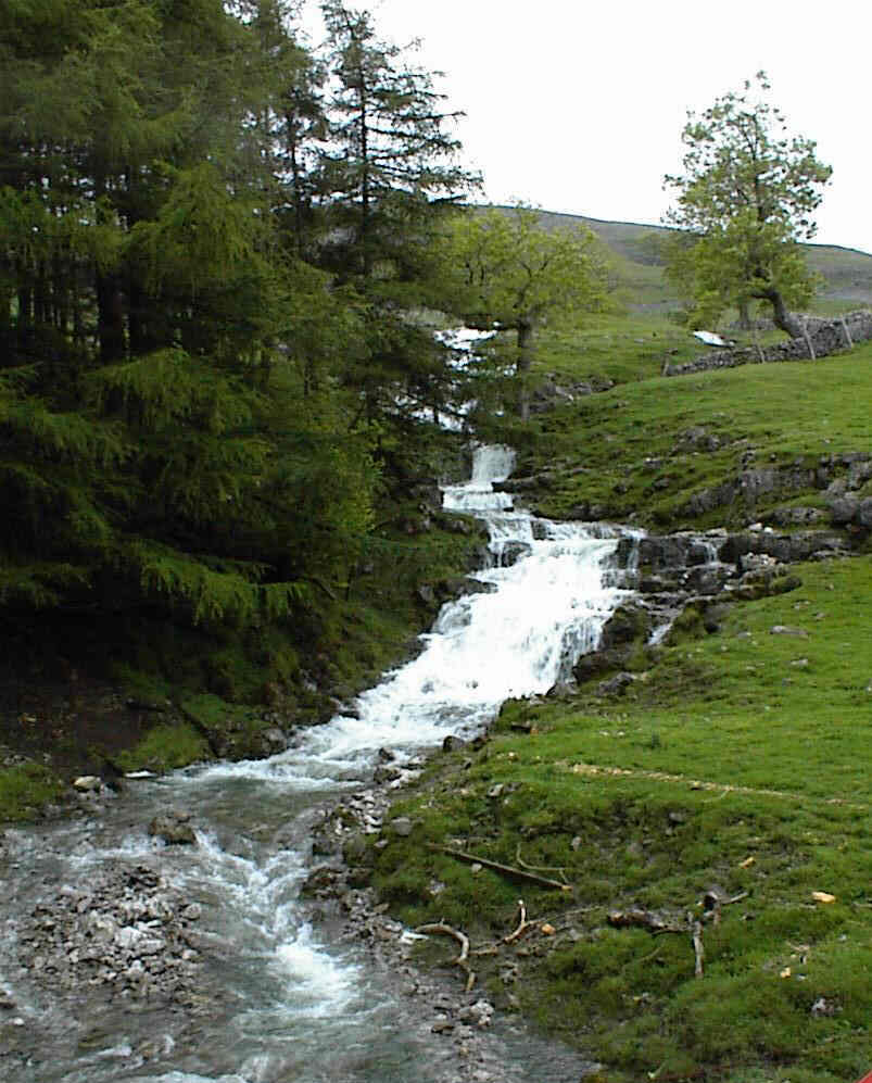
Sleets Gill Cave entrance in flood.
NRG 959692
Alt. 290m
June 4, 2001
Sleets Gill in high flood.
June 4, 2001
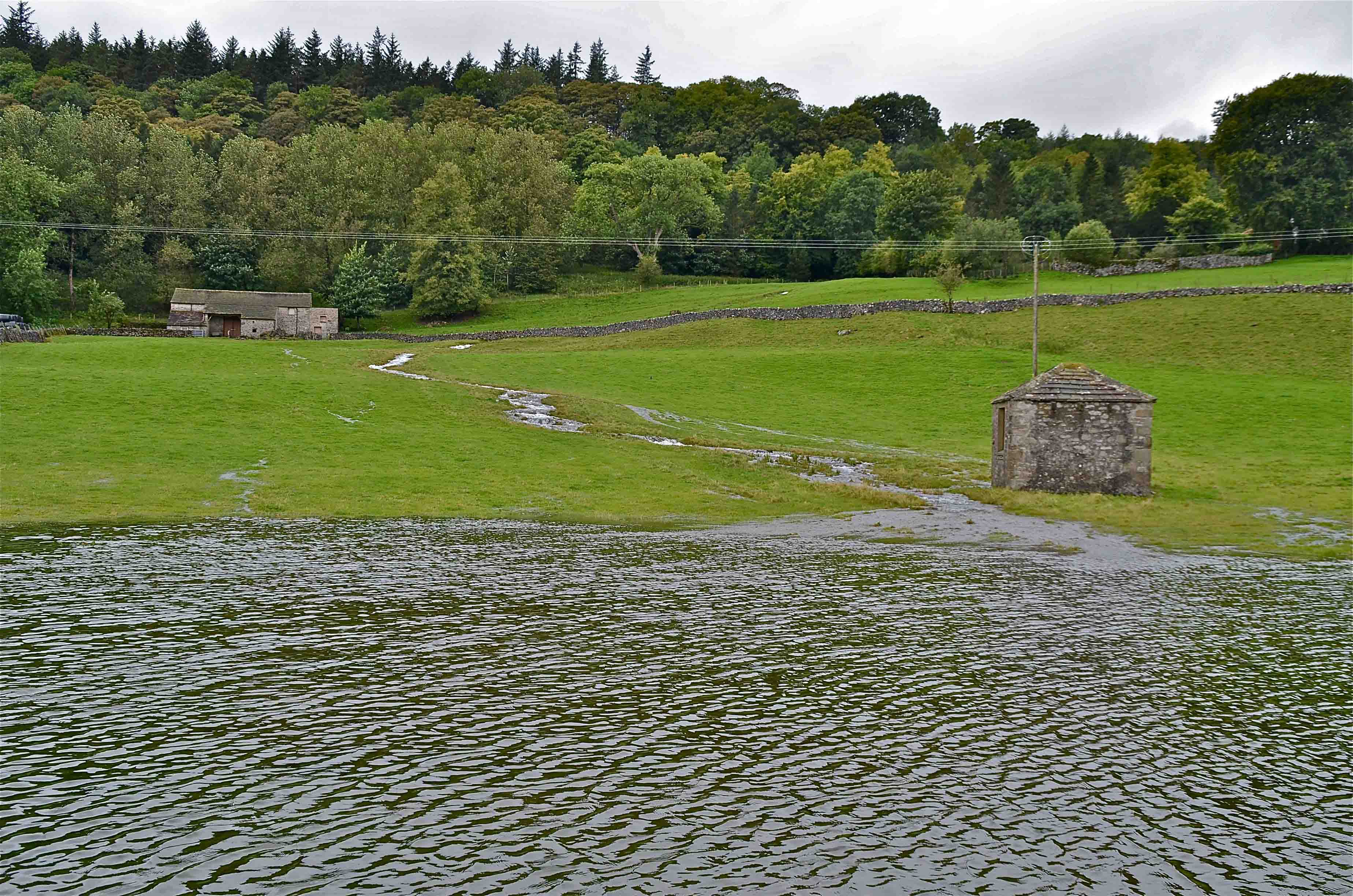
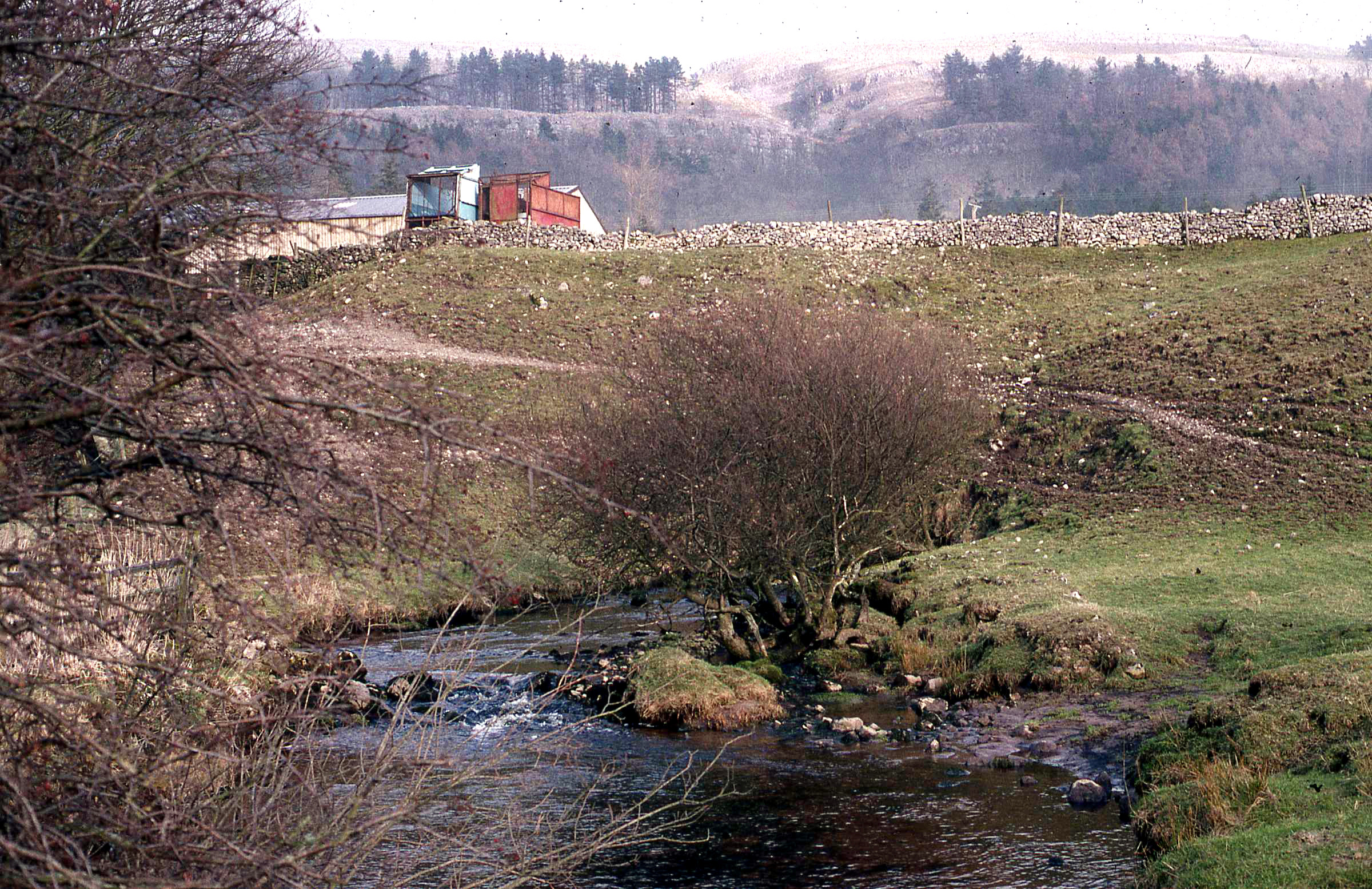
Broad Keld in flood.
September 26, 2012.
NGR 976685 Alt. 220m
Broad Keld drains from Chapel Lodge Cave
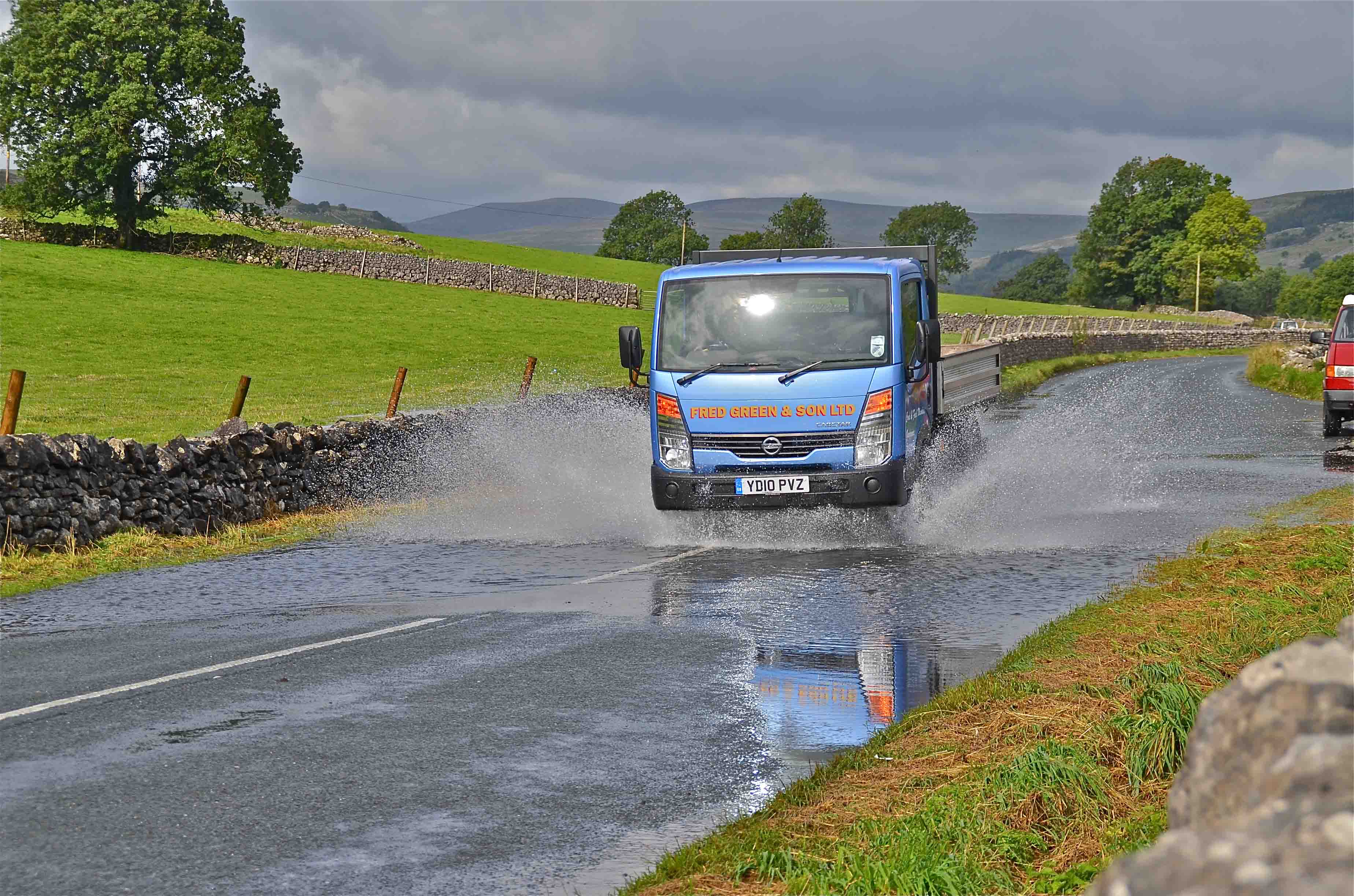
Broad Keld can create problems on the highway..
Sykes Beck also known as the Fish Farm Rising.
November 2013
NGR 970675 Alt. 230m
Sykes Beck in good flow.. Novermber 2013
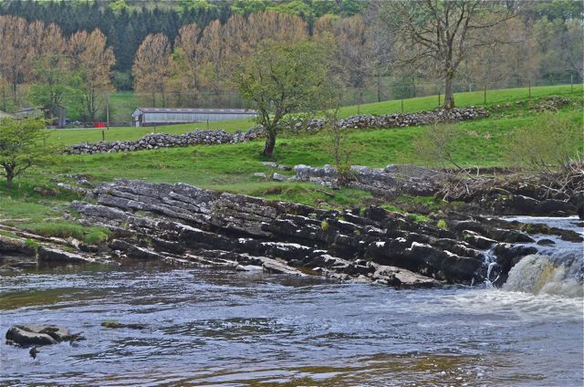
Mill Scar Lash showing Chapel House Limestone dipping to the north at approx. 12 degrees.
NGR 980656 Alt.180m
May 2012.
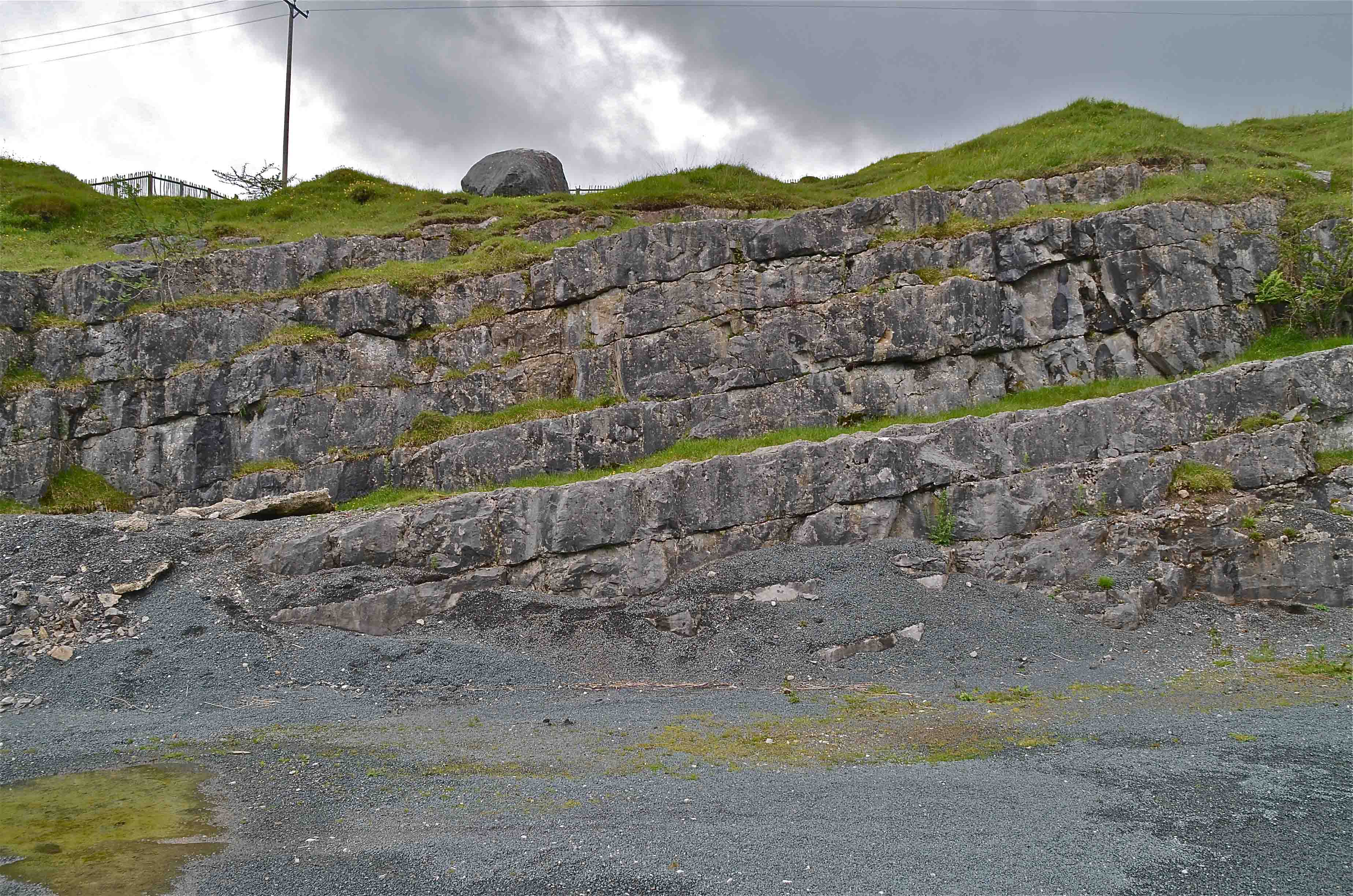
Kirk Bank Quarry showing Chapel House Limestone dipping approx 10 degrees to the south.
NGR 978652 Alt. 200m
June 2012
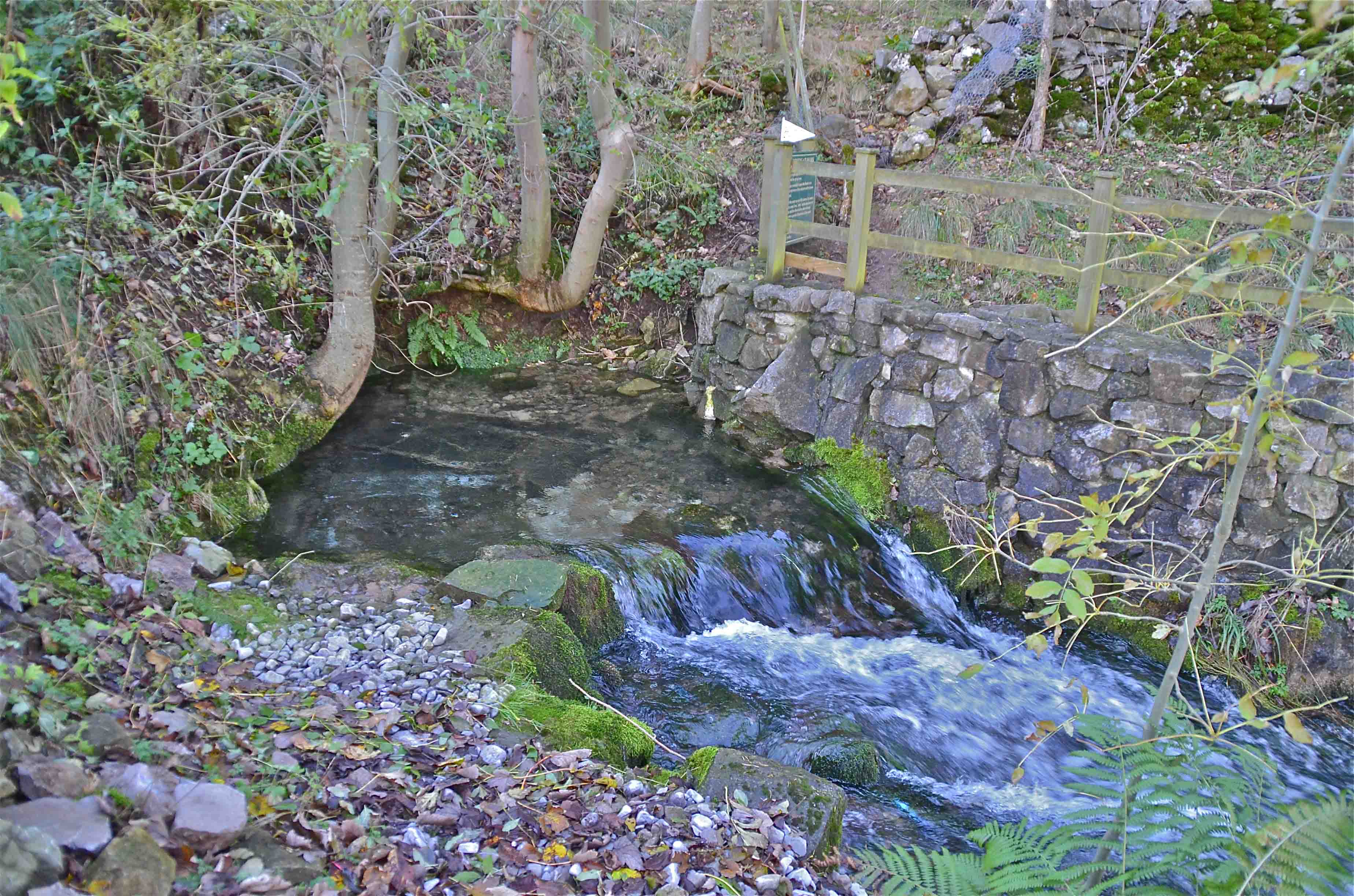
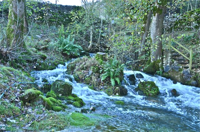
Coniston Keld - usually dry
August 2020.
NGR 981674 Alt. 194m
A history of the keld can be found on the Conistone with Kilnsey Website
Any
shortcomings in the text are entirely my own.
If you would like to get in touch or add information, there is an email
address:
mudinmyhair@btinternet.com
Steve Warren
Website created by WarrenAssociates 2012
Website hosted by Tsohost
Copyright © Steve Warren 2012