Geology in Wharfedale
The
pages below are under development and will
be updated on a regular basis.
All images are from the author's collection unless otherwise indicated.
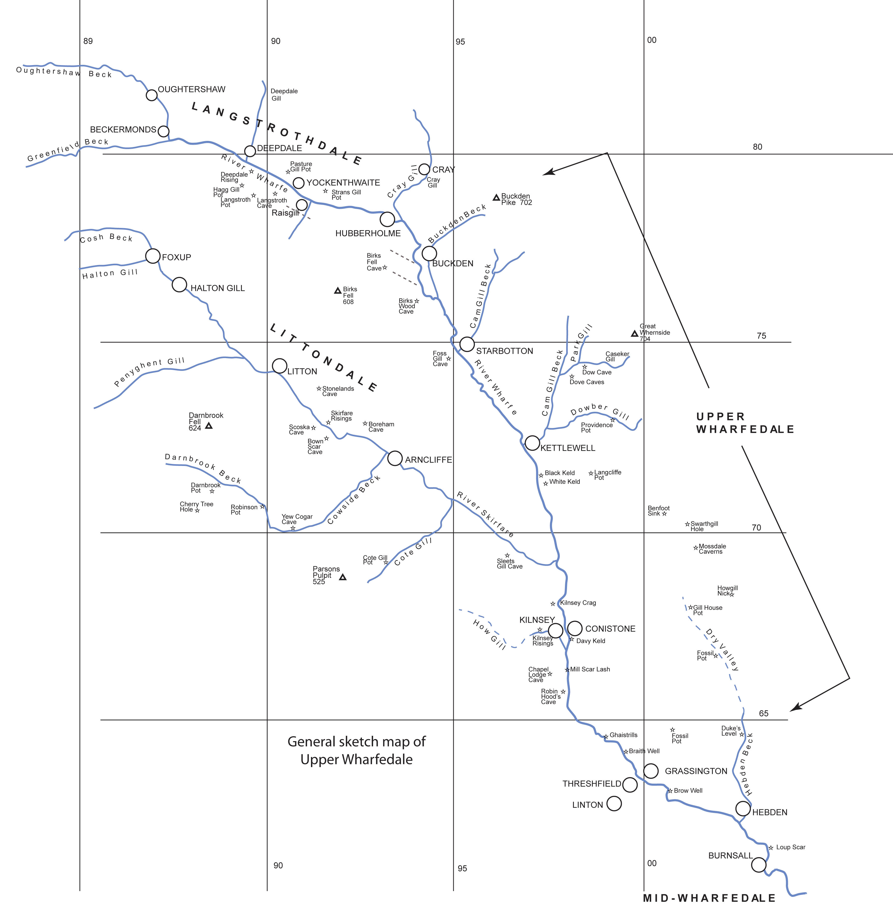
The River Wharfe
The River Wharfe is arguably the most spectacular river in the land with remote headwaters, numerous cascades, glacial lake flats and wide peaceful water meadows: its waters are gathered from more gills, becks, gorges, springs and kelds, than any other Pennine river.
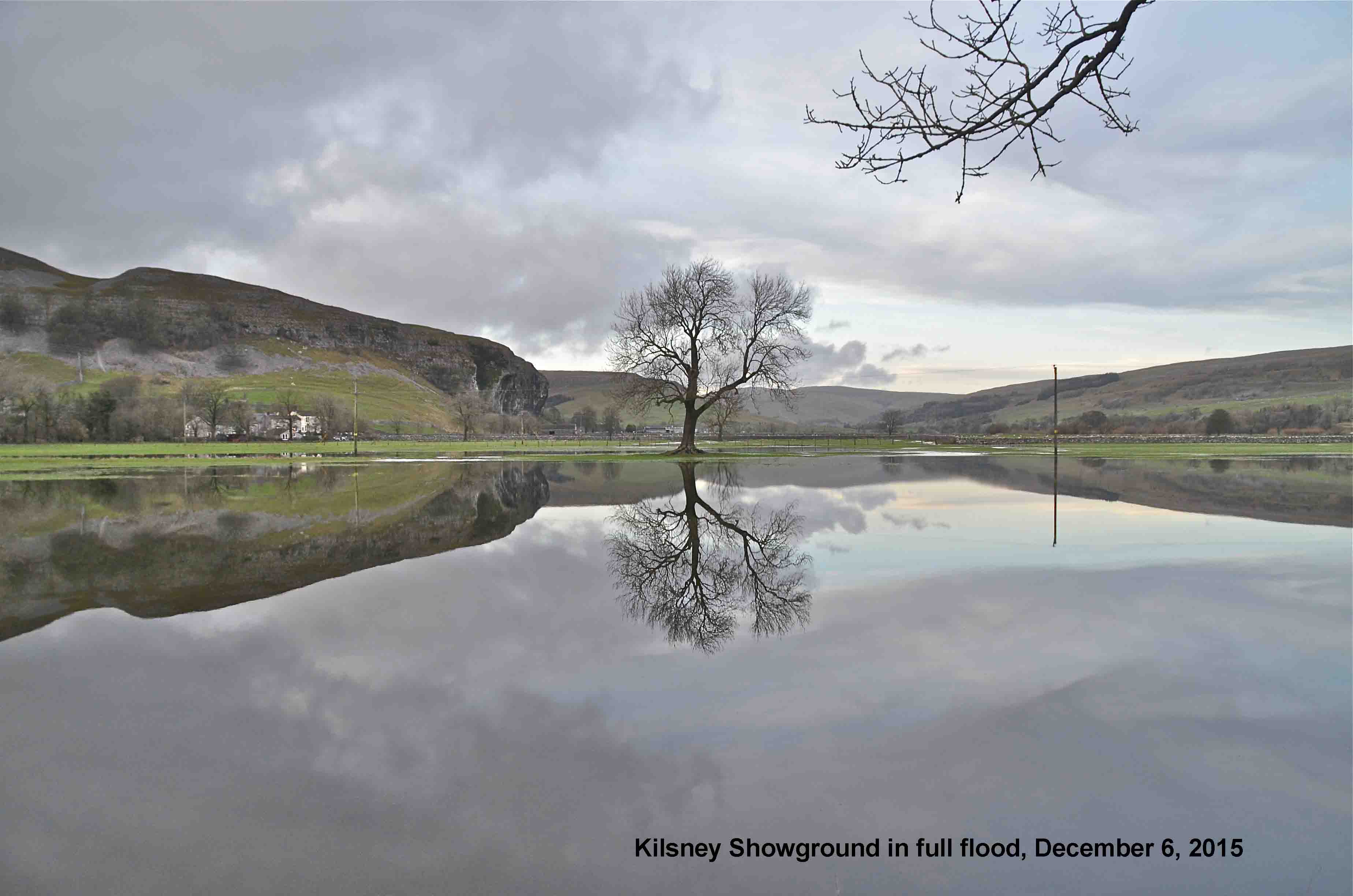
Often a tranquil stream with many pleasant bankside locations where the kiddies can play, the Wharfe is also a fickle stream which, as we will see in the images below, can rapidly rise to a foaming torrent after rain on the headwaters of the westerly reaches. Many have come to grief in misreading the moods of this tempestuous river. However this is not a new phenomenom because, according to Geoffrey Wright (1985), William Camden, Queen Elizabeth I's historian, described in or around the year 1590, the Wharfe as "a troublesome River and dangerous even in summertime also ... for, it hath such slippery stones in it that a horse can have no sure footing on them, or else the violence of the water carryeth them away from under his feete'.
Note: Lower Wharfedale is usually taken as the stretch from the Vale of York upstream to around Ilkley, Mid-Wharfedale from Ilkley to Grassington, and Upper Wharfedale above that point.
Ref. Wright Geoffrey N, 1985. Roads and Trackways of the Yorkshire Dales. Moorland Publishing company ISBN 0 86190 410 9
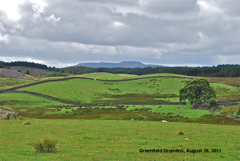
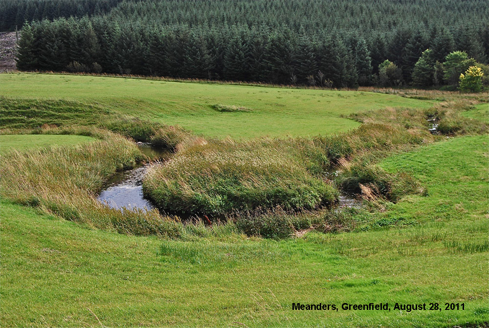
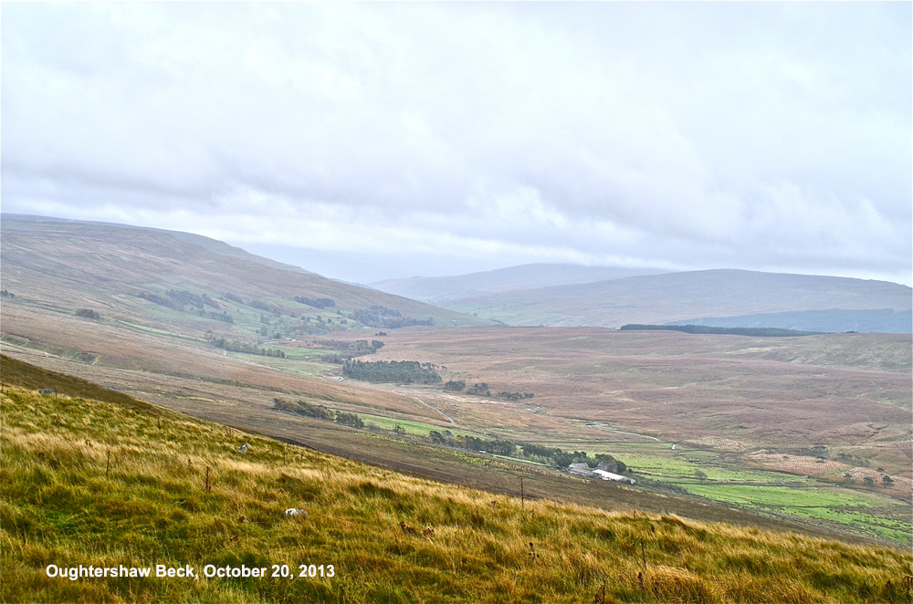
With a backdrop of the Ingleborough massif to the west, the headwaters of the Wharfe, in part, arise from the high ground of Greenfield amidst the drumlins left by the disappearing ice at the end of the most recent glaciation (above). Nearby, the infant River Wharfe meanders around the drumlins (below) in the shade of 1960s and 70s afforestation.
Further sources lie amidst the hills around the remote homesteads of Cam Houses, Swarthgill and Nethergill (below), forming Oughtershaw Beck.
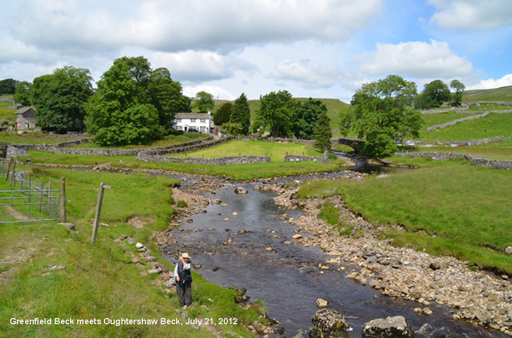
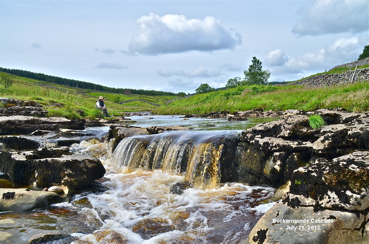
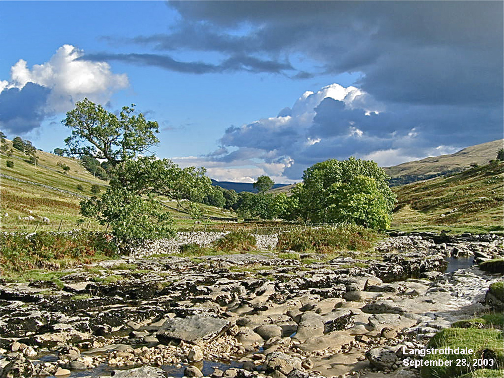
Oughtershaw Beck meets up with Greenfield Beck at Beckermonds. (below). From Beckermonds the combined waters flow down through the picturesque limestone scenery of Langstrothdale as the River Wharfe (below).
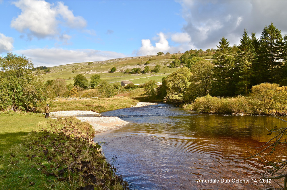
The Wharfe comes to a confluence with the Skirfare at Amerdale Dub, above, collecting on the way major inputs from Cray Gill, below, and from the western slopes of Buckden Pike and Great Whernside.
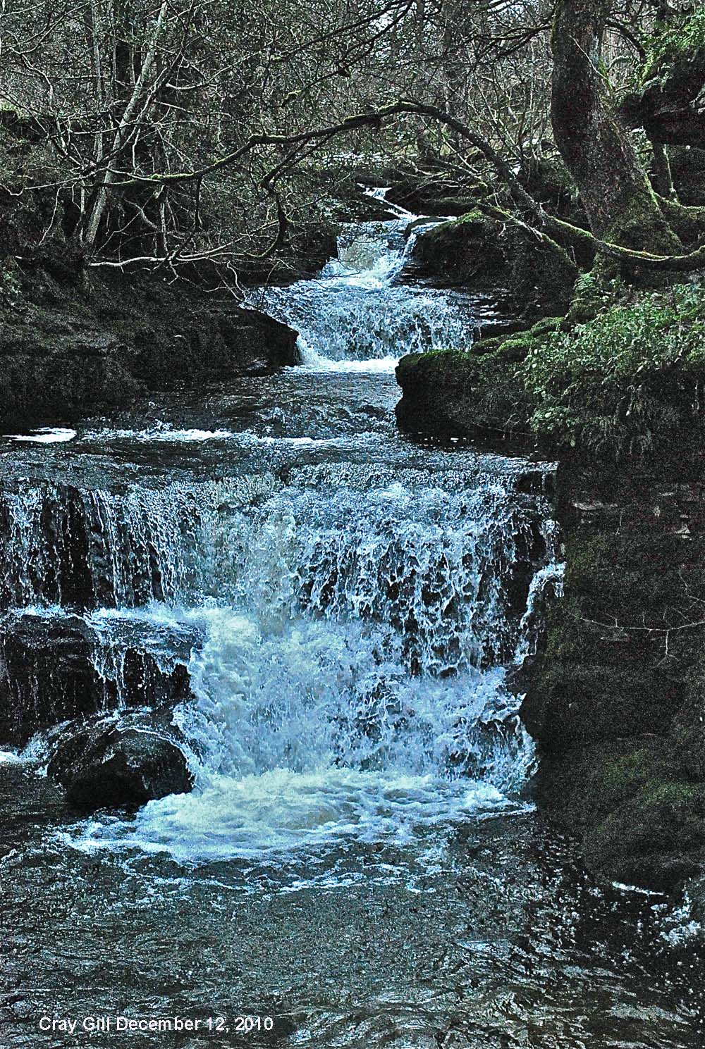
Above: Cray Gill (Fairy Glen).
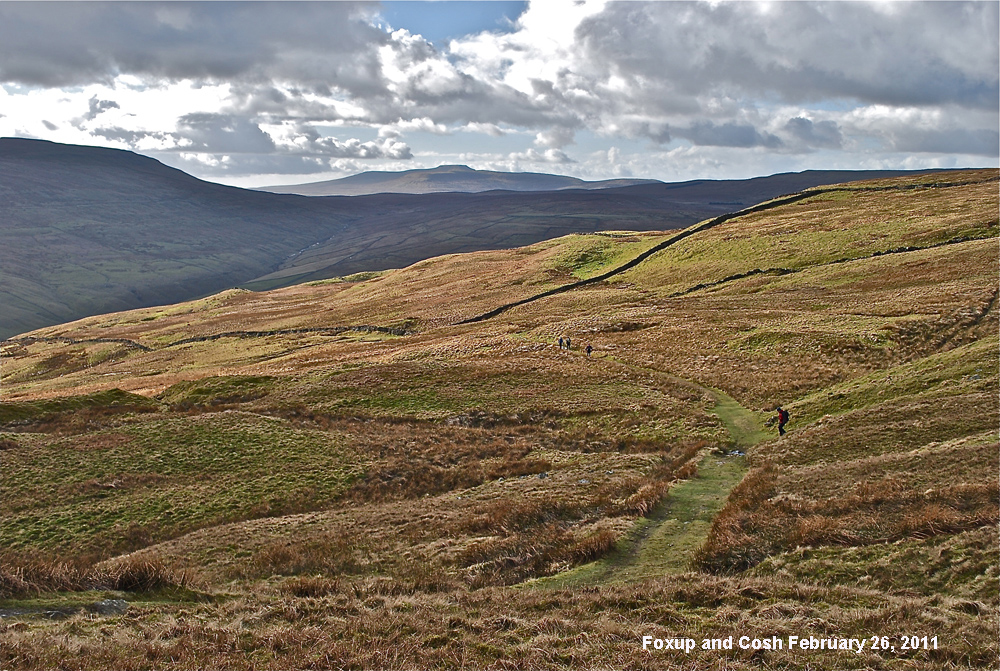
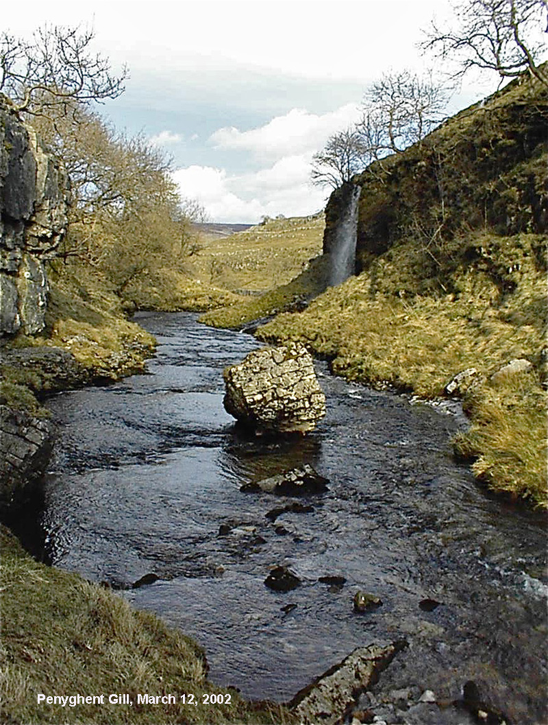
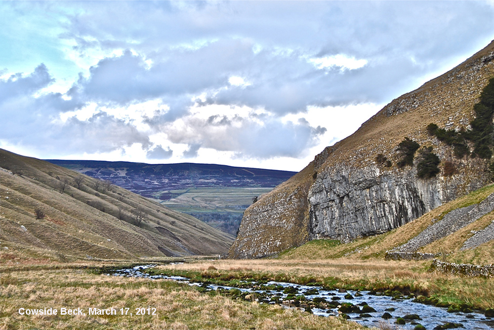
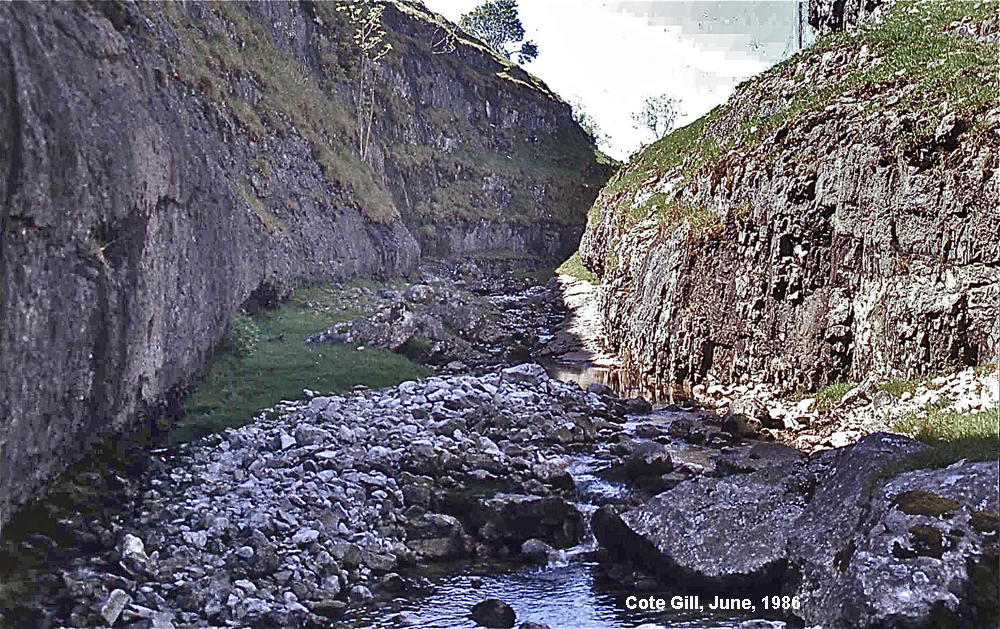
The Skirfare, too, is a river in its own right, flowing through the glaciated valley of Littondale. The Skirfare arises from the remote fells of Cosh and Foxup, above, to follow a course down Littondale (below) with tributaries draining from Penyghent over Blishmire (below) and down Penyghent Gill (below), as well as Cowside Beck (below) and Cote Gill (below).
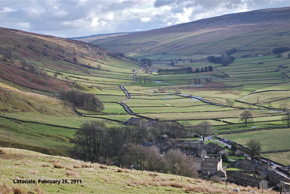
The glaciated U-shaped valley of Littondale.
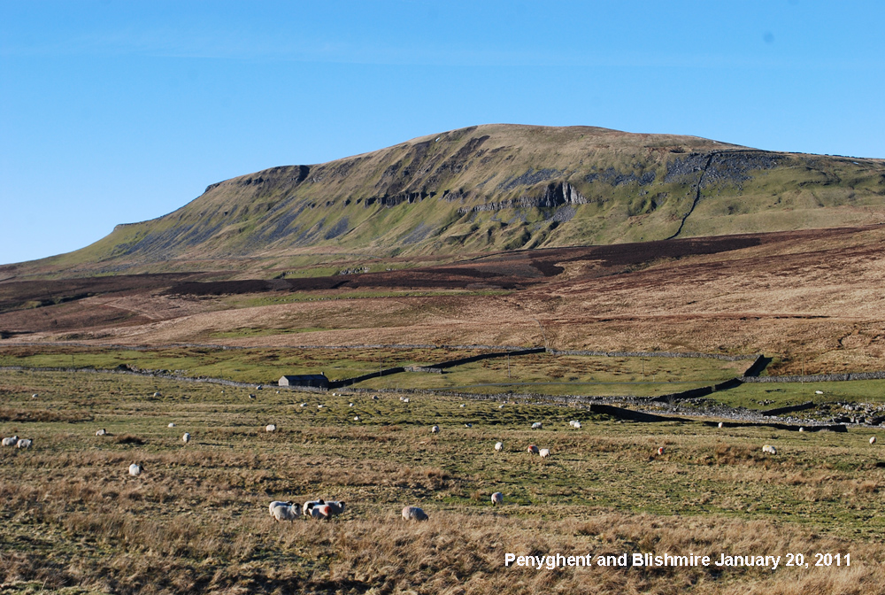
The south-eastern slopes of Penyghent, above, drain to Penyghent Gill, below.
Cowside Beck, below, is not only a magnificent glaciated side valley to Littondale but it is also a major feeder to the Skirfare drawing drainage from Darnbrook and the eastern slope of Fountains Fell..
Yet another spectacular tributary to the Skirfare is Cote Gill, below.
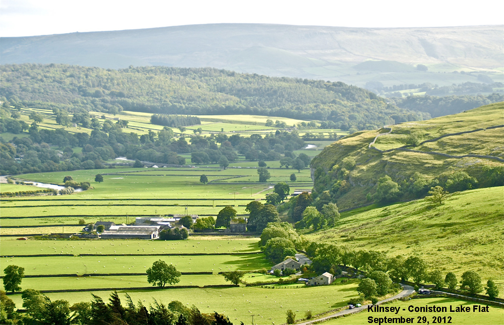
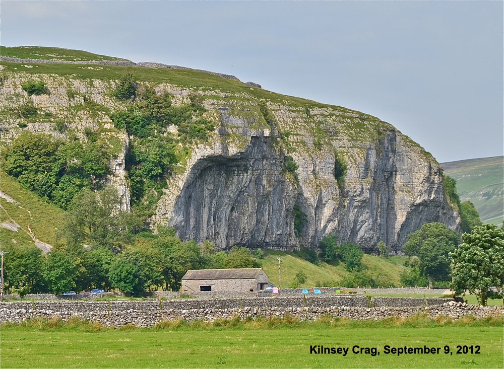
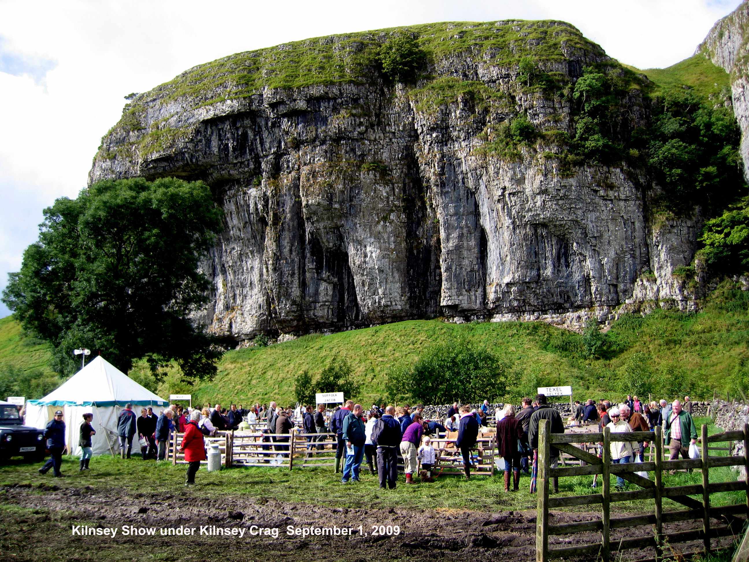
The Wharfe pursues a course over a glacial lake flat under the shadow of Kilnsey Crag, below, just one of many, to tumultuous cascades at Mill Scar Lash, Ghaistrills and Linton Falls, below.
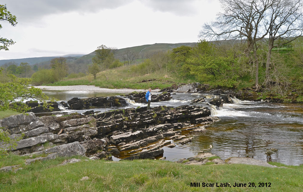
Mill Scar Lash, photo by M I Warren,
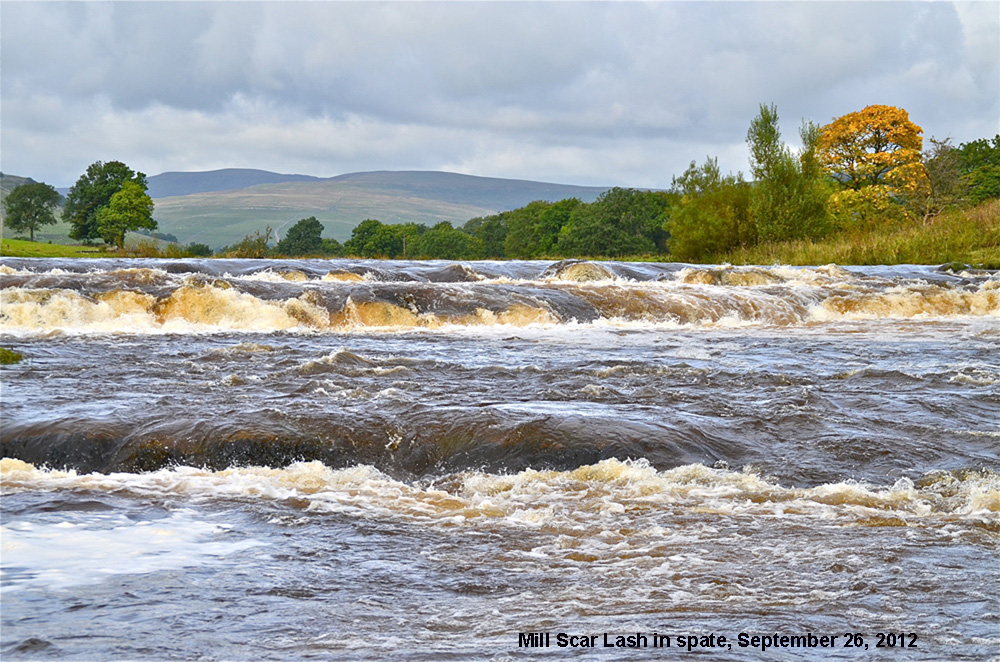
Mill Scar Lash in spate.
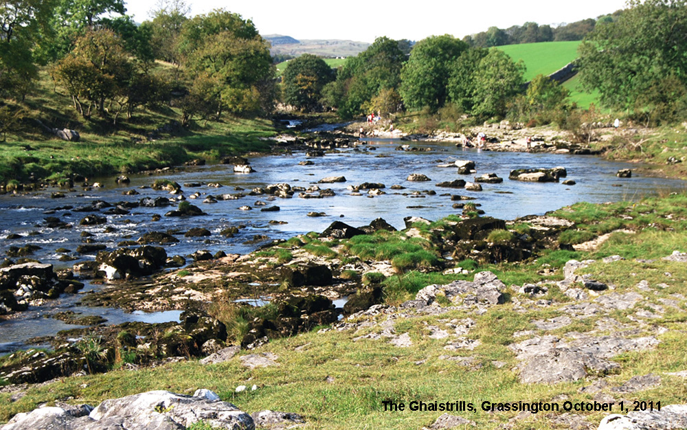
Ghaistrills.
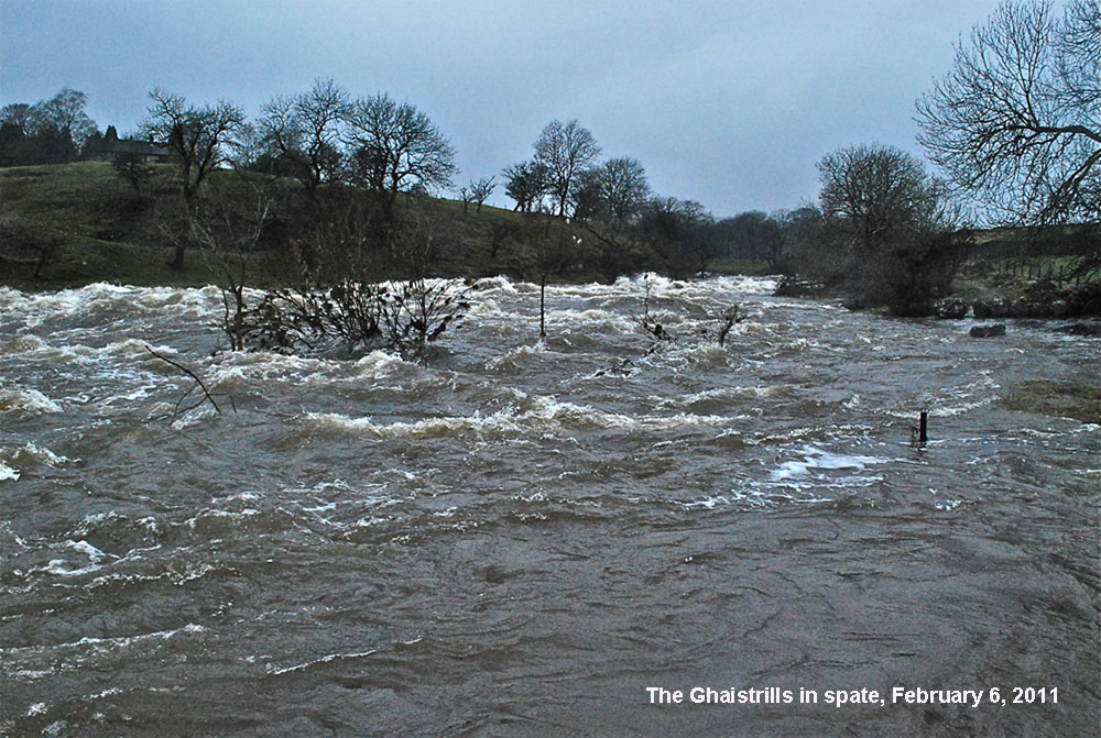
The Ghaistrills in high flood.
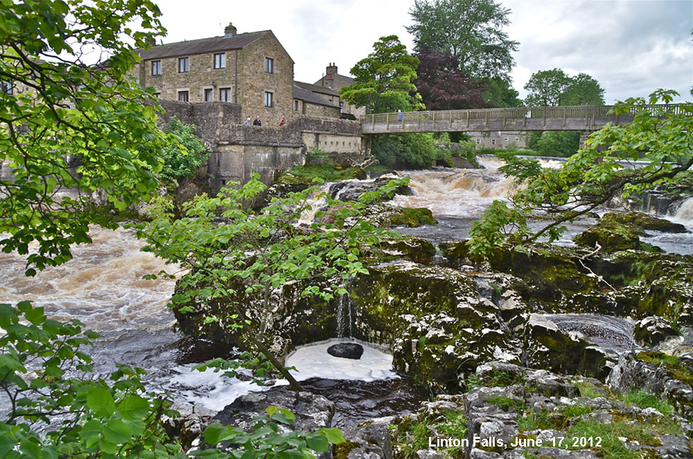
Linton Falls on the line of the North Craven Fault.
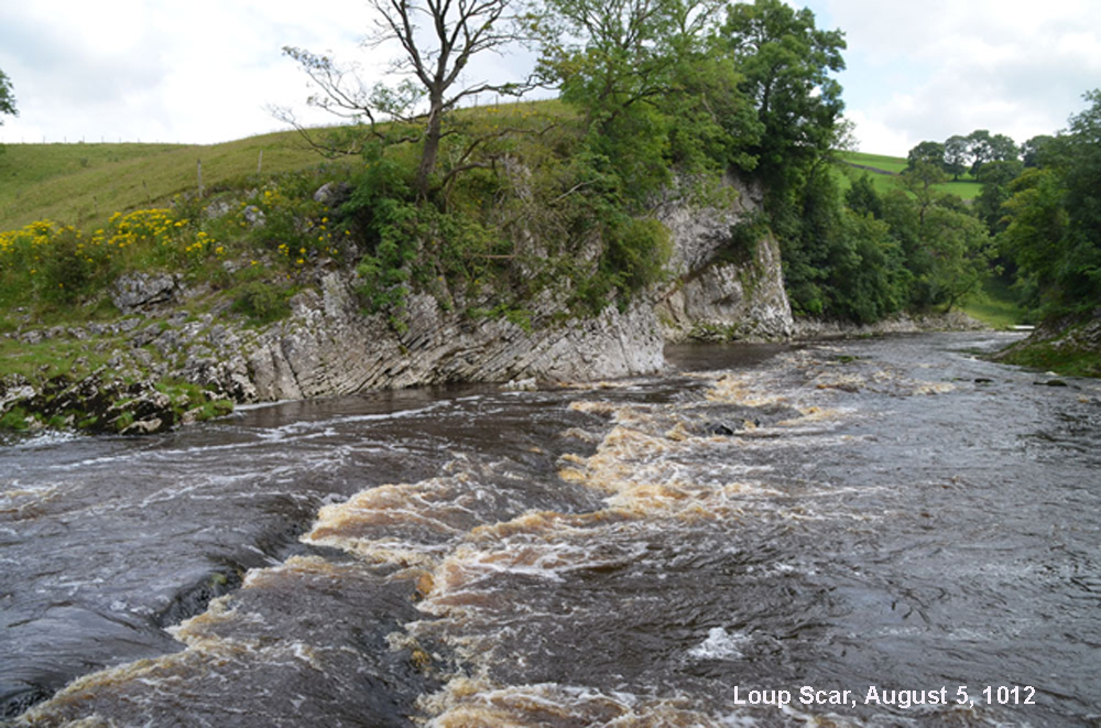
The North and Mid Craven Faults, cutting through Wharfedale, mark the change from limestone country to millstone grit terrain. A little way downstream from Linton Falls the limestone gorge of Loup Scar, above, exposes a cross-section through a much disturbed part of the limestone sequence.
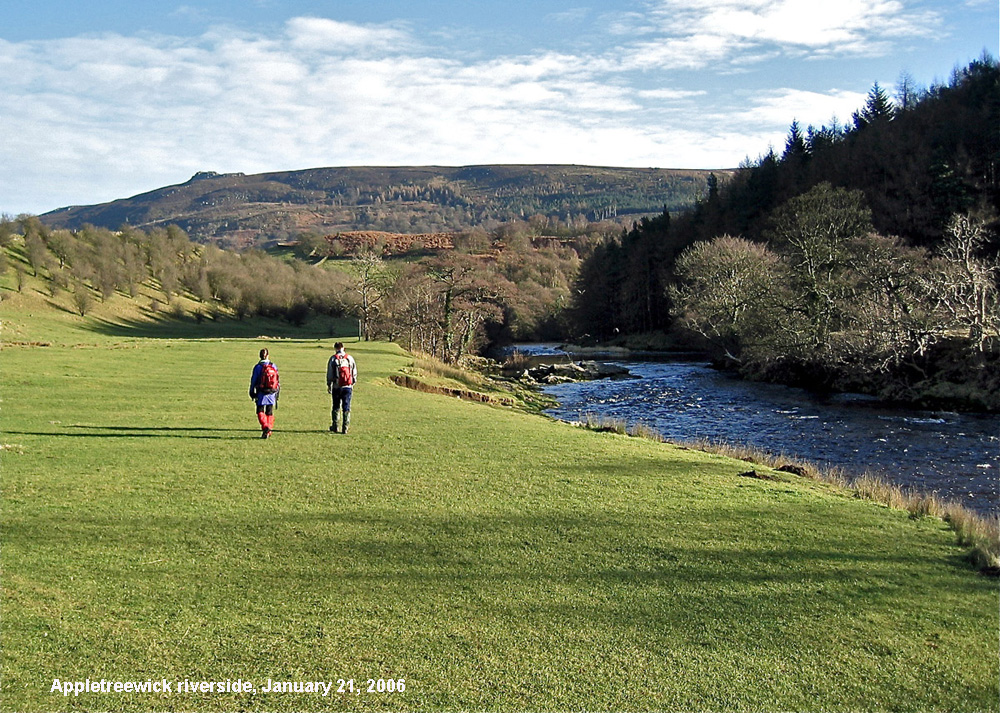
At Appletreewick one is definitely in millstone grit terrain.
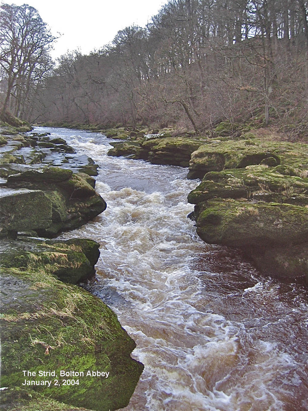
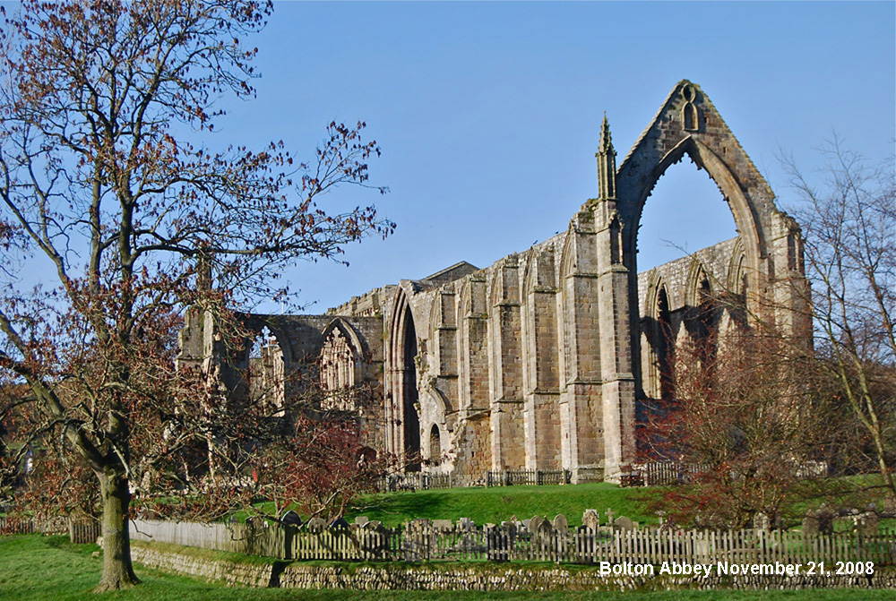
After racing down the Strid, above, the Wharfe glides peacefully past one of our greatest treasures, the 800 year old priory at Bolton Abbey, below.
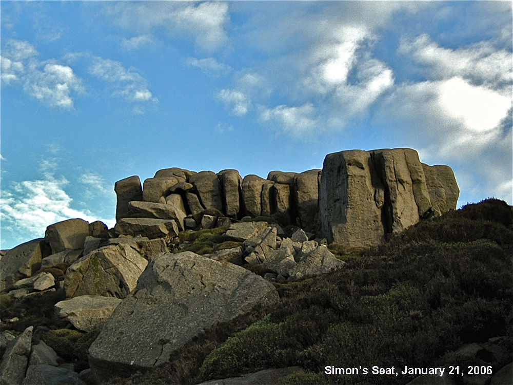
Now we are in mid-Wharfedale, there are the magnificent gritstone scarps of Rolling Gate Crags, Simon's Seat, above, Addingham Edge and, greatest of all, Ilkley Moor and the world famous Cow and Calf Rocks, below.
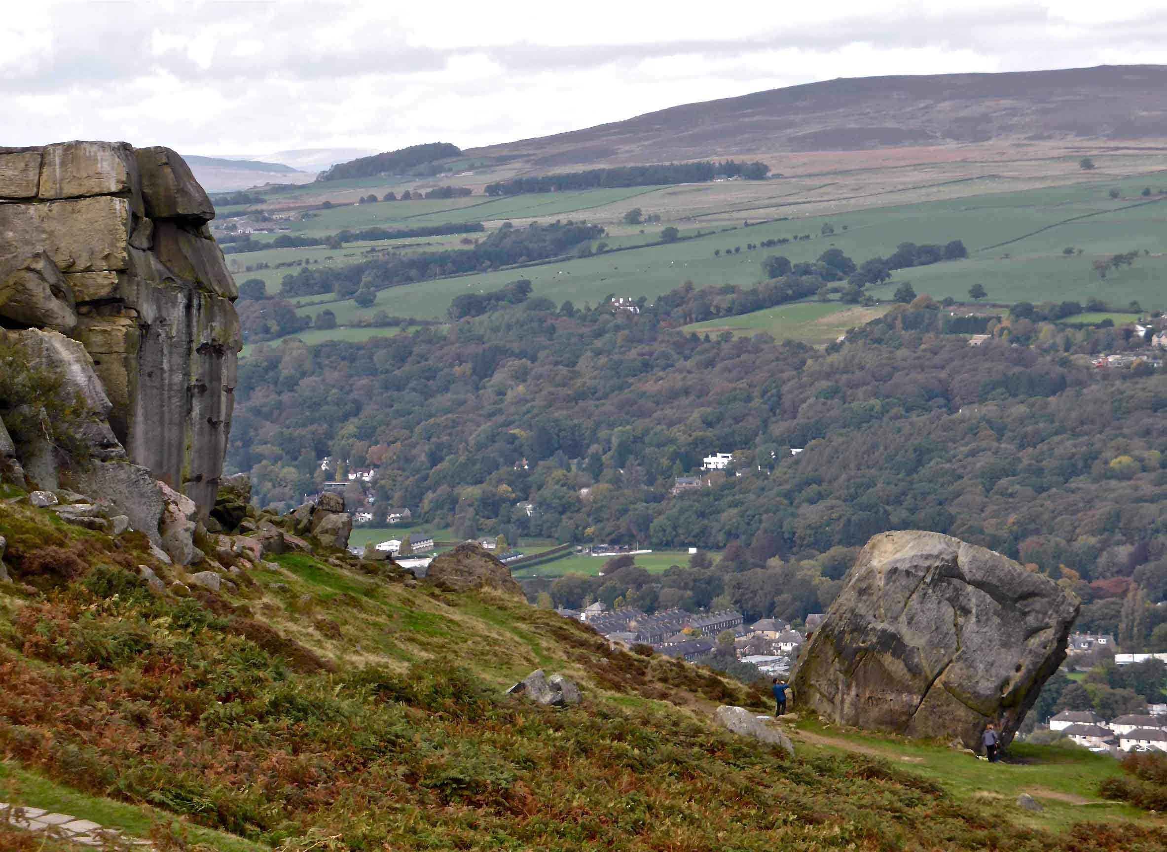
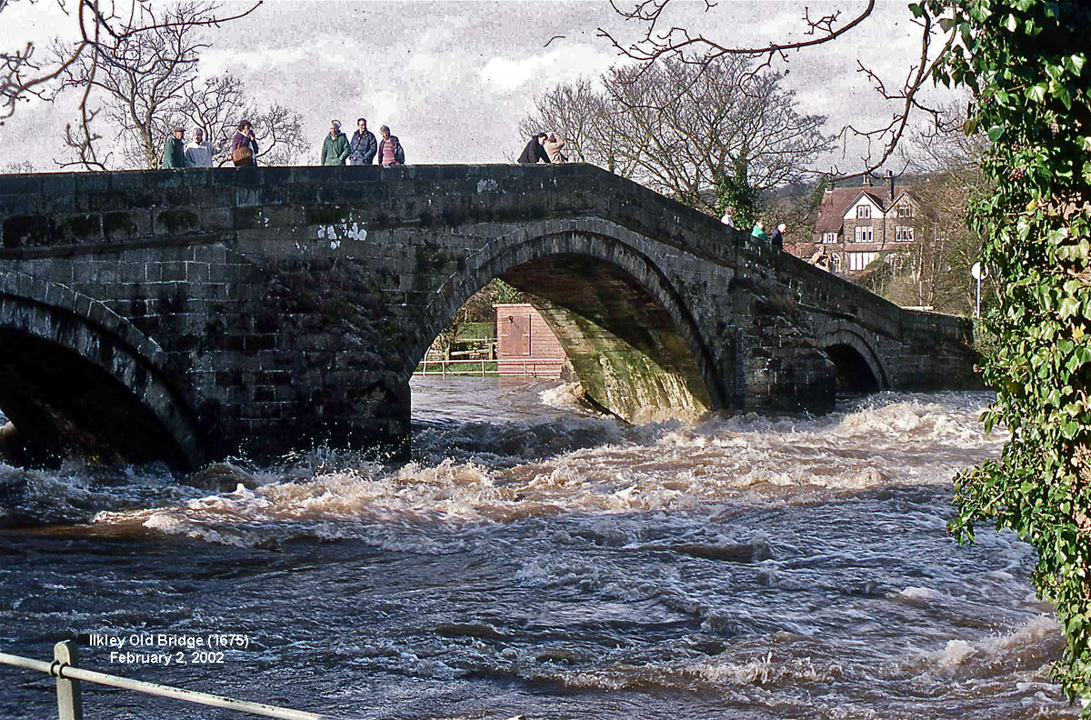
Ilkley, of course, is noted for the moors and the many gritstone crags, for the bluebell woods and for the river with its seventeenth century packhorse bridge, above.
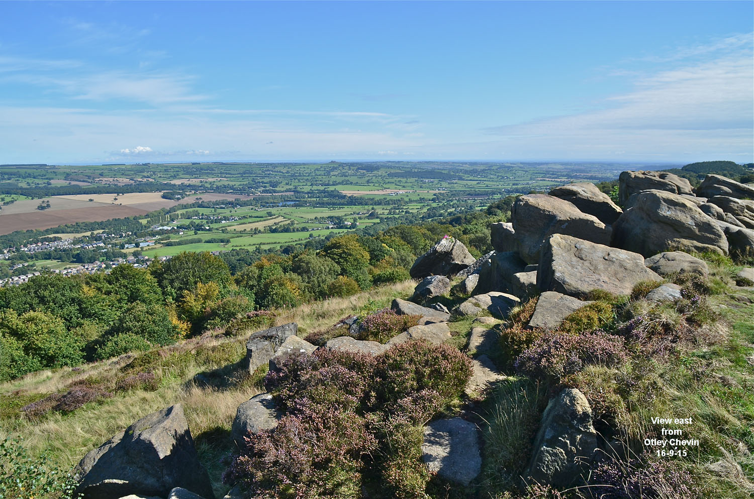
A few miles down valley there are spectacular views from Otley Chevin, below. Looking over Lower Wharfedale: centre horizon - Almscliffe Crag, distant left of centre Hambledon Hills, distant right of centre Vale of York and, on a clear day, York Minster.
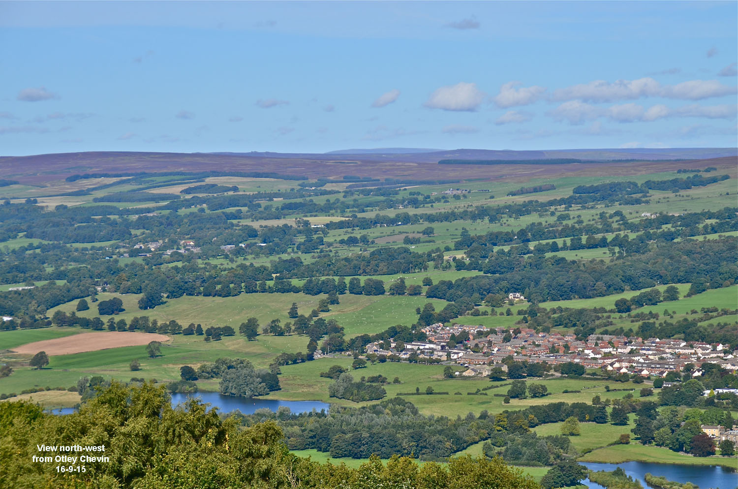
Below: looking north from Otley Chevin: centre horizon is Great Whernside, 28 miles, left of centre Pockstones Moor, 11 miles.
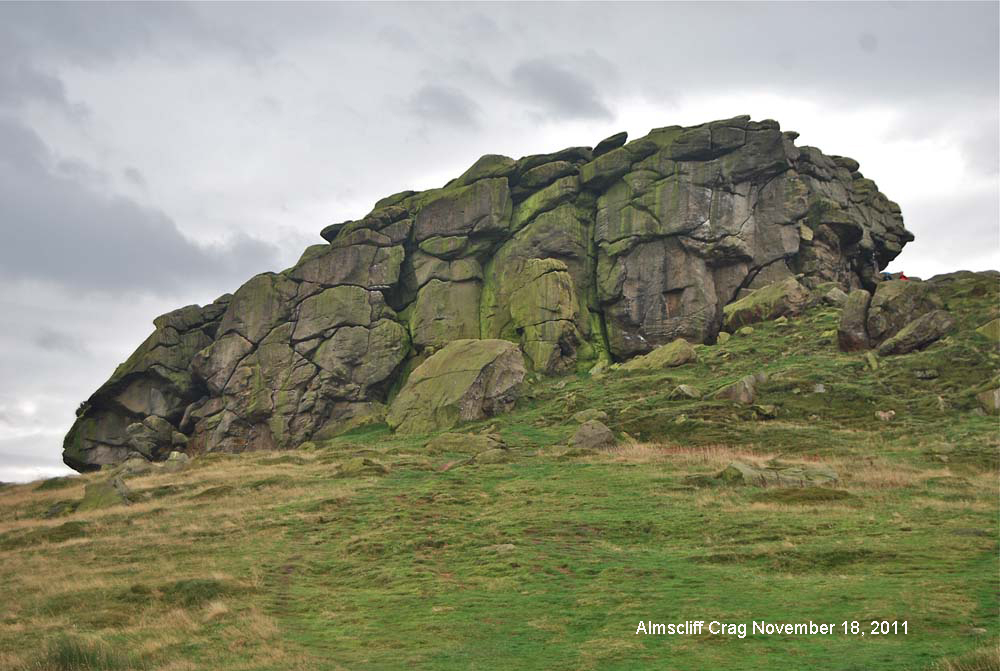
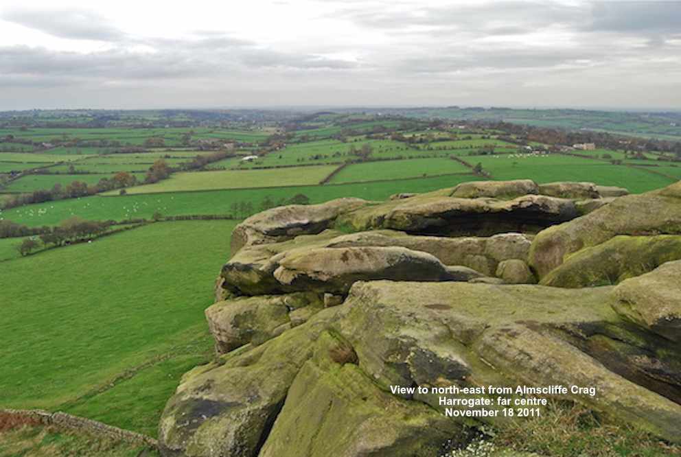
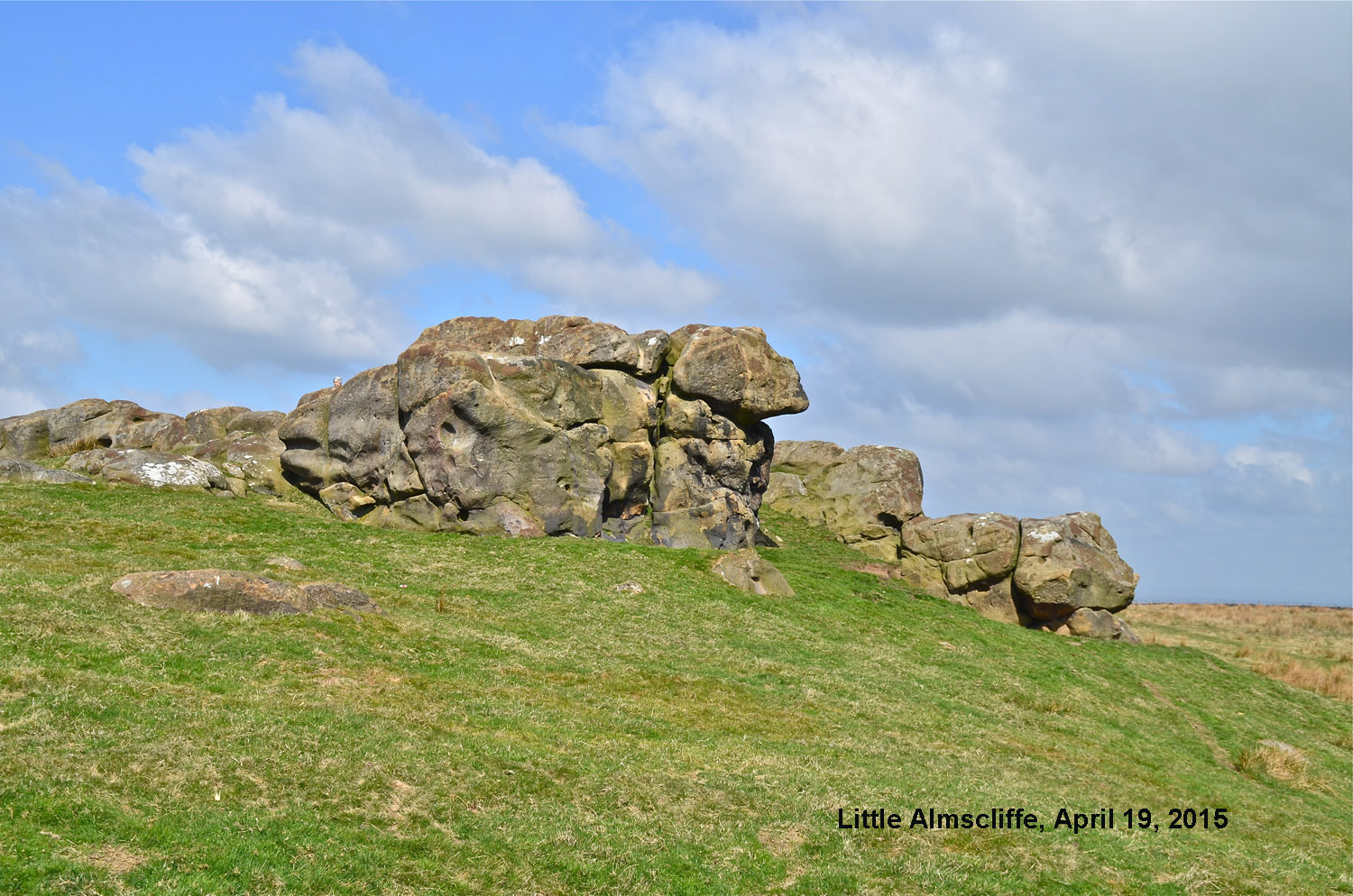
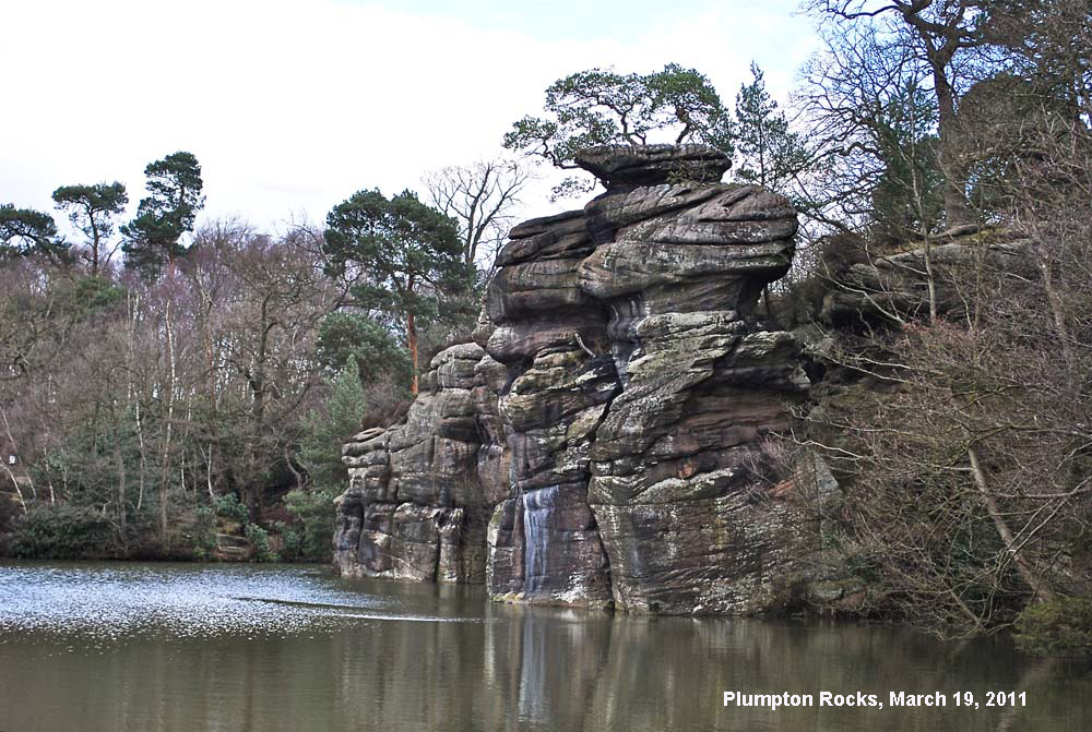
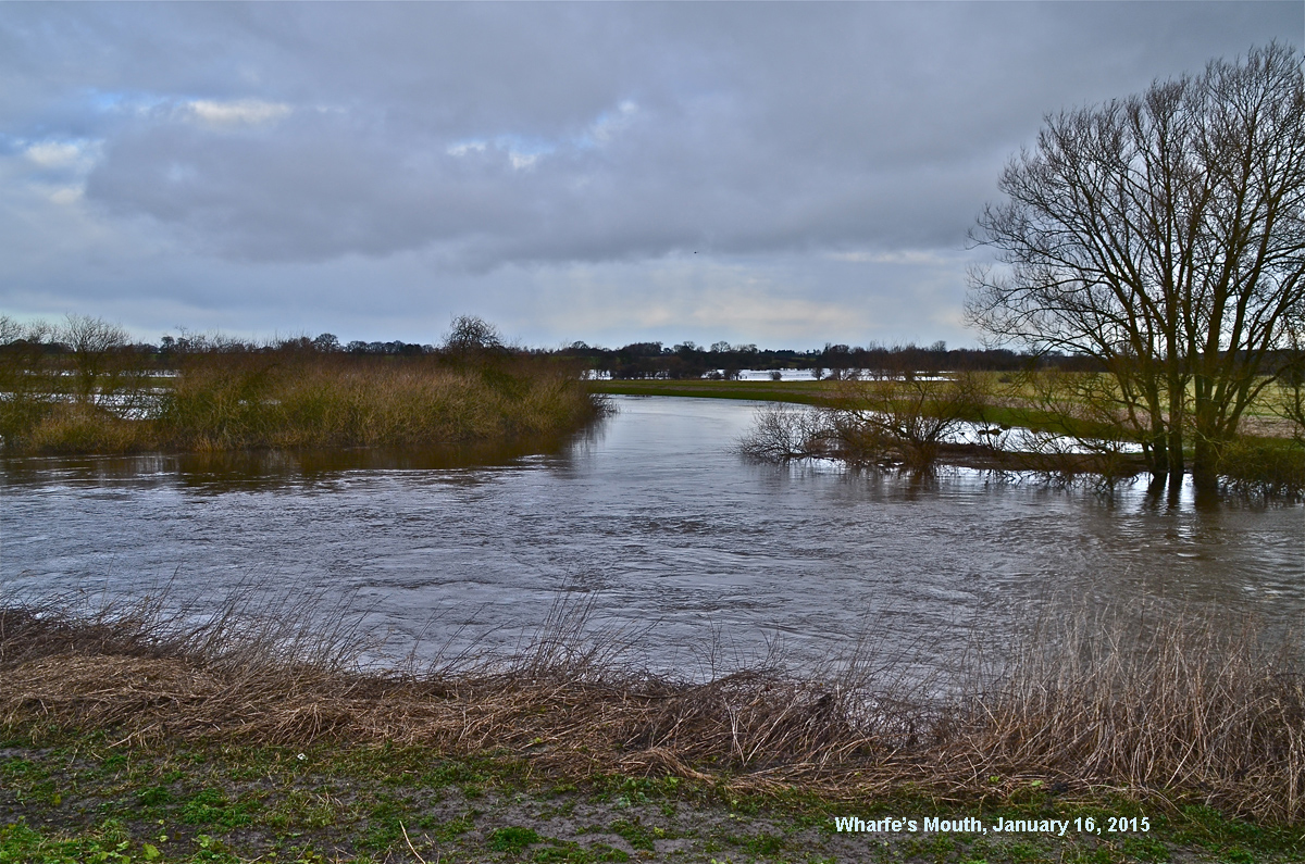
There are still more outstanding features further down in Lower Wharfedale at Almscliffe Crag, above, not forgetting nearby Little Almscliffe, below, and Plumpton Rocks, below, before this most beautiful of dales peters out at Wharfe's Mouth where the Wharfe joins the Ouse near Cawood in the Vale of York, below.
The aim of this section was to consider the magnificent landscapes of Wharfedale but a good place to begin our understanding of the underlying geology is right at the bottom with the rocks beneath the limestones so prominent in Upper Wharfedale. Thus we consider what the early geologists observed as long ago as 1871. The section on the Silurians does just that.
At this stage move back to the main menu (back space key) or move directly to:
The Silurians: click here.
Any
shortcomings in the text are entirely my
own.
If you would like to get in touch or add information, there is an email
address:
mudinmyhair@btinternet.com
Steve Warren
Website created by WarrenAssociates 2012
Website hosted by Vidahost
Copyright © Steve Warren 2012