The Girvanella Band
The
pages below are under development and will be updated on a regular
basis.
All images are from the author's collection unless otherwise indicated.
Click on images for larger view: use back arrow to return from image view.
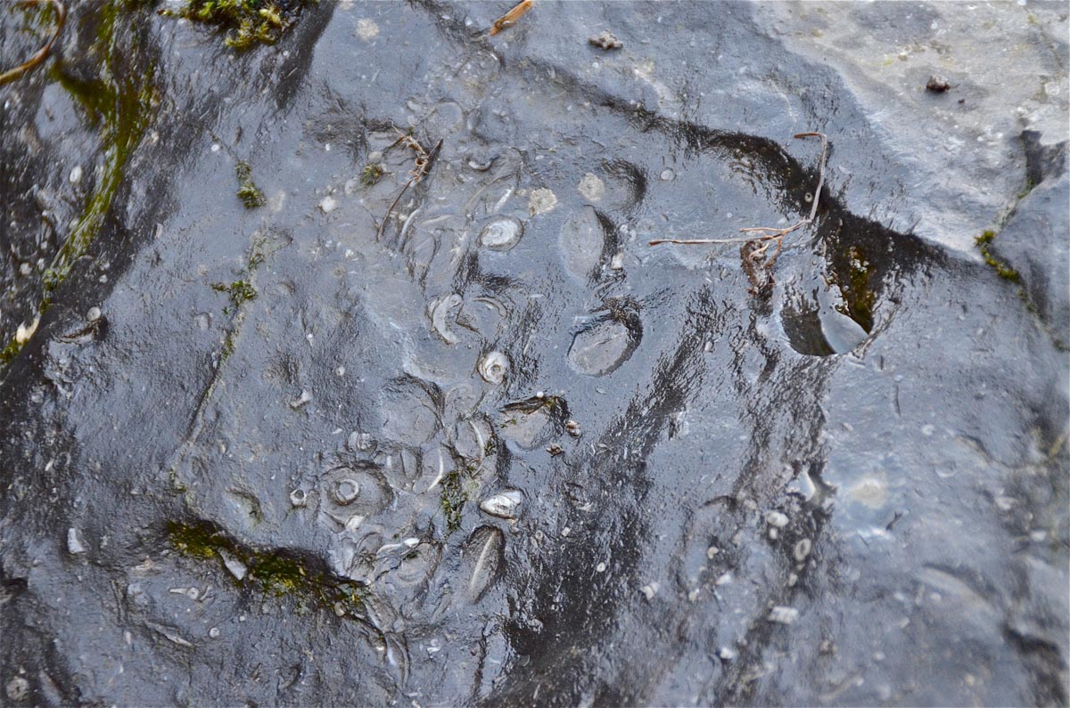
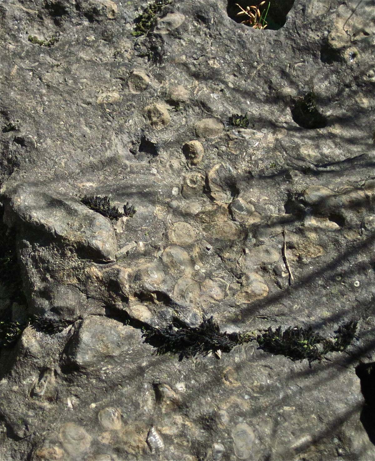
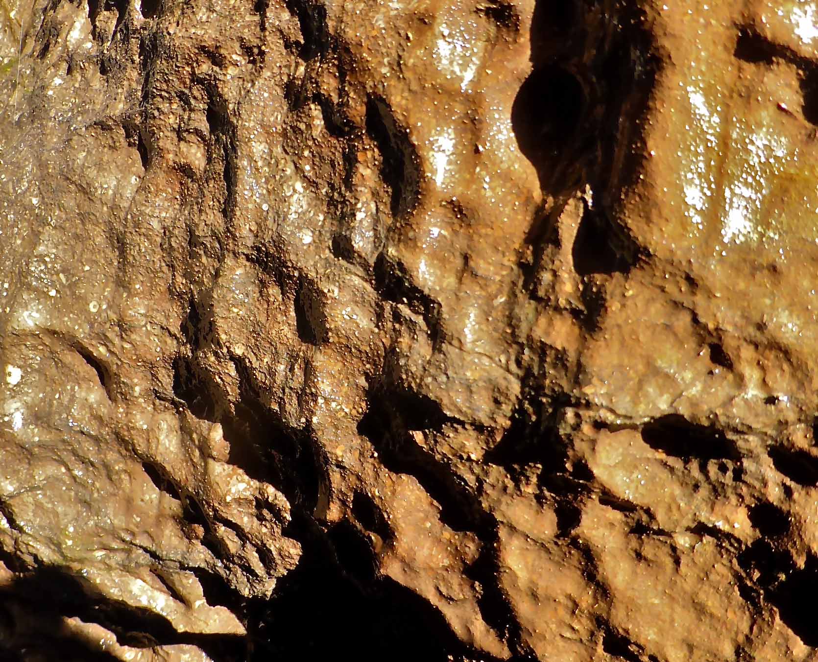
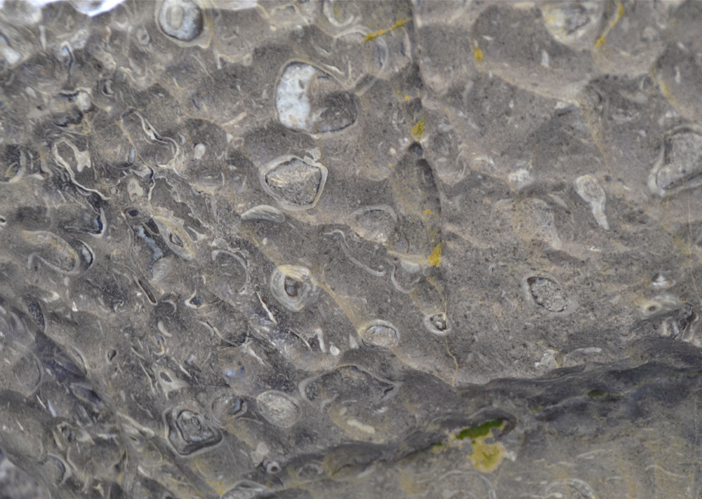
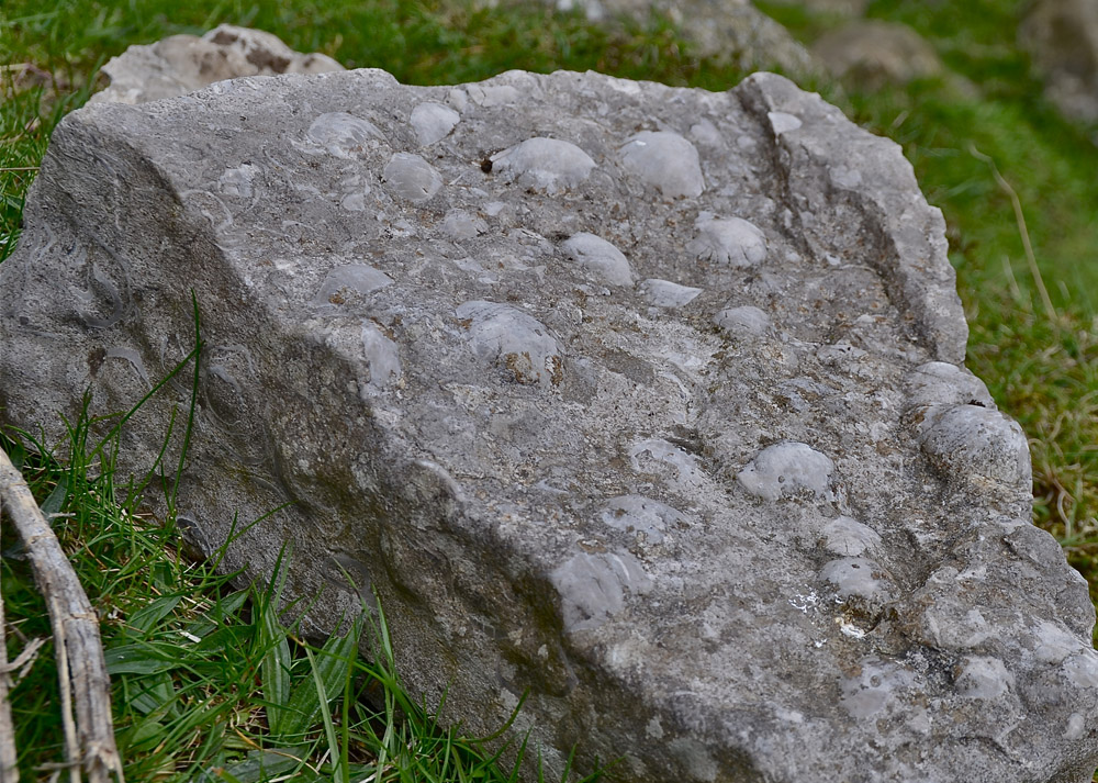
Originally described as 'almond rock' by Hughes (1900) from its appearance, the Girvanella Band (GB) is a band of very dark or black bituminous limestone containing Girvanella nodules or oncoids. The nodules represent a symbiotic intergrowth between three species of lowly plants and animals, including the alga Girvanella which forms concentric rings around shell fragments (O'Connor 1964).
A highly distinctive feature of the Girvanella limestone in the field is the strong sulphurous smell that emanates when a specimen is hammered or fractured.
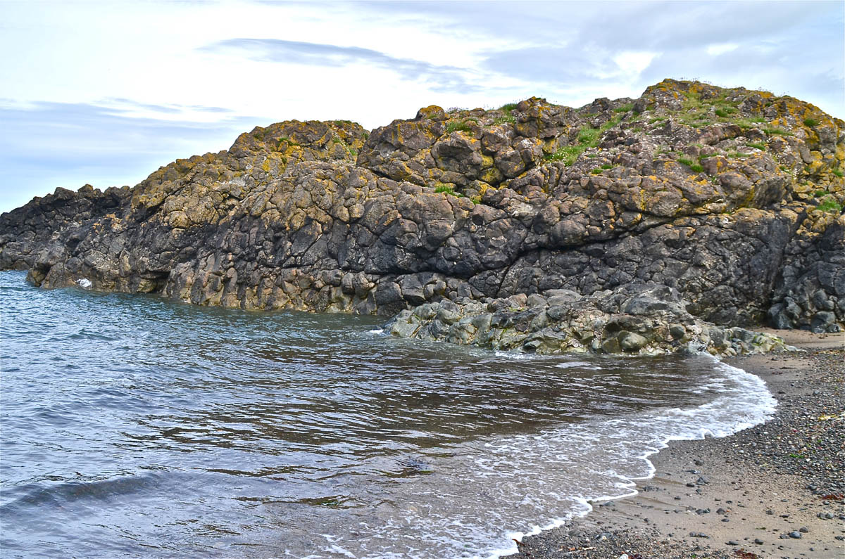
The genus Girvanella was founded by Nicolson and Etheridge in 1878 from exposures near Girvan, a small fishing port half-way between Stranraer and Ayr on the Ayrshire coast. (Girvan, of course, is well known to geologists as a good location to see pillow lavas: (see images here, and here for pillow lavas at Downan Point a few miles south of Girvan). Although it was originally assigned to the Foraminifera, Girvanella is now generally placed in the blue-green algae (Cyanophyta). A genus of fossil algae, Girvanella is characterized by tubular filaments of a diameter in the order of 10-30 microns, composed of thick, calcareous walls. Filaments usually occur in groups, twisted together to form nodules and encrusting masses on various objects.This genus is a very common fossil, with a worldwide distribution. Occurring mainly in marine rocks, it has been reported from the Cambrian to Cretaceous (notes based on Wood A, 1957).
In the limestones of the Yorkshire Dales. the Girvanella Band (GB) occurs at the top of the Great Scar Limestone where it is taken as the boundary between the lower limestones of D1 age and the higher limestones of D2 age, the Yoredales. Many of the widespread limestones terraces of the Dales, at the top of the 'Great Scar Limestone', to use a traditional term, are where the Girvanella Band is present and, significantly, where the entrances to many of the major potholes are found.
According to Wood (1957 op cit), the genus (Girvanella):
"has considerable value as a facies indicator, the nodules and pisoliths formed by its growth indicating shallow clear water. By comparison with modern algal balls these forms cannot have flourished below depths of about 30 fathoms (60m). Often, as is the case of the well known Girvanella Band in the Lower Carboniferous of northern England, these fossils show the sea to have been shallow and of uniform depth over an area of hundreds of square miles".
The porcellanous band mentioned on another page also has characteristics of a development in shallow seas over an area of hundreds of square miles. Where the intrigue lies is in the manner in which these 'marker' bands vary in thickness over such vast areas, and also the varying nature of the overlying and underlying limestone beds. This is a much neglected topic which merits further attention.
A compilation of some locations for the Girvanella Band may be found as a download at the end of the section.
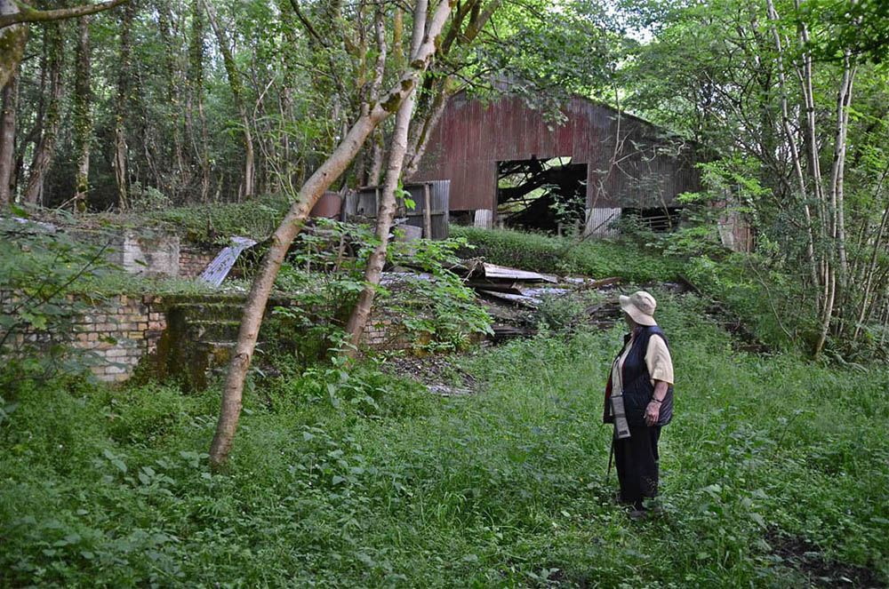
In June 2015, my wife and I paid a visit to Craighead Quarry, the original location of Wood's girvanella. We found that the quarry had closed down long ago and the whole site was heavily overgrown and littered with dilapidated buildings and machinery. It was clearly a dangerous place as illustrated below so our project was abandoned forthwith.
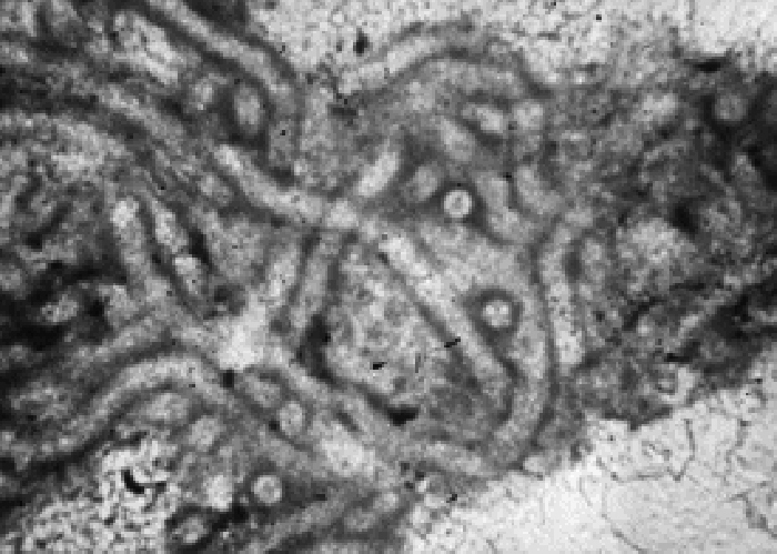
Microphotograph of a specimen of girvanella clearly showing the tubular nature of this algae. Source: author's collection, origin unknown.
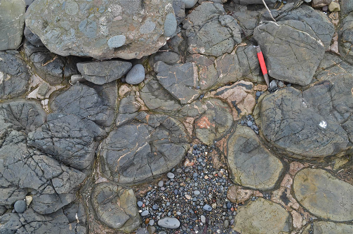
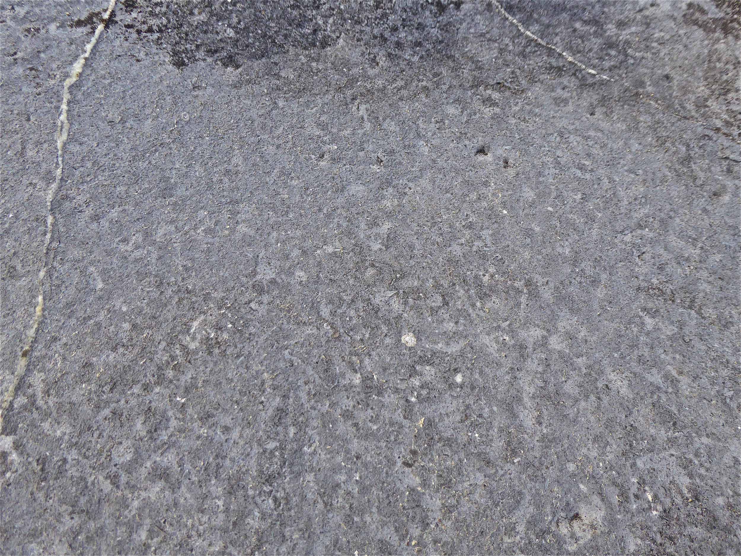
Left: Typical appearance of girvanella limestone in the field. Hesleden Bergh. June 16, 2004.
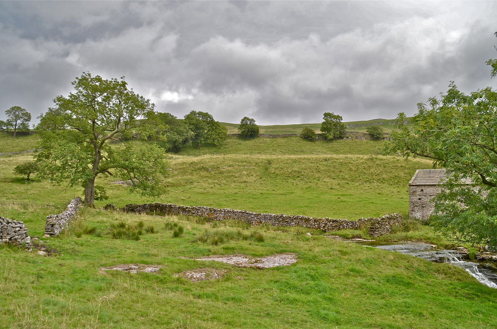
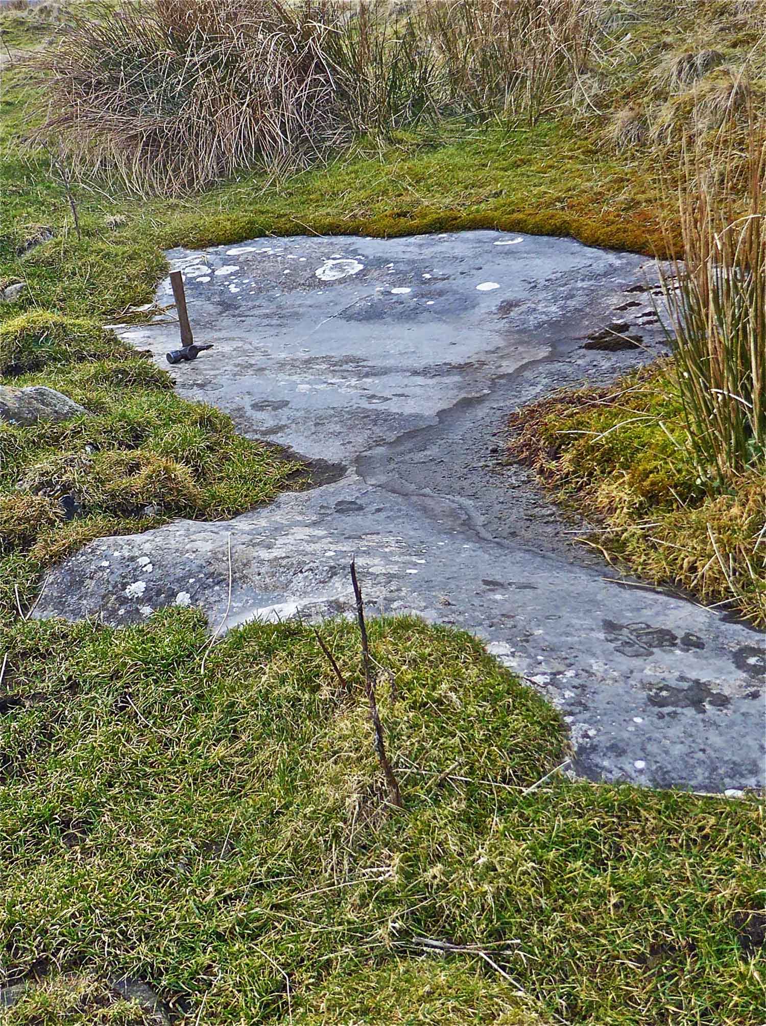
Right: there is a fine exposure of the Girvanella Band at Ling Gill Bridge. March 26, 2002
Around Wharfedale
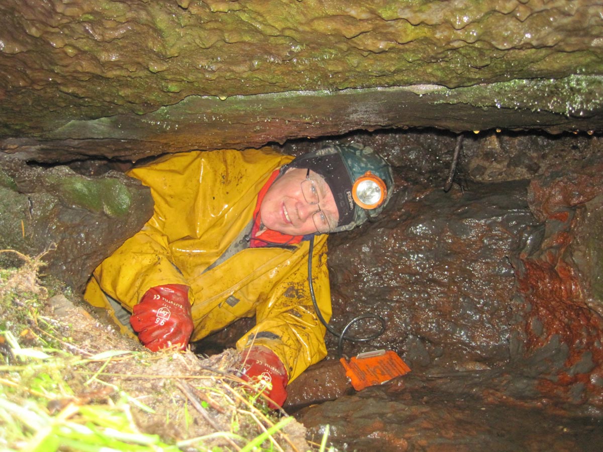
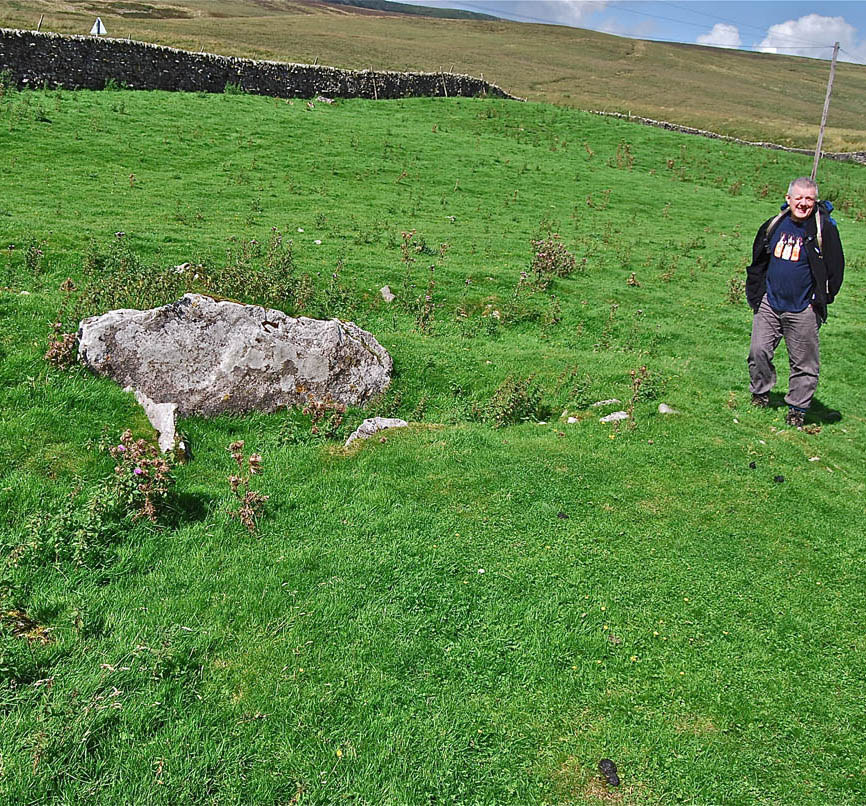
Left: the author in Jack's Cave, NGR 89696 78817, an otherwise insignificant 6m long cave on the Hagg near Langstroth Pot. What is significant is that it is formed entirely within a 7m thick bed of black limestone. This is Wharfedale's answer to the skinny thin Girvanella Band of Ribblesdale. Nearby 11m Kneeprint Cave is of a similar nature.
Photo by Phil Ryder, January 5, 2013
Left: Dave Milner just inside the entrance to Birks Fell Cave where the light grey Great Scar Limestone gives way quite abruptly to the black Girvanella limestone of the Hawes Limestone sequence. At an altitude of 365m this is approximately some 105m higher than the Porcellanous Band seen at a rock step immediately before Elbow Bend lower down the cave. The Girvanella limestone does appear to have been deposited on a palaeokarstic surface but this aspect requires further investigation.
February 17 2014
Left: More black and white: light grey Great Scar limestone meets black Girvanella limestone of the Hawes sequence. First pitch, Pasture Gill Pot, Langstrothdale. Photo by Adele Ward, July 7 2018
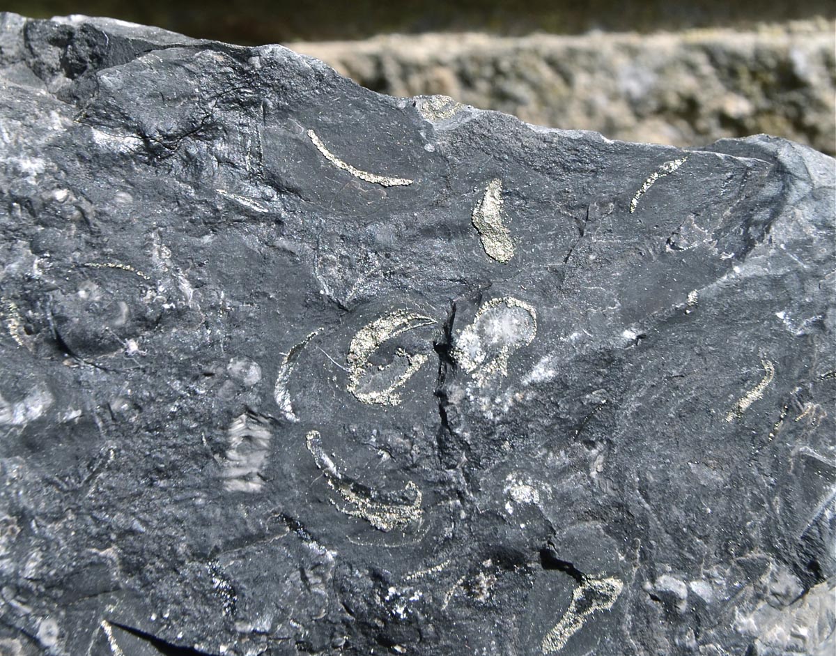
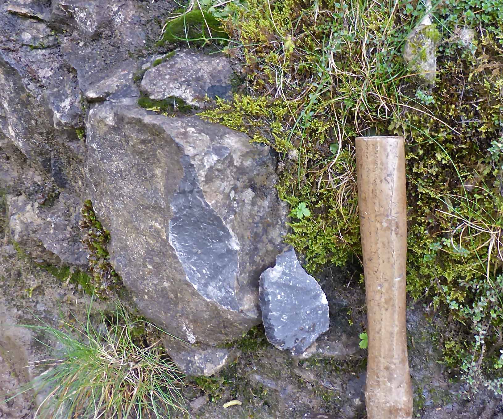
Left: a hand specimen of Girvanella Band from Raisgill Wood with many of the shell fragments infilled with, or replaced by, pyrites.
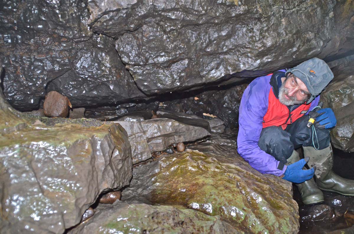
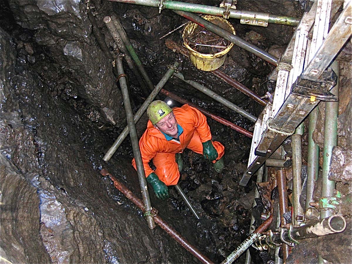
Right: At least six metres of Girvanella Band are exposed in the walls of this dig. Phil Ryder in Compass Pot, NGR 901785, Langstrothdale. January 11, 2005.

Left: black Girvanella limestone meets grey limestone near the bottom of Compass Pot. November 25, 2006.
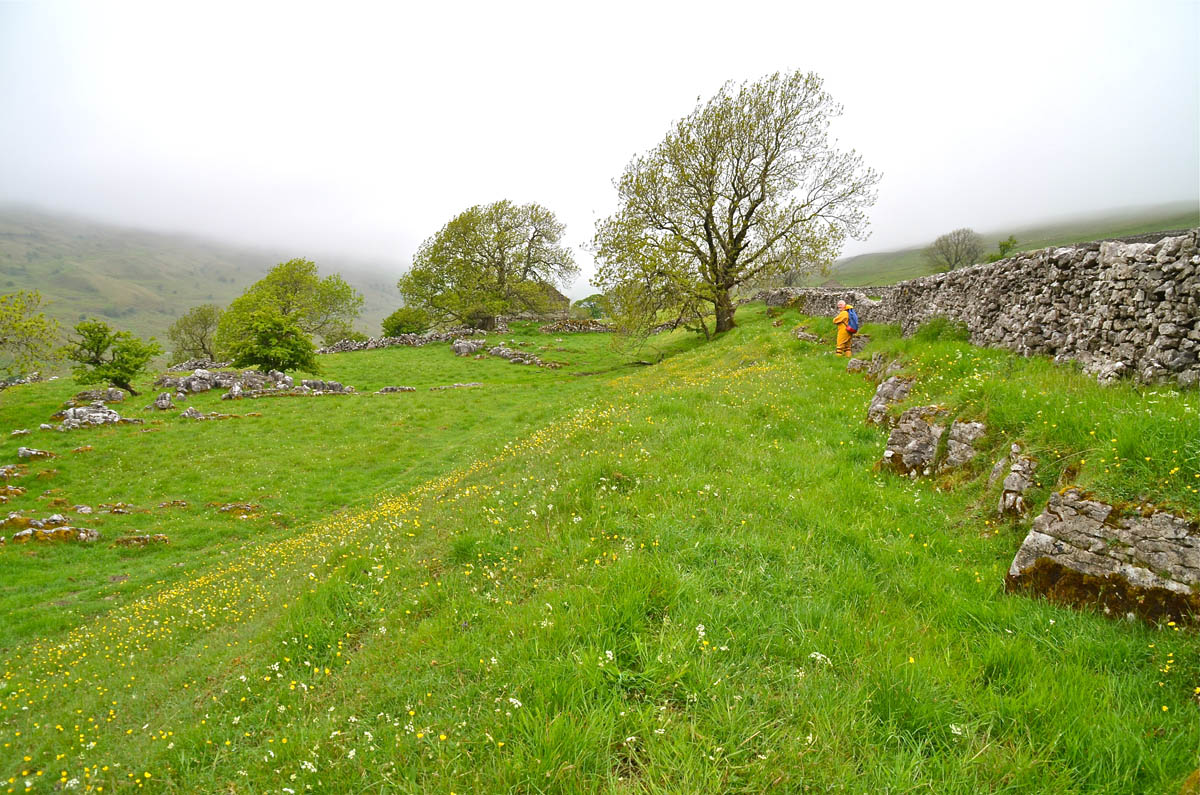
Right: On the fellside above Yockenthwaite NGR 909791, this grassy bank represents a three metre thick Girvanella Band inconspicuously sandwiched between two beds of grey limestone. Apparently, the seven metres of GB on the west side of Langstrothdale has thinned to three metres over a distance of one kilometre. June 13, 2013
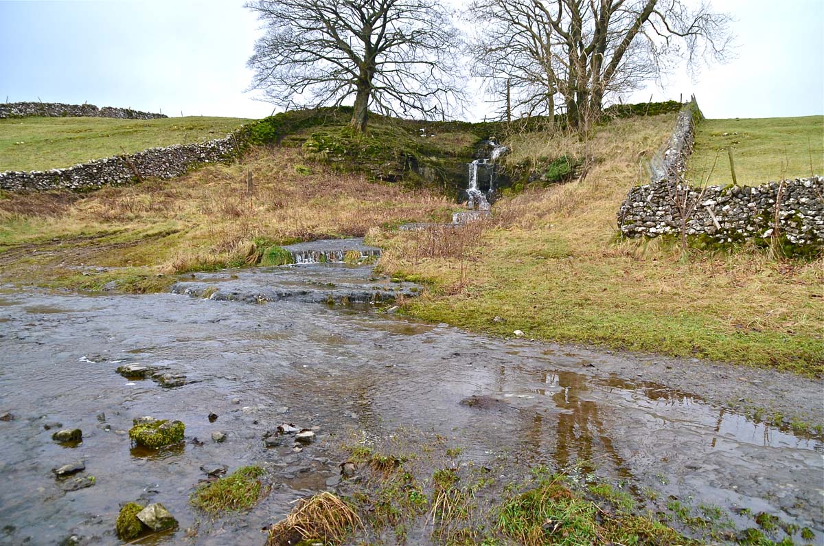
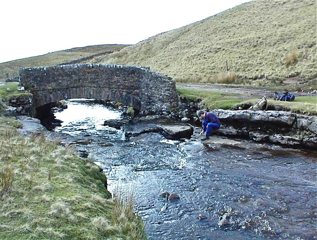
Left: the Girvanella Band is well exposed where the public footpath crosses a ford behind the White Lion public house at Cray. December 16, 2012.
Right: at Cray, NGR 943793, as at Yockenthwaite above, the Girvanella Band is conspicuous only as a grassy bank just a 100m or so up the road from the White Lion pub. September 1, 2013
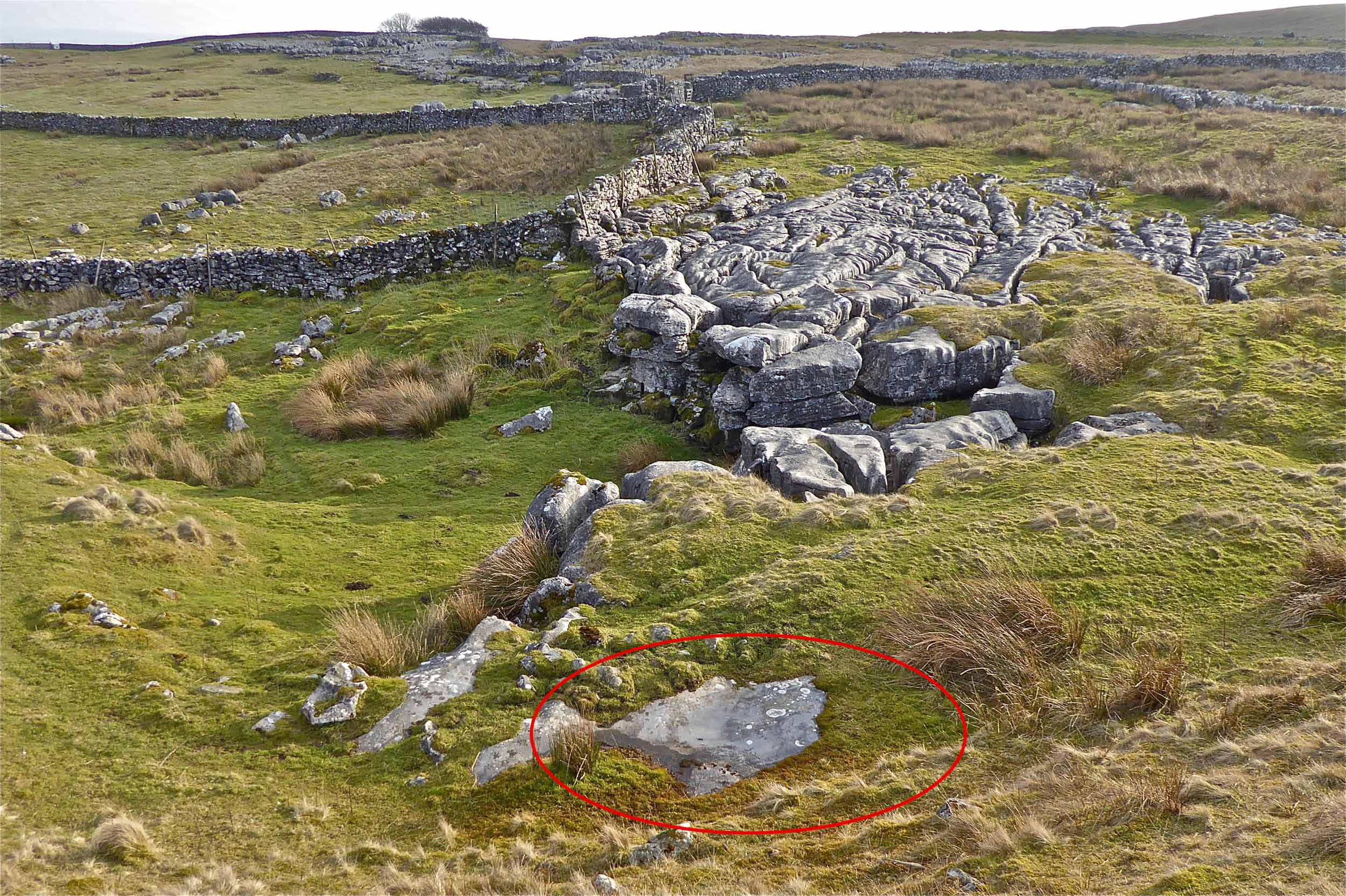
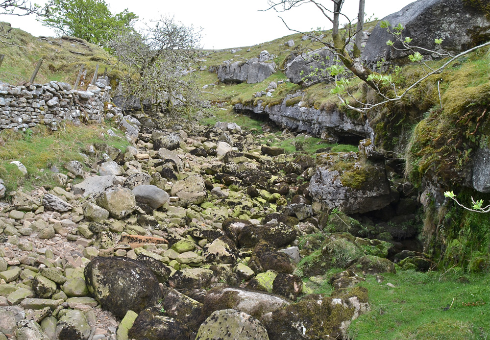
Left: the outstanding accessible exposure of the Girvanella Band at Lockey Gill, NGR 857735.
Photo by M I Warren, October 13, 2013.
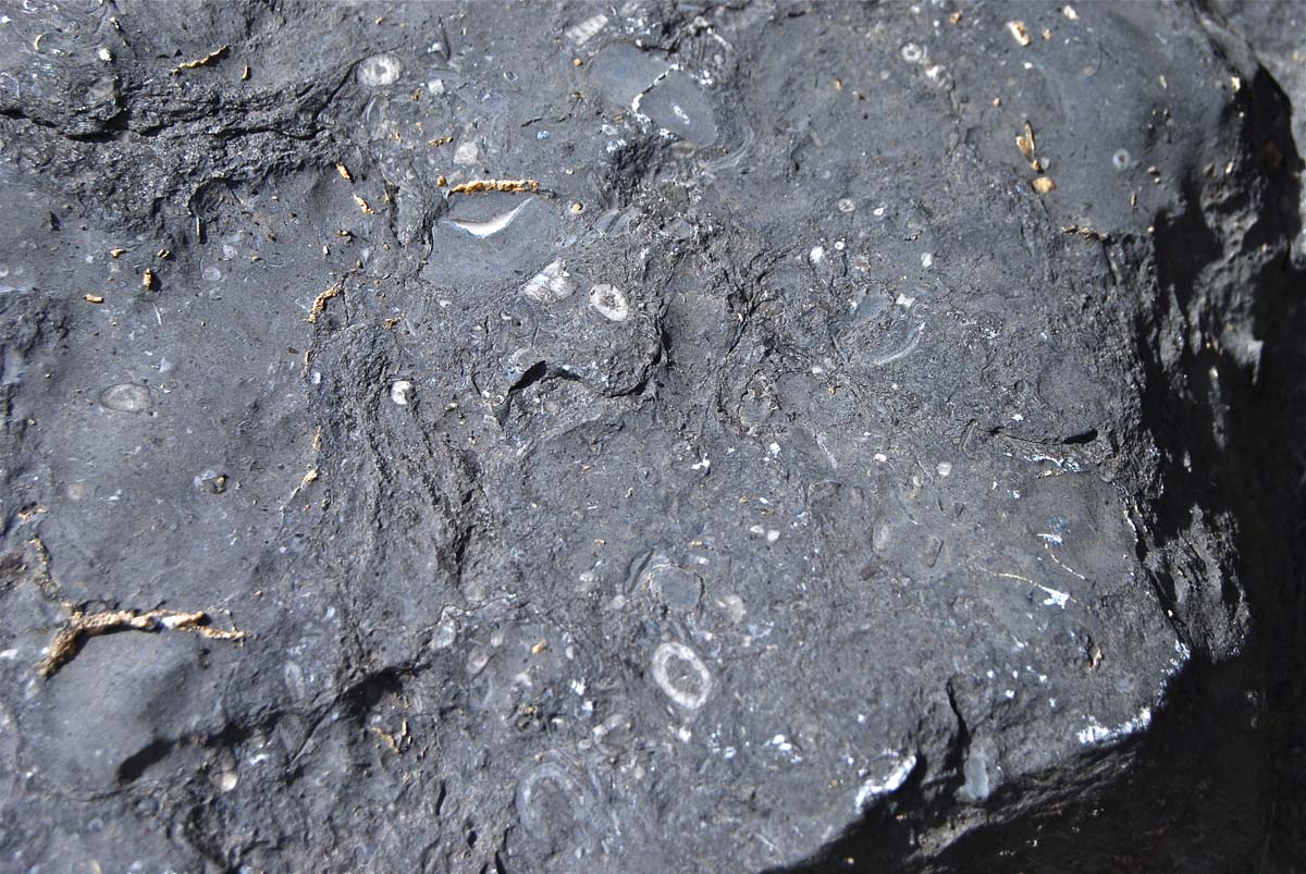
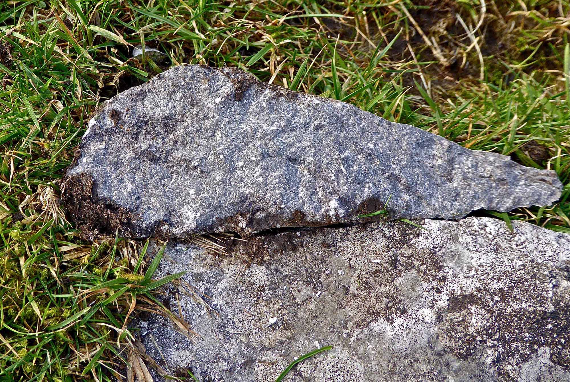
Right: close-up of the Girvanella Band seen at Lockey Gill. April 15, 2012.
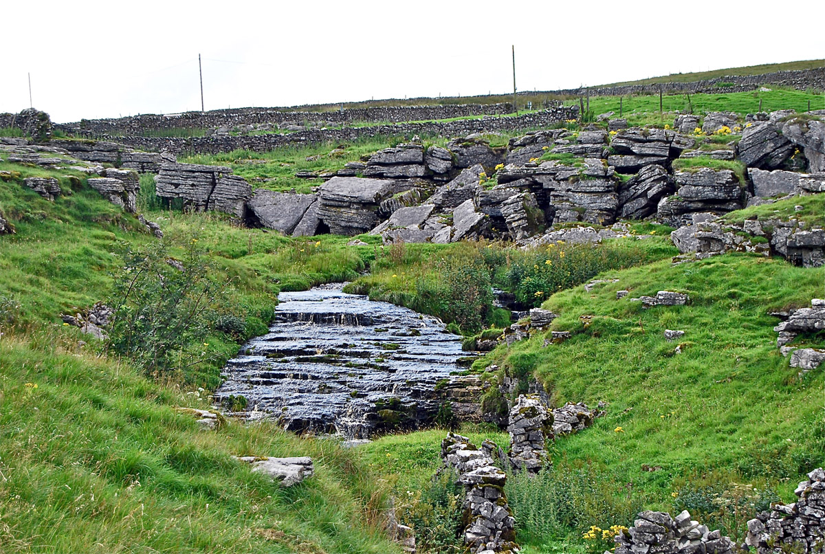
Giant's Graves
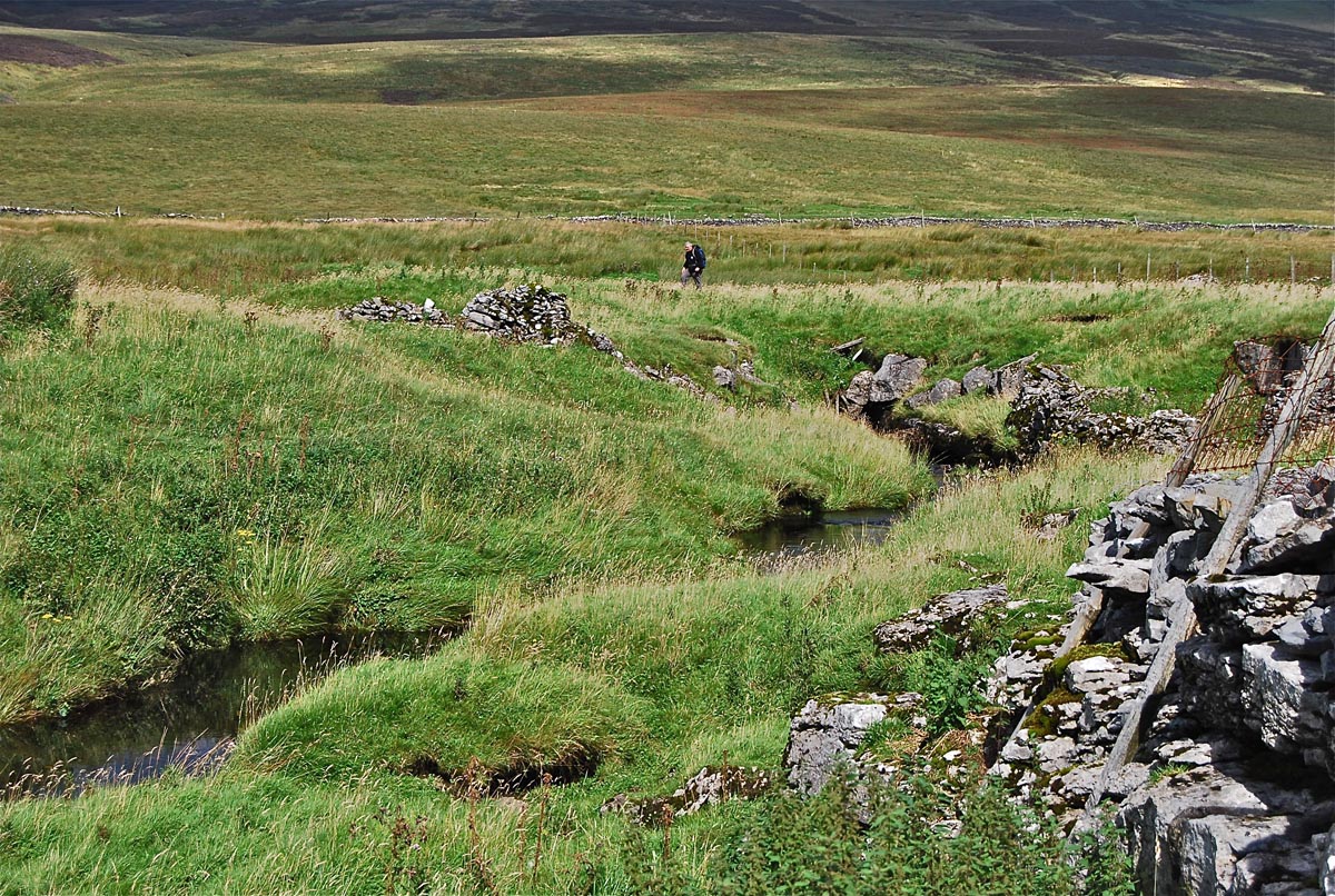
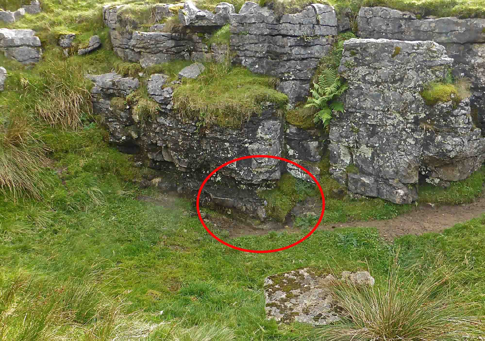
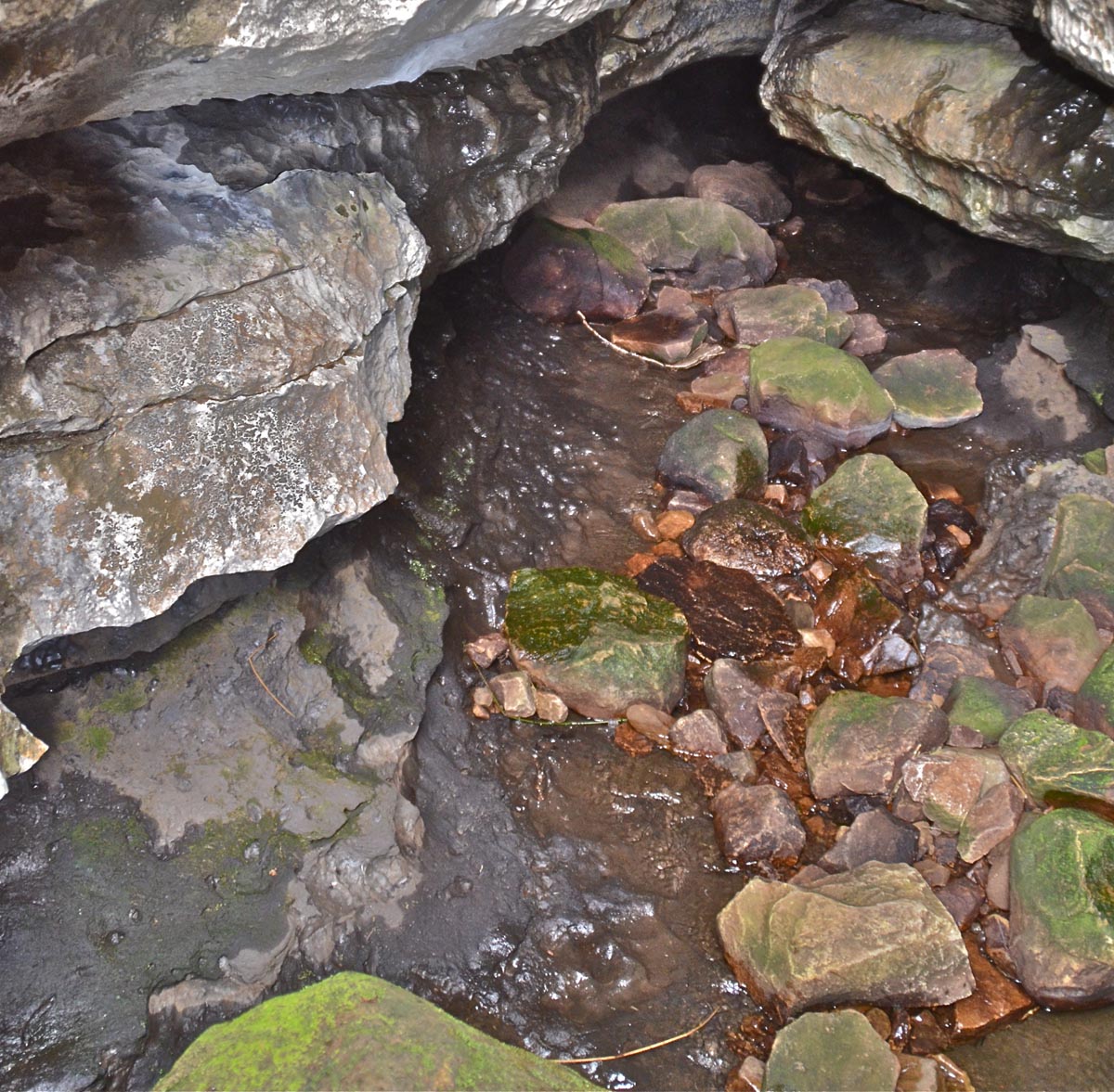
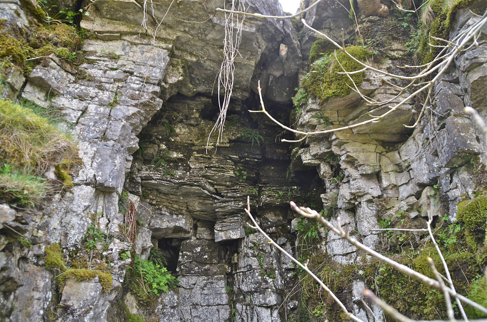
Left: a few hundred metres from Lockey Gill, Crooke Gill disappears into a series of shallow caves formed in or adjacent to the Girvanella Band, finally to resurge 600m away at the head of Penyghent Gill. The stream appears and disapears at several points along its course, the system being known as Giant's Graves Caves.
Right: strictly speaking, the term Giants's Graves refers to a burial site of Iron Age origins located a hundred metres or so to the west of Lockey Gill. Photos: August 24, 2008.
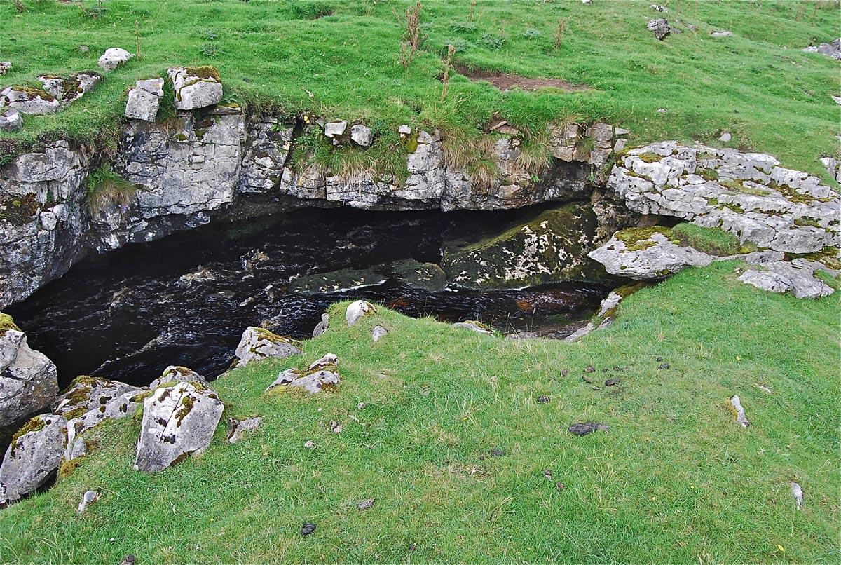
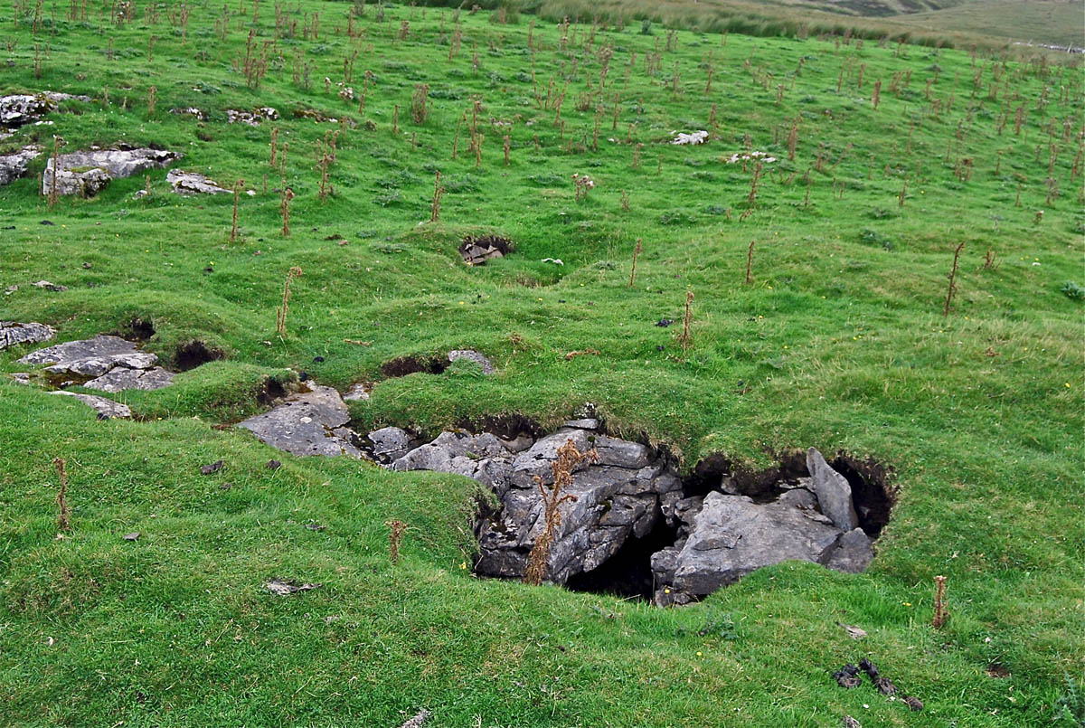
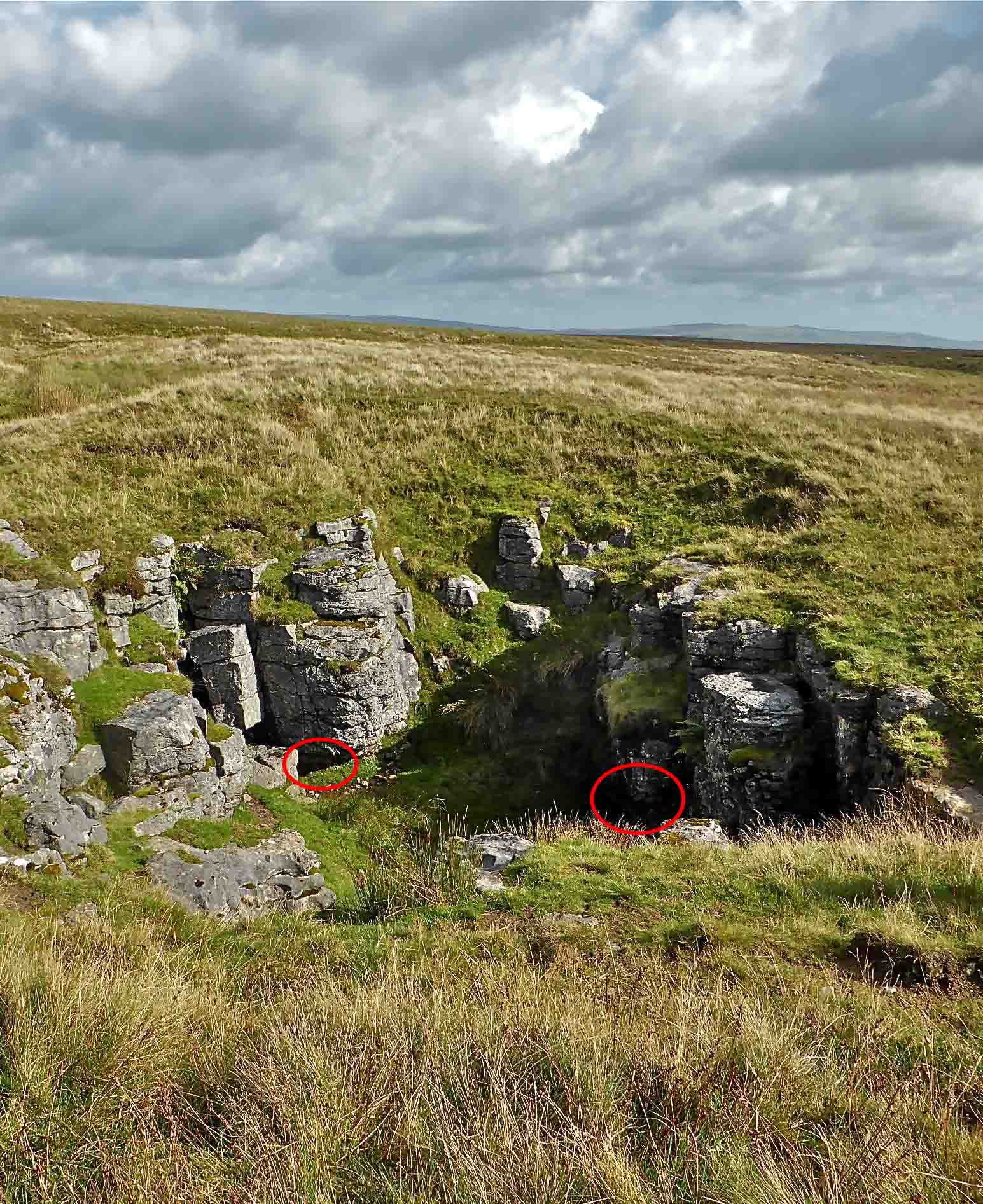
Left: now you see it, now you don't!
At this point the stream re-appears for some 200m before disappearing again with occasional windows into the underground stream course (right).
Photos: August 24, 2008
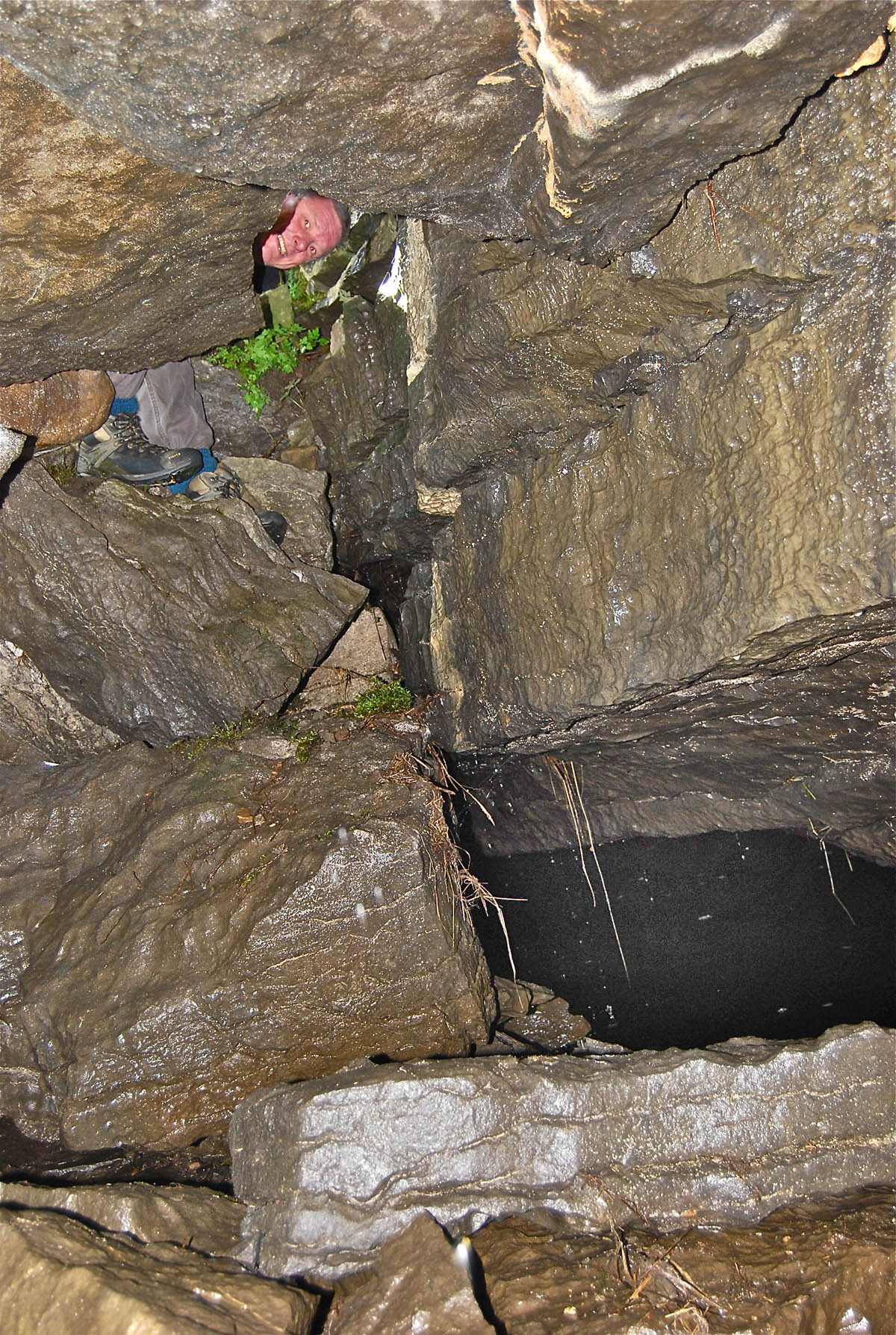
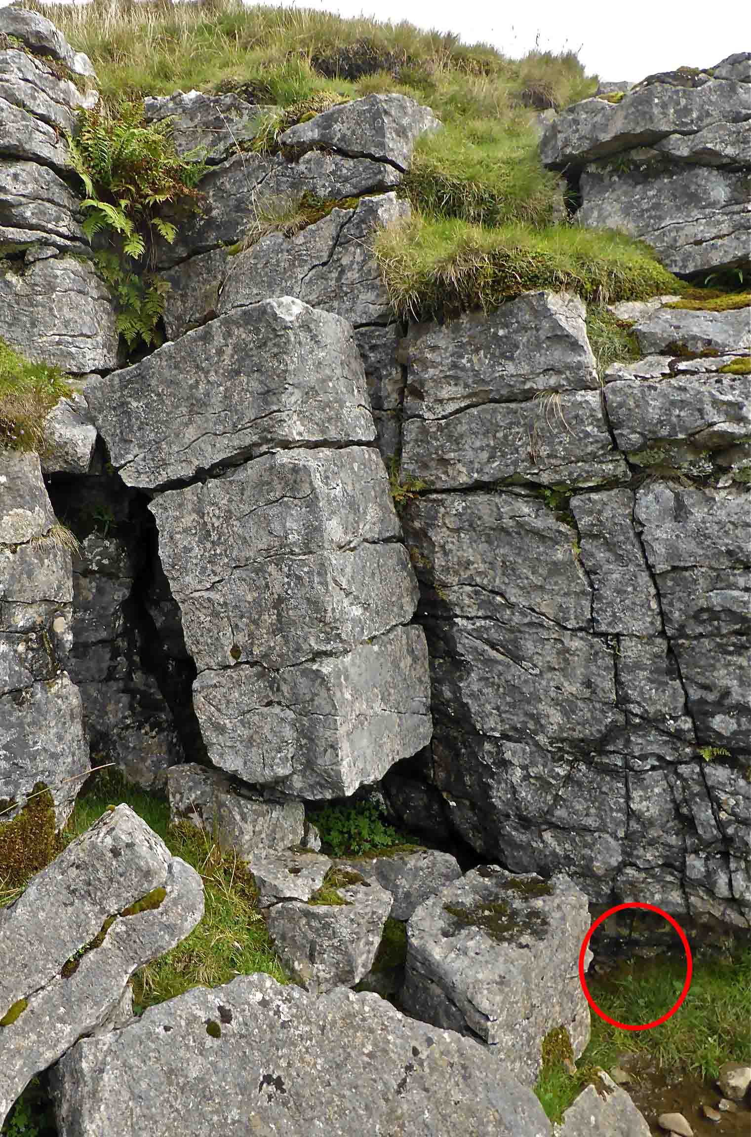
Above right and left: larger and smaller windows into the underground stream.
Right: a surface appearance of the stream from a highly fractured area of limestone.
Photos: August 24, 2008


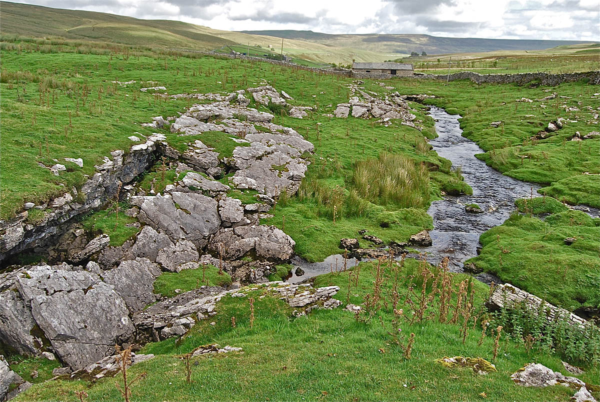
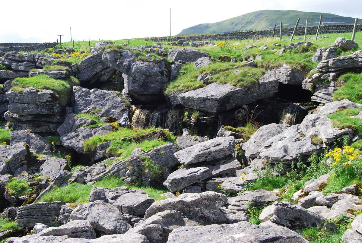
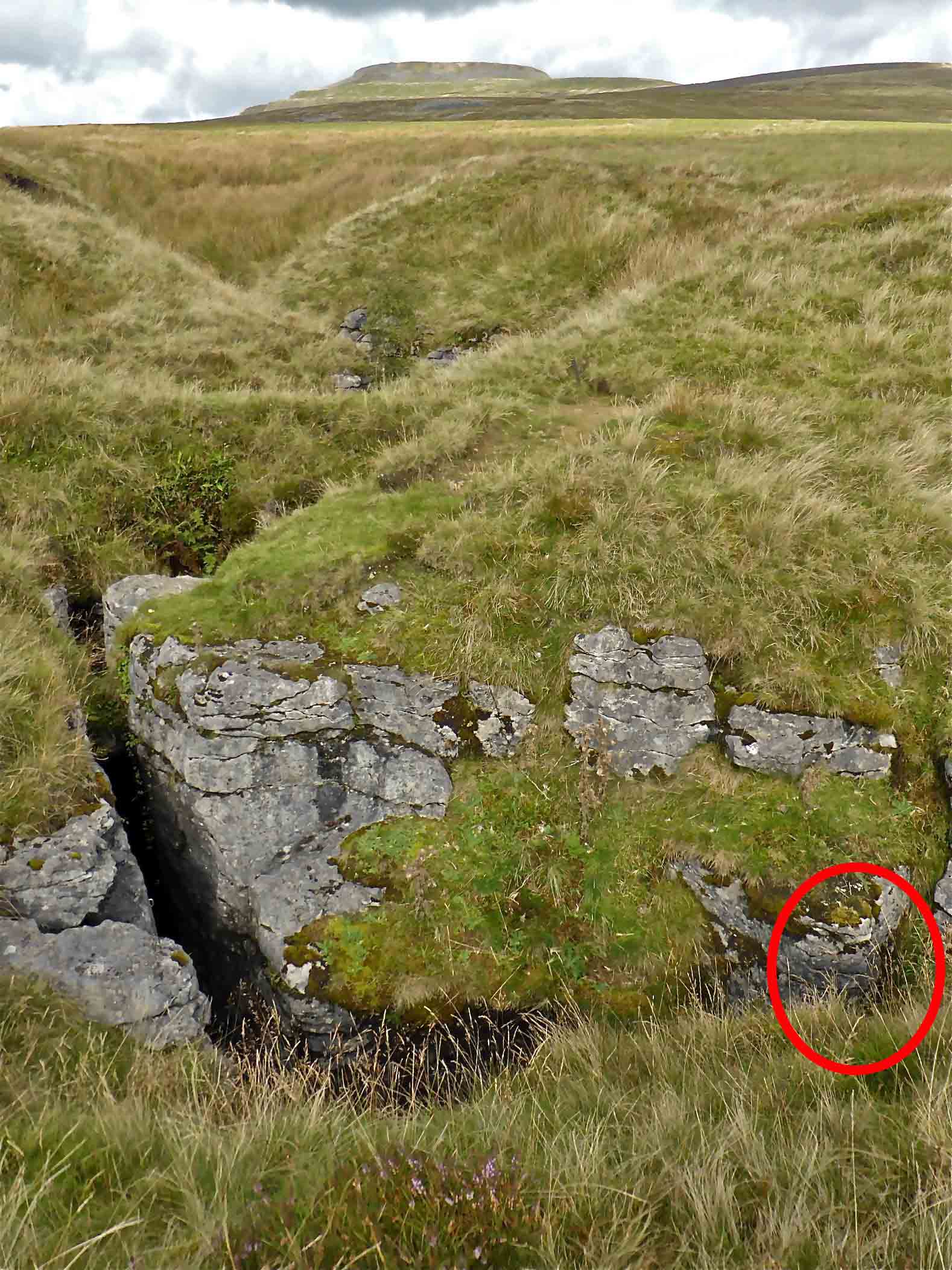
Above: the underground stream course is readily accessible at several points as in this location where the Girvanella Band can clearly be identified.
Right: Yet another access point to the underground stream and to the Girvanella Band.
Photos: August 24, 2008
Left: The roof collapse features of the Giant's Graves Caves may well be an example of shallow caves having been "crushed" by the weight of ice or by the forces of ice movements during the last ice age. However another line of thought may be that the caves were formed largely by the great masses of melt-water available during the melting or wasting of the ice sheets that once covered this area. As the stream course develops into the deep V-shaped valley of Penyghent Gill the evidence may be in favour of a melt-water valley. However many of the familiar melt-water channels seen in the area were abandoned and left as dry valleys. This may be a subject for more detailed investigation.
Photo: August 24, 2008.
Sulber Nick

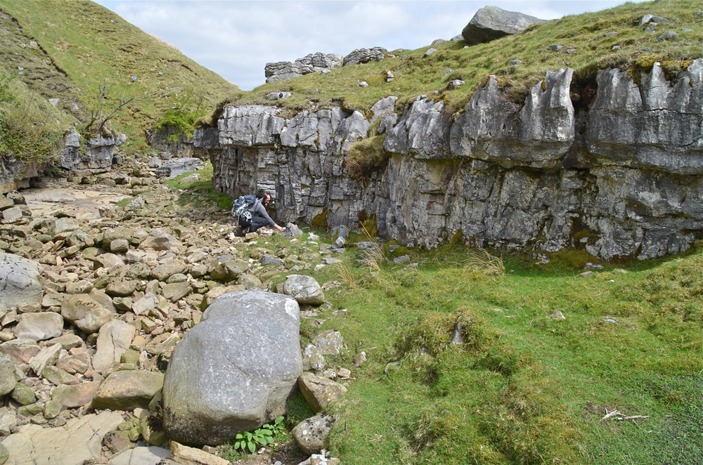
Left: the Girvanella Band at Sulber Nick, NGR 770737, the original location of T M Hughes ‘almond’ bed of 1908. September 8, 2013.
Right: overview of the Girvanella Band shown on the left. September 8, 2013.
Selside
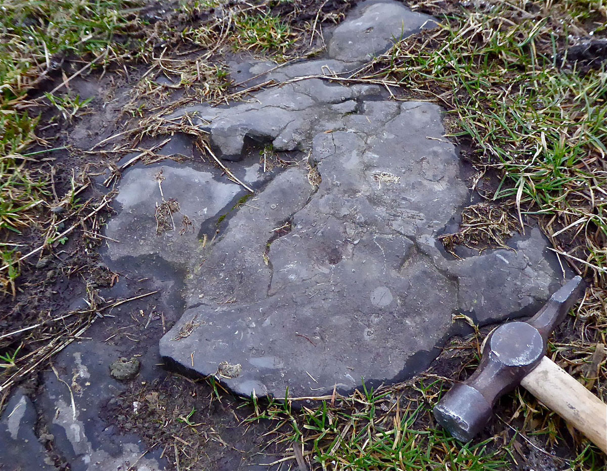
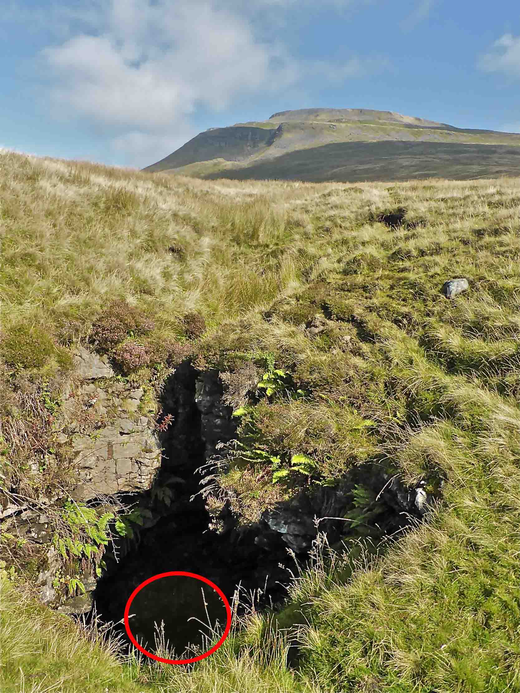
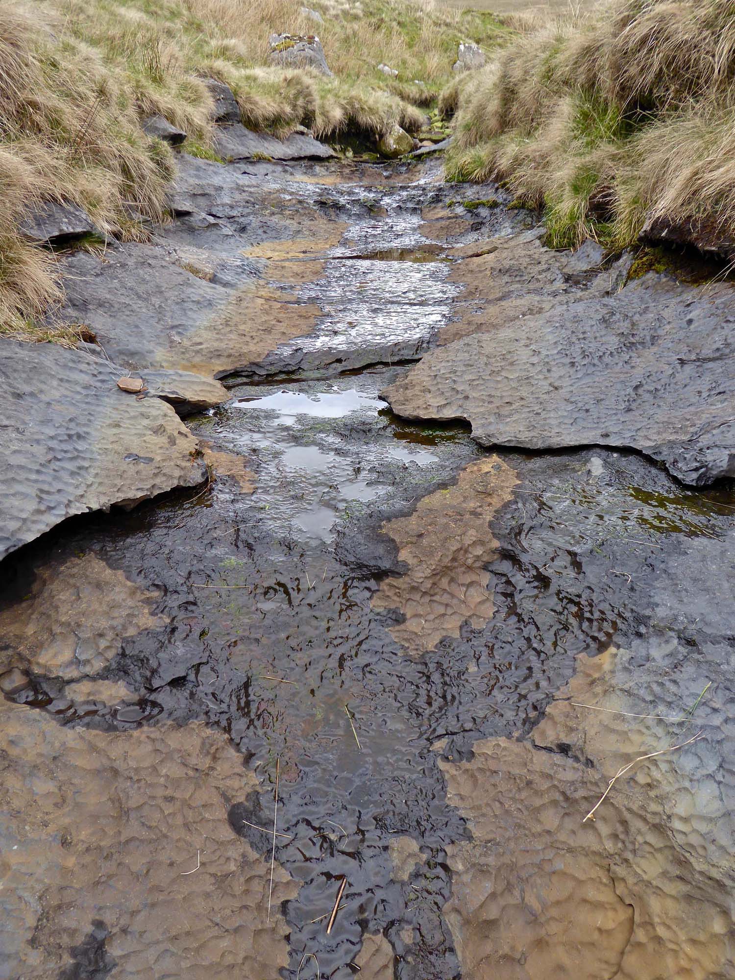
Left: the Girvanella Band is seen in the upper part of Alum Pot Beck at 77181 75311 at 368mOD, in a small scar above the wall crossing the beck: February 22, 2018.
Right: first sighting of the Girvanella was at this weathered but prominent and well preserved remnant of stream bed: February 22, 2018.
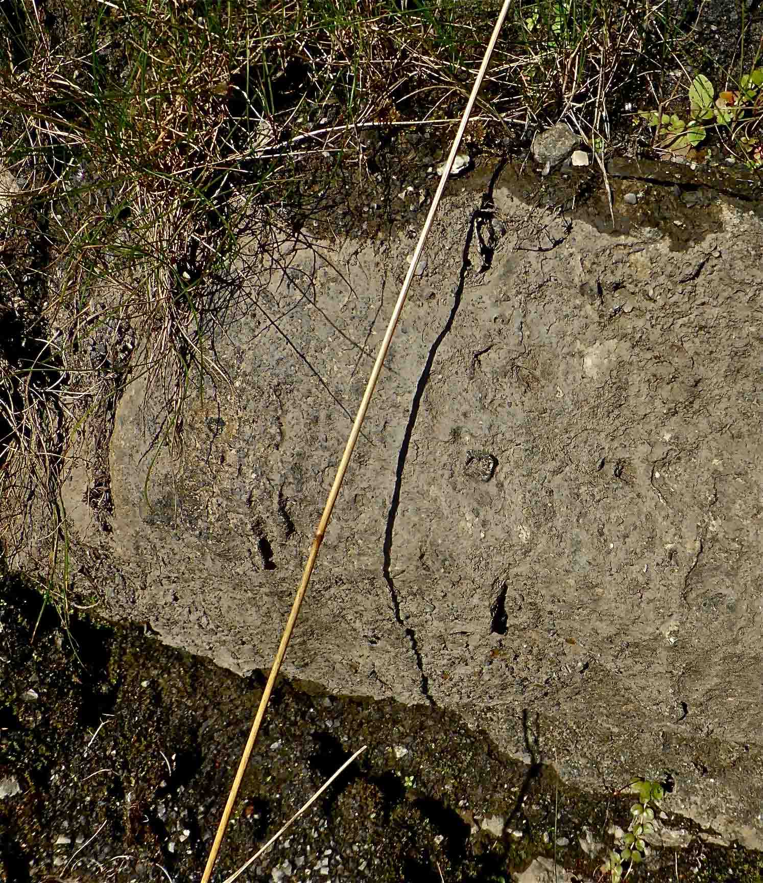
Left: close up of above outcrop: February 22, 2018.
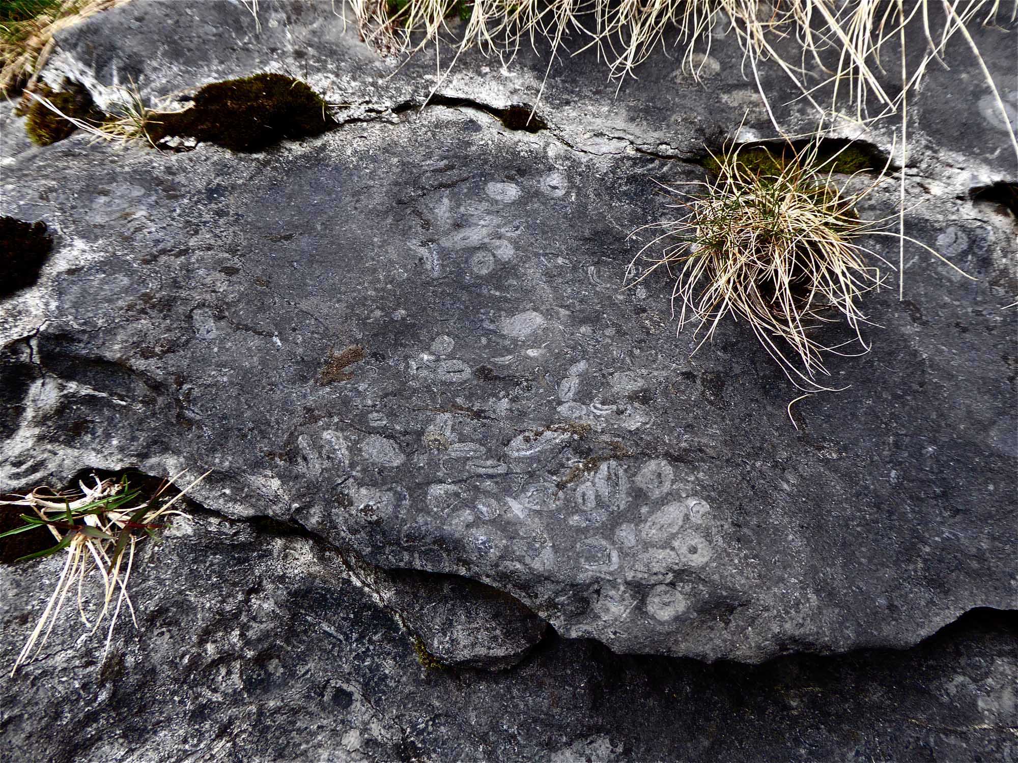
Right: close up of hand specimen of Girvanella from the same location: February 22, 2018.
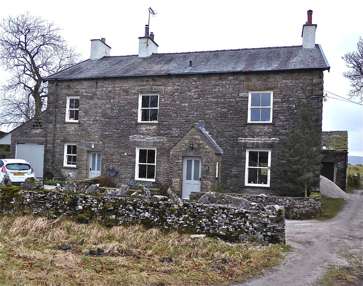
Left: top surface of Girvanelle Band can be seen near Colt Park Farmhouse at NGR 77090 78234 Alt. 343m. February 2, 2017
Right: Colt Park Farmhouse 77212 77935 351m: GB is located some 400m on 330º from here: February 2, 2017.
Newby Moss
Left: the Girvanella Band is seen in the lower part of the bedrock in Moss Hole, 73101 72430, 444m OD, adjacent to Long Kin West. September 13, 2019.
Right: closer view of Girvanella Band in Moss Hole: September 13, 2019.
Left: the same Girvanella Band continues to the northern wall: September 13, 2019
Right: overview of Moss Hole from the west September 13, 2019.
Left: the Girvanella Band may be seen in waterworn fluted bedrock in a difficult to access corner of Long Kin West Hole at NGR 77090 78234 Alt. 443m. September 13, 2019
Right: overview of Long Kin West location: September 13, 2019.
Lead Mine Moss, Ingleborough

Left: the Girvanella Band is seen in the Quaking Pot shakehole (73132 74076 Alt. 436) some 5m below moor level. September 19, 2019.
Right: closer view of Girvanella Band specimen Quaking Pot : September 19, 2019.

Left: Girvanella Band seen in large shakehole (73005 74056 Alt. 440) on fault line 100m west of Quaking Pot: September 19, 2019
Right: close-up of Girvanella bedrock in large shakehole. September 19, 2019.
Kingsdale
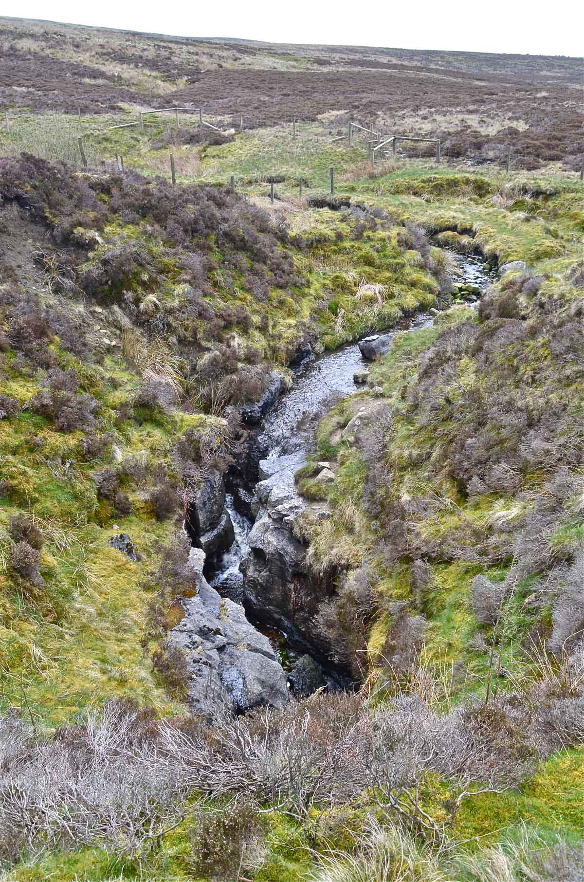
Left: the Girvanella Band is seen lining the stream bed for some 20m or more above the entrance to Heron Pot, Kingsdale. April 13, 2017.
Right: Typical appearance of the Girvanella bed may be seen at the same location. April 13, 2017.
Leck Fell and Easegill
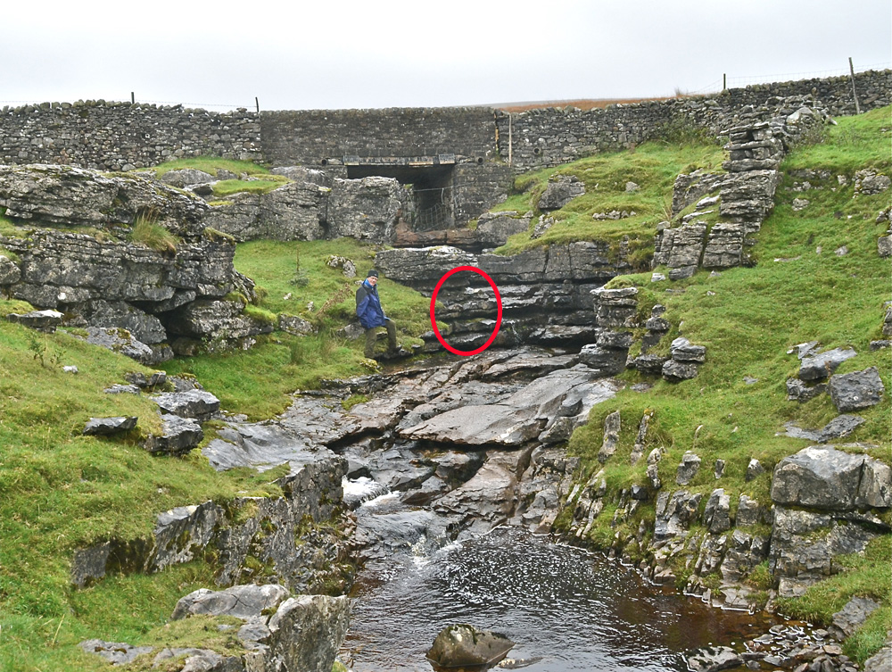
Left: the Girvanella Band is well exposed at Lost Johns Cave (NGR 6707 7863 Alt 360m) in the surface stream bed and for a considerable, as yet undetermined, distance down the cave passage. April 30, 2015.
Right: Black Girvanella limestone at floor level in the entrance of Lost Johns. April 22, 2015..
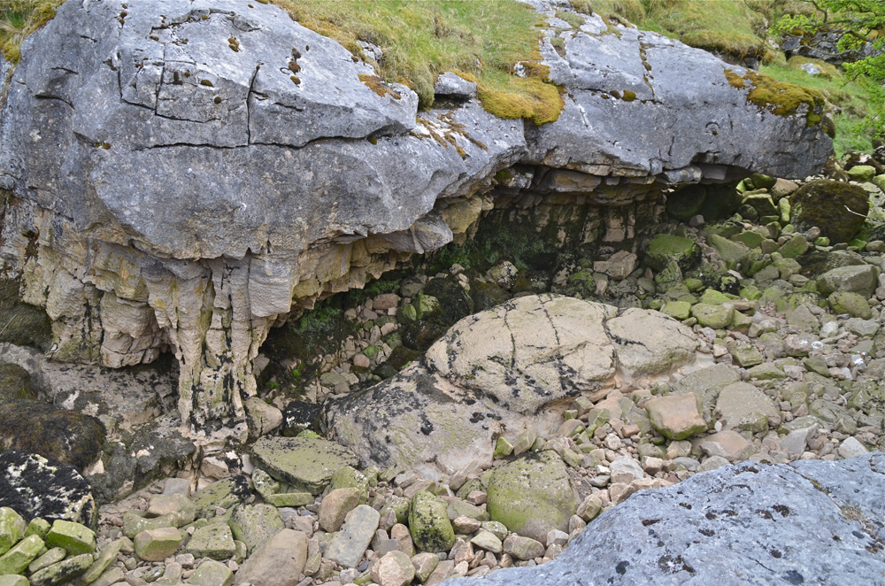
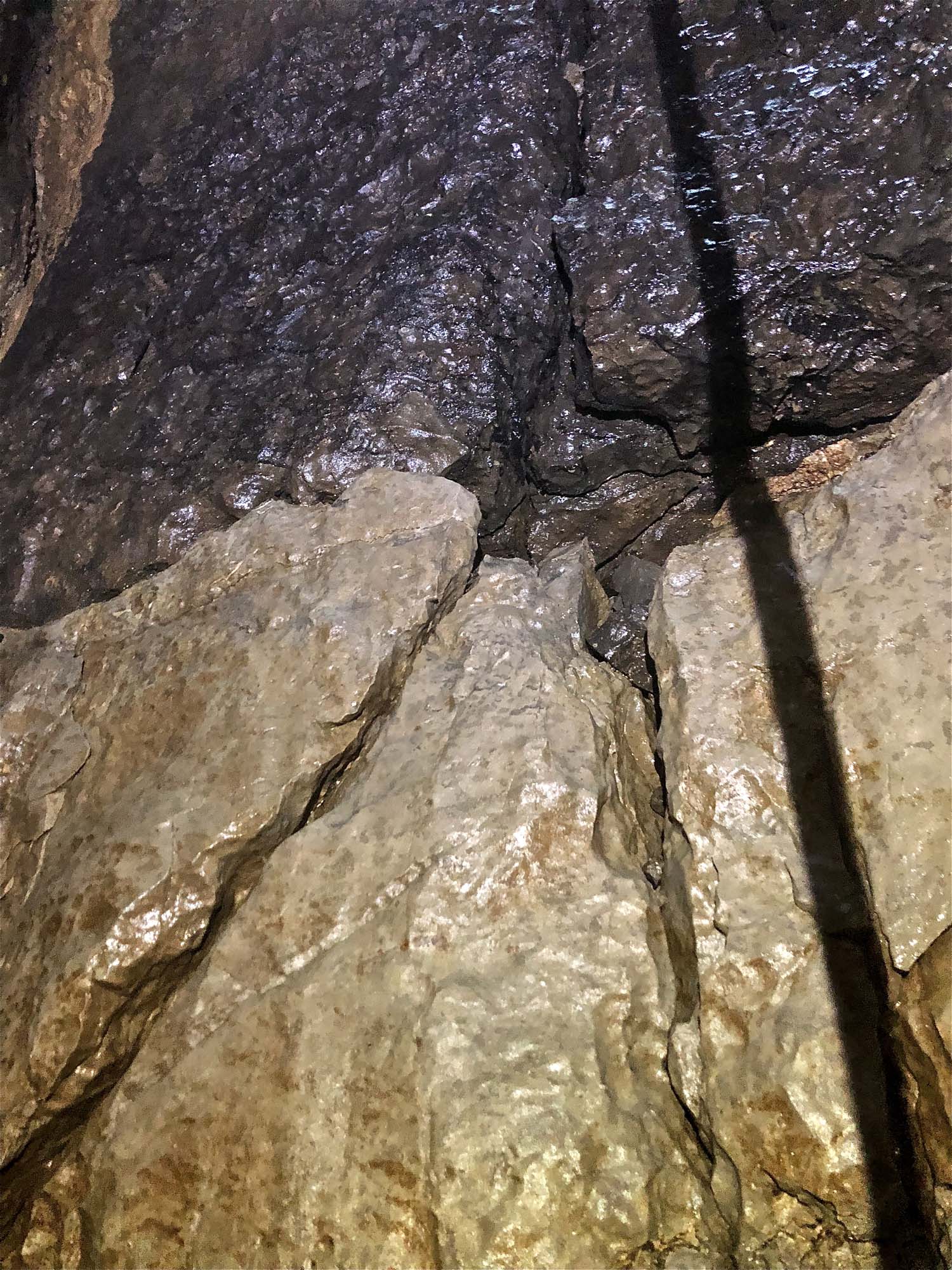
Left: the Girvanella Band occurs in this overhanging black limestone. NGR 67722 80714 Alt 334m. (See the GB.pdf appended below). The flaky slabby beds below are largely comprised of a lighter coloured sandy limestone packed with brachiopods: May 15, 2015.
Right: Black Girvanella limestone viewed on the underside of the overhang: May 15, 2015.
Left: a detached specimen of limestone immediately underlying the black girvanella limestone as a metre or so of thin slabby, friable sandy limestones rich in brachiopod fossils. May 15, 2015.
Right: view of the underside of the GB overlying brachiopod beds. May 15, 2015.
Left: all the above features are readily accessible along the rocky banks of upper Easegill. May 15, 2015.
Right: a similar view with the remains of the dry stone wall that once marked the county boundary between Lancashire and Westmorland. May 15, 2015.
A provisional and far from complete list of other Girvanella Band locations may be downloaded HERE
References
see references at bottom of Geology of Western Penyghent
Any
shortcomings in the text are entirely my
own.
If you would like to get in touch or add information, there is an email
address:
mudinmyhair@btinternet.com
Steve Warren
Website
created by WarrenAssociates 2012
Website hosted by Vidahost
Copyright © Steve Warren 2012