The Porcellanous Band
The
pages below are under development and will be updated on a regular
basis.
All images are from the author's collection unless otherwise indicated.
Click on images for larger view: use back arrow to return from image view.
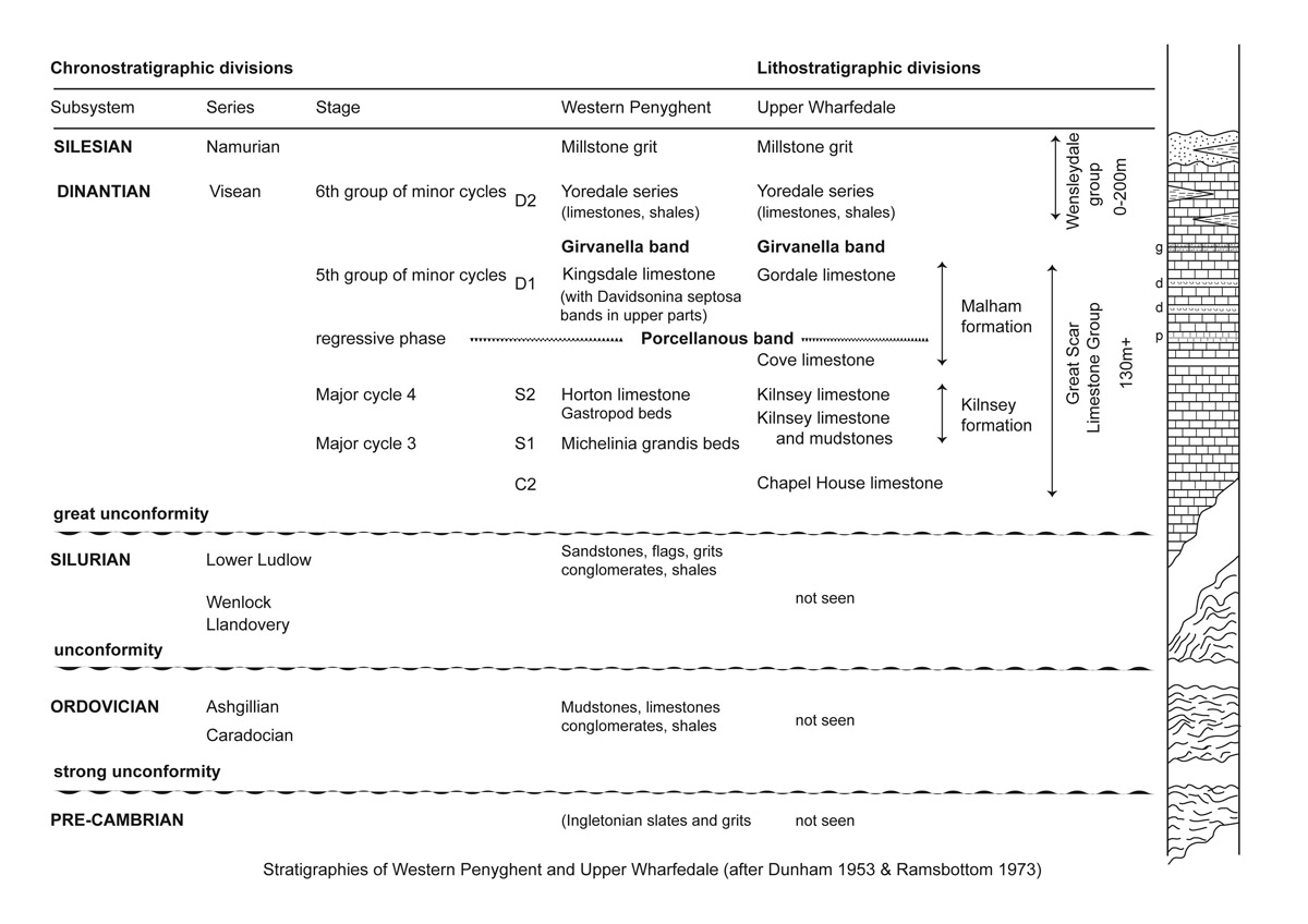
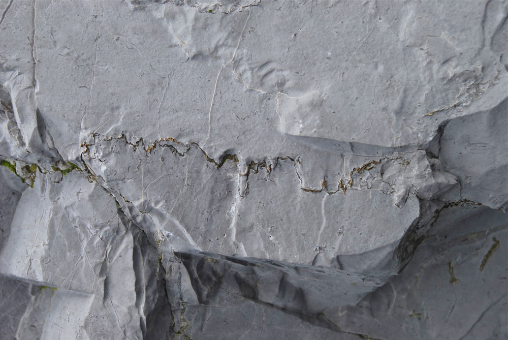
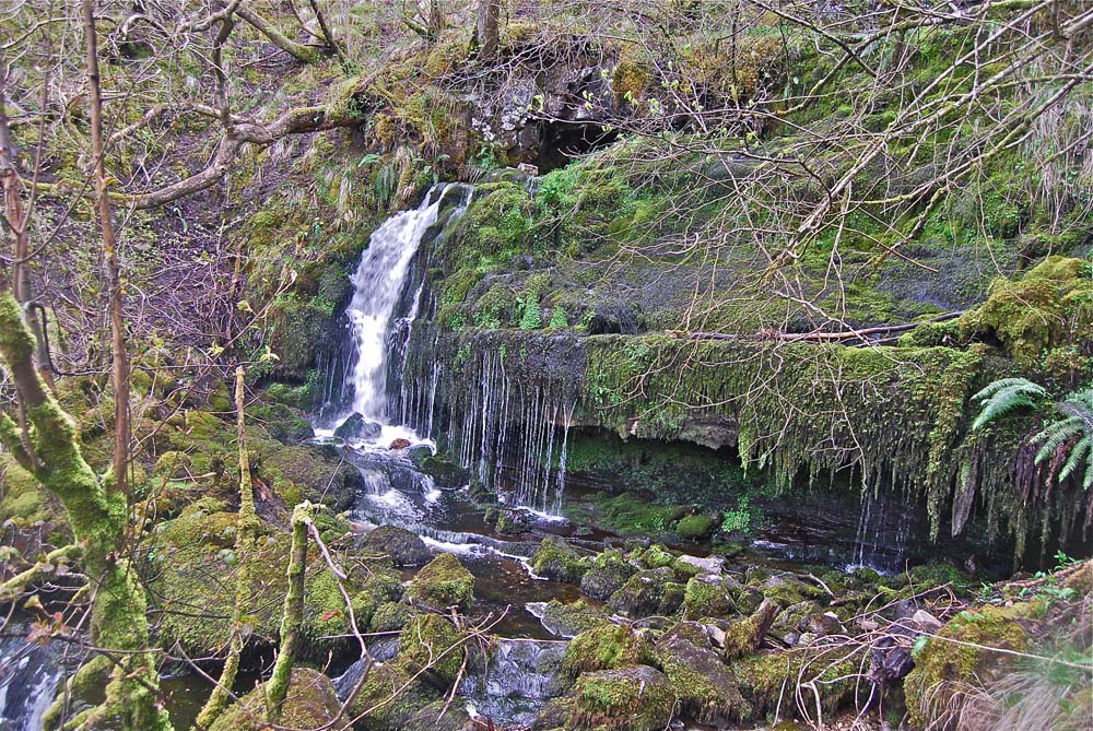
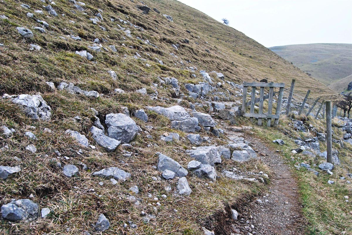
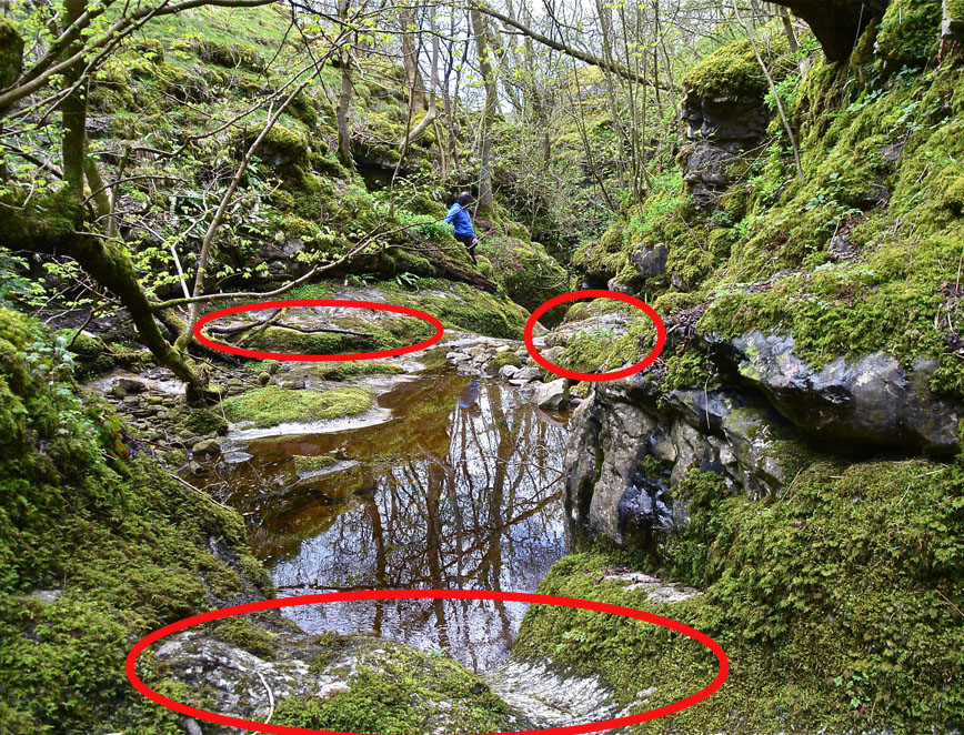
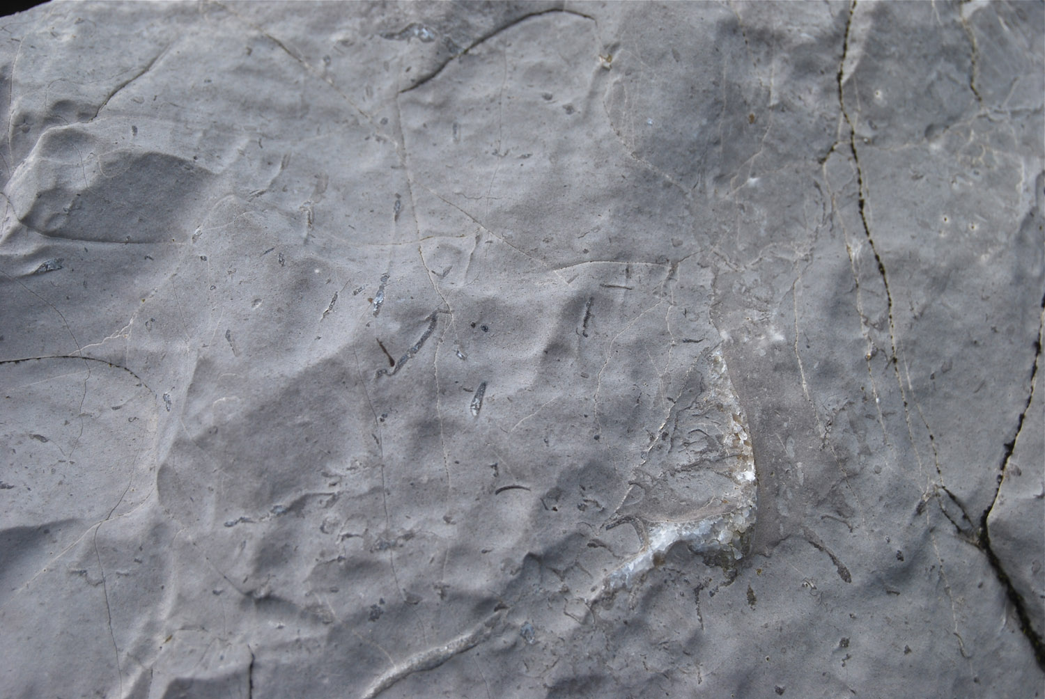
The Porcellanous Band, or bed, (PB) is a thin bed of very fine-grained micritic limestone or mudstone, otherwise known as 'china-stone', which usually weathers very much whiter than the surrounding limestones. It occasionally occurs as twin bands, referred to as the upper and lower bands respectively. It is located about a hundred metres below the top of the Great Scar Limestone - the grey, white-weathering limestone forming the limestone scars throughout the lower dales: Wharfedale, Littondale, Ribblesdale, Chapel-le-Dale and Kingsdale. The Porcellanous Band is generally taken as the boundary between the Cove Limestone and the overlying Gordale Limestone in the Malham Formation. The geological succession in the Western Penyghent pages of this website (seen here) illustrates the disposition of these limestones and the image in Picture Gallery 2 of a specimen of Porcellanous limestone (seen here) shows a typical appearance of the PB on a fresh surface. The PB is only rarely obvious at surface exposures but it is often very conspicuous in underground locations. Typical examples can be seen in Gaping Gill (seen here), (November 18, 2012}, (and see image below), at the bottom of Rift Pot on the Allotment, and at many points in Kingsdale Master Cave. In Wharfedale it is quite prominent at Scoska Cave (below), at Foss Gill Cave entrance (seen here) (April 21, 2012), in Water Gill Wood (seen here) (April 8, 2012), and, quite prominently at the foot of Dowbergill (seen here) (March 12, 2012).
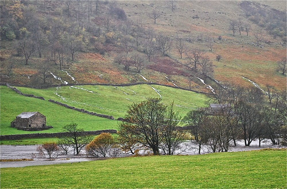
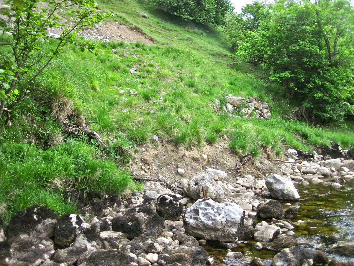
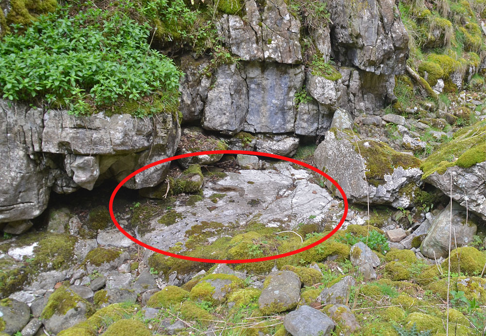
As shown in Picture Gallery 3, many of the springs in Upper Wharfedale, for example Lords Wood, resurge along the line of the Porcellanous Band (seen here). At Hubberholme, the PB can be seen to form the bed of the River Wharfe where a fence line drops to the river bank (NGR 92383 78404 Alt 240m), some 0.3km upstream from the Church. Although obscured by river sediments and moraine material, it is quite clear that the river runs along the PB for a considerable distance, possibly as much as several hundred metres both upstream and downstream from that point. Furthermore, at that point, the PB comprises at least two distinct beds. The lower bed forms the bed of the river and the thickness cannot be determined. The upper leaf, although quite distinct, lies immediately on top of the lower leaf and is approximately 0.5m thick (see below).
Glover (1973, 1974 and 1976) maintained that the low solubility of this rock enhanced lateral water flows, and therefore horizontal passages, in the early phreatic stages of cavern formation. Glover's hypothesis was substantiated by observations in Gaping Gill and in Kingsdale Master Cave. It is now apparent that Glover's ideas are further supported by exposures in Scoska Cave shown below.
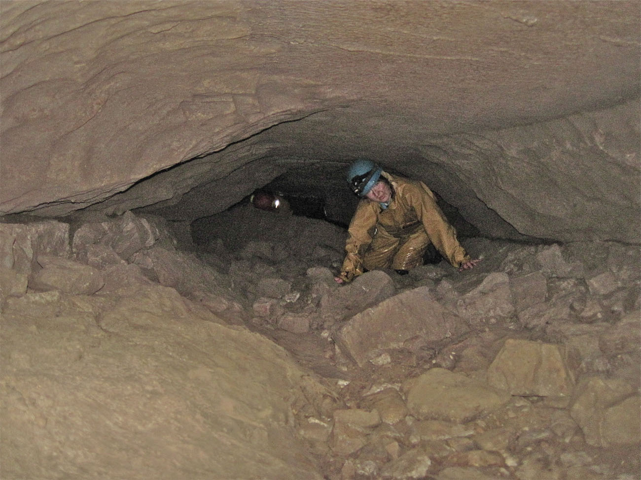
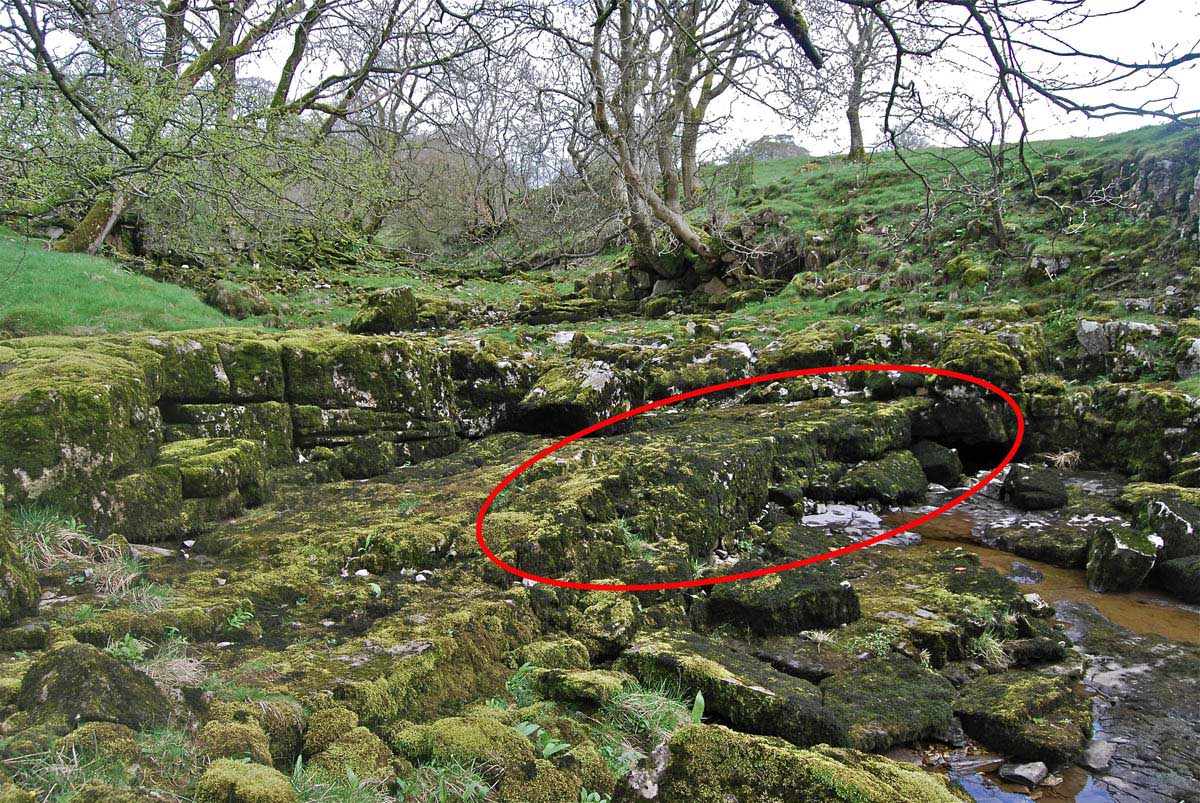
Around Scoska Cave
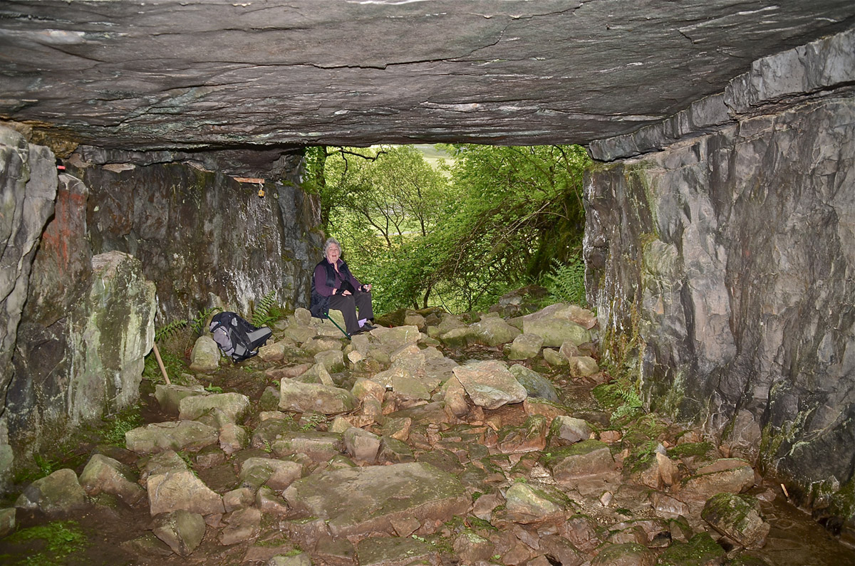
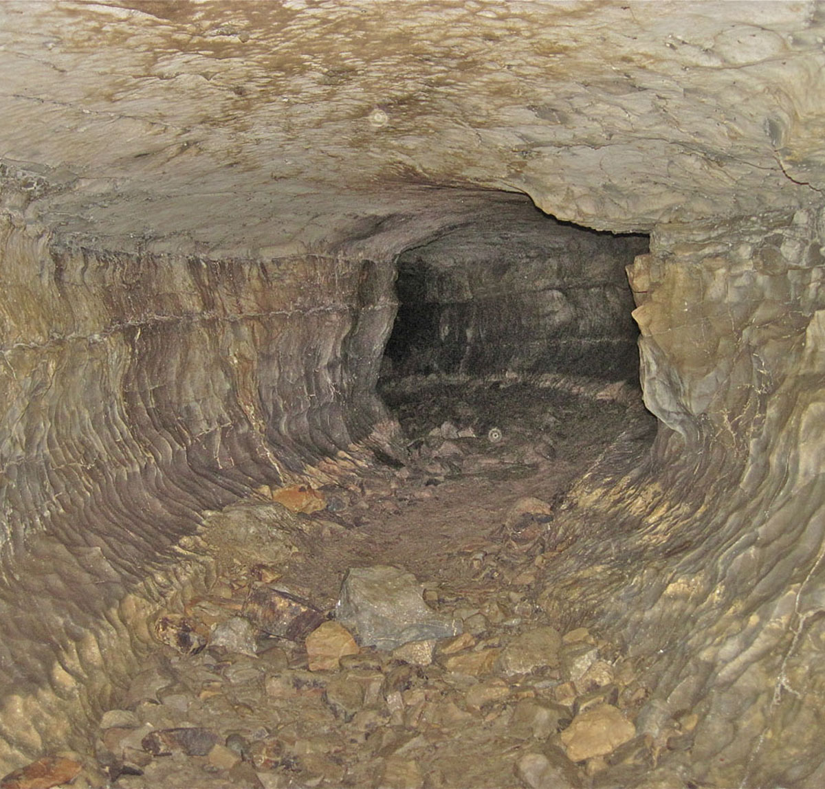
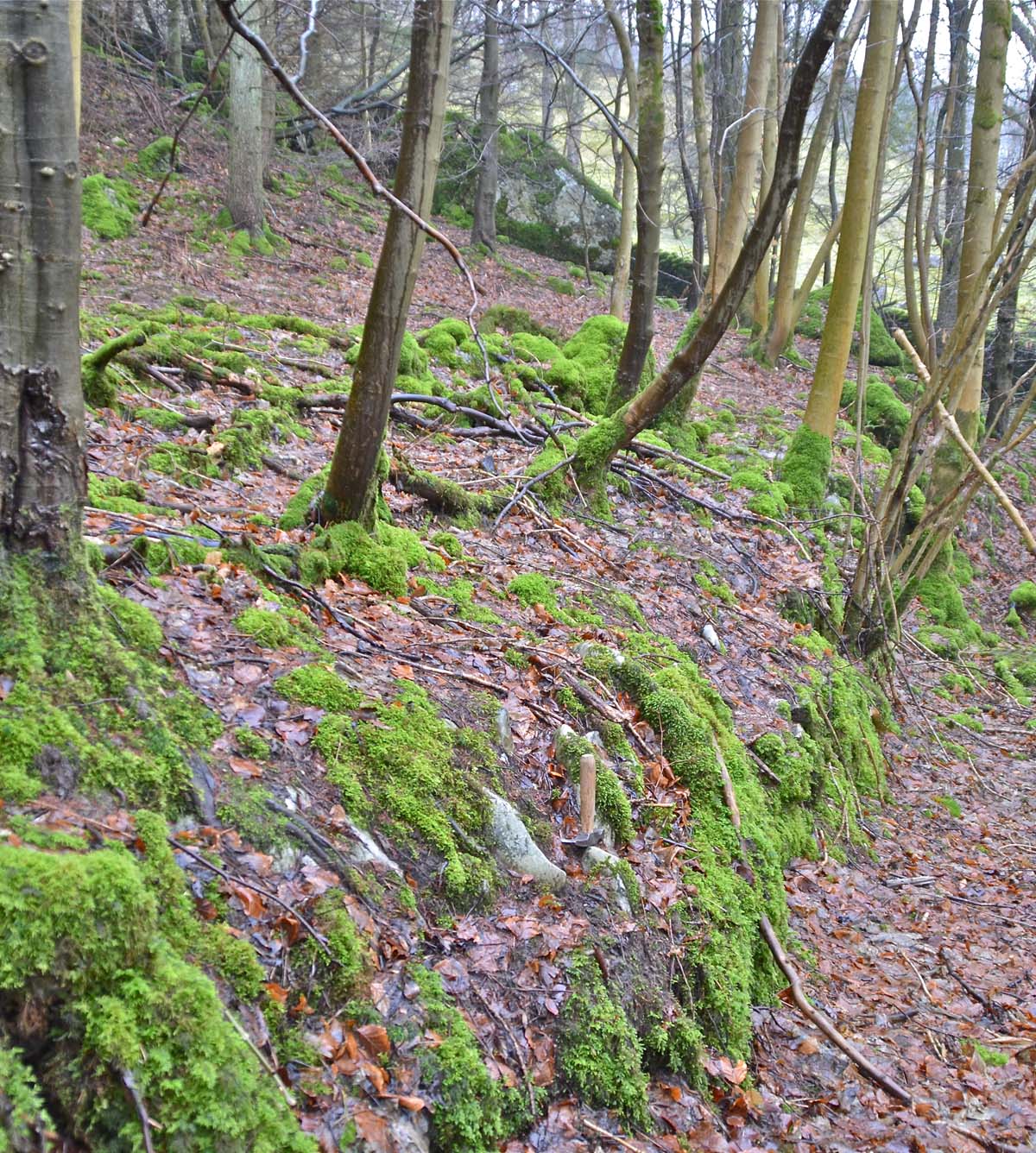
Scoska Cave (NGR 915724 Alt. 285m) has an imposing entrance but the most significant feature of this scene is the presence of a band of porcellanous limestone (PB) at roof level.
The main routes through the 1400m cave follow the PB almost entirely as 'hands-and-knees', or lower, crawls until they meet up with a large streamway Bown Scar Cave system (NGR 918721 Alt. 260m) very shortly curtailed by a major breakdown area.
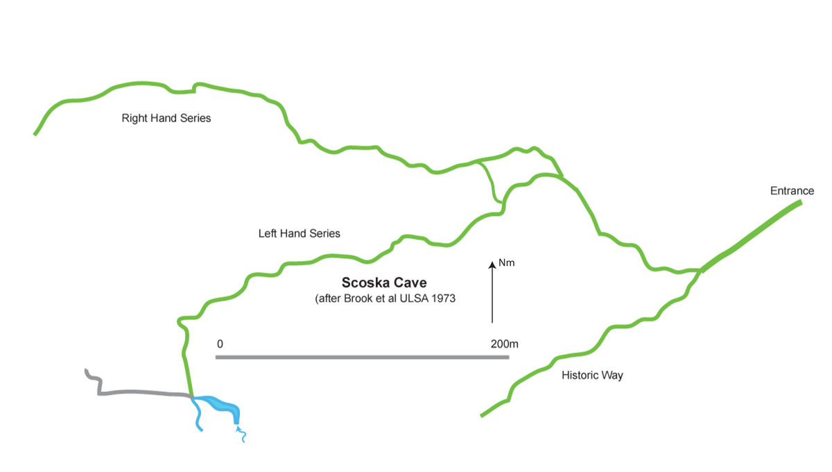
The 1973 survey of Scoska Cave made by Brook et. al. of University of Leeds Speleological Association adapted to show in green the passages that appear to be associated with the presence of the PB.
This view does support Dick Glover's contention that such developments tend to be "up-dip" as the general dip of the strata in Littondale is in the order of two degrees in a north-easterly direction. The logical conclusion then is that Scoska Cave originally was formed by a water flow from the surface, i.e. from the present entrance inwards, and up-dip! This development fortuitiously encountered an entirely independent cave system, the upper reaches of the Bown Scar System. The above mentioned water flow may have its origins in glacial meltwater at a time when the Littondale valley floor was at a somewhat higher level than that we perceive today.
Alternatively, such a flow of water may have originated from a glacial lake, the evidence for may be seen in the present topography of Littondale. Further indications lie in the nature of Scoska Cave which is essentially a tube formed in, on, or under, the Porcellanous Band and later developed to a much large size, in the nearer reaches; by flood overflows from the further reaches; from each of the various sections of tube; from passages which are presently unseen due to being choked with later deposits; and, nearer the entrance, by frost shattering.
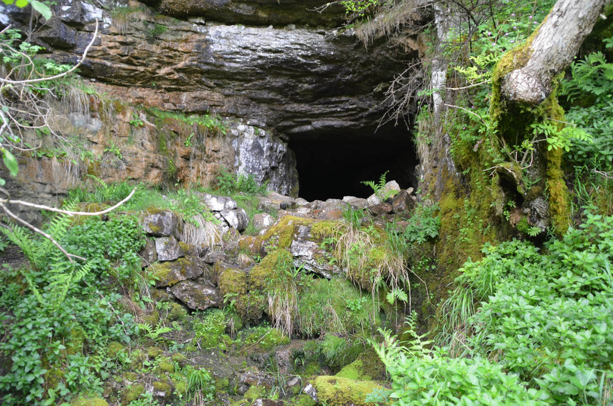
A further complicating feature, that of adaptation by early man, is evident in the manner in which the un-natural level entrance porch is in fact built up on very substantial stonework. June 10, 2012.
In 1905 members of the Yorkshire Ramblers Club found the skeletal remains of a woman in Scoska Cave. The remains were estimated to be some 1500 to 2000 years old and probably of the Celtic people who inhabited the area up to the end of the Roman occupation. (Hill C A, 1907)
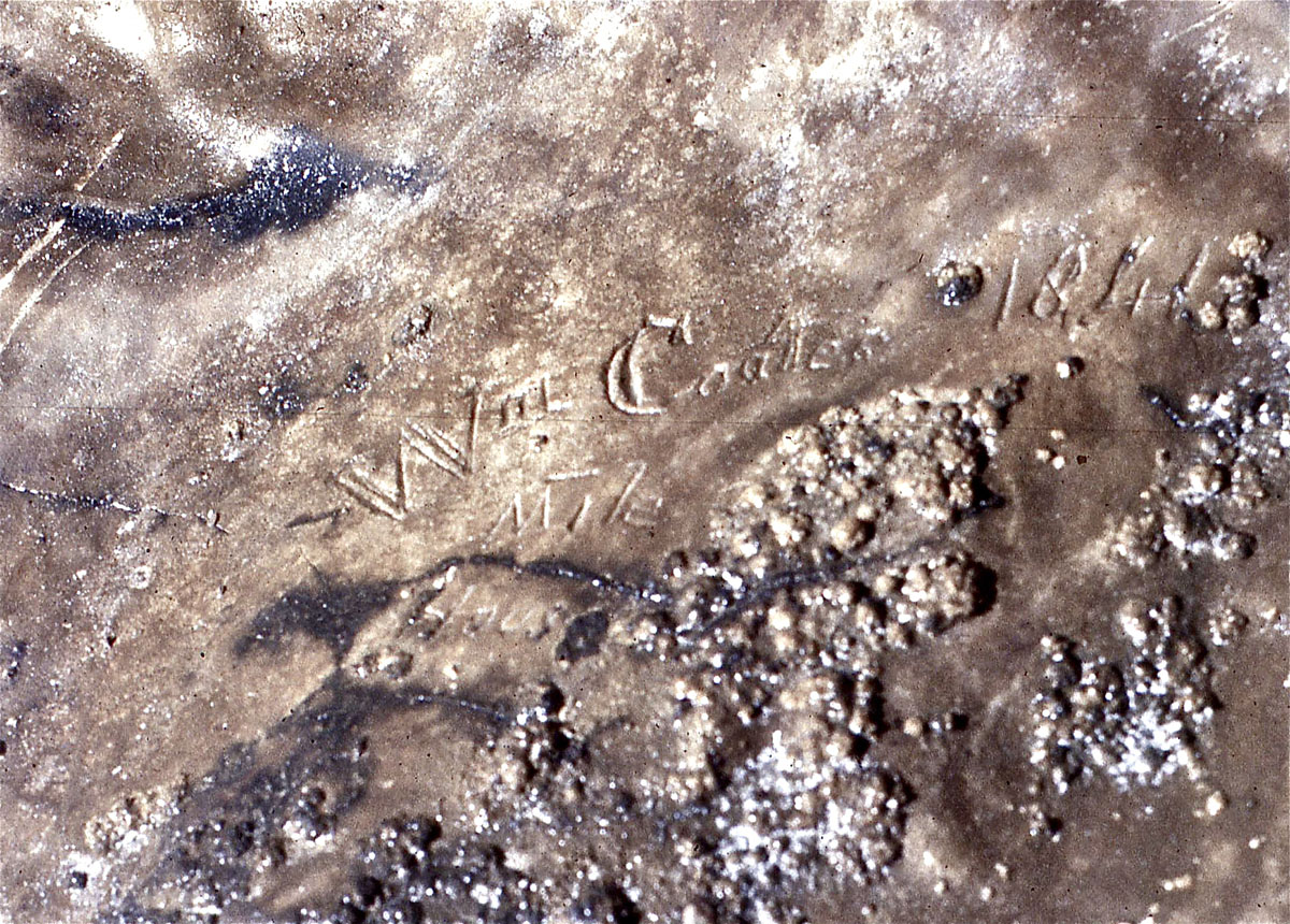
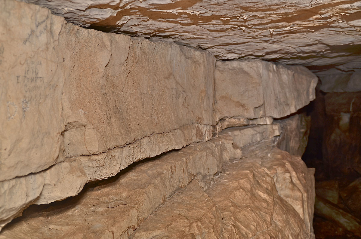
Left: the PB was recognised in Scoska Cave on Easter Monday, 1980, on a visit to record Victorian inscriptions on the walls. April 7, 1980
Right: This inscription reads "Wm Coates, Mile House, 1841. On this visit the noted Scoska moths, bats and spiders were well in evidence. April 7, 1980
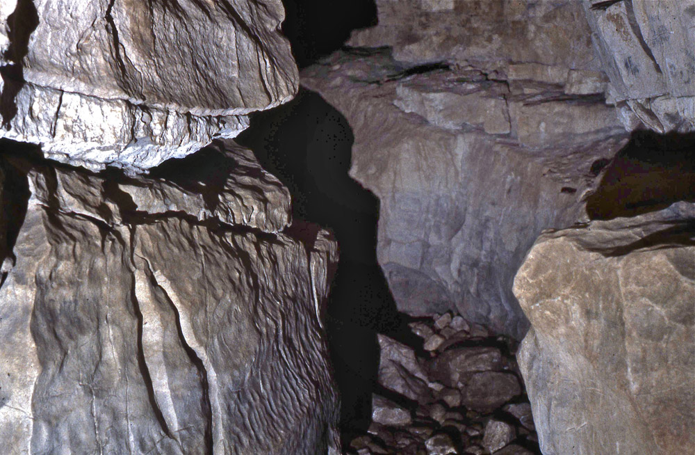
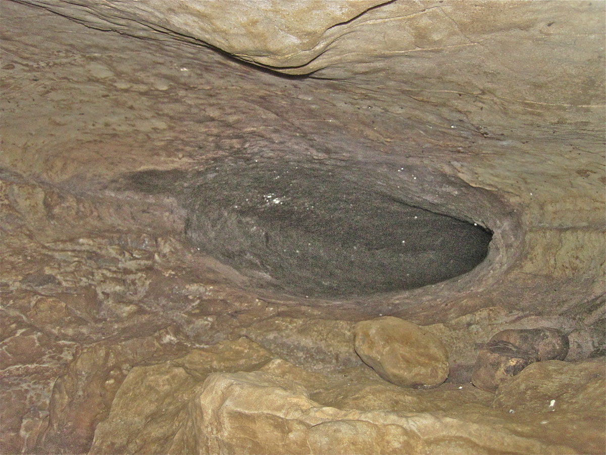
Left: At this point the roof has collapsed into the passage formed under the PB, leaving the PB exposed in the side of the passage. May 11, 2013
Right: The passage formed under the PB has been enlarged by stream erosion: leaving a passage very similar to much of the streamway in Upper Long Churn in Ribblesdale. May 11, 2013.
Left: This 0.4m high side passage appears to have the PB in the upper part and the underlying grey limestone below. May 11, 2013
Right: The main PB runs across the centre of the picture but there is also a possible second (Upper) PB in the roof. June 12, 2012 .
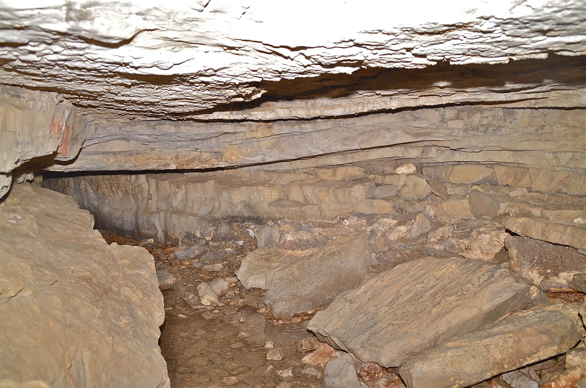

Left: The PB appears to be undulating and changing into mutiple leaves or bands. June 10, 2012.
Right: Further into the cave the PB roof has collapsed into the vadose enlarged passage below as most of the fallen flakes are of PB rock. May 11, 2013.
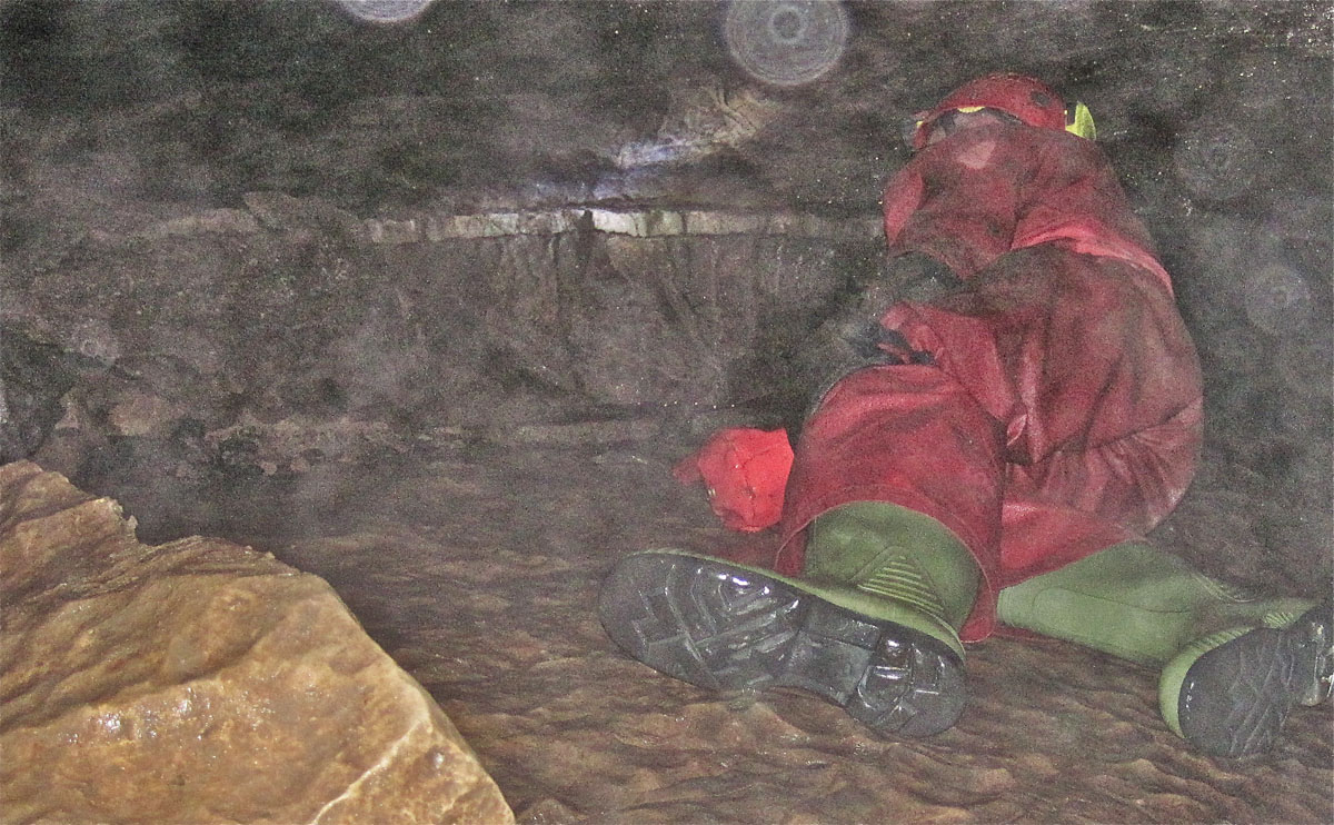
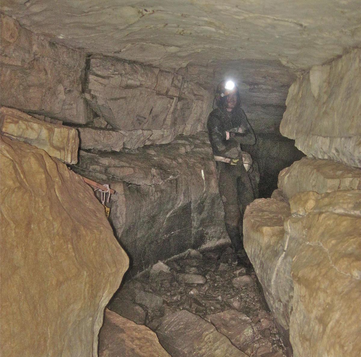
Left: Towards the end of the accessible cave, Jane is located in a section of passage apparently formed entirely within the PB. May 11, 2013
Right: Geoff is at the end of the crawl way at the intersection with the stream passage but the PB can be seen in the wall to be in at least three divisions, upper very thin, middle c0.5m and lower very thin. May 11, 2013
Scoska Cave can tell us much about cave formation in relation to the Porcellanous Band: it can also tell us much about the nature of the PB. To understand these features a more detailed study is needed (as well as some better photographs}. It is quite clear that similar features can be seen in Kingsdale Master Cave, and in South East Passage and other parts of the Gaping Gill System. Can this phenomena be seen anywhere else? A good place to start may be in the Three Counties System! In the vicinity of Scoska Cave the PB appears to be overlain, and underlain, by fine-grained grey limestone but this is not always the case.
For example in Langstrothdale at Foss Gill Cave and in Firth Gill the PB is underlain by a considerable but as yet undetermined thickness of very dark or black shaly limestone. Much the same occurs at Midge Hole in Chapel-le-Dale.
Whilst the PB may often be clearly visible underground it is less easy to detect in surface exposures, see below.
Around Buckden
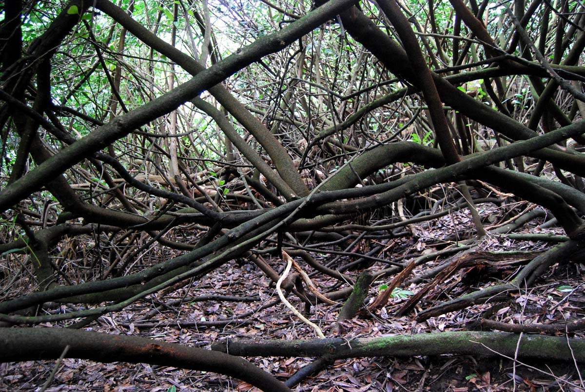
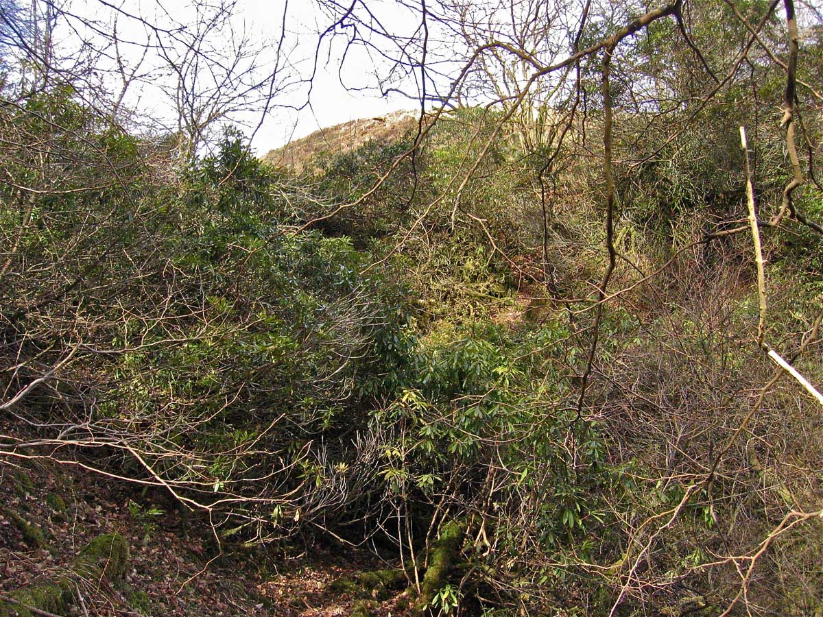
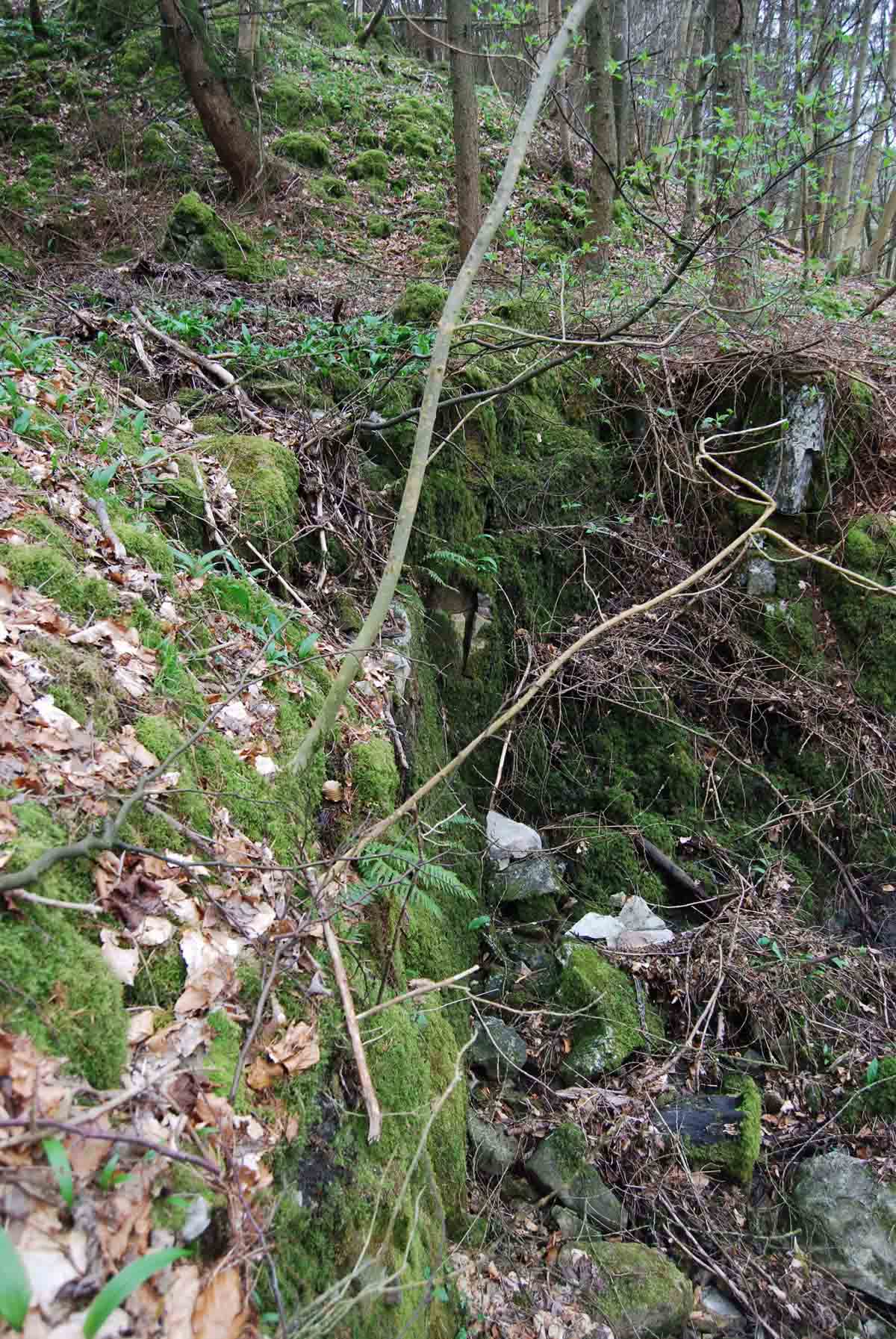
Left: the geologist's curse - rhododendron in Birks Wood right over the expected location of the PB. February 1, 2009.
Right: Not only is the PB inaccessible here, but a significant fault is totally obscured by this vegetation. Sighting of the PB in this location would give valuable information on the disposition of the fault. April 16, 2013.
Left: the PB is easily seen at the top of the cascade and along the carriage drive in Water Gill Wood (NGR 93597 77122 Alt. 244m). February 17, 2014.
Right: a close up of the adjacent location. February 17 2014.
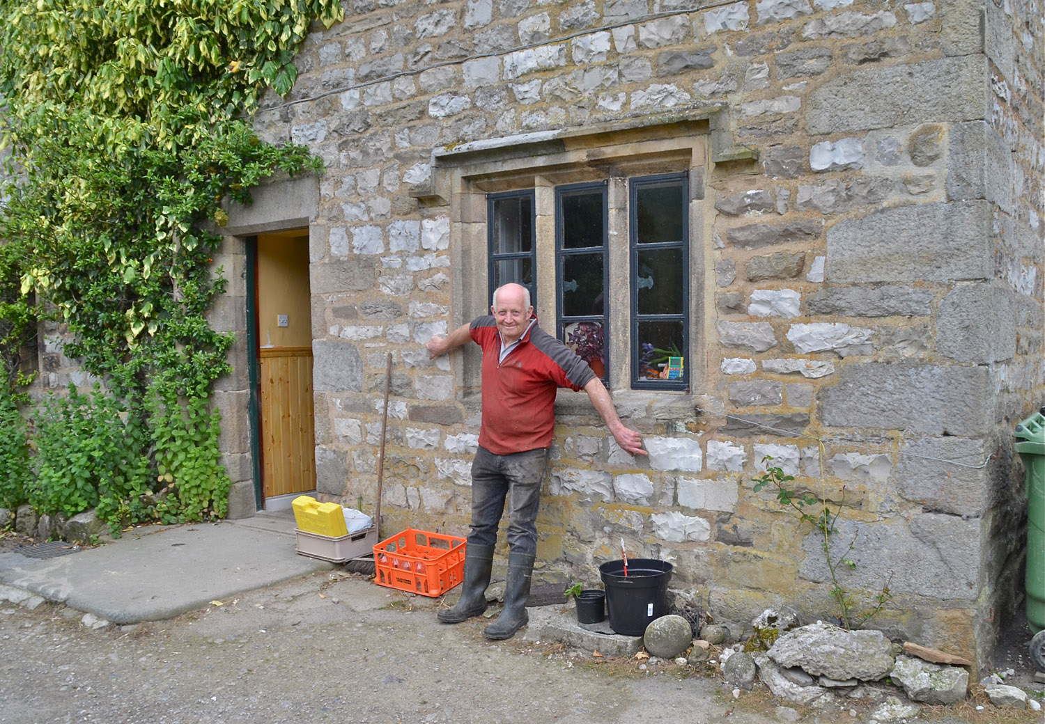
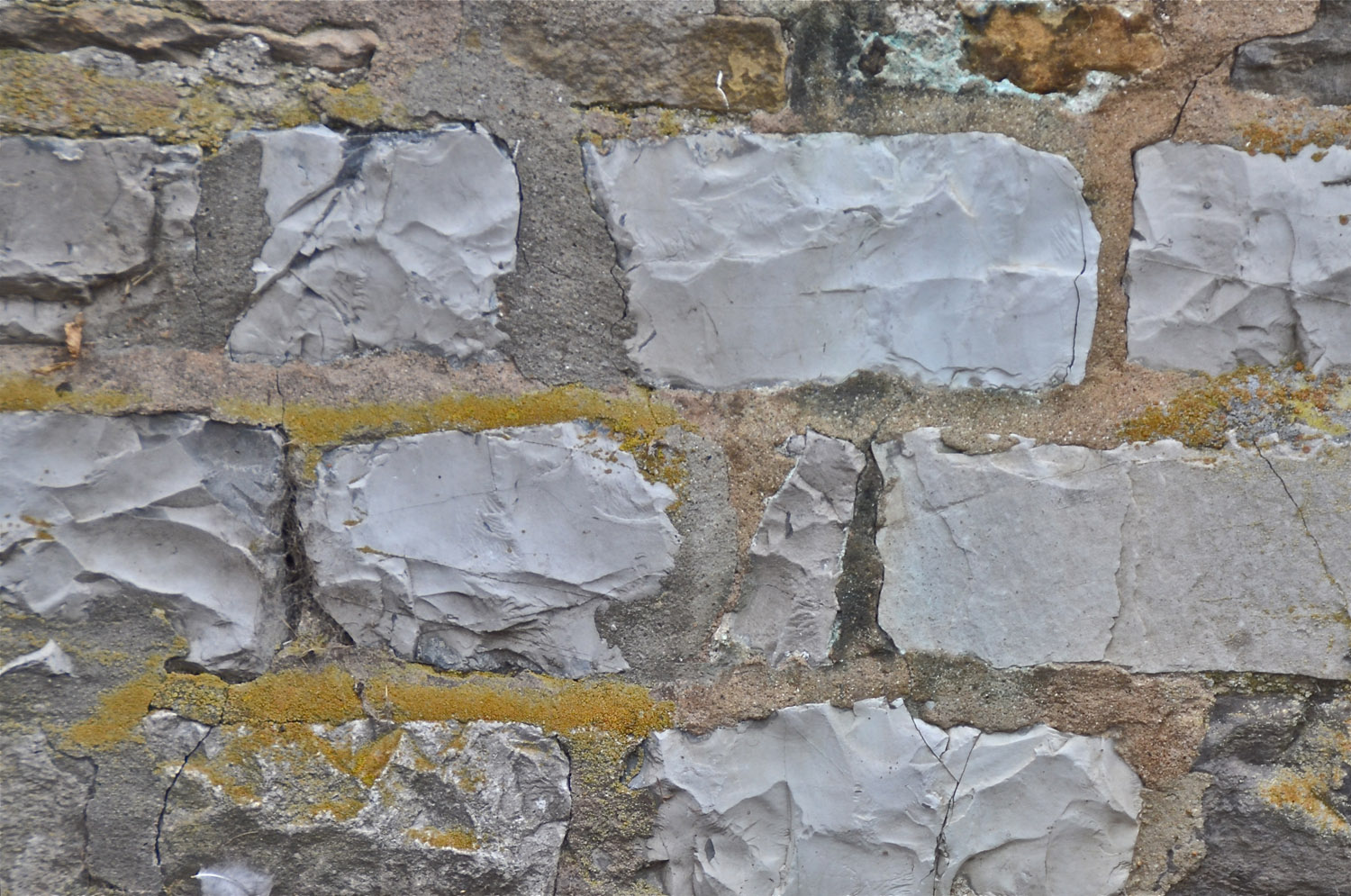
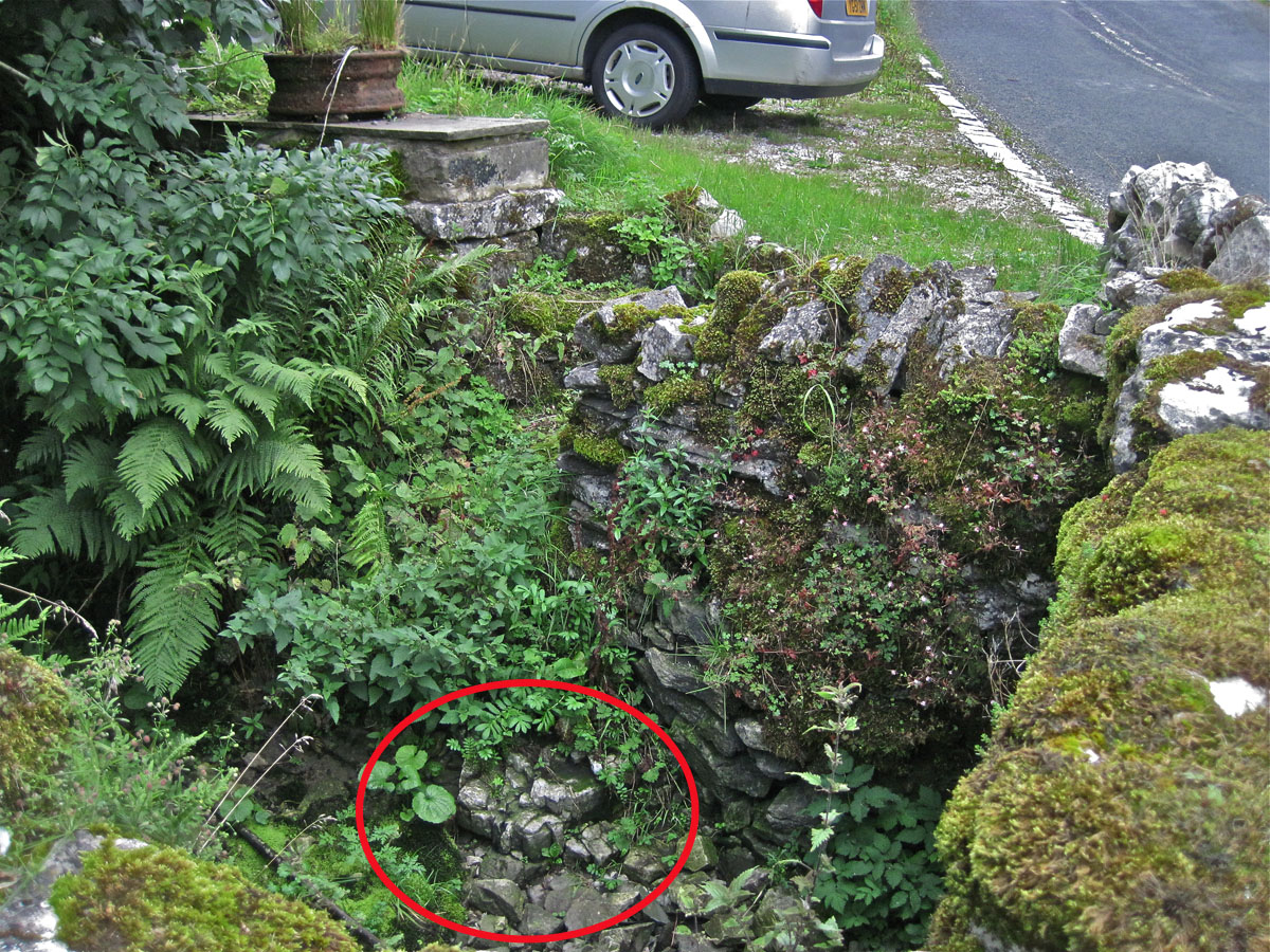
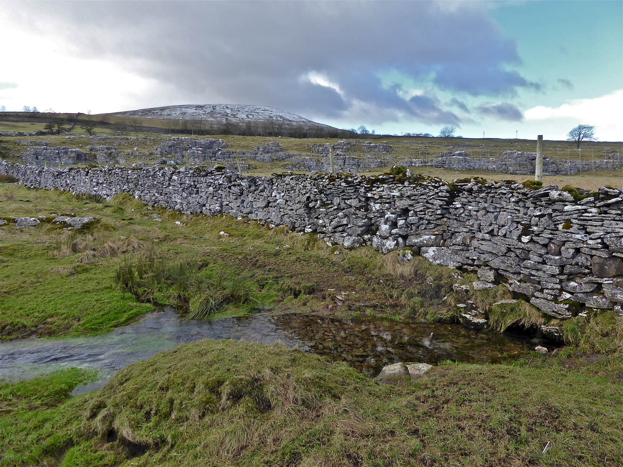
Proximity of the PB is often revealed in buildings and dry-stone walls. There are a number of such instances in the walls of Middle Barn, Ivy Barn and Low Buckden as well as around Redmire Farmhouse.
Left: John Horner shows porcellanous stone-work at Redmire.
Right:
a close up of the wall-stones, July 26, 2015
Around Kingsdale
Click on images for larger view: use back arrow to return.
All images are from the author's collection unless otherwise indicated.
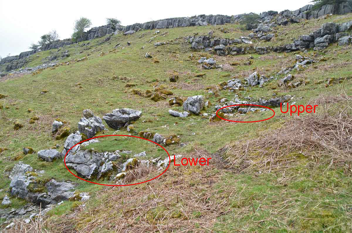
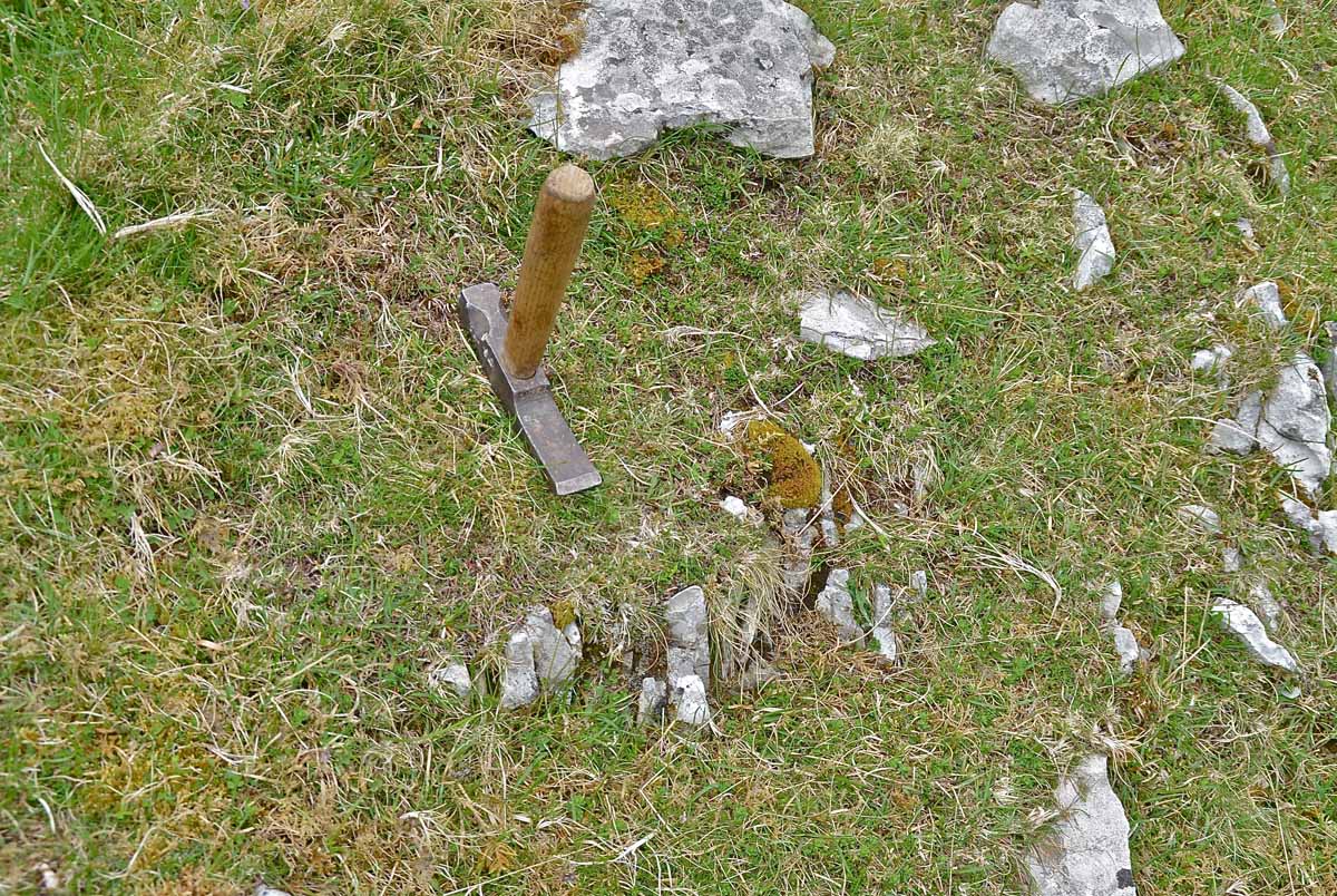
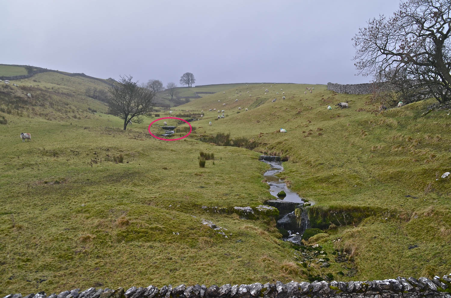
Left: the PB is easily seen in a normally dry gully at a point 50m from Valley Entrance on a bearing of 230 degrees. A small spring emerges on top of the upper leaf of the PB and some 3m lower down passes over the lower leaf. (69964 77376 283m and 69966 77369 280m) May 18, 2013.
Right: The PB is not easily followed round the fell due to heavy deposits of scree, glacial drift and vegetation. May 18, 2013.
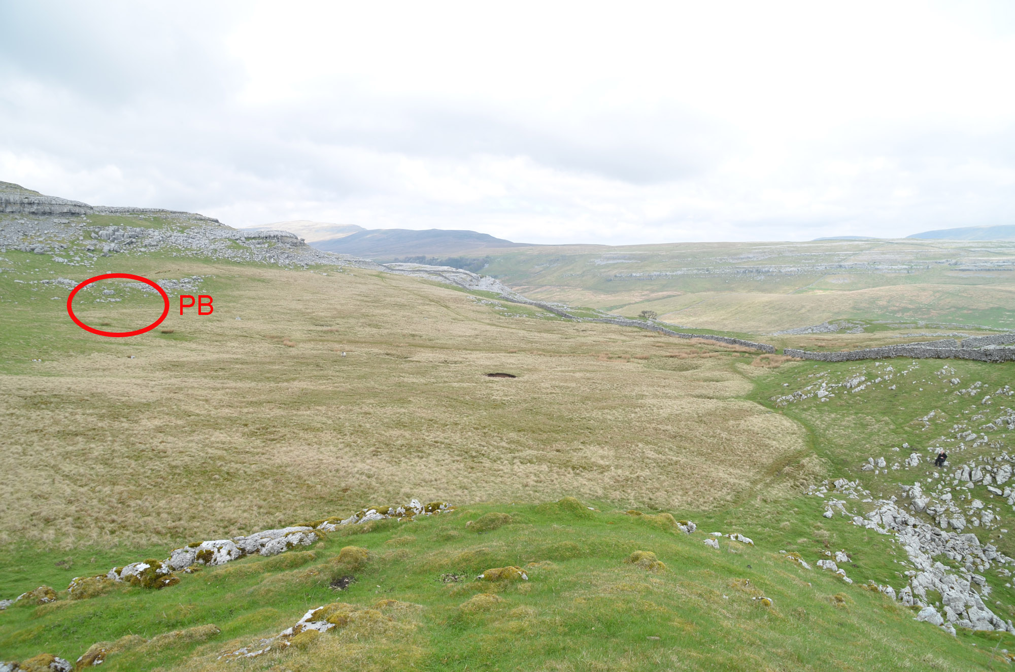
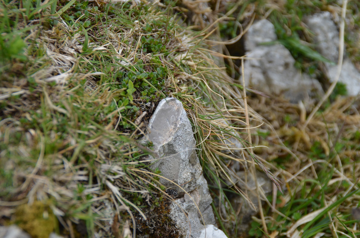
Left: The PB was located at the approximate location, behind Hunt's Cross, NGR 689759, Alt. 318m approx, noted by Dick Glover in his 1976 paper. May 18, 2013.
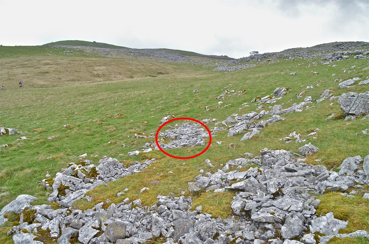
Right: When exposed to weathering as this location shows PB limestone tends to break up into sharp flakes. May 18, 2013.
Left: The upper PB was located with difficulty. May 18, 2013.
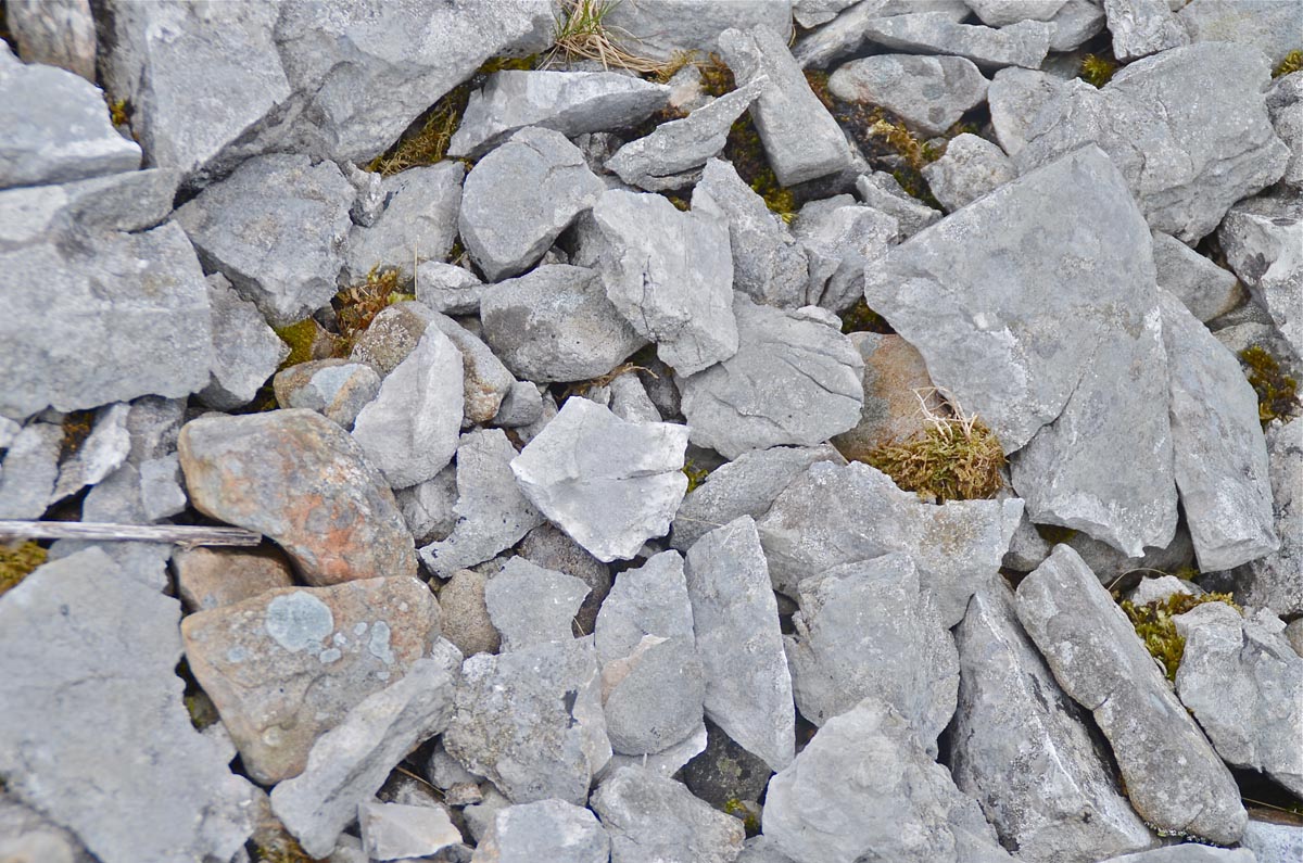
Right: an example of the typical appearance of PB in the field. May 18, 2013.
Langstrothdale
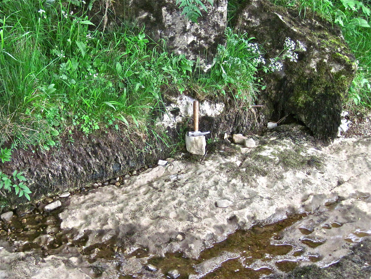
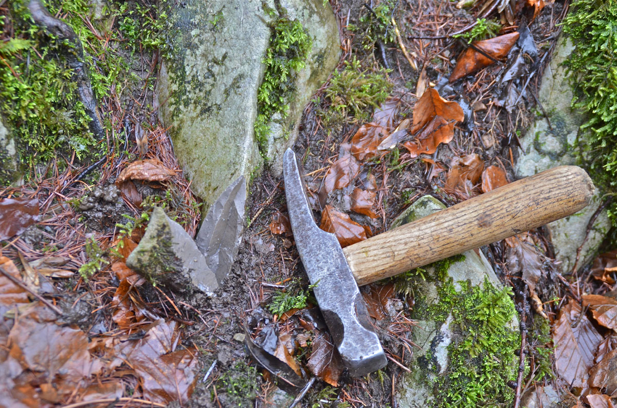
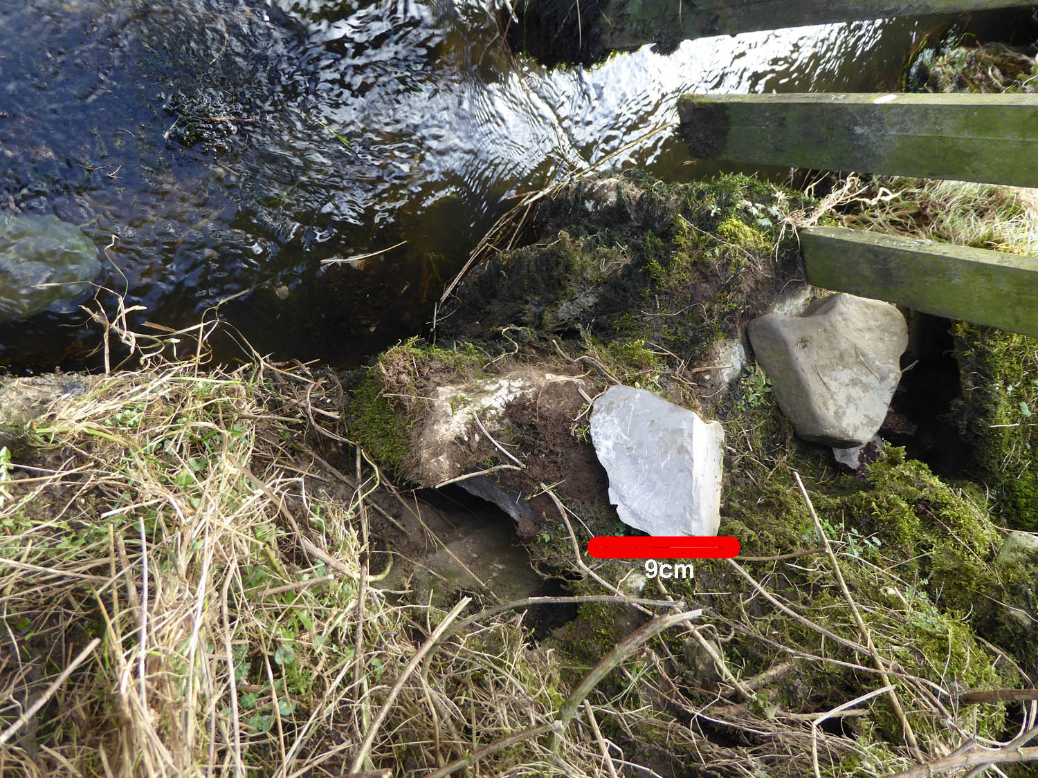
Left: the PB seen in the river bank near Hubberholme comprises two distinct leafs. The hammer shaft is approximately 0.3m long (June 19, 2013). NGR 92368 78400 Alt. c243
Right: looking downstream, the river bed has a very low gradient. The hammer stands on a block of PB which may have been dislodged from the exposure of the upper leaf in the nearby river bank (June 19, 2013).
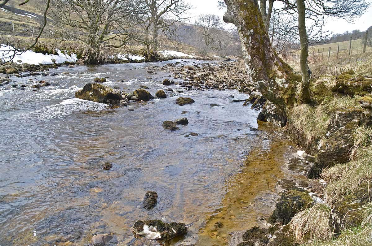
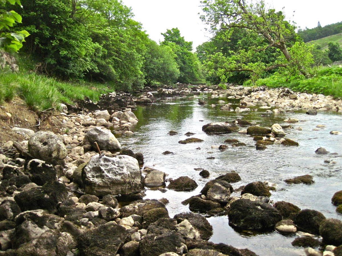
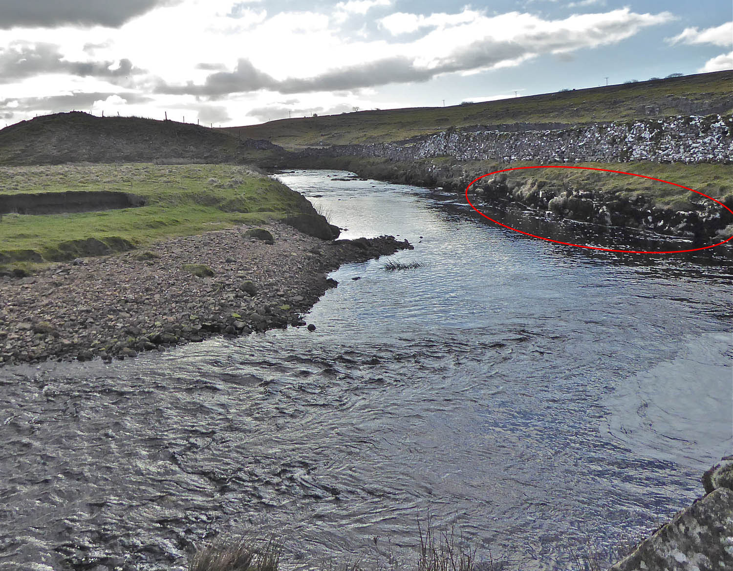
Left: looking upstream, PB is seen to form the river bed: as above, the river bed has a very low gradient upstream too (April 4, 2013).
Right: a large bank of glacial moraine is being eroded. The dislodged debris joins other river deposits which conceal the true nature of the river bed.(June 19, 2013).
Ease Gill
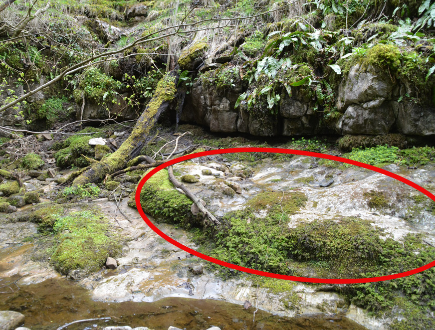
Left: the PB was first reported in Ease Gill by Dick Glover c1970 at the top of the (normally) dry cascade of Ease Gill Kirk. It is highlighted here at 66133 80011 Alt. 236 (approx).There appears to be a second thicker bed of PB above this exposure but the true extent of the PB is obscure due to contorted strata and large amounts of stream deposits.
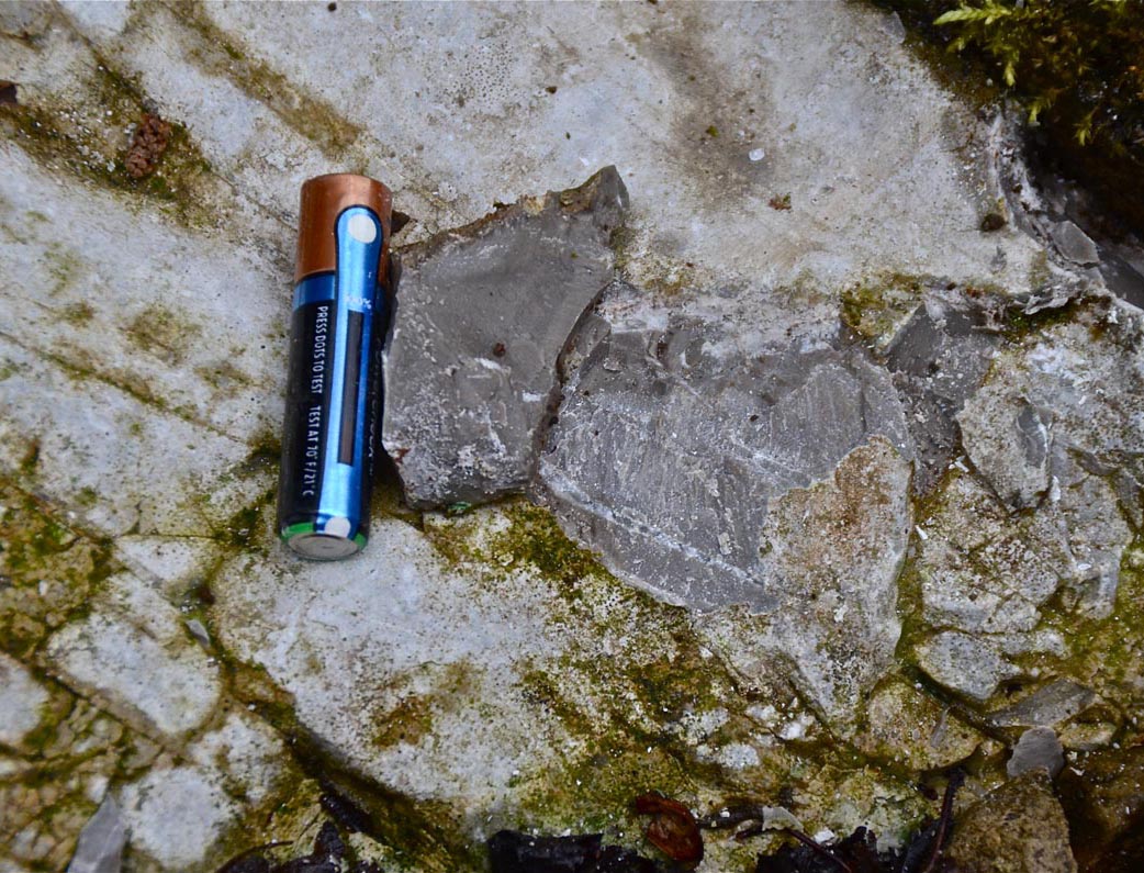
Right: close up of the PB at the same location, AAA cell gives a scale: April 30, 2015.
Left: Overview of the location of the PB at the head of the fall in Ease Gill Kirk. Circled area indicate outcrops of PB.
May 7, 2015.
Right: a few metres upstream from that location the PB is well exposed in the stream bed and continues upstream under superficial deposits. A possible higher PB (at 244m) is located above the highlighted area. More information can be found in the PB.pdf file attached as a download below. May 7, 2015.
Gaping Gill
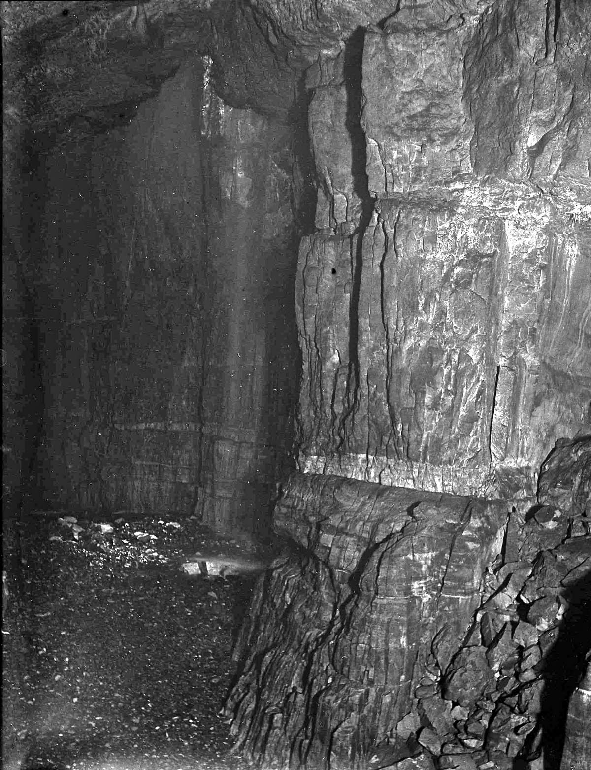
Left: One of the early photographs from Gaping Gill Main Chamber clearly showing the Upper Porcellanous Band. This appearance and the difference in relative heights across the Main Chamber was first used to establish the nature of the Main Chamber Fault by Eli SImpson and later by Dick Glover.
Not until Glover made known his findings in 1973 did the significance of the Porcellanous Band in the development of the Gaping Gill System become apparent. (From a glass slide, Albert Mitchell collection, probably taken on the 1935 Gaping Gill meet).
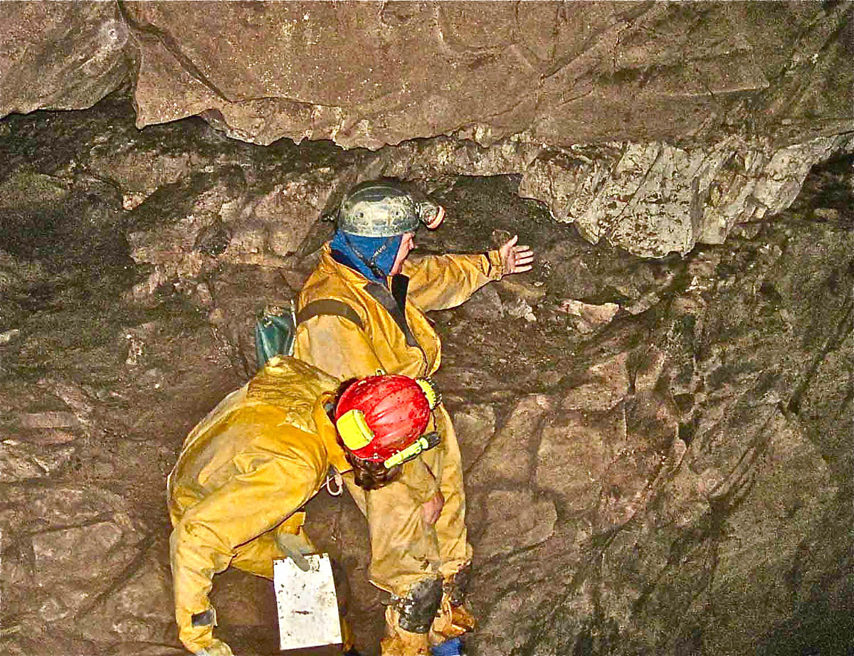
Above: a close up of the Porcellanous Band
may be seen at the exit from South Passage
into Gaping Gill Main Chamber.
(November 12, 2012).
Chapel-le-Dale
Left: a strong outcrop of Porcellanous Band may be seen at Midge Hole, Chapel-le-Dale (737770 Alt. 235). Thanks to John Cordingley for this location. April 22, 2012.
(Access to this location is restricted at the present time)
Right: close-up of adjacent PB outcrop.
Ribblesdale
Left: the Porcellanous Band crosses Gillgarth Beck near Selside at 78494 75358 Alt. 280m.
Right: The Porcellanous Band may be seen in the beck bottom close to the road bridge over the beck in the centre of Selside (78468 75651 Alt. 280m). September 9, 2013.
Left: the Porcellanous Band was found near Ingham Lodge at 78392 77361 Alt 260m. February 2, 2018
Right: The Porcellanous Band forms a small scar along the river bank at water level.
Left and right: springs in this area, south of Ingham Lodge, draining Park Fell along the western side of the Ribble valley, are most probably coming out on the Porcellanous Band
A provisional and far from complete list of locations may be downloaded HERE
References
see references at bottom of Geology of Western Penyghent
Any
shortcomings in the text are entirely my
own.
If you would like to get in touch or add information, there is an email
address:
mudinmyhair@btinternet.com
Steve Warren
Website
created by WarrenAssociates 2012
Website hosted by Tsohost
Copyright © Steve Warren 2012